The state of Colorado is working on a system that would use drones to provide live video of wildfires to wildland firefighters’ cell phones. The Center of Excellence for Advanced Technology Aerial Firefighting is beta testing a DVI Mavic drone that would push the real time video to firefighters using software developed by the military, Android Team Awareness Kit (ATAK).
The program has the capability of displaying data from tracking devices carried by soldiers, or firefighters, and identifying their location on a map, which in this case could also show the fire in real time.
If they are successful in developing and implementing a system that can provide to fire managers real time information about the location of a wildfire AND firefighting resources, it would achieve what we call the Holy Grail of Wildland Firefighter Safety — knowing those two elements of information.
The DJI Mavic can only stay in the air for 20 to 30 minutes before having to return to base to replace the battery. So this beta test is probably only a proof of concept attempt, perhaps leading to a more robust drone, rotor or fixed wing, that could stay in the air for a much longer period of time.
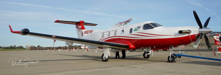
“https://wildfiretoday.com/wp-content/uploads/2017/06/PilatusPC12.jpg”> One of the two State of Colorado’s Pilatus PC12’s, was photographed in March of 2016 in Sacramento.[/captioColorado already has the ability to transmit near real time imagery of fires from their two MultiMission Aircraft, Pilatus PC12’s. They are integrated with the Colorado Wildfire Information System, a geospatial database that displays incident images and details to local fire managers through a web based application.
Above: Estimated precipitation July 4 to July 11, 2018. Intellicast
We have entered a relatively quiet period of wildfire activity in the western United States. On today’s national Situation Report, more fires decreased in size than increased. Of the fires that had changes of more than 100 acres, only three got larger, while five actually decreased. The reported size getting smaller is a result of more accurate mapping.
The seasonal monsoonal flow has been bringing precipitation to not only the Southwest, but it has been pushing north into parts of Nevada, Utah, and Colorado. And the typical July thunderstorms have been affecting other areas as well.
As a reminder, the National Interagency Fire Center predicted July 1 that fire activity would increase this month in parts of California, Nevada, Utah, Washington, Oregon and Idaho. California has had some large fires, Utah has had several, and the Martin Fire in Northern Nevada has burned almost 440,000 acres. We’ll see what happens during the second half of the month.
The updated precipitation and temperature outlooks for the next six to ten days predict higher than normal temperatures in the far west and dry conditions in the Northwest and Northern Rockies.
Above: The burned drone. Photo by Cameron Austin-Connolly
(Originally published at 5:10 p.m. PDT July 11, 2018)
A small drone started a vegetation fire when it crashed near Springfield, Oregon this week. On July 10 Cameron Austin-Connolly was flying his drone over a field when a large unleashed dog left its owner, ran and jumped on him. The impact knocked the controller out of his hands and the drone immediately went out of control and crashed. As you can see in the video (that Mr. Austin-Connolly gave us permission to use) within about three seconds the still operating camera recorded flames.
You can also see two dogs running at Mr. Austin-Connolly.
He wrote on his Facebook page:
My drone crashes and when I go to look for it I saw smoke and flames so I called 911. Springfield FD quickly showed up and put out the flames. They even returned my drone and gopro. The Fire Marshall said that was their first drone fire.
In case you’re wondering about the reaction of the dogs’ owner, Mr. Austin-Connolly said he just kept walking and didn’t say anything.
Mr. Austin-Connolly told us, “it is a hand built first person view drone, or FPV done. Some people also call them racing drones since they are fast.”
He said it was using a lithium polymer, or “lipo”, battery.
Most small consumer-sized drones use lithium ion batteries, while racing drones generally operate with lithium polymer batteries.
The battery that was in the drone. The label says: “Infinity, 1300 MAH, race spec”. Photo by Cameron Austin-Connolly
In March we wrote about the crash of a drone that started a 335-acre fire on the Coconino National Forest in Northern Arizona. Few details about that drone were available, except that it was about 16″ x 16″. The comments by our readers developed a great deal of information about rechargeable batteries and the possibility of them catching fire. We also learned about several other drone crashes that started fires.
The fact is, there are many examples of both lithium ion and lithium polymer batteries catching fire. There is no doubt that when a lithium ion battery is subject to an impact, a short circuit can occur in one or more of the cells, creating heat which may ignite the chemicals inside the battery. This can spread to the adjoining cells and lead to the condition known as “thermal runaway” in which the fire escalates. If as in a vehicle, there are thousands of batteries, it can be extremely difficult to extinguish the blaze. And worse, it can reignite days or weeks later.
When compact fluorescent light bulbs were introduced they saved energy but were slow to get fully bright and many people thought the color of the light was unpleasant. I knew then that it was immature lighting technology. There were going to be better options. Now LED bulbs save even more energy, come in various light temperatures (colors), and illuminate at near full brightness immediately. For now, they are expensive, but will still pay for themselves in three to five years.
Lithium ion and lithium polymer batteries are the compact fluorescent bulbs of battery technology. They are too heavy, don’t hold enough power, and they too often catch fire. No one wants to be on an airplane when flames erupt from an e-cigarette, cell phone, wireless headphones, or laptop computer, all of which can ignite even if they are turned off.
So until that next major step in battery technology occurs, what do we do about drones? Is the risk so low that we should not be concerned? When land managers enact fire restrictions during periods of high wildfire danger, do we also prohibit the use of drones? Should drones ever be allowed over vegetation in a fire-prone environment during wildfire season? And what about the hundreds of drones owned and operated by the Department of the Interior that flew 5,000 missions last year? Not all are battery operated, but some are.
We thank Mr. Austin-Connolly for providing the information, photos, and the video. When we asked, he said, “If my experience can be helpful I’m all for it.”
Thanks and a tip of the hat go out to Kelly. Typos or errors, report them HERE.
Dwight and Steven Hammond will be freed from prison
Dwight and Steven Hammond (Photos: U.S. Department of Justice)
President Trump has issued full pardons to two Oregon ranchers who were convicted of arson on federal lands. Dwight Hammond, 76, and his son Steven Hammond, 49 were convicted in 2012 and sentenced to five years in prison.
On September 30, 2001 the two Hammonds distributed boxes of matches to everyone in their hunting party with instructions to“light up the whole country on fire”. Initially they ignited fires on their property but the fires spread onto 139 acres of federal land.
Steven Hammond was also convicted of setting a series of fires on August 22, 2006. Those ignitions, during Red Flag Warning conditions, compromised the safety of firefighters who were working on another fire nearby. Some of them were forced to retreat from the area for their own safety. They were given advice and led to safety via radio by an orbiting Air Attack.
The Hammond case inspired the 40-day armed occupation of the Malheur National Wildlife Refuge in 2016. Robert LaVoy Finicum, one of the occupiers died, but brothers Ammon and Ryan Bundy, the accused leaders of the occupation, were not convicted.
Below are excerpts from a statement issued by the White House today, July 10:
The Hammonds are multi-generation cattle ranchers in Oregon imprisoned in connection with a fire that leaked onto a small portion of neighboring public grazing land. The evidence at trial regarding the Hammonds’ responsibility for the fire was conflicting, and the jury acquitted them on most of the charges.
The Hammonds are devoted family men, respected contributors to their local community, and have widespread support from their neighbors, local law enforcement, and farmers and ranchers across the West. Justice is overdue for Dwight and Steven Hammond, both of whom are entirely deserving of these Grants of Executive Clemency.
On January 5, 2016 we compiled a time line of the Hammond’s run-ins with law enforcement that involved land management. We developed the data from court documents, information provided by U.S. Attorney’s Office spokesperson Gerri Badden, and other sources provided by some of our loyal readers. The entire time line including the fires in 2006 is here.
Below is an excerpt from our time line, published in 2016, about the Hammond fires of September 30, 2001:
2001, September 30 — Hardie-Hammond Fire.
According to testimony from a commercial hunting guide, his two clients, and Dusty Hammond the grandson to Dwight Hammond and nephew to Steven Hammond, their family and friends were hunting when shots were fired from the group into a herd of deer on BLM land. The guide said four bucks were crippled, but the Hammond hunting party did not track or collect any deer.
Later, Steven, with Dwight at his side, handed out boxes of matches to everyone in the party including 13-year old Dusty. Their instructions were to “light up the whole country on fire”. They went off in different directions and began igniting fires, but Dusty was by himself, following a path pointed out by Steven. He was at first unsuccessful in getting the vegetation to ignite, but after Steven showed him how to use several of the “strike anywhere” matches together, he was creating eight to ten-foot flames which at one point surrounded and entrapped him causing him to fear for his life — “I thought I was going to get burned up”, he said. The fires were lit along the line between their property and public land, and spread onto public land.
Gerri Badden, a spokesperson for the U.S. Attorney’s office, said the motive for setting the fires was to cover up the illegal slaughter of the deer which was witnessed by the hunting guide, the guide’s two hunters, and was affirmed by Dusty.
Two hours after igniting the fires Steven called the BLM to report that they were going to burn invasive species.
The hunting guide saw that the fire was moving toward their camp and was concerned about his safety and that of his two clients from Utah. The three of them evacuated from the area without even taking the time to break down and remove their equipment at the camp. As they drove away they were able to see the flames of the fire in the area they had left. Testimony in the trial indicated that the Hammonds were aware of the location of the guide and his clients before lighting the fires since they flew their airplane over the area earlier that morning.
Later in the day Dwight and Steven took to the sky again in their airplane to examine the burnt area, telling Dusty they were going to check to see if the fire got rid of the juniper, which is an invasive species that robs water from grasses grazed by cattle.
Dusty said that when the Hammond hunting party returned to the house after setting the fires, “Dwight told me to keep my mouth shut, that nobody needed to know about the fire”. Eight years later 21-year old Dusty told investigators why he waited so long to speak up about the arson, saying that if Steven heard he provided information he would come to Dusty’s front door and kill him.
The writers of the sentencing report said the setting of the fires created a “conscious or reckless risk of death or serious bodily injury” to individuals including Dusty Hammond. The fires burned 139 acres of federal land.
As our regular readers know, we do not allow discussions in the comment section about politics. However, for this one article only, we are going to try something, and allow it, since the action that occurred today directly affects wildland firefighters. If it devolves into bitter, nasty, hate-filled diatribes, we’ll shut it down. It’s OK to disagree, but let’s not be disagreeable.
The fire has burned approximately 425,000 acres in Northern Nevada
(Originally published at 9:07 a.m. MDT July 10, 2018)
When a wildfire reaches 100,000 acres we often refer to it as a “megafire”. But what name do we put on a fire when it is four times the megafire threshold? The incident management team on the Martin Fire in Northern Nevada estimates their fire has burned approximately 425,000 acres. (I think we should reserve “gigafire” for a 1 million-acre fire.)
According to the National Situation Report there are only 634 personnel assigned. That is extremely low density of firefighters for such a huge fire — it stretches for 56 miles, west to east. Let’s assume for a moment that the perimeter is 150 miles (it is probably more). If so, that is about three people per mile of fireline, not including support personnel. However with mostly light fuels, there is less mop up after the spread is stopped, requiring fewer personnel.
The perimeter of the Martin Fire at 8:49 p.m. MDT July 10, 2018. The yellow line was from the previous day.
With the long distances, limited numbers of firefighters, and what may be difficult access, firefighters on the Martin Fire say they have developed an innovative approach to containing the blaze.
Firefighters know that air tankers and helicopters dropping water or retardant do not put out fires. Under ideal conditions they can slow them down enough to allow ground-based firefighters the opportunity to move in and actually put out the fire in that area. If there is no ground support working with the aircraft, the chances of success are very low. Reading between the lines of an update about the fire (embedded farther down) it appears that firefighters realized that in some instances the fire was spreading beyond retardant drops. It is not clear if the fire burned through the retardant, spotted over, or burned around the retardant.
Photo uploaded to InciWeb July 8, titled: “Martin Fire Crossing Retardant Lines”.
The tactic they decided to deploy involved using a combination of water-scooping air tankers, retardant-dropping air tankers, and firefighters building line on the ground. Aircraft that drop water, helicopters or fixed wing, apply it directly to the flaming front, since dropping it out ahead of the fire is often not effective since it does not adhere to the vegetation or have a long-term effect like retardant.
Here is how they described what they did:
Crews and equipment are making excellent progress building containment lines along the southeast flank of the fire. Due to the heavy, fine fuel loads, high winds and extremely fast fire rates of spread, an innovative tactic has been developed to combat these conditions using a three-prong attack. First, a long line of water is laid down by super scoopers, immediately followed by a retardant drop from air tankers. The approaching fire is thus cooled sufficiently that dozers and crews can safely and immediately dig a containment line right up against the side of the retardant line facing away from the flame front. Very close timing and coordination of air drops of water and retardant with ground forces has been proven to be the most effective tactic in these volatile burning conditions.
The part that may be innovative is slowing the flaming front with scooping air tankers AND then putting retardant just outside the edge of the fire. And as usual, quick followup by ground forces is essential.
Here are links to videos shot on the Martin Fire of drops by a DC-10 and two water scoopers.
Is it interesting that these firefighters, like many others in Canada and Europe, know that water-scooping air tankers are a very important tool in the toolbox. However, this year the U.S. Forest Service decided not to have any of them on exclusive use contract. The ones being used thankfully were available on a Call When Needed contract. And the number of retardant-dropping large air tankers on EU contracts were cut by one-third over last year.
They are also having success on the Martin Fire using a local task force:
Yesterday, fire spread slowed significantly due to the hard work of the local Elko Task Force that hit the head of the fire early Sunday morning and throughout the day. The task force took advantage of the fire naturally slowing as it entered flatter terrain with lesser fuel loads. Operations personnel report that the fire is moving into patches of greener vegetation such as Siberian wheat grass, which was planted as part of the BLM’s rehabilitation and fuel treatment efforts on previous fires. Green fuels slow the fire’s advance, making it easier for bulldozers and engines, with the aggressive assistance of super scooper air tankers and heavy and light helicopters, to catch up and get containment lines in place.
The head of the fire on the east side has approached and so far has not crossed the major drainage in the 3-D map below, thanks, no doubt, to the points brought out in the preceding quote.
A 3-D map showing the perimeter on the east side of the Martin Fire at 8:49 p.m. MDT July 10, 2018. The yellow line was from the previous day.
The Martin Fire is bringing in Beth Lund’s Type 1 Great Basin Management Team to handle the east side, while Taiga Rohrer’s Type 2 Great Basin Incident Management Team will continue to take care of the west side.
Long time fire photographer Jeff Zimmerman sent us these photos he shot at two recent Southern California fires that you did not hear about. Like many, many others, they were successfully attacked by firefighters and contained before growing into major conflagrations.
The photo above as well as the next three, were from the July 6 Hunter Fire off Sylvan road near Lake Hughes. Jeff got some quick shots with a camera phone of U.S. Forest Service and Los Angeles County personnel working at a vehicle fire that got into the brush at 5:20 a.m. during Red Flag Warning conditions. It burned one acre in addition to the vehicle.
Hunter Fire at Lake Hughes. Photo by Jeff Zimmerman.Hunter Fire at Lake Hughes. Photo by Jeff Zimmerman.Hunter Fire at Lake Hughes. Photo by Jeff Zimmerman.
On July 8 Jeff was at a fire in Lebec, California as firefighters from Kern County, BLM, USFS and LA County battled a stubborn vegetation fire. It was reported at 1:35 p.m. along Lebec and Lebec Oaks Road which brought a large response including fixed wing aircraft. No structures were damaged but several rural homes had to have structure protection put in place and large animals were evacuated. Firefighters stopped it at 62 acres. Jeff said extremely high temperatures and very low relative humidity have been a big factor in spawning wildfires across the State this week.
The next four photos are of the fire in Lebec:
Fire at Lebec, California. Photo by Jeff Zimmerman.Fire at Lebec, California. Photo by Jeff Zimmerman.Fire at Lebec, California. Photo by Jeff Zimmerman.Fire at Lebec, California. Photo by Jeff Zimmerman.
Jeff Zimmerman photographs fires and writes about them, usually from Southern California.