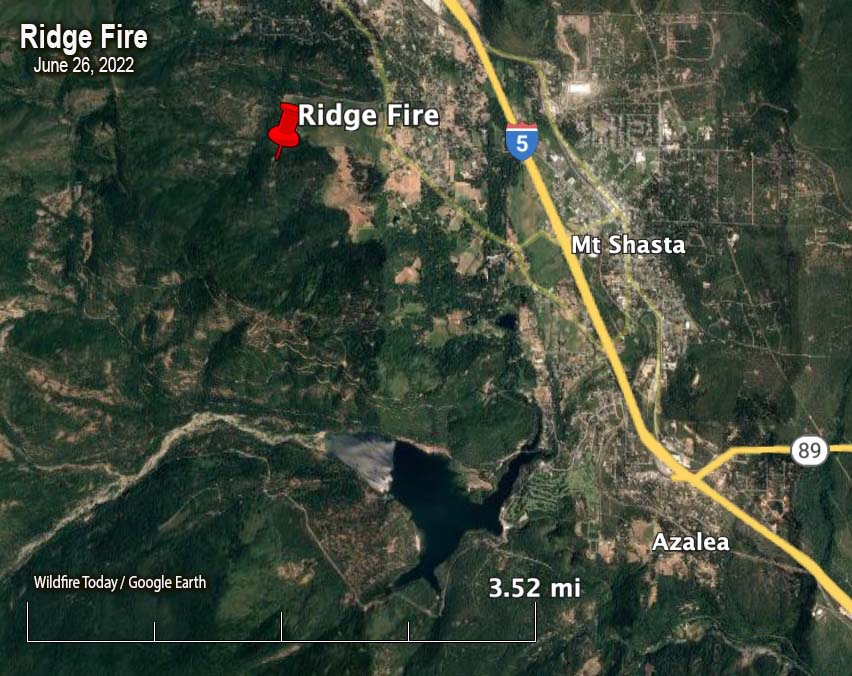
Map showing the location of the Ridge Fire at 1 a.m. June 26, 2022.
At about 9 p.m. Saturday firefighters responded to the Ridge Fire two miles northwest of the city of Mt. Shasta, west of Interstate 5 in Northern California. Infrared cameras showed multiple heat sources. It is not known if there was more than one ignition or if spot fires occurred from a single fire. The size estimate from CAL FIRE is 10 acres.
It is in an area with difficult access, on private land about a quarter mile outside the Shasta-Trinity National Forest.
The weather after sunset at the Mt. Shasta weather station two miles away in the community, recorded 2 mph winds out of the southeast switching to the northeast after 9 p.m. The relative humidity in the town, which may not be representative of conditions near the fire on ridge, increased overnight from 10 to 63 percent.
The forecast for Sunday at the fire area calls for 93 degrees, 12-15 percent relative humidity, and 2 to 6 mph winds out of the southeast becoming south in the afternoon.
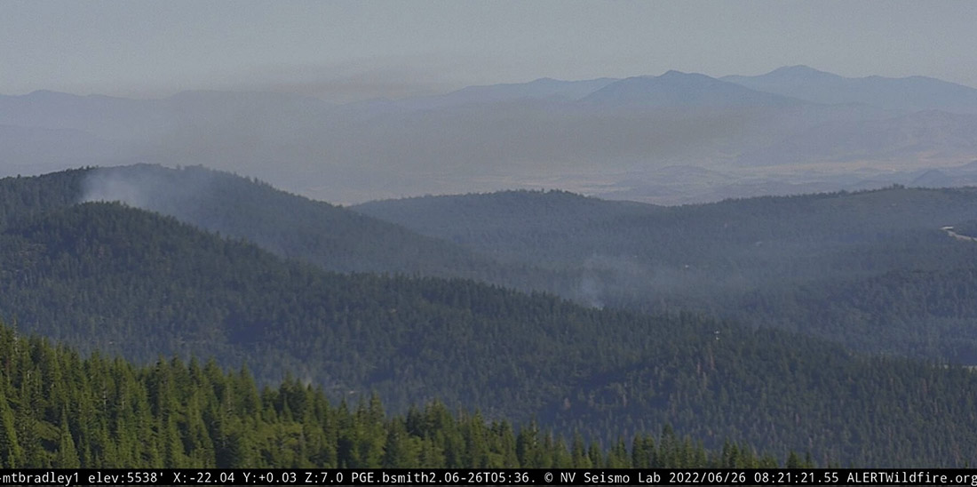
Ridge Fire as seen from Mt. Bradley, 8:21 a.m., June 26, 2022.
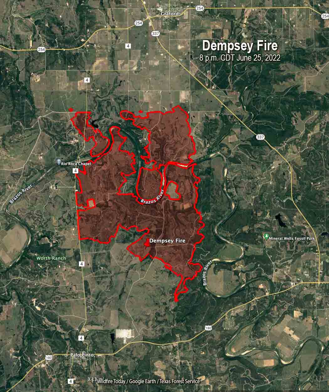
Dempsey Fire, June 25, 2022. Texas Forest Service.
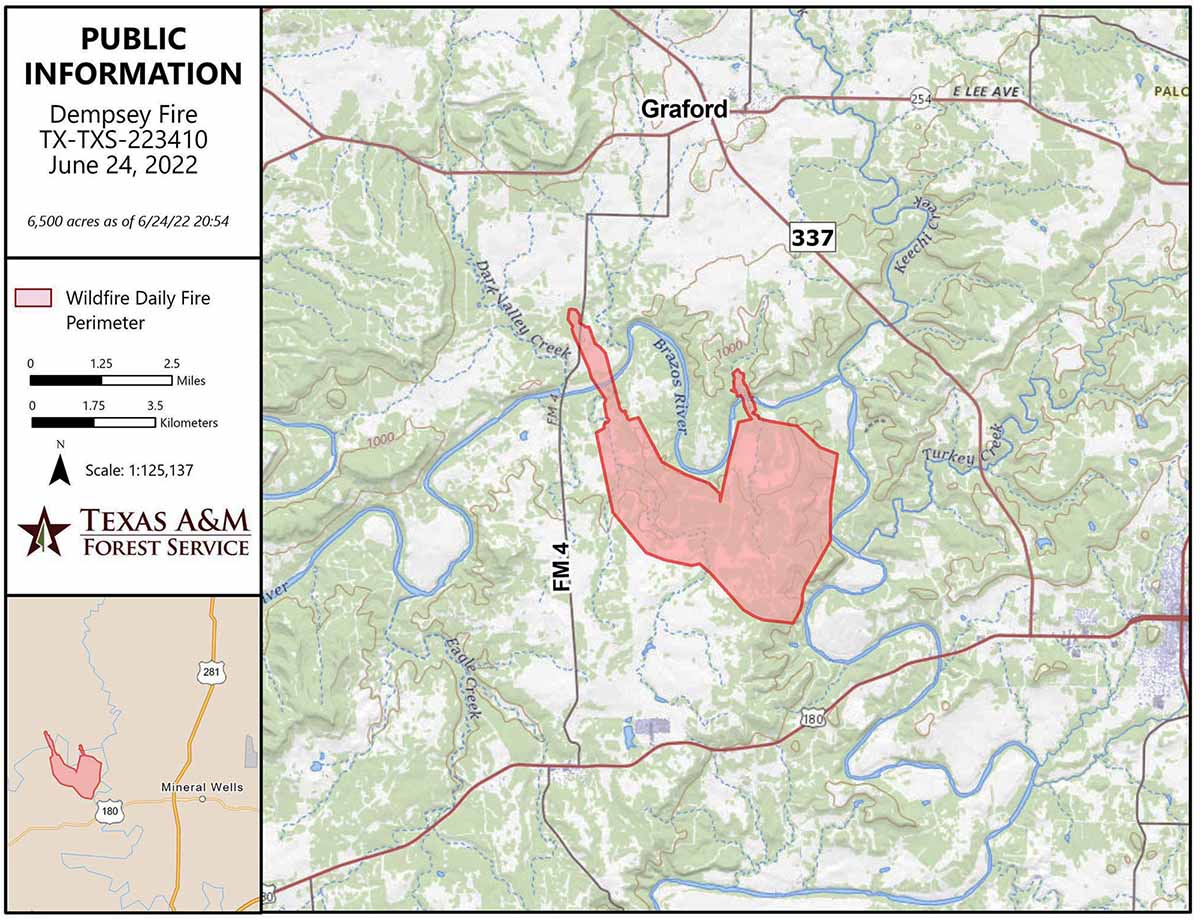
The Dempsey Fire six miles west of Mineral Wells, Texas has crossed the Brazos River in several places. It was very active again Saturday, but not to the extreme levels seen on Friday.
When the fire was mapped by an aircraft at 8 p.m. Saturday the northwest side had reached Fortune Bend Road and spotted across. The northeast side of the fire was close to Wrangler Field and had not reached Grassy Ridge Road or Lewis Road. It was about three miles south of Graford, one mile west of highway 337, and two to three miles south of highway 254.
To see all articles on Wildfire Today about the Dempsey Fire, including the most recent, click HERE.
The size at that time, accounting for the large unburned areas along the river, was about 10,000 acres. Sunday morning the Texas Forest Service reported it had burned 11,597 acres.
Dempsey Fire map, 8 p.m. CDT June 25, 2022.
On Saturday crews continued to construct line, hold the fire along roadways, engage spot fires, and hold the fire along the Brazos River where they could. Aircraft assisted firefighters on the ground with drops from helicopters and air tankers.
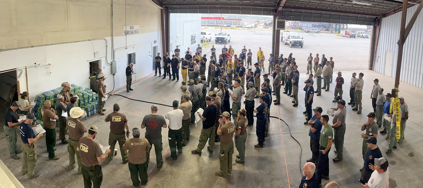
Dempsey fire morning briefing, June 26, 2022. Texas Forest Service.
The weather forecast for the fire area issued at 5:55 a.m. Sunday calls for sunny skies becoming partly cloudy after 3 p.m., 100 degrees, 25 percent relative humidity, and 9 to 13 mph winds out of the west shifting to the northeast in the afternoon with gusts to 23 by 5 p.m. The variable wind direction should slow the growth to the north, but will be a challenge to firefighters as they work to remain safe as the direction of spread changes.
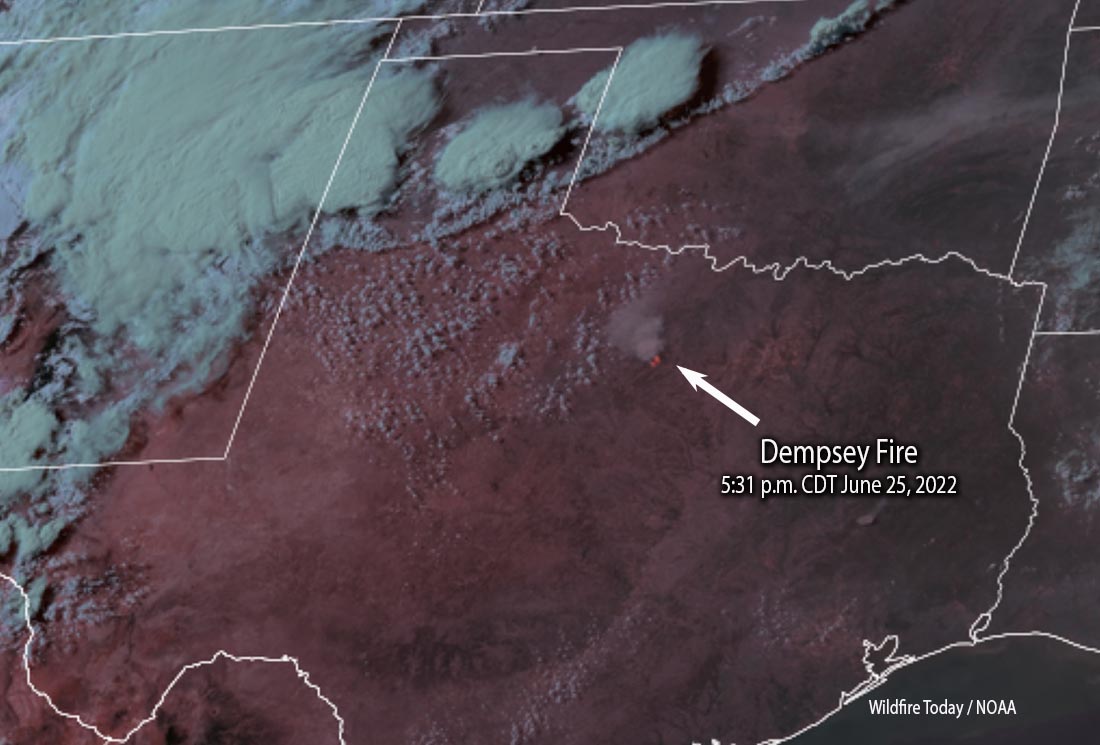
Dempsey Fire, satellite photo, 5:31 p.m. CDT June 25, 2022. NOAA.Dempsey Fire, the afternoon of June 25, 2022. Texas Forest Service.
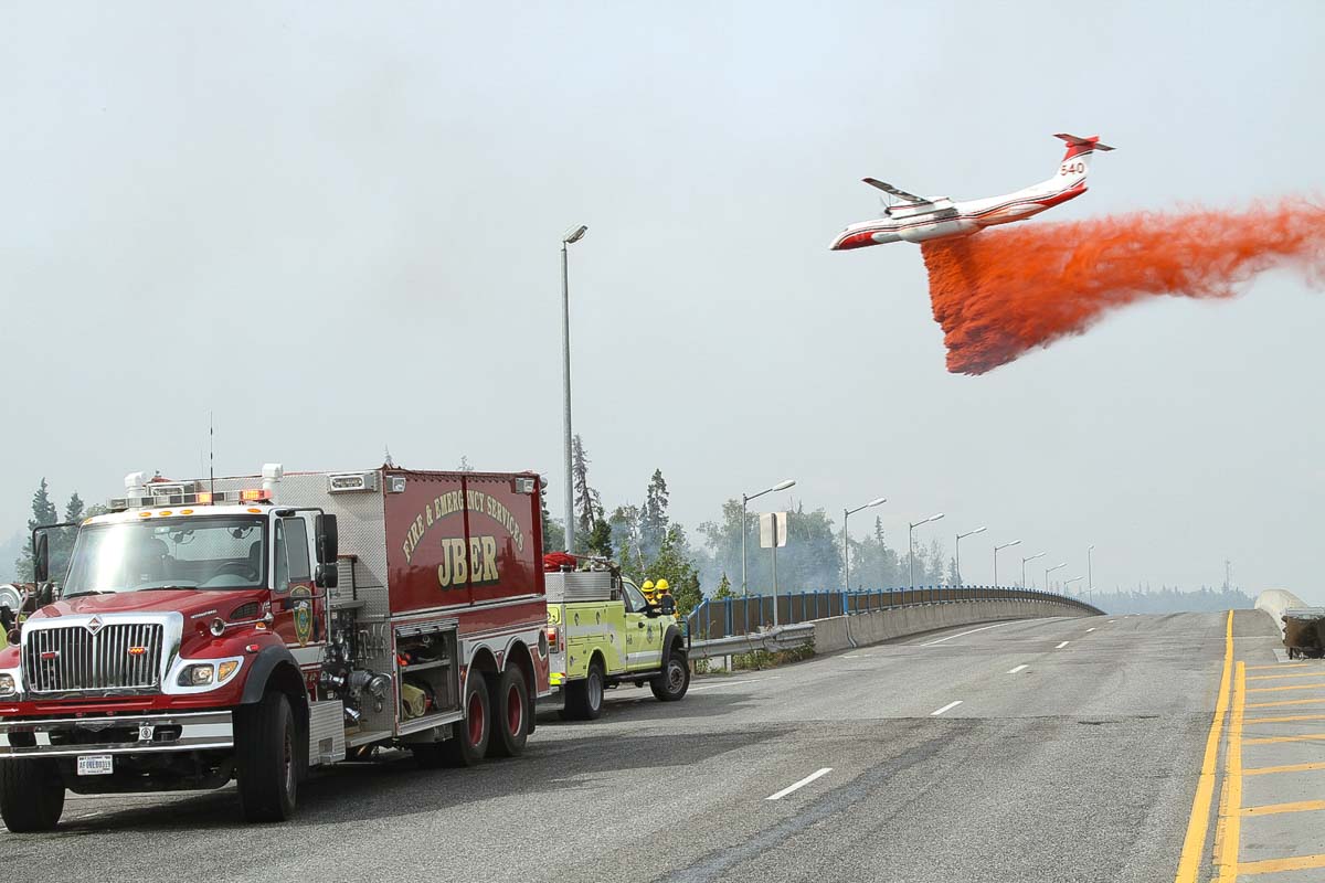
A Q400 air tanker, Tanker 540, drops on the Elmore Fire near Anchorage, Alaska June 23, 2022. Mike McMillan/ AK DOF.
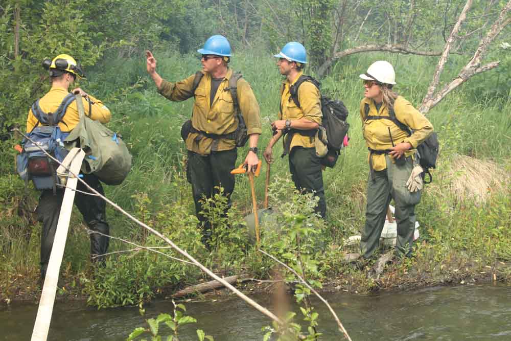
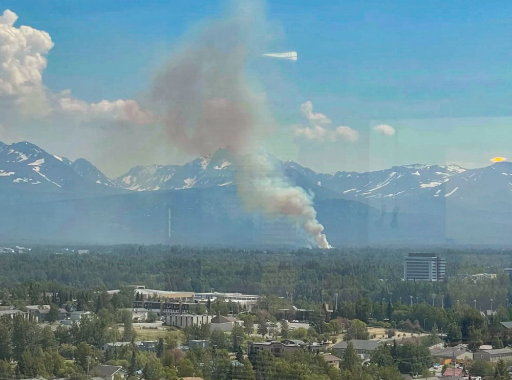
Firefighters in Alaska were able to stop the spread of the Elmore Fire on the east side of Anchorage Thursday at 13 acres before it spread into structures. It was reported at 5 p.m. in the Campbell Track area near the intersection of Dowling and Elmore Roads.
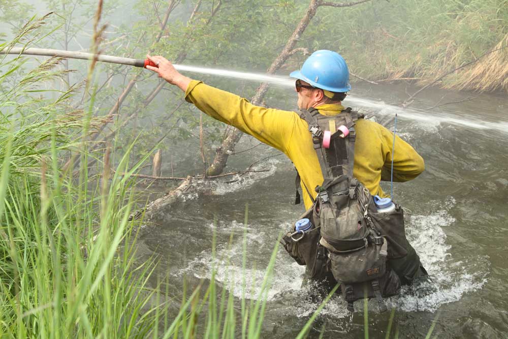
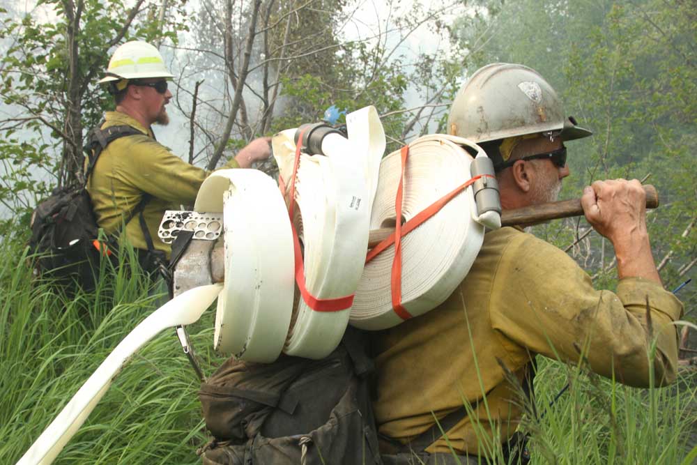
Alaska Dept. of Forestry firefighters on the Elmore Fire, Anchorage, AK June 23, 2022. Mike McMillan-Alaska DOF.
Personnel responded from the Pioneer Interagency Hotshot Crew, Palmer forestry, Joint Base Elmendorf-Richardson, Anchorage Fire Department, and Alaska Division of Forestry (DOF). A group of Canadian firefighters staged in the area with the DOF through the use of the Northwest Compact were also on scene.
Alaska Dept. of Forestry firefighter on the Elmore Fire, Anchorage, AK June 23, 2022. Mike McMillan-Alaska DOF.
The firefighters were assisted by one DOF helicopter and two fixed wing air tankers operated by Conair, a Q400 and a Convair 580. The Q400, Tanker 540, is seen above.
Elmore Fire, Anchorage, AK June 23, 2022. Brent Goodrum-Alaska Div. or Forestry
The DOF has a contract with Conair to supply two Convair 580 air tankers, but the company has the option to substitute one of their Q400 tankers for a 580 at the same price. One of the tankers is usually based at Palmer and the other at Fairbanks.
Alaska Dept. of Forestry firefighters on the Elmore Fire, Anchorage, AK June 23, 2022. Mike McMillan-Alaska DOF.
In 2021 Conair purchased 11 Q400 aircraft from Flybe Airlines. The first one was delivered at Conair facilities in Abbotsford, British Columbia, February 21, 2021. After being converted to air tankers, called A400ATs (Air Tanker), they will eventually replace the L-188’s and CV-580’s currently operated by Conair. Showcasing a Q400 in Alaska can increase the familiarity of the tanker among Conair’s potential clients.
The repurposed Q400s are capable of holding up to 2,640 gallons of retardant. The CV-580s were produced between 1947 and 1954 and can carry up to 2,100 gallons. The Q400 cruises about 50 mph faster than a CV-580.
Before purchasing the 11 Q400’s from Flybe, Conair had two A400ATs operational within their fleet that were used in 2021 for the first time in the North American fire season, including Alaska. They also had one under contract in Australia during the 2020-2021 bushfire season.
In 2017 the Conair Group secured a deal to sell six Q400MR (Multi-Role) air tankers to France’s Securite Civile (Department of Civil Defense and Emergency Preparedness). These were new aircraft that Conair purchased from Bombardier which can be reconfigured in a few hours to carry passengers, hence the Multi-Role designation. The new aircraft are replacing France’s old S-2 air tankers.
The Dempsey Fire showed extreme activity well into Friday night and only slowed down when when high humidity set in early Saturday morning. The fire jumped FM Road 4 and Fortune Bend Road, and crossed the Brazos River in multiple places.
To see all articles on Wildfire Today about the Dempsey Fire, including the most recent, click HERE.
Additional dozer and engine crews have arrived on scene and began constructing and holding line early Saturday morning. Helicopters and air tankers are expected to be available to assist firefighters.
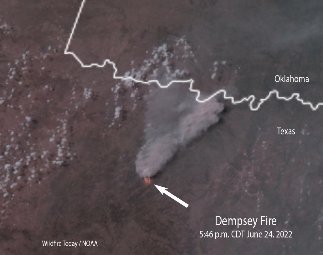
Satellite photo of smoke from the Dempsey Fire at 5:46 p.m. CDT June 24, 2022.
At 9 a.m. Saturday the Texas Forest Service was still saying the size is 6,500 acres. That could change with updated mapping.
An updated spot weather forecast from the NWS for Saturday calls for clear skies, 105 degrees, 19 percent relative humidity, and winds out of the south at 5 to 9 mph.
10:35 p.m. CDT June 24, 2022
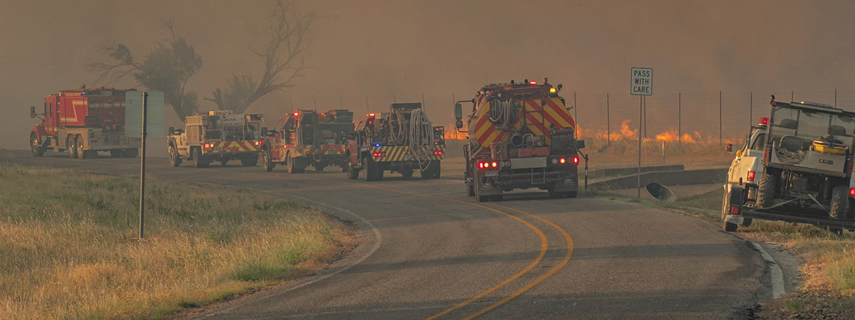
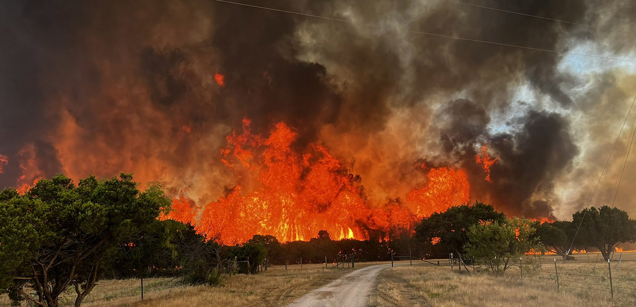
Dempsey Fire, west of Mineral Wells, Texas, June 24, 2022. Photo via Texas Forest Service.
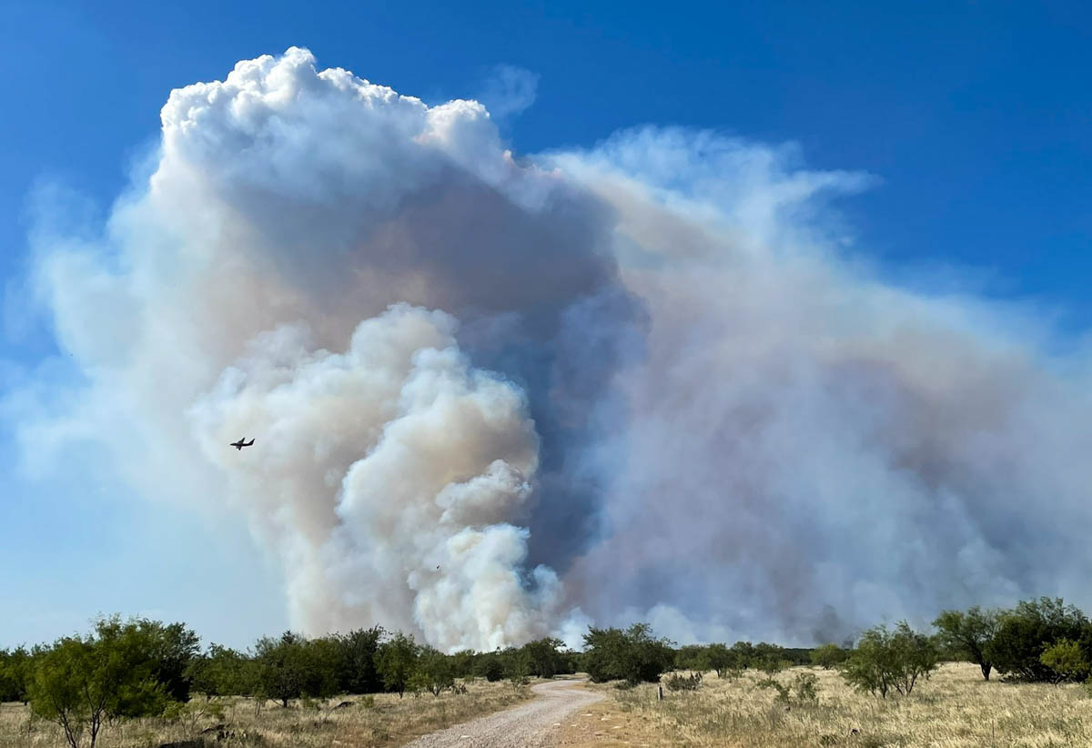
The Dempsey Fire 6 miles west of Mineral Wells, Texas was extremely active Friday afternoon, growing to approximately 6,500 acres as the temperature soared to 106 degrees. The Texas Forest Service reported it ran to the north and northwest, jumping the Brazos River and FM Road.
Dempsey Fire location map, 6 miles west of Mineral Wells, TX.
Engines have been engaged in structure protection as dozers construct line along the flanks of the fire. Aircraft are assisting firefighters by cooling the head and flanks, slowing the rate of spread and buying time for the ground crews. Evacuations are in effect south of Grassy Ridge Road.
Dempsey Fire map, estimated perimeter at 2:22 p.m. CDT June 23, 2022. Texas Forest Service.
After 2 p.m. Friday the wind at the Mineral Wells Airport was out of the south and southeast at 10 to 18 mph gusting at 20 to 30 while the relative humidity was 17 percent. The spot weather forecast for Friday night calls for 7 to 12 mph winds out of the south and southeast with the humidity rising to 50 percent by dawn. On Saturday the wind will be from the south at 10 to 15 mph with 18 percent relative humidity and a high temperature of 105. These weather conditions will favor the continued spread of the fire to the north and northwest .
Dempsey Fire, west of Mineral Wells, Texas, June 24, 2022. Photo via Texas Forest Service.
Canyon Fire as seen from the Sunol Ridge 1 camera at 2:37 p.m. June 23, 2022
A Fremont, California firefighter was injured Thursday while working on the Canyon Fire northeast of the city near Sunol in Alameda County. The Fremont Fire Department said Thursday night that “the firefighter was hit by a falling tree after a water drop operation. Thankfully the firefighter was released from the hospital this evening and is expected to be ok.”
A reporter from KPIX TV, @KatiePPIX, said another firefighter was transported to a hospital for a heat related injury after working in “near triple digit temps.”
The spread of the fire was stopped after it burned 71 acres. Firefighters were assisted by helicopters and air tankers.
In the second video below, a large Type 1 helicopter can be seen making a drop on the Canyon Fire.
On May 29, 2022 three firefighters were injured when struck by water dropped from a large Type 1 helicopter on the Calf Canyon-Hermits Peak Fire in New Mexico. They were not injured directly by the water, but were knocked onto boulders by the force of the drop. It occurred while they were crossing a steep rocky piece of ground consisting boulders two to three feet in diameter, according to a preliminary report. The most seriously injured had multiple surgeries to repair facial fractures and a broken kneecap.
In 2018 three firefighters were injured and one was killed by falling tree debris resulting from an air tanker retardant drop. The accident occurred on the Ranch Fire which was part of the Mendocino Complex of Fires east of Ukiah, California.
Sequoia grove in Sequoia and Kings Canyon NP, November, 2021. NPS photo by Daniel Jeffcoach.
At Wildfire Today we don’t get too excited about proposed legislation because most of it is introduced, sent to a committee, and is never seen again. But pending, there are two that will interest land managers and wildland firefighters and may have a better than 50/50 chance of passing.
Save Our Sequoias
Today House Minority Leader Kevin McCarthy (R-Bakersfield-23) and co-author House Committee on Natural Resources Ranking Member Bruce Westerman (R-Ark.) introduced the Save Our Sequoias (SOS) act.
These trees that can live for up to 3,000 years need protection. This should include actively managing and reducing the surrounding hazardous fuels. In addition, when firefighting resources are scarce, which seems to be the new normal, Multi-Agency Coordinating Groups need to consider the irreplaceable value of these iconic groves when allocating personnel and equipment for going fires. Some may say these behemoths are at least, if not more, valuable than man-made structures that also may need protection from nearby fires.
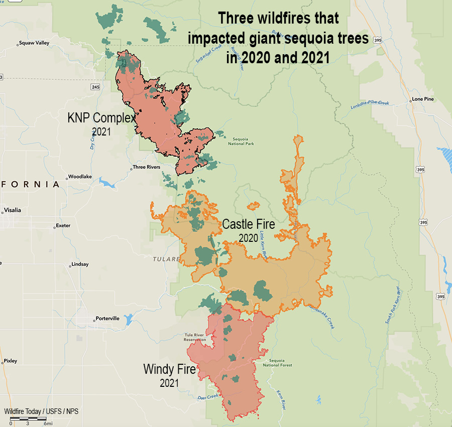
Preliminary surveys found that in a two year period, 2020 and 2021, almost 20 percent of all giant sequoias in their natural range over four feet in diameter were killed by fire (and neglect) or will die in the next few years. In 2020, 10 to 14 percent of the entire Sierra Nevada population of giant sequoia trees over 4 feet in diameter were killed in the Castle Fire. Early estimates after two fires the following year, the KNP Complex and the Windy Fire, 2,261 to 3,637 sequoias over four feet in diameter were killed or will die within the next three to five years.
At this rate, with this climate, we could lose the rest of these massive trees in just a few years.
Three fires in two years that killed giant sequoia trees. The darker green areas represent groves of giant sequoias.
Please watch this video to see how urgent the issue is.
The film was produced by Kyle Dickman and the Mariposa County Resource Conservation District thanks to a grant from the California Wildlife Conservation Board’s Forest conservation Program.
Despite the looming threat to the remaining Giant Sequoias, federal land managers have not been able to increase the pace and scale of treatments necessary to restore Giant Sequoia resiliency to wildfires, insects, and drought. At its current pace, it would take the U.S. Forest Service approximately 52 years to treat just their 19 highest priority Giant Sequoia groves at high-risk of experiencing devastating wildfires. Without urgent action, we are at risk of losing our iconic trees in the next several years. Accelerating scientific forest management practices will not only improve the health and resiliency of these thousand-year-old trees but also enhance air and water quality and protect critical habitat for important species like the Pacific Fisher.
The SOS Act will provide land managers with the emergency tools and resources needed to save these remaining ancient wonders from the unprecedented peril threatening their long-term survival. The bill would:
Enhance coordination between federal, state, tribal and local land managers through shared stewardship agreements and the codification of the Giant Sequoia Lands Coalition, a partnership between the current Giant Sequoia managers.
Create a Giant Sequoia Health and Resiliency Assessment to prioritize wildfire risk reduction treatments in the highest-risk groves and track the progress of scientific forest management activities.
Declare an emergency to streamline and expedite environmental reviews and consultations while maintaining robust scientific analysis.
Provide new authority to the National Park Foundation and National Forest Foundation to accept private donations to facilitate Giant Sequoia restoration and resiliency.
Establish a comprehensive reforestation strategy to regenerate Giant Sequoias in areas destroyed by recent catastrophic wildfires.
Neither the text or a summary of the bill, H.R.8168, is available, but on the day it was introduced Congress.gov listed 26 cosponsors — 13 Republicans and 13 Democrats.
$1,000 Recruitment or Retention bonus for wildland firefighters
An amendment has been added to the National Defense Authorization Act (NDAA) of 2023, H.R.7900, which would pay a recruitment or retention bonus of not less than $1,000 to Federal wildland firefighters. The minimum amount would be increased each year according to the Consumer Price Index. It would be available once a year to any primary or secondary firefighter after successfully completing the Work Capacity Test.
‘‘Federal wildland firefighter’’ is defined as “any temporary, seasonal, or permanent position at the Department of Agriculture or the Department of the Interior that maintains group, emergency incident management, or fire qualifications, as established annually by the Standards for Wildland Fire Position Qualifications published by the National Wildfire Coordinating Group, and primarily engages in or supports wildland fire management activities, including forestry and rangeland technicians and positions concerning aviation, engineering heavy equipment operations, or fire and fuels management.”
It does not appropriate any additional funding to pay the bonuses, but the dollars could most likely come from the salaries from unfilled positions.
The NDAA is far from being passed, but this is a high priority piece of legislation which is sometimes used as a vehicle for slipping in unrelated bills. The 2014 NDAA, for example, included authorization and $130 million to transfer seven HC-130H aircraft from the Coast Guard to the US Forest Service to be used as air tankers. But that’s a long, sad, story with a couple of unexpected twists. (Unless there are still more delays, one or more may be actually flying over fires for the California Department of Forestry and Fire Protection, not the Forest Service, in 2023.)
A correction was made to the dates in which nearly 20 percent of all giant sequoias in their natural range over four feet in diameter were killed by fire (and neglect) or will die in the next few years.