Lead plane and air tanker avoid falling tree branch

Ensalados Fire Vandenberg Air Force Base
File photo of Tanker 103, July 9, 2017. Photo by Vandenberg Fire Department.

This article was first published at Fire Aviation

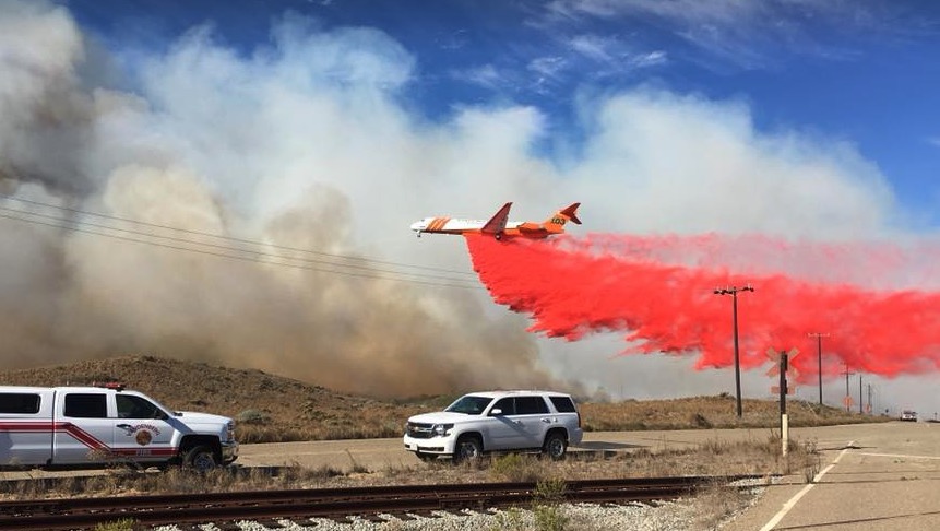
Yesterday July 9 a lead plane and a large air tanker had a close call while on a retardant dropping sortie on the Washburn Fire in Yosemite National Park.

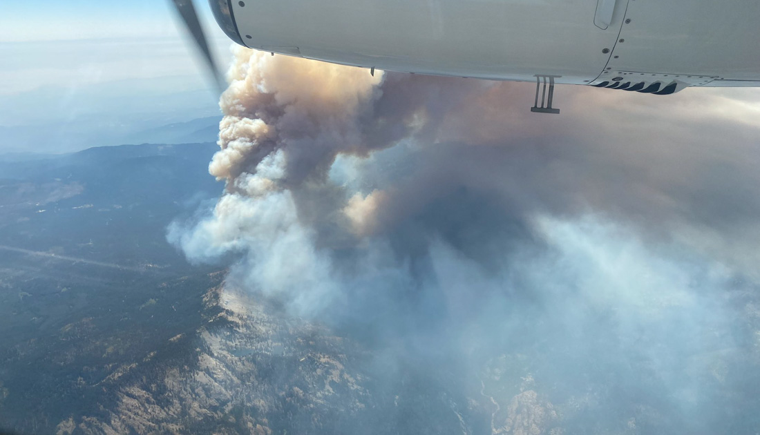
There was virtually no wind over the fire most of the day and the area was smoked in causing very poor visibility making it impossible for air tankers to drop on the fire. But by 6 p.m. conditions had improved and at about 6:10 p.m. a lead plane was leading Tanker 103, an MD-87, over a target when they saw a falling tree branch above the lead plane. It fell between the two aircraft, in front of the tanker.

Twitter user Robert, @Rob_on_sisukas, captured an audio recording of the radio conversation. We’re not sure who the lead plane pilot was talking to, but we’ll call it “dispatcher” for now:

LEAD PLANE: Hey I just want to let you know that a branch went right over the top of us, pretty good size, probably 50 feet above us coming down and fell right in between Tanker 103 and myself.

DISPATCHER: OK. Copy. So it’s repeat of yesterday’s (unintelligible) 

LEAD PLANE: That’s exactly what I’m getting at. So if we keep seeing that we might have to knock it off. I don’t want to take a chance on busting a window in an airplane or hurting an aircraft for this. 

DISPATCHER: Absolutely. Keep me updated on this.

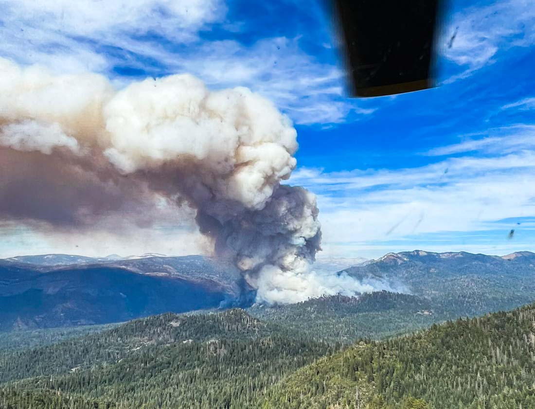
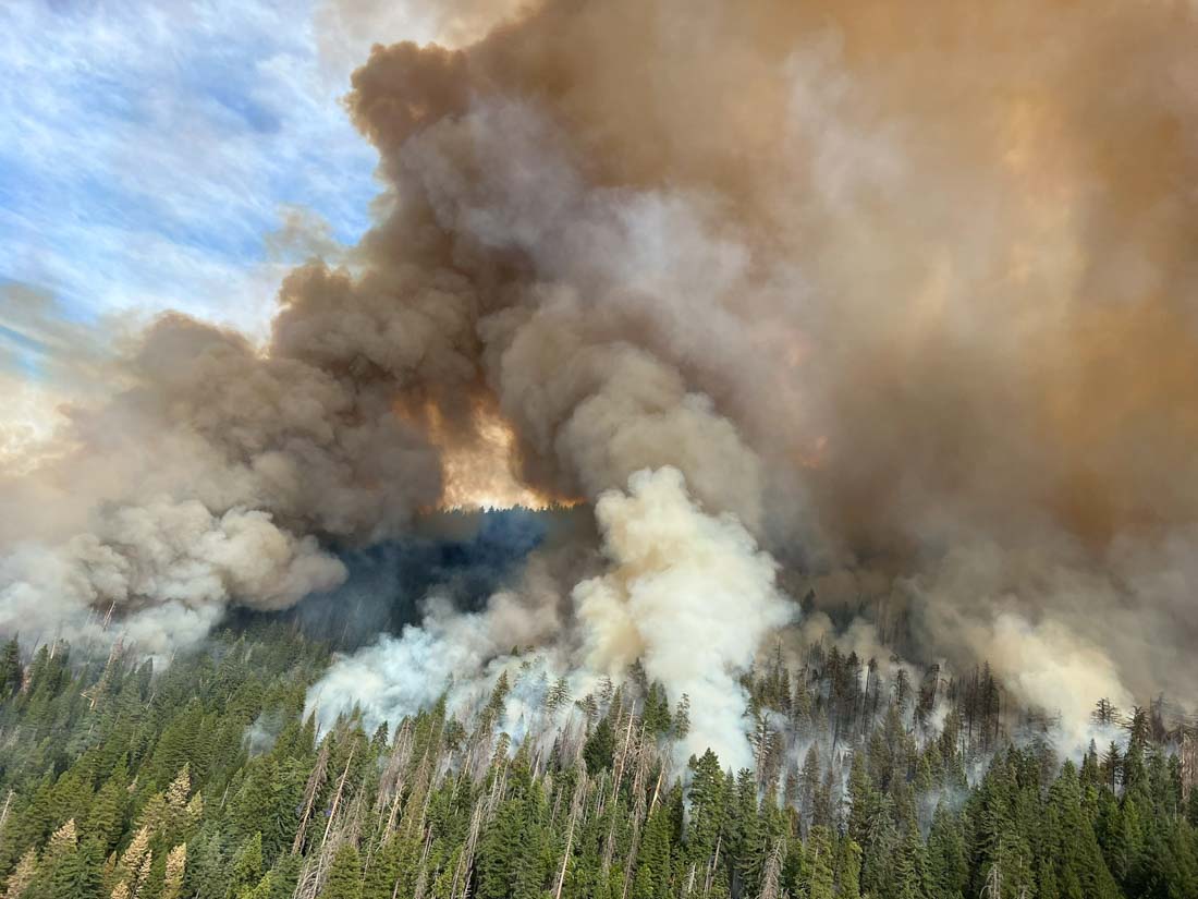
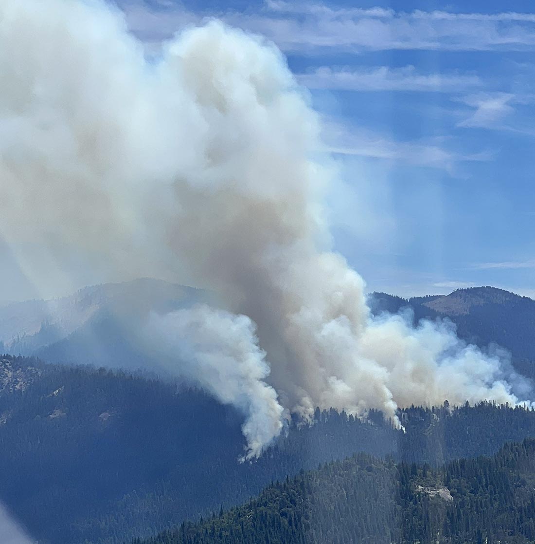
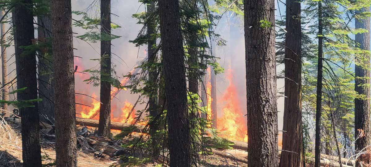
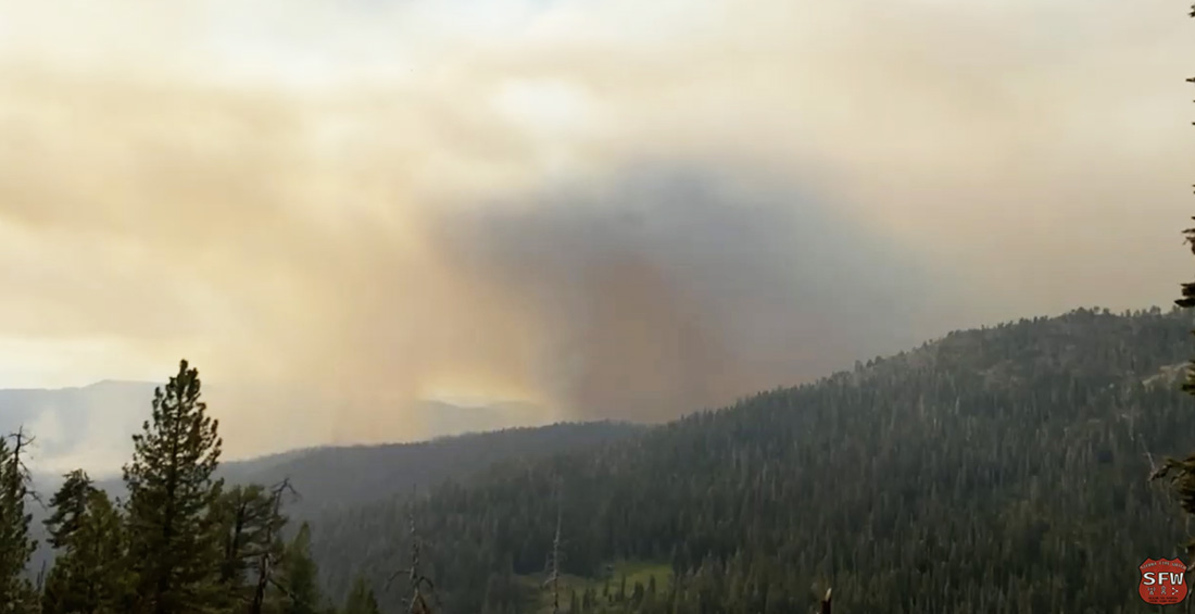
When a fire is burning intensely in an unstable atmosphere the convection in the rising smoke column can be powered by a tremendous amount of energy. As air at ground level rushes in to take the place of the rising column, the developing horizontal wind and the fresh oxygen feed the fire, causing an even higher level of intensity. The horizontal and then vertical movement of air can sometimes transport unexpectedly large objects up into the sky. Large columns may rotate as they rise and in extreme cases can actually become a fire tornado. You don’t want to be nearby when that happens. Fire tornados are not to be confused with small dust devils or fire whirls.

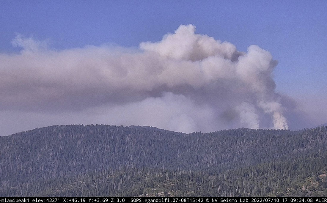
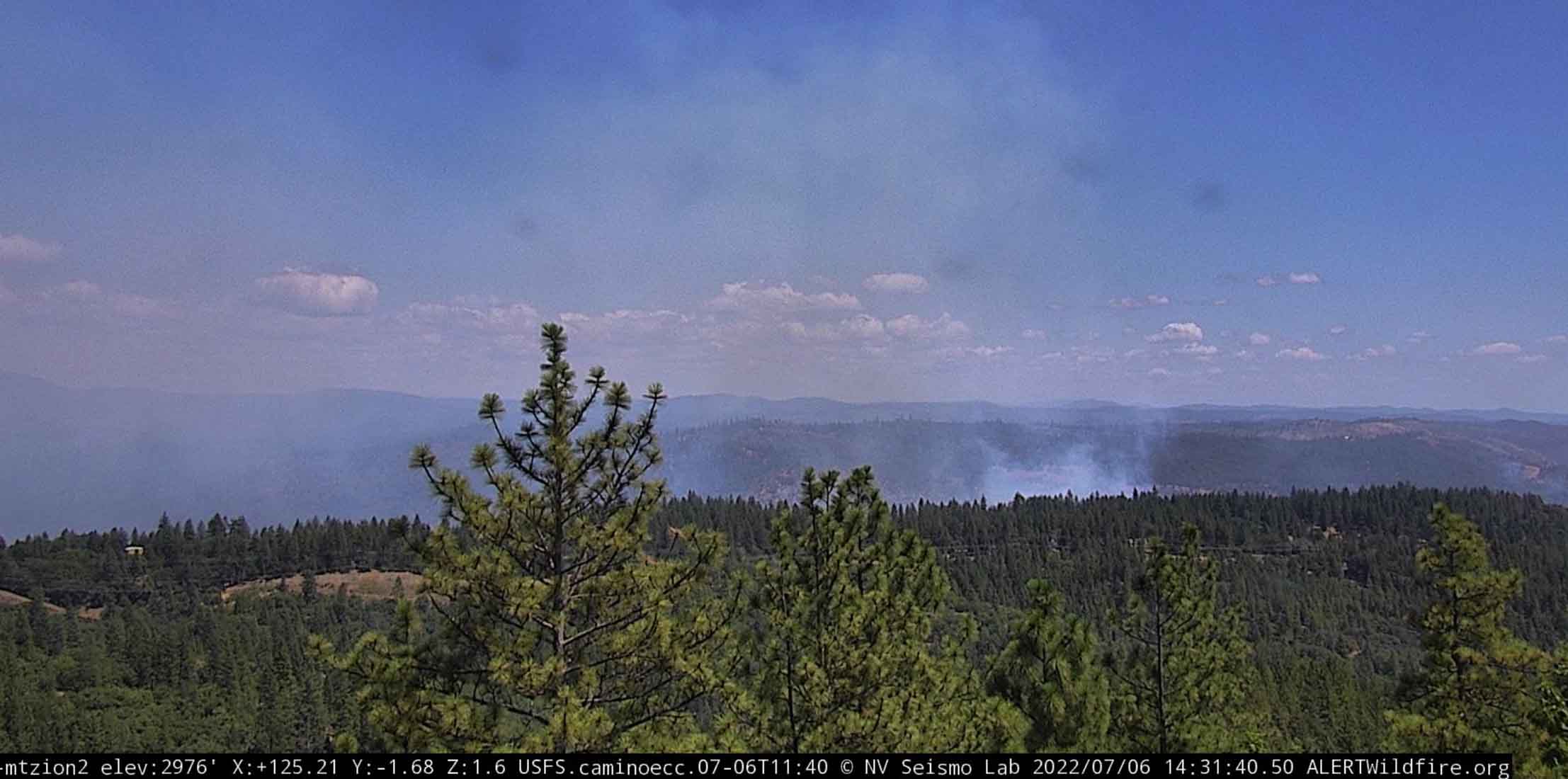
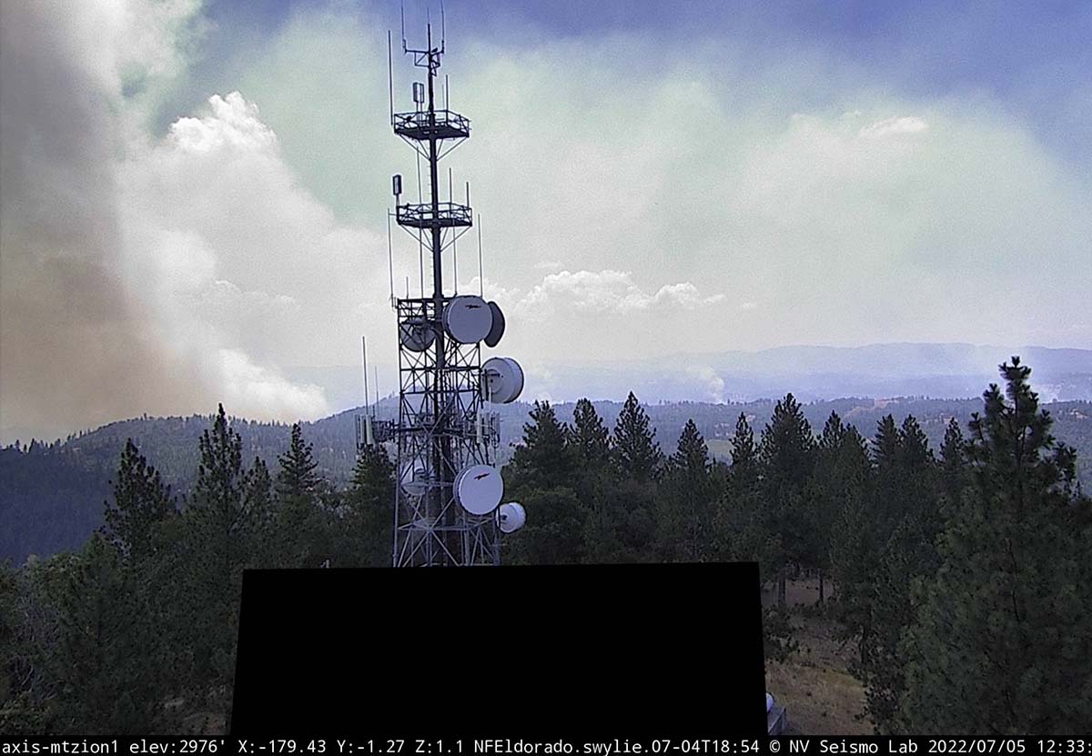
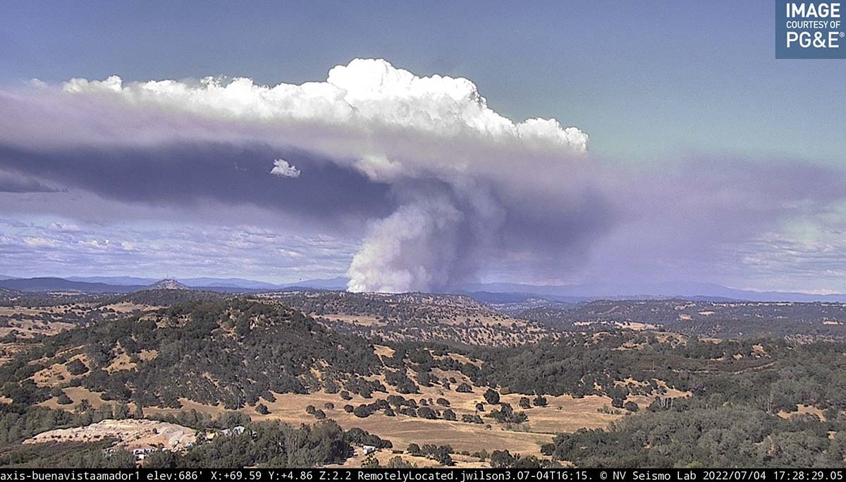
What is surprising about the incident yesterday is that the fire was smoked in most of the day, and tankers could not fly until about 6 p.m. I looked at various AlertWildfire cameras a few times and did not see any smoke columns. Maybe the cameras I saw were not able to see all of the fire, but I remember that late in the afternoon fire activity increased at the Sierra Fire Watch camera below, and columns may have developed.

Washburn Fire at 5:24 p.m. July 9, 2022
Washburn Fire at 5:24 p.m. July 9, 2022. Sierra Fire Watch image.

Firefighting aircraft being damaged by debris being lofted into the air over a fire is not unheard of. Here’s part of an article I wrote for Wildfire Today in 2018:

During the large vegetation fires in southern California in 2003 some of the convection columns were so powerful that the windshields on six air tankers were cracked by chunks of debris that were being hurled into the air (page D-6 in 2003 California Governor’s Blue Ribbon Report; huge 20 Mb file). One pilot saw a four by eight sheet of plywood sail past at 1,500 feet.

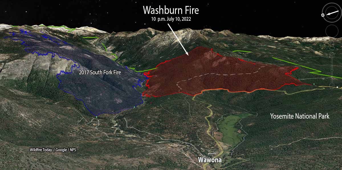
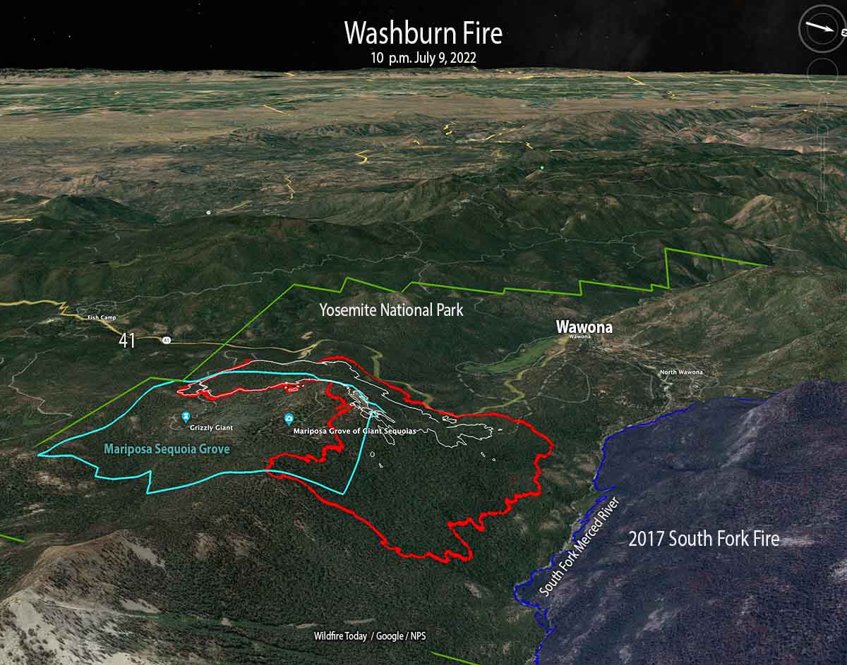
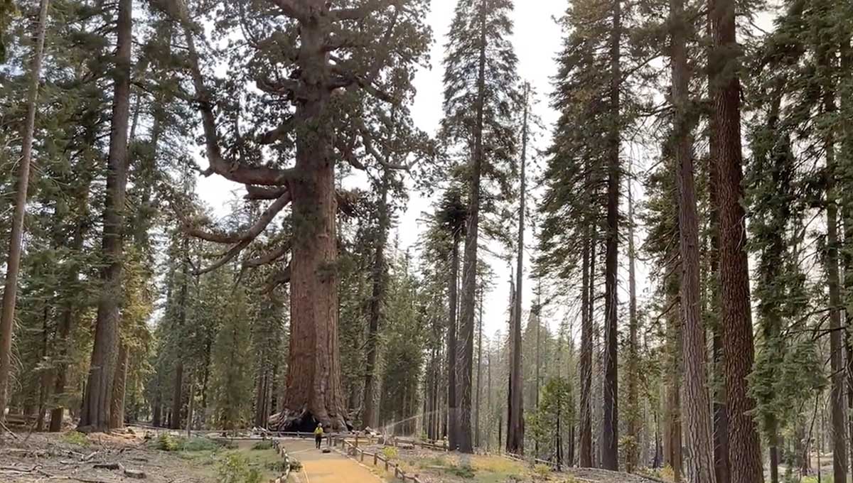
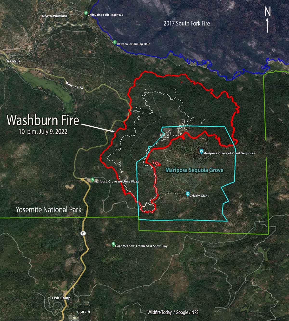
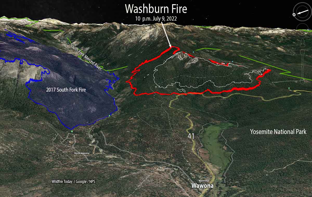
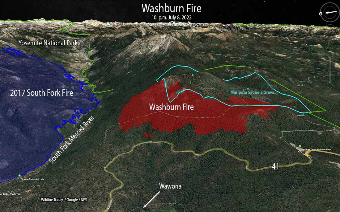
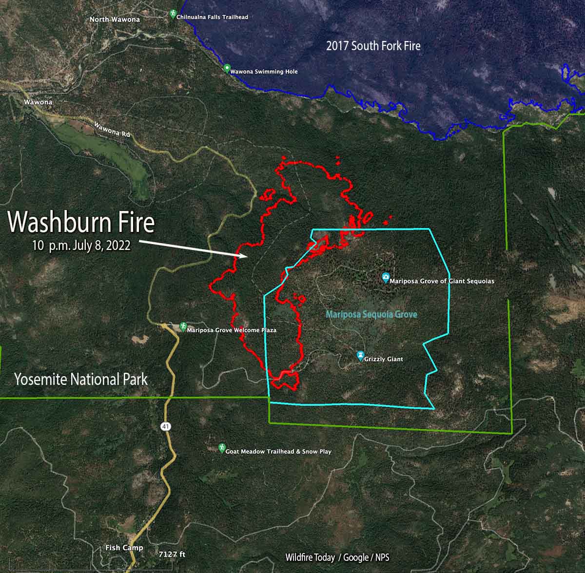
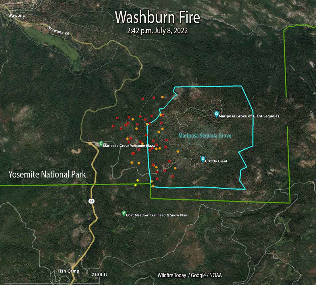
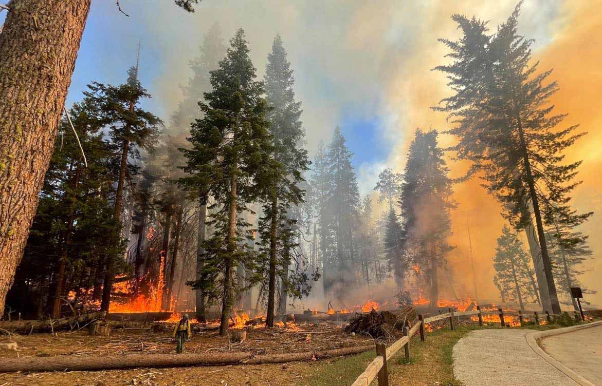
As of late morning today, July 10, the Washburn Fire has burned about 1,800 acres in Yosemite National Park. About 300 of those acres are in the Mariposa Grove of giant sequoia trees, some of them 3,000 years old.

Thanks and a tip of the hat go out to Kelly.

Washburn Fire grows in Yosemite National Park

It has burned into a grove of giant sequoia trees, some of which are 3,000 years old

Updated 5:08 p.m. PDT July 11, 2022

Washburn Fire, July 11, 2022
This photo of the Washburn Fire posted at about 4 p.m. PDT July 11 appears to have been taken near the South Fork of the Merced River, looking west. Compare it to the west-facing 3-D map below and you can pick out the large rock face on the north side of the ridge. The column of smoke appears to be coming from an area east or northeast of the sequoia grove, near the park boundary. Photo by Courtney Aviation.

Late Monday afternoon activity on the Washburn Fire increased substantially. There have been reports of at least one spot fire on the north side of the South Fork of the Merced River. There were also reports of spot fires across highway 41 on the west or northwest side of the fire.

Satellite heat detections at 2:36 p.m. Monday showed numerous heat sources east of the earlier perimeter of the fire across the park boundary on the Sierra National Forest, and on the northwest side of the fire between Highway 41 and the river.

In mid-afternoon the FIRIS aircraft mapped the fire at 2,720 acres.

Washburn Fire at 3:13 p.m. July 11, 202
Washburn Fire at 3:13 p.m. July 11, 2022. AlertWildfire.

Updated 7:11 a.m. PDT July 11, 2022

Washburn Fire, 3-D map 10 p.m. July 10, 2022
Washburn Fire, 3-D, looking east at 10 p.m. July 10, 2022.

The Washburn Fire in Yosemite National Park in California continued to spread west, north, and east on Sunday. On Saturday and Sunday the size increased by 749 acres, bringing the total to 2,340 acres according to a mapping flight Sunday at 10 p.m.

Approximately 340 acres of the fire are within the Mariposa Grove of giant sequoias. While protective foil-based structure wrap is not being used on the sequoias themselves, additional methods are being employed including the removal of fuels around the trees, and ground-based sprinkler systems to increase humidity and fuel moisture near the sequoias. The Mariposa Grove has a long history of prescribed burning and studies have shown that these efforts reduce the impacts of high-severity fire.

Washburn Fire map 10 p.m. July 10, 2022
Washburn Fire map. The red line was the perimeter at 10 p.m. July 10, 2022. The white line was the perimeter 24 hours before.

Firefighters are constructing direct fireline on the fire edge where possible, but are also using tactical firing to tie it in with barriers, such as Highway 41 on the west side.

Evacuations are in effect in the Wawona area. A map is available showing the locations. The Wawona Road (Highway 41) is closed from the South Entrance to Henness Ridge Road.  Yosemite West remains accessible from the northern side of the Wawona road.

Washburn Fire, 3-D map 10 p.m. July 10, 2022
Washburn Fire, 3-D map, looking west at 10 p.m. July 10, 2022.

The weather forecast for the fire area (6,400 feet above sea level) predicts for Monday and Tuesday 81 degrees, 3 to 8 mph west and southwest winds, relative humidity in the low to mid-20s, partly cloudy skies, and no chance of rain.


Updated 5:34 p.m. PDT July 10, 2022

Smoke from the Washburn Fire
Smoke from the Washburn Fire, looking northeast from the Miami Peak camera at 5:09 p.m. July 10, 2022. AlertWildfire.

The Washburn Fire, part of which is burning in a grove of giant sequoias in Yosemite National Park, has grown to 2,045 acres, according to a mapping flight at about 4 p.m. Saturday. Most of the additional acres are on the north and east sides. It spread closer to the South Fork of the Merced River, but at that time had not crossed. The east side has moved across the county line, from Mariposa into Madera county.

Washburn Fire map, July 10, 2022

Three large air tankers and a very large air tanker dropped retardant along a ridge in mid-afternoon, pretreating it in anticipation that when the fire reaches that location the spread will be slowed or stopped.

Satellite view of the Washburn Fire July 10, 2022
Satellite view of smoke from the Washburn Fire at 5:17 p.m. PDT July 10, 2022. NOAA.

Late in the afternoon the fire activity increased substantially, sending up a substantial smoke column which was blown off to the north.


9:11 a.m. PDT July 10, 2022

Washburn Fire 3-D map 10 p.m. July 10, 2022
Washburn Fire, 3-D map looking west. The red line was the perimeter at 10 p.m. July 9, 2022. The white line was the perimeter 24 hours before.

With very little wind Saturday, the Washburn Fire continued to spread in and adjacent to the Mariposa grove of giant sequoia trees in Yosemite National Park in California. In spite of the relatively mild weather conditions, spot fires are occurring hundreds of feet out in front of the leading edge. The growth into the grove has been limited due to previous prescribed fires that reduced the amount of fuel on the ground, and by the efforts of firefighters. Some of the trees are about 3,000 years old.

Firefighters set up sprinklers at Grizzly Giant sequoia fire
Firefighters set up sprinklers at the Grizzly Giant sequoia during the Washburn Fire in Yosemite National Park, July 9, 2022. NPS image.

While the huge, very old trees are adapted to fire, they are not prepared for human caused climate change and the current “exceptional drought” conditions that have led to low soil and fuel moistures. The monster trees are more vulnerable to the existing weather and fuel conditions. They only grow in about 70 groves located on the western slopes of California’s Sierra Nevada Mountains. They are the largest trees on Earth in terms of volume.

The fire was mapped Friday night at 1,591 acres. Approximately 300 acres are in the Mariposa Grove of giant sequoias, on the west and north sides.

Smoke at times on Saturday degraded visibility to the point where retardant-dropping aircraft were grounded. Most of the movement of the fire was on the north end where it is working its way down-slope to the South Fork of the Merced River, which is also the southern edge of the South Fork Fire that burned 7,563 acres in 2017. The footprint of that 5-year-old fire scar will not stop the fire by itself, but there will be less resistance to control as it spreads through the lighter fuels.

Washburn Fire map 10 p.m. July 10, 2022
Washburn Fire map. The red line was the perimeter at 10 p.m. July 9, 2022. The white line was the perimeter 24 hours before.

The Washburn Fire is burning in mostly high load conifer litter with a heavy dead and down component as well as numerous standing dead trees.

There was very little wind on the fire Saturday and none overnight at Fish Camp, south of the fire and 1,000 feet lower where the minimum humidity Saturday was 31 percent but rose to 83 percent by 7:31 a.m. Sunday. Warmer and drier weather is predicted for the next few days.

The weather forecast for the fire area on Sunday calls for temperature around 80, relative humidity 26 percent, and ridgetop winds out of the west at 5 mph gusting to 12 mph in the afternoon. For Sunday night, 66 degrees, 33 percent RH, and 5 to 10 mph northwest winds in the evening shifting to east after 9 p.m.   Monday should bring 83 degrees, 20 percent RH, and 5 to 10 mph winds out of the southeast shifting to southwest by 11 a.m.

Washburn Fire 3-D map 10 p.m. July 10, 2022
Washburn Fire, 3-D map looking east. The red line was the perimeter at 10 p.m. July 9, 2022. The white line was the perimeter 24 hours before.

CAL FIRE to add more firefighters, engines, dozers, and helicopters

Will add 1,503 personnel, 27 engines, 4 helicopters, and 10 dozers

CAL FIRE dozer and transport
File photo of a new dozer and transport for the Nevada Yuba Placer Unit of the California Department of Forestry and Fire Protection. CAL FIRE photo, March, 2019.

The new budget for California signed into law June 30 by Governor Gavin Newsom includes a massive increase for the California Department of Forestry and Fire Protection (CAL FIRE) for the fiscal year that began July 1, 2022.

Firefighters
The budget authorizes 11,293 positions, a 13 percent increase of 1,503 personnel. 

Helicopters
To add to the 12 new S70i Firehawk helicopters that were funded a couple of years ago, they will spend $99 million to purchase an additional 4 to help maintain continuous flight operations during critical fire weather conditions when frontline helicopters are due for maintenance. 

In addition, $45 million is set aside annually for the next three years to secure exclusive use (EU) contracts for 10 additional helitankers while awaiting the federal delivery of seven former Coast Guard C-130 air tankers that over the last 9 years have been waiting for the US Air Force to convert them into retardant-dropping air tankers.

CAL FIRE Director Joe Tyler told Fire Aviation in March that the incorporation of the seven former Coast Guard C-130 aircraft into the state’s air tanker fleet might be pushed back to 2024 due the pandemic/endemic and supply chain issues. This is in spite of the agency’s efforts in attempting to facilitate movement in the project. He said they had hoped to see some of the C-130s flying on fires this year. CAL FIRE is working with the Coast Guard, the Air Force, and the contractor who will install the retardant delivery system, Coulson Aviation.

California Conservation Corps (CCC) and California Military Department (CMD) Hand Crews 
Appropriated is $104 million and 238 positions starting now, and $50 million and 270 positions phased in over five years. Eight additional year-round hand crews will be added and 16 seasonal hand crews will be converted to year-round.

Four existing seasonal CAL FIRE/CCC hand crews will convert to year-round staffing in July 2022 and the personnel for the remaining two transitioned seasonal hand crews will be hired beginning January 2023. On these hand crews, two temporary Fire Captains (FC) per hand crew are replaced by three permanent FCs and three new FAEs are added to each hand crew. In total, 18 FCs and 18 FAEs will staff all six hand crews.

Ten existing seasonal CMD hand crews will be converted to year-round and four year-round CMD hand crews will be added for statewide response and fuels reduction projects.

Engines and Dozers
$36 million will be used to acquire surge capacity fire engines and bulldozers. This will add two additional engines in each of the 21 Units and six contract counties, plus 10 additional bulldozers. These resources will be available to be staffed during times of resource drawdown and critical fire activity.

Approximately $9 million will be used to hire support staff for the Firehawk program and positions for the contract EU helicopters,

July through December Fire Protection Augmentation
One-time funding of $83.1 million General Fund is available to augment fire protection resources from July through December 2022 given trends associated with climate change and current drought conditions, increasing fire severity and size, and declining inmate camp populations. It will be used to extend the staffing of 16 additional CAL FIRE firefighter hand crews through December 2022, plus support staff and training.

Fire burns into another giant sequoia grove, this time in Yosemite National Park

Washburn Fire has burned hundreds of acres in the Mariposa Giant Sequoia Grove

Updated at 5:26 p.m. PDT July 9, 2022

Washburn Fire at 5:24 p.m. July 9, 2022
Washburn Fire at 5:24 p.m. July 9, 2022. Sierra Fire Watch image.

Smoke over the Washburn Fire is preventing air tankers from dropping retardant.

The FIRIS mapping aircraft reported at about 4 p.m. that the fire had grown to 1,384 acres


Updated 8:03 a.m. PDT July 9, 2022

Map 3-D Washburn Fire Yosemite National Park 10 p.m. July 8, 2022
3-D map of the Washburn Fire in Yosemite National Park, looking east at 10 p.m. July 8, 2022.

The Washburn Fire in Yosemite National Park in California was very active throughout Friday night and into Saturday morning. The photo below taken at dawn on Saturday shows a convection column of smoke, something you don’t often see over a wildfire at dawn.

Washburn Fire, July 9, 2022
Washburn Fire, looking NNE from the Deadwood camera at 6:03 a.m. July 9, 2022.

The National Park Service, which often “manages” wildfires in Yosemite rather than aggressively putting them out, said they are fully suppressing this fire. California Interagency Incident Management Team 13 has assumed command, and additional firefighting resources will continue to arrive over the coming days.

A mapping flight at 10 p.m. Friday found that it had grown to 703 acres, a number that has no doubt been exceeded in the subsequent hours.

Map Washburn Fire Yosemite National Park 10 p.m. July 8, 2022
Map of the Washburn Fire in Yosemite National Park, 10 p.m. July 8, 2022.

The overnight weather at the Fish Camp weather station south of the fire 1,000 feet lower in elevation, recorded a maximum relative humidity of 53 percent and light winds out of the west and northwest. The spot weather forecast issued Friday afternoon predicted for Saturday 82 degrees, 27 percent relative humidity, and 6-12 mph afternoon ridgetop winds gusting to 18 mph out of the southwest and west. This should  influence the fire to continue spreading to the northeast and east.

Approximately 155 acres of the fire has burned into the west side of the 1,300-acre Mariposa giant sequoia grove. The Park Service has been conducting prescribed fires within the grove for years, including about seven since 1999. This should slow the spread in the grove and reduce the fire intensity compared to other locations that do not have similar recent fire history. It remains to be seen how much sequoia mortality will occur under the present low fuel moistures and “exceptional drought” conditions.

It appears likely that the blaze will reach the South Fork of the Merced River, the southern perimeter of the 2017 South Fork Fire, which should also slow the progression of the fire.

Washburn Fire, July 8, 2022
Washburn Fire, July 8, 2022. By @countryheli
Washburn Fire, July 8, 2022
Washburn Fire, July 8, 2022. By @countryheli

7:04 p.m. PDT July 8, 2022

Washburn Fire map, 2:42 p.m. July 8, 2022
Washburn Fire map. The dots represent heat detected by a satellite as late as 2:42 p.m. July 8, 2022. The red dots are the most current.

Another wildfire is burning in a grove of giant sequoia trees — behemoths that can live for 3,000 years. The Washburn fire was reported at 2 p.m. Thursday July 7 and by 4 p.m. Friday it had been mapped by a FIRIS aircraft at 466 acres. At least 150 acres of the fire are within the Mariposa giant sequoia grove in the south end of Yosemite National Park two miles southeast of Wawona, a community that is under an evacuation order. An evacuation map has been posted and the south entrance to the park is closed.

Preliminary surveys found that in a two year period, 2020 and 2021, almost 20 percent of all giant sequoias in their natural range over four feet in diameter were killed by fire (and neglect) or will die in the next few years. In 2020, 10 to 14 percent of the entire Sierra Nevada population of giant sequoia trees over 4 feet in diameter were killed in the Castle FireEarly estimates after two fires the following year, the KNP Complex and the Windy Fire, 2,261 to 3,637 sequoias over four feet in diameter were killed or will die within the next three to five years.

Washburn Fire, July 8, 2022
Washburn Fire, July 8, 2022. NPS photo.

Aircraft report that as the activity on the Washburn Fire increased Friday afternoon multiple spot fires occurred near the South Fork of the Merced River and east of Highway 41, some of them 0.7 miles out ahead of the main fire. That river was the south edge of the South Fork Fire that burned 7,563 acres in 2017. Normally a fire would slow down considerably when it encountered a fire scar less than 8 or 9 years old, but the Electra Fire near Jackson, CA burned quite well earlier this week in a seven year old scar. It will be interesting to see what the Washburn Fire will do if it bumps the South Fork Fire footprint.

Washburn Fire
Washburn Fire, looking north-northeast from the Deadwood AlertWildfire camera at 6:07 p.m. July 8, 2022.

The National Park Service has conducted four prescribed fires east of the Washburn Fire, in 2003, 2004, 2006, and 2016 for a total of 295 acres. This would have reduced some of the fuel in those areas, which may slow the spread in those treated locations, reduce the wildfire intensity, and the mortality of the giant sequoias. The more recent treatments are the most effective for modifying the behavior of a wildfire.

Washburn Fire, fuel treatments
Washburn Fire, fuel treatments. There have been other fuel treatments in the Mariposa Grove not shown on this map.
Washburn Fire
Washburn Fire, as seen from a firefighting helicopter. Photo by @countryheli July 8, 2022.
Washburn Fire shortly after it was discovered, July 7, 2022
Washburn Fire shortly after it was discovered, July 7, 2022. NPS photo.

Information about the Mariposa grove of giant sequoia, from Yosemite Mariposa County:

The most famous tree in the grove is the Grizzly Giant, one of the largest trees in the Mariposa Grove and, at an estimated age of 2,700 years, one of the oldest living sequoia.

Beyond the Grizzly Giant sit hundreds of lesser-visited sequoias in the upper grove including the Clothespin Tree, the Faithful Couple and the fallen Wawona Tunnel Tree.

Firefighters gain more containment on Electra Fire

Four miles southeast of Jackson, California

Updated 9:59 a.m. PDT July 7, 2022

Electra Fire map 11:15 p.m. July 6, 2022
The red line on the map was the perimeter of the Electra Fire at 11:15 p.m. July 6, 2022. The green line was the perimeter about 24 hours before. Most of the fire is within the footprint of the 2015 Butte Fire (white line).

Most of the 372-acre growth of the Electra Fire Wednesday was on the northeast side east of Clinton Bar Road, where crews conducted a firing operation. There was also growth on the southeast side in the Rich Gulch area near Highway 26.

Fire behavior moderated Wednesday night due to increased humidity. Several small spot fires were detected and mitigated with the support of intel platforms and one of the first uses of a CAL FIRE helicopter (C-101) conducting night-flying operations dropping water, using one of the new Firehawk ships.

The wind has been moderate since the Electra Fire started July 4. The prediction for Thursday is 6 to 10 mph winds out of the southwest in the afternoon, 86 degrees, and about 30 percent relative humidity.


Updated at 3:01 p.m. PDT July 6, 2022

Electra Fire map, northeast side, 1:39 p.m. MDT July 6, 2022
Electra Fire map, northeast side. The red squares represent heat detected by satellites at 1:39 p.m. PDT July 6, 2022. The red line was the perimeter at 11:50 p.m. MDT July 5, 2022.

The Electra fire 4 miles southeast of Jackson, California was not as active in the early portion of Wednesday afternoon as it was the previous two days. A satellite overflight at 1:39 p.m. only detected large heat sources on the northeast side southeast of Clinton Bar Road. There is no doubt there were many small heat sources scattered around the fire which could not be seen by the sensors on the satellite, but if it was vigorously spreading those areas would have shown up in the data.

Electra Fire, northeast side
Electra Fire, northeast side, looking southeast from Mt. Zion at 2:31 p.m. MDT July 6, 2022.

Wednesday afternoon at 2 p.m. CAL FIRE announced changes regarding road closures and evacuation status.

AMADOR COUNTY

Evacuation Order Update: The Amador County Sheriff’s Office is removing the road closure at the intersection of Lower Clinton Road and Butte Mountain Road. The new road closure will be moved to the Upper Clinton Road and Butte Mountain intersection. All residents along Clinton Road and Butte Mountain Road within this area are clear to return home. The evacuation order for this area has been reduced to a warning. Visit www.bit.ly/AmadorCountyEvacMap for more information.

Evacuation Warning Update: The warning zone running east from Jackson, along Hwy 88 to Previtali Road has been removed. All existing Evacuation Orders and Warnings not listed above remain in effect.

Road Closures: Tabeaud Road southbound at Highway 88, Mount Zion Road southbound at Highway 88, Upper Clinton Road at Butte Mountain Road, Clinton Road at West Clinton Road, and Electra Road at Highway 49

CALAVERAS COUNTY

All evacuation orders, evacuation warnings, and road closures remain unchanged.


9:37 a.m. PDT July 6, 2022

Electra Fire 3-D map 1150 p.m. MDT July 5, 2022
3-D map of the Electra Fire map at 11:50 p.m. MDT July 5, 2022. Looking northeast.

On Tuesday the Electra Fire four miles southeast of Jackson, California was not as active as it was on Monday, which allowed firefighters to make progress aided by numerous drops by air tankers and helicopters. Crews have been constructing direct fireline and burning out where possible, gaining containment, even though the official containment percentages are very low.

As of Tuesday night the 3,900-acre fire was almost entirely still within the footprint of the Butte Fire that burned more than 70,000 acres in September of 2015. It has burned both sides of the drainage along the Mokelumne River and reached but not crossed Highway 26 on the south side near Rich Gulch.

To see all articles on Wildfire Today about the Electra Fire, including the most recent, click HERE.

Electra Fire map 1150 p.m. MDT July 5, 2022
Map of the Electra Fire at 11:50 p.m. MDT July 5, 2022; and, the 2015 Butte Fire.

The most recent growth of the Electra Fire has been on the north and northeast sides, where firefighters are working to protect homes near Quail Drive and Clinton Bar Road. Where possible they are taking advantage of firelines used during the Butte Fire, firing out or backfiring from those areas.

The Amador County Sheriff’s office has created an online map showing the areas under evacuation orders.

Resources on the fire Tuesday included 200 fire engines, 26 water tenders, 7 helicopters and 41 dozers for a total of 1,334 personnel.

The weather forecast for Wednesday calls for skies clearing in the afternoon, 84 degrees, 40 percent relative humidity, and 5-10 mph afternoon winds out of the southwest and west gusting to 15.

Two CAL FIRE firefighters, Emily Eymann and Jessica Moser, rescued a pair of dogs, loading them into a US Forest Service truck for evacuation as the Electra Fire approached.

Electra Fire prompts evacuations southeast of Jackson, CA

Approximately 5 miles southeast of Jackson

Updated 1:39 p.m. MDT July 5, 2022

Electra Fire history July 4, 2022
Map showing the current Electra Fire, as of Monday night, and the 2015 Butte Fire.

The activity on the Electra fire southeast of Jackson, California has been increasing since noon Tuesday. Several air tankers are dropping retardant, including a DC-10, MD-87, C-130, and S-2T.

The Amador County Sheriff’s office has created an online map showing the areas under evacuation orders.

To see all articles on Wildfire Today about the Electra Fire, including the most recent, click HERE.

As of the Monday night mapping data, the Electra Fire has been burning entirely within the footprint of the huge Butte Fire that blackened more than 70,000 acres in 2015 while leading to two deaths and 135 destroyed homes.

Electra Fire 12:33 p.m. July 5, 2022
Electra Fire, looking south from Mt. Zion at 12:33 p.m. July 5, 2022.
Map Butte Fire
CAL FIRE’s map of the Butte Fire obtained Sept. 12, 2015. No information was provided about the date of the perimeter.

Resources working the fire include 128 engines, 22 water tenders, 33 dozers, 39 hand crews, and multiple aircraft.

On Monday approximately 100 recreational visitors and PG&E employees had to shelter in the Electra Powerhouse, but were safely evacuated from the area by 9:30 p.m.

The control objectives are to keep the fire east of Hwy. 49, south of Hwy. 88, north of Jesus Maria Road, and west of Hwy. 26 and Railroad Flat Road.

About 450 structures are threatened.

The weather at the Golden Chain Highway weather station south of Jackson at 1:20 p.m. Tuesday was 80 degrees, 49 percent relative humidity, and 6 mph winds out of south gusting to 12 mph. The forecast is for the RH to drop to about 40 percent by late afternoon.  Monday afternoon while the large convection column was raging, the nearby weather stations recorded a minimum RH of around 60 percent — remarkably high for such vigorous fire behavior.

Electra Fire
Electra Fire at the Mokelumne River. July 4 or 5, 2022.

Updated 5:25 a.m. PDT July 5, 2022

Electra Fire map, Monday night July 4, 2022
Electra Fire map, Monday night July 4, 2022. Data from FIRIS.

The Electra Fire 5 miles south of Jackson, California grew substantially Monday evening and into the night, but the activity slowed in the very early hours of Tuesday. Most of the growth was on the north and east sides after it crossed the Mokelumne River and reached highway 26 near Rich Gulch.

The FIRIS mapping crew estimated the size at 3,034 acres at about 1 a.m. Tuesday.

Electra Fire 8:07 p.m. July 4, 2022
Electra Fire, looking north from the Buena Vista camera at 8:07 p.m. July 4, 2022.

6:00 p.m. MDT July 4, 2022

Electra Fire, location
Map showing the location of the Electra Fire.

The Electra Fire that started Monday afternoon near Electra Road approximately 5 miles southeast of Jackson, California has prompted evacuations. At 5:06 p.m. a mapping aircraft estimated the size at nearly 390 acres. It is on both sides of the Mokelumne River.

perimeter map of the Electra Fire
Approximate perimeter of the Electra Fire at about 5:20 p.m. July 4, 2022. FIRIS aircraft.

At 5:36 the Amador County Sheriff Office said a mandatory evacuation order has been issued for all residents in the Butte Mountain Road area. Butte Mountain Road will be closed except for egress purposes.

An evacuation warning is in effect for all residents in a two mile radius around Lake Tabeau.

Electra Fire 5:28 p.m. July 4, 2022
Electra Fire, looking northeast from the Buena Vista camera at 5:28 p.m. July 4, 2022.

Soon after it started the fire was putting up a very large plume of smoke topped by condensation and a pyrocumulus cloud, indicating extreme fire behavior.

Aircraft near the Electra Fire in Northern California
Aircraft near the Electra Fire in Northern California at 5:23 p.m. July 4, 2022. FlightRadar24.