Mullen Fire reaches Albany, Wyoming

Updates on the Middle Fork and Cameron Peak fires in Colorado

Updated October 8, 2020   |   7:53 a.m. MDT
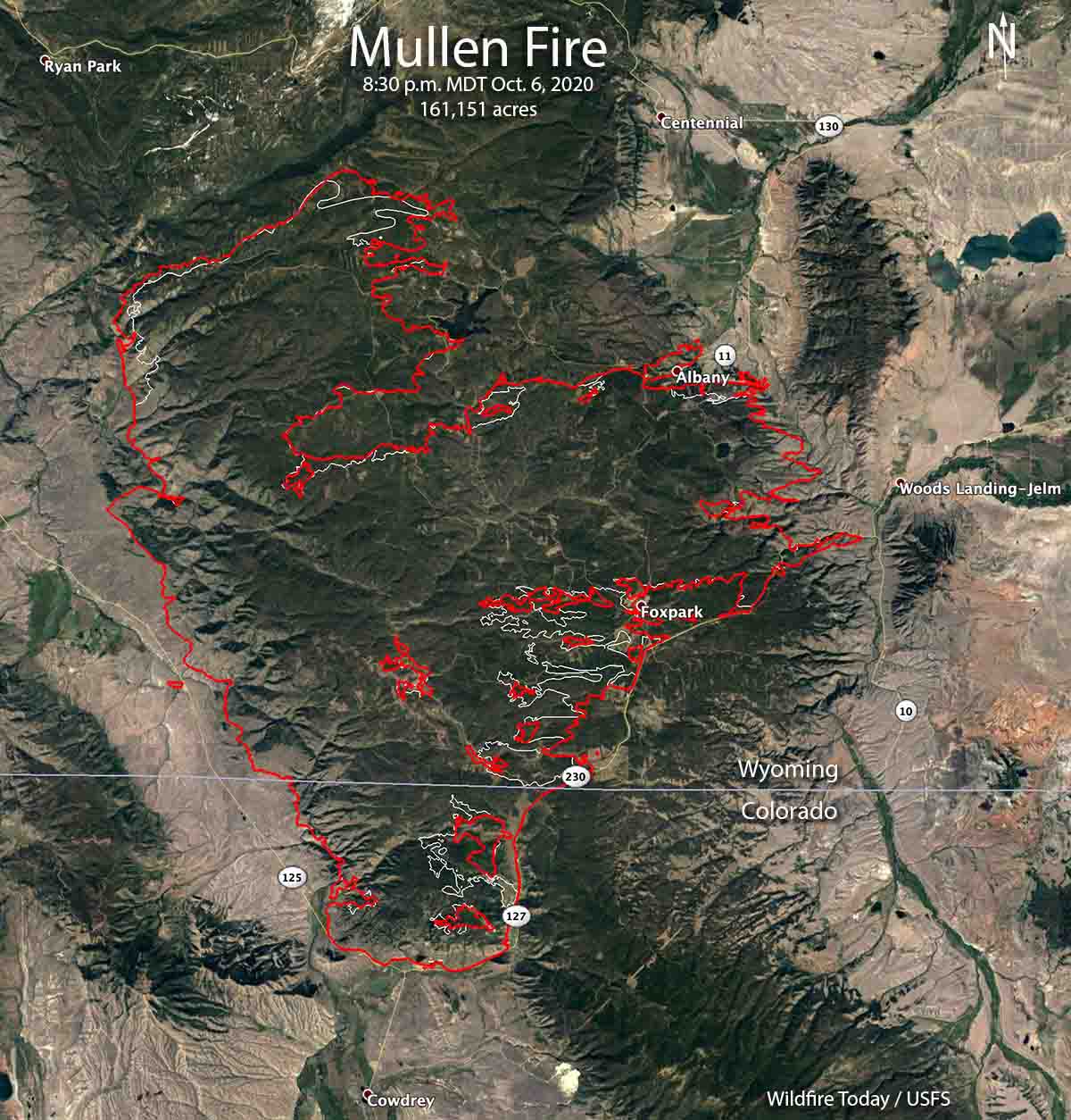
map of the Mullen Fire
The red line was the perimeter of the Mullen Fire at 8:30 p.m. MDT October 6, 2020. The white line was the perimeter two days before.

The Mullen Fire has been active on the east and northeast sides and reached the small community of Albany, Wyoming on Highway 11. The fire grew to the east and is now on both sides of the highway. Firefighters have been working to protect structures in Albany, the Wyoming Infrared Observatory, and the Rob Roy reservoir which is the main water source for the city of Cheyenne, WY.

The incident management team reported October 7 that 32 residences and 33 other structures have been destroyed.

Albany County crews established and strengthened indirect fire lines to slow the potential spread towards Centennial which is six miles north of the fire.

The Mullen Fire has burned 170,996 acres, according to the Incident Management Team Thursday morning. The weather forecast through Saturday could be troublesome for firefighters — breezy conditions and low relative humidity. The wind will be generally out of the west or southwest at 8 to 14 mph with the humidity in the teens. There is a slight chance of a small amount of rain Sunday but that will come with 20 mph winds gusting out of the west at 29 mph.

The resources assigned include 14 hand crews, 116 engines, and 16 helicopters, for a total of 1,079 personnel.
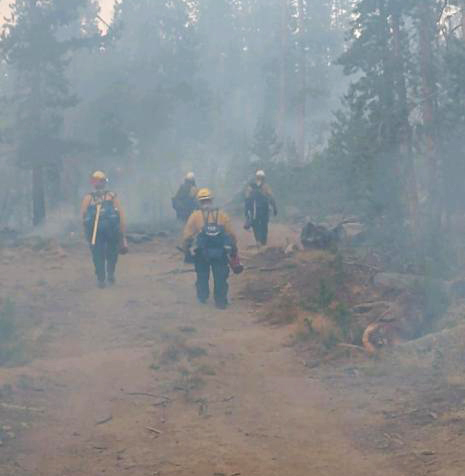
Firefighters on the Mullen Fire
Firefighters on the Mullen Fire hike to their assignment Oct. 5, 2020. Photo by Josh Shroyer.


The Cameron Peak Fire has been much less active than the Mullen Fire, and has been mapped at 129,055 acres. The incident management team reported October 7 that 27 residences and 30 other structures have been destroyed.

The 11,005-acre Middle Fork Fire 7 miles north of Steamboat Springs, Colorado was very active Tuesday and Wednesday on the south, west, and north sides. As of Wednesday evening the resources assigned, according to the national situation report, included no hand crews or engines, and 4 helicopters, for a total of 70 personnel. Two structures are threatened.
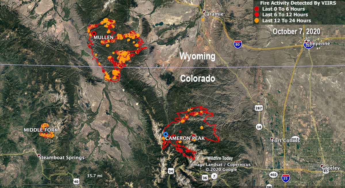
Fires in Colorado & Wyoming Oct. 7, 2020.

Mullen Fire spreads from Wyoming into Colorado

Evacuations are in effect

October 2, 2020   |   7:57 a.m. MDT

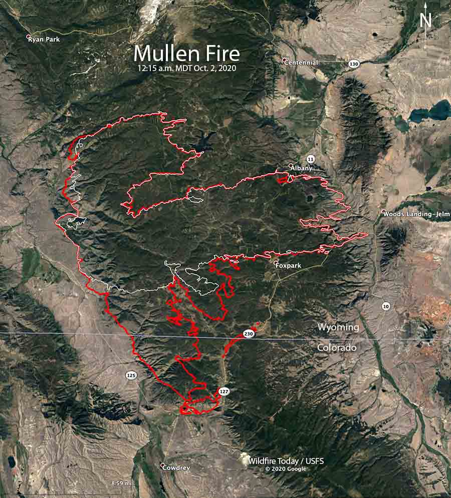
Map of the Mullen Fire
Map of the Mullen Fire. The red line was the perimeter at 12:15 a.m. MDT October 2, 2020. The white line was the perimeter about 48 hours before.

The Mullen Fire that started September 17 in Wyoming 12 miles north of the Colorado border has spread south into Colorado. At 12:15 a.m. Friday a mapping flight determined it had progressed to the intersection of Colorado Highways 127 and 125 about four miles north of Cowdrey. Firefighters are conducting strategic firing operations along portions of Highway 127 and Wyoming Highway 230 to protect structures.

In Colorado the Jackson County Sheriff’s Office has ordered evacuations for “the east side of Jackson County Road 8 along the eastern range north to the sand dunes following up to Highway 127, and along Jackson County Road 6E.” The most current information is on CodeRED and on the Sheriff’s Office Facebook page.

To see all articles on Wildfire Today about the Mullen Fire, including the most recent, click here.

On Thursday the incident management team reported that the Mullen Fire had burned 118,778 acres. After an overnight mapping flight the team may add another 8,000 to 9,000 acres to that figure. (Update at 12:56 p.m. October 2: the incident management team updated the size to 127,503 acres.)

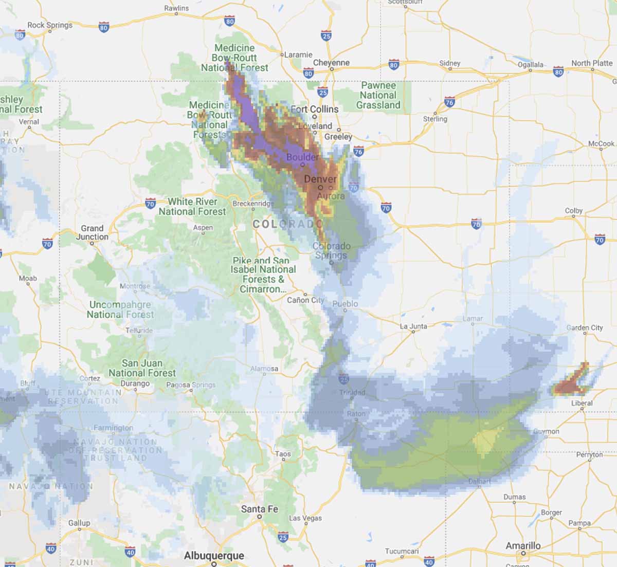
Forecast for wildfire smoke Colorado
Forecast for wildfire smoke in the Colorado area at 8 p.m. MDT October 2, 2020

The Mullen Fire is producing large quantities of smoke that has been pushed to the south and southeast. On Friday it is predicted to heavily affect Rocky Mountain National Park, Boulder, and Denver.

The fire area is under a Red Flag Warning Friday. The forecast for the southern portion of the fire calls for a high temperature of 62, relative humidity of 16 percent, and winds from the west and northwest at 13 to 16 mph. Conditions will be similar on Saturday, with slightly stronger winds and slightly higher humidity.

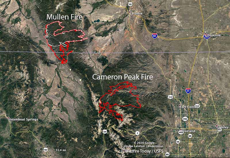
The 125,271-acre Cameron Peak Fire, 26 miles southwest of the Mullen Fire, has been growing much more slowly than the Mullen Fire in recent days.

Map of the Mullen and Cameron Peak Fires
Map of the Mullen and Cameron Peak Fires, October 2, 2020.
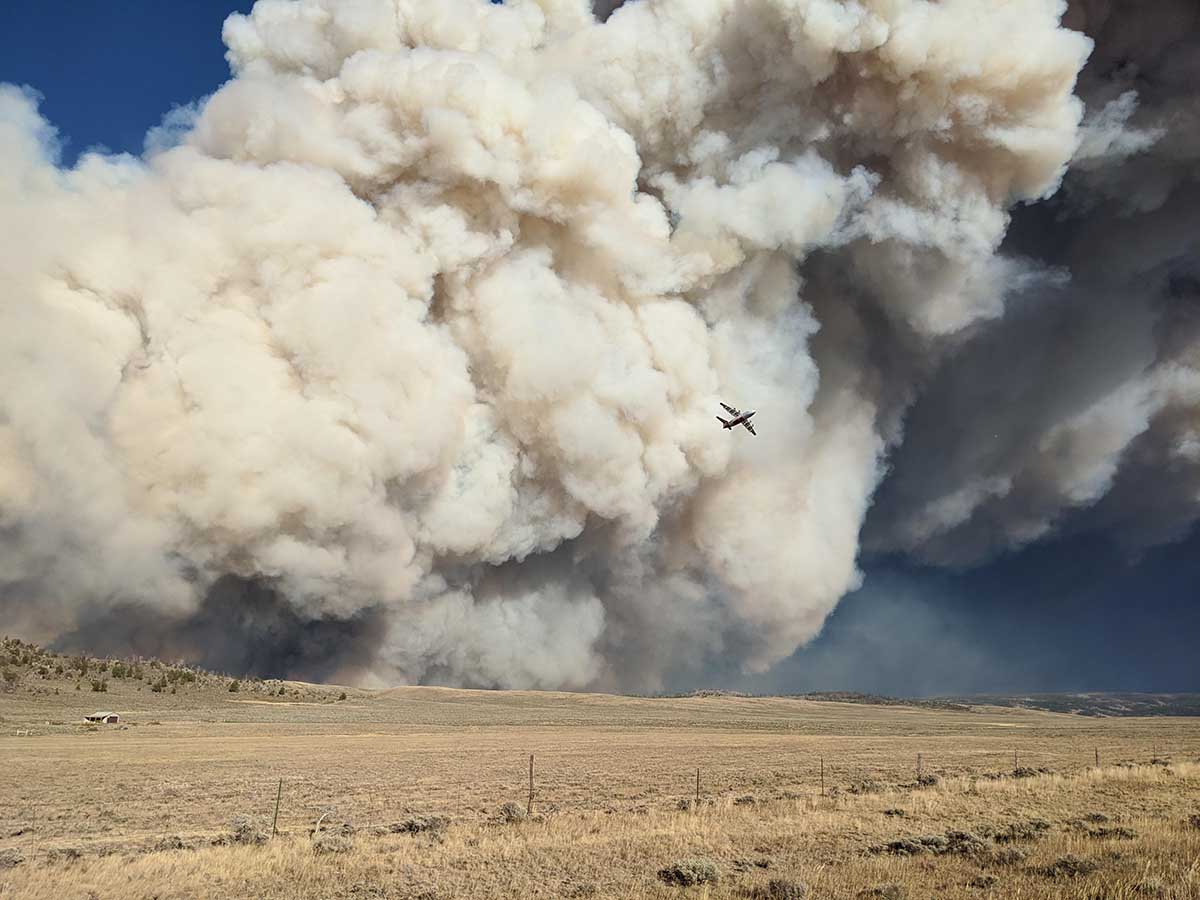
Mullen Fire smoke
An air tanker maneuvers over the Mullen Fire Sept. 30, 2020. It is either a BAe-146 or an RJ 85. InciWeb photo.

Engine crew on Cameron Peak Fire tests positive for COVID-19

Beginning next week at the fire west of Fort Collins, Colorado, personnel will be tested as they are demobilized if they request it

Cameron Peak Fire map
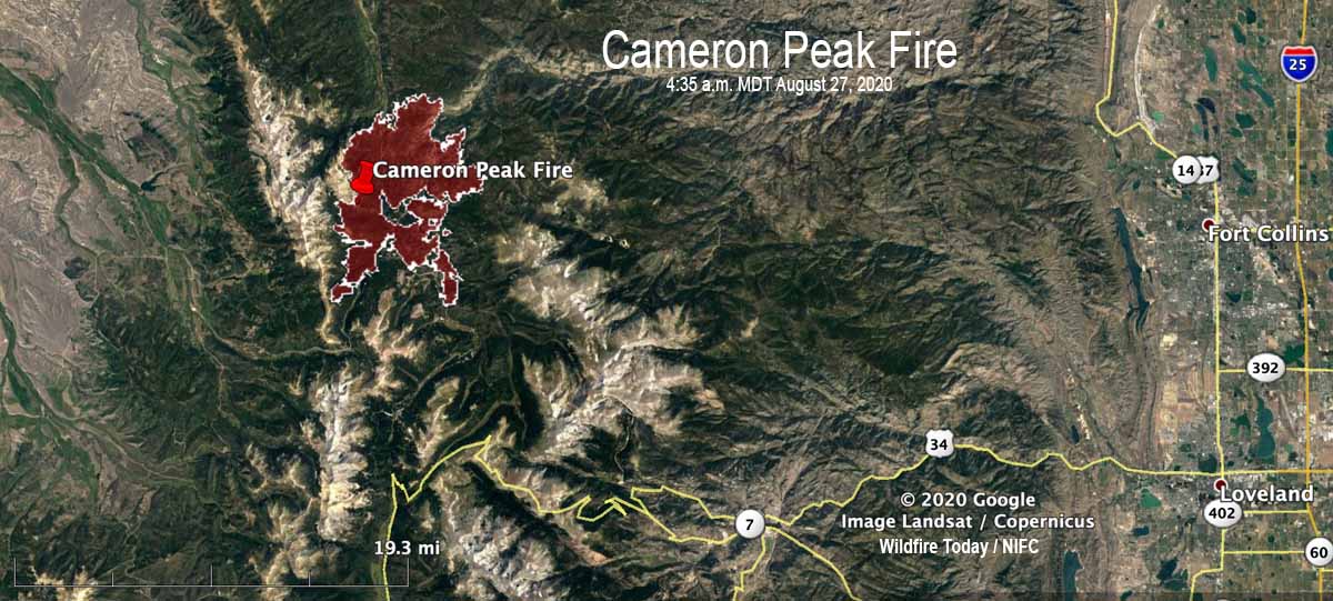
Map of the Cameron Peak Fire at 4:35 a.m. MDT August 27, 2020.

Three engine crew members working the night shift on the Cameron Peak Fire 32 miles west of Fort Collins, Colorado tested positive earlier this week for COVID-19. Five others at the 22,845-acre fire were considered exposed, so all eight were quarantined.

“It was three people off of one engine,” that tested positive, said Kevin Ratzmann the Medical Unit Leader for the fire. “One individual [initially] tested positive for COVID August 24. He started having a little shortness of breath so he was tested at the local hospital.”

The other two members of the engine crew also tested positive.

To see all articles on Wildfire Today about the Cameron Peak Fire, including the most recent, click here.

Before the first person who tested positive received his results, he came back to the fire camp and potentially exposed others, so five more people were put on precautionary quarantine. Local public health personnel determined that those five individuals were exposed within six feet for 15 minutes or longer, so they were quarantined out of an abundance of caution, explained Mr. Ratzmann. “Not one of [those five] have any symptoms,” he said. “They were all tested today [August 28]. We are waiting on the results and will test them again in three days and if they are all clear they will return to work.”

The person on the engine crew that reported symptoms claimed a medical exemption for wearing a mask, but the incident management team is now requiring everyone to wear a mask except when they are actually fighting fire on the fire line.

Many of the activities normally located at the incident command post have been converted to virtual systems or using QR codes, including check-in, demobilization, and meetings.

After contact tracing was completed, no personnel at the fire other than the eight that were isolated or quarantined were tested for COVID-19. However, the incident management team is offering voluntary COVID testing to others on the fire. Mr. Ratzmann said it was mostly because their home unit wanted the testing, not because they have symptoms. He said it took about two days to receive test results on the Pine Gulch Fire, another blaze in Colorado where he was assigned earlier, as the incident management team was tested when they demobilized.

Mr. Ratzmann said that starting early next week anyone at the Cameron Peak Fire who is being demobilized will be tested once if they request it. The national situation report shows 730 personnel assigned to the fire.

There are 38 people working in the Medical Unit at the incident command post, including personnel on the 5 ambulances. That is a larger staff for a Medical Unit on a 730-person fire than in the pre-COVID era.

The Cameron Peak fire has been less active in the last couple of days. Satellites orbiting more than 200 miles overhead have not been able to pick up very many large heat sources. However, there are undoubtably numerous areas on the fire that are still burning and where much still needs to be accomplished by firefighters. Most of the areas detected by satellites were on the northeast side, four to five miles northeast of Chambers Lake.

Four large wildfires keep firefighters in Colorado busy

August 15, 2020 | 10 a.m.

Pine Gulch Fire
The Wyoming Hotshots on the Pine Gulch Fire August 7, 2020. InciWeb.

A week ago when I was talking with a colleague about the national wildfire situation we agreed there was a “lull” in the action. With new fires in California and Colorado since then, that has changed.

In southern California on August 12 the Lake Fire west of Lancaster grew large enough 29 minutes after it was reported to create pyrocumulus clouds above the smoke column. Three hours later it was 10,000 acres and Friday had blackened at least 17,000 acres.

But much of the focus has turned Colorado where four large fires are out of control.

Map four large wildfires Colorado
Map showing four large wildfires in Colorado, August 15, 2020.

The Pine Gulch Fire 15 miles north of Grand Junction, Colorado at 73,381 acres Saturday became the fourth largest fire in the recorded history of the state. The Rocky Mountain Type 1 Incident Management Team with Dan Dallas as Incident Commander assumed command of the Friday morning after transitioning with the type 2 team.

Pine Gulch Fire fourth largest Colorado

The Grizzly Creek Fire just east of Glenwood Springs has been adding thousands of acres every day since it started August 10. Interstate 70 has been closed since then due to the fire.

More information about the Grizzly Creek Fire on Wildfire Today.

Grizzly Creek Fire
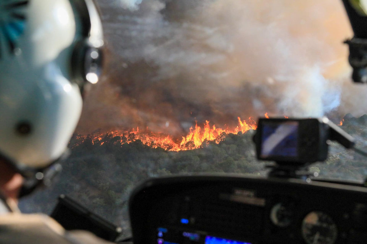
View of the Grizzly Creek Fire from a helicopter August 14, 2020. InciWeb.

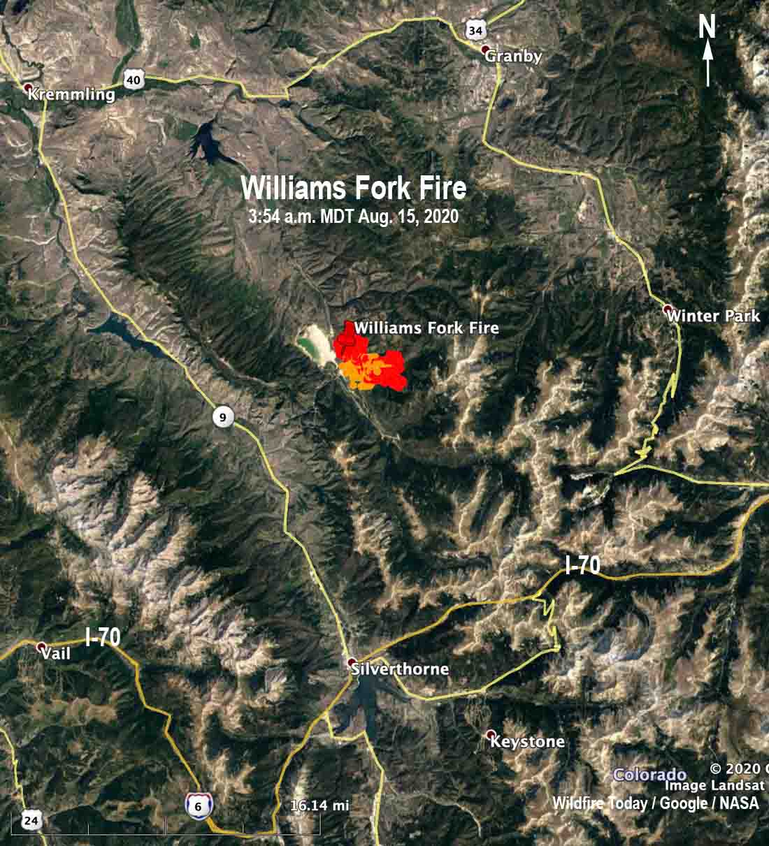
The newest of the four large fires in Colorado is the Williams Fork Fire 10 air miles southeast of Williams Fork Reservoir and 19 miles southeast of Kremmling reported just before noon Friday August 14. Firefighters estimated Friday night it was 1,300 acres and said it is exhibiting extreme fire behavior as it moves east and northeast toward Church Park. The fire is currently holding east of CR 30 and south of Keyser Creek in an area with intensive beetle kill from the early 2000s. Henderson Mill and its infrastructure along with multiple other utilities are in the immediate area.

map Williams Fork Fire
Map showing heat on the Williams Fork Fire detected by a satellite at 3:54 a.m. MDT August 15.

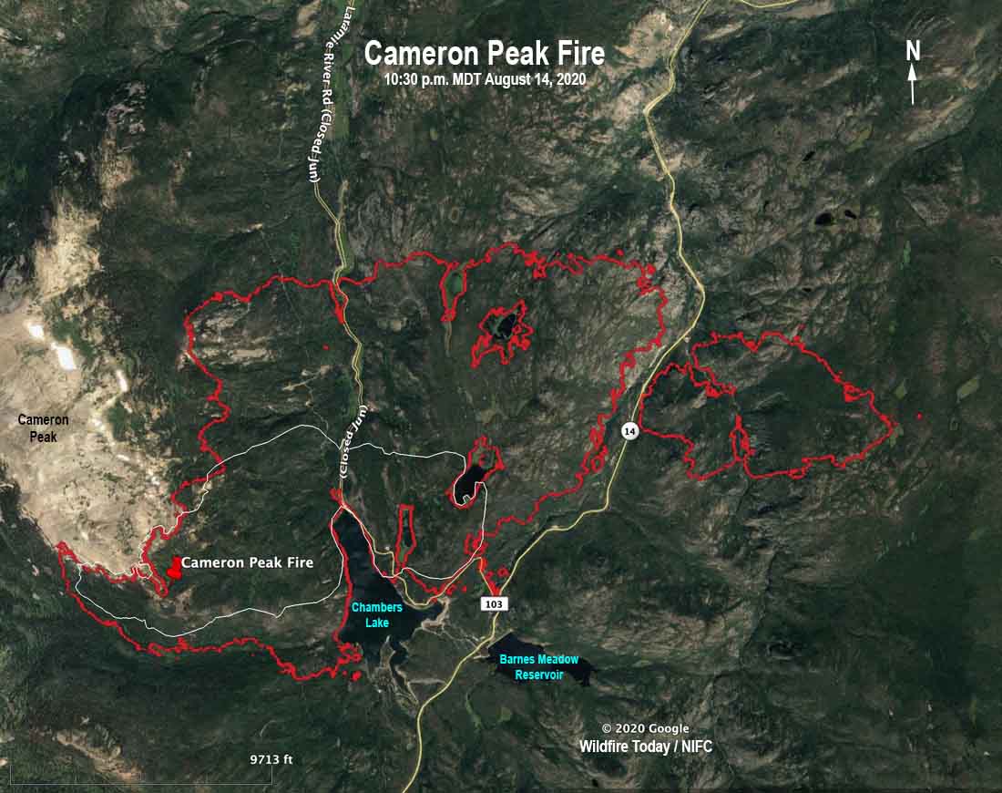
The Cameron Peak Fire has been burning since August 13 in the Rawah Wilderness on the Arapaho & Roosevelt National Forests near Highway 14 and Chambers Lake. It is 36 air miles west of Fort Collins, Colorado and as of Friday night had burned about 5,424 acres. Mike Haydon’s Type 2 Rocky Mountain Incident Management Team Blue will assume command today, August 15. The Cameron Peak Fire started west of Chambers Lake and has crossed Highway 14 to the east, burning nearly 800 acres on the south side of the highway.

To see all articles on Wildfire Today about the Cameron Peak Fire including the most recent, click here.

Cameron Peak Fire map
The red line was the perimeter of the Cameron Peak Fire at 10:30 p.m. MDT August 14, 2020. The white line was the perimeter about 24 hours before.

Cameron Peak Fire burns over 1,500 acres west of Fort Collins

The fire started Thursday afternoon

Updated August 14, 2020 | 7:39 a.m. MDT

Map of the Cameron Peak Fire
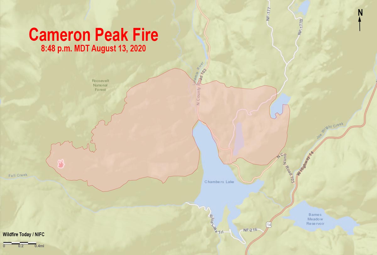
Map of the Cameron Peak Fire at 8:38 p.m. MDT August 13, 2020.

A map from data collected at 8:48 p.m. MDT August 13 shows that the Cameron Peak Fire 36 miles west of Fort Collins, Colorado had burned about 1,540 acres. It is spreading in the Roosevelt National Forest between 8,900 and 10,500 feet above sea level and is under the management of a Type 3 Incident Management Team. A Type 2 Team has been ordered.

To see all articles on Wildfire Today about the Cameron Peak Fire, including the most recent, click here.

The fire is near Cameron Pass, 15 miles southwest of Red Feather Lakes.


August 13, 2020 | 9:22 p.m. MDT

Cameron Peak Fire map
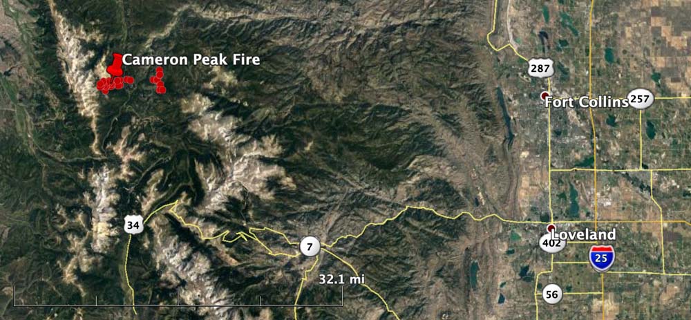
The Cameron Peak Fire is 36 miles west of Fort Collins, Colorado

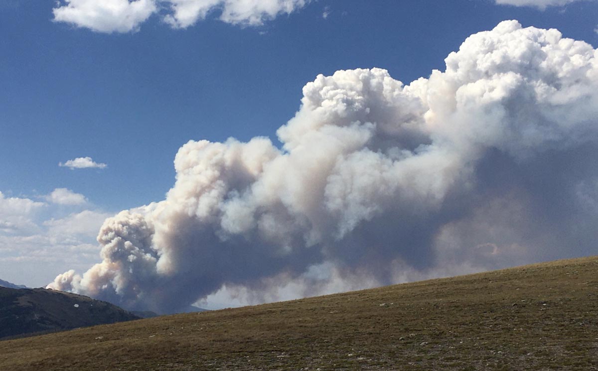
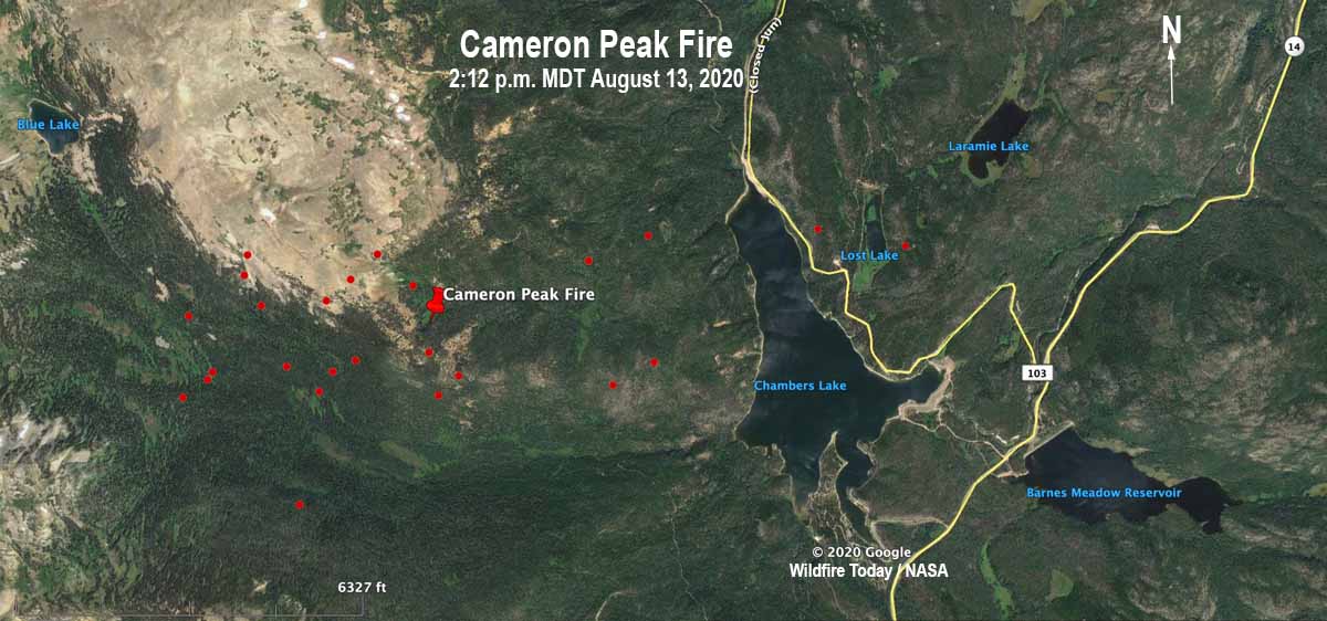
When the Cameron Peak Fire was reported in mid-afternoon Thursday resources dispatched included, in addition to firefighters on the ground, a load of smokejumpers, three helicopters, two large air tankers, and four Single Engine Air Tankers. Within a short time it put up a very large smoke column topped by pyrocumulus clouds which indicate high fire intensity. After 5 p.m. the aircraft were unable to assist due to strong winds. At 7:15 p.m. the U.S. Forest Service estimated it had burned 1,540 acres.

The fire is burning in the Rawah Wilderness on the Arapaho & Roosevelt National Forests near Highway 14 and Chambers Lake.

Cameron Peak Fire
Cameron Peak Fire. Photo by @CritterCat2020 August 13, 2020.

The Larimer County Sheriff’s office ordered evacuations at about 4:30 p.m. Thursday for Chambers Lake and areas near the intersection of Highway 14 and CR 103.

Cameron Peak Fire map
The red dots represent heat detected on the Cameron Peak Fire by a satellite at 2:12 p.m. MDT August 13, 2020. There were other detections two miles to the east, but they may be false positives from heat in the smoke column and will need verification.