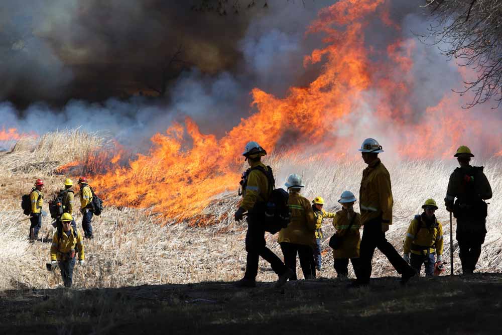
Forest Service intends to restore areas in Wyoming with logging, prescribed fire, and building roads

The project would take place in the Medicine Bow National Forest in southern Wyoming

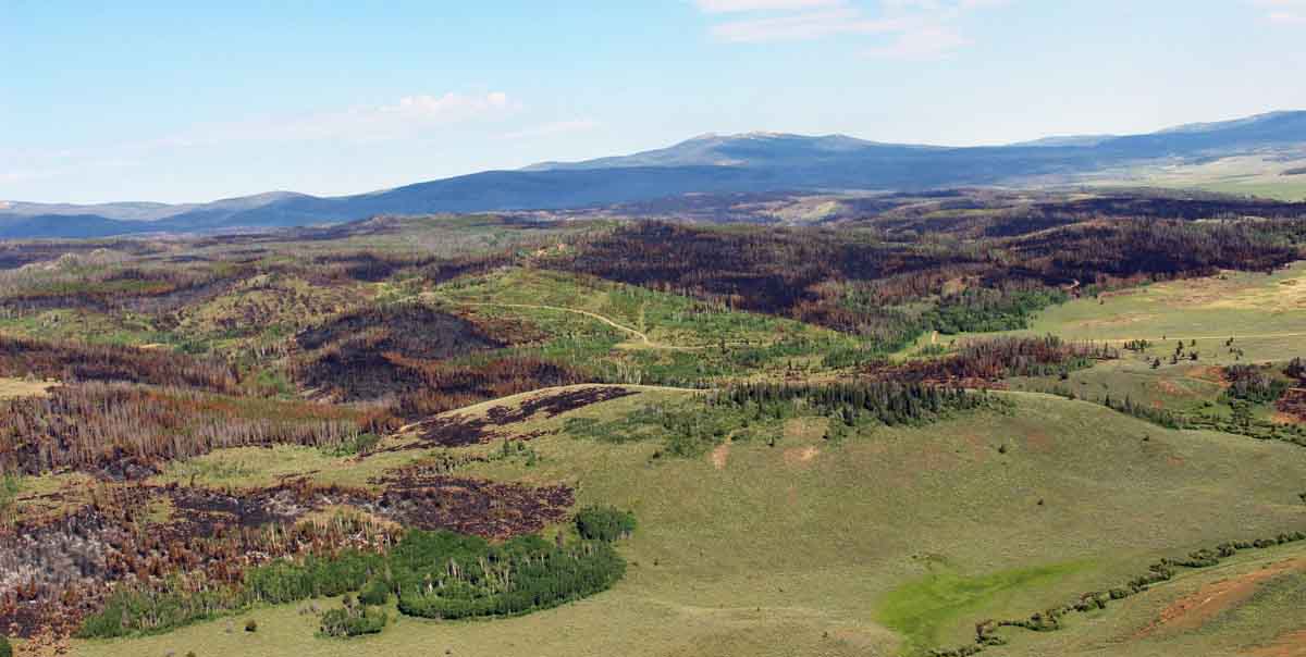
Beaver Creek Fire intensity
Varying burn intensities on the Beaver Creek Fire in the Medicine Bow-Routt NF in Colorado about 1 mile south of the Wyoming state line. The area had large areas of beetle-killed trees. July, 2016. InciWeb.

The U.S. Forest Service has a plan to treat 360,000 acres in the Medicine Bow National Forest in southern Wyoming by logging, thinning, prescribed burning, and building 600 miles of roads. The justification for what they are calling the Landscape Vegetation Analysis project, or LaVA, is to treat areas in the forest with the intention of “restoring forest health”. This area just north of the Colorado/ Wyoming border has been heavily impacted by Mountain Pine Beetles, so it fits the agency’s definition of an unhealthy forest and is considered by the U.S. Forest Service as an undesirable condition.
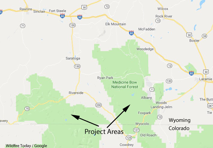
Landscape Vegetation Analysis project
The areas in the Medicine Bow National Forest north of the Colorado line would be part of the Landscape Vegetation Analysis project.

The Forest Service intends to build 600 miles of roads, clear cut 95,000 acres, selectively cut or commercially thin 165,000 acres, and use prescribed fire, mastication, and hand thinning on 100,000 acres.

Climate change that brought drought and warmer weather has provided a better habitat for the beetles. During normal times their spread is inhibited in the higher elevations by cold winters. Several days with low temperatures of around 35 degrees below zero can knock them back, but if that does not occur the rice-sized insects can come back with a vengeance the next summer.

Beetle-killed trees can be hazardous to firefighters due to the possibility of falling trees and burning snags. And, 5 to 15 years after the outbreak heavy ground fuels make fireline construction difficult. The dead trees can also be problematic near roads, trails, and structures. But a couple of years after the beetle attack and the red needles have been shed, the tree skeletons are less prone to crown fires than green trees. In 2015 University of Colorado Boulder researcher Sarah Hart determined Western U.S. forests killed by the mountain pine beetle epidemic are no more at risk to burn than healthy Western forests. Other scientists have found similar results.

Below is an excerpt from the Washington Post:

Not everyone considers the plan a good idea. Some biologists say science doesn’t back up the efficacy of the treatments proposed, particularly logging and the prescribed burns that the Forest Service calls necessary for lodgepole pine to reproduce and more diverse species to take root.

“They say they are going to reduce fuel loads to limit wildfires, and the literature doesn’t support that,” said Daniel B. Tinker, an associate professor at the University of Wyoming, who has studied the region for 23 years. “We’ve had fires this summer that burned through areas that were clear-cut 15 years ago. Those stands weren’t supposed to burn for 100 years.”

Conservation groups also say the Forest Service truncated scientific review in a rush to meet congressional demands for increased timber production on public lands. For now, the proposal does not specify which parcels would be targeted and where those hundreds of miles of road would be built.

In the Washington Post, article Andy Stahl, executive director of Forest Service Employees for Environmental Ethics, was quoted as saying “Certainly, prescribed burning doesn’t pay its way — it’s expensive at around $100,000 per acre.”

If there is a prescribed fire somewhere that actually cost $100,000 an acre, which is very hard to believe, it is definitely an outlier. The costs vary greatly across the country and by vegetation type. They can be as inexpensive as less than a dollar an acre in Oklahoma, but usually run $10 to $250 an acre.

The federal agencies have had to cut back on their prescribed burning programs in recent years due to budget reductions.

The Forest Service expects to make a decision on the Medicine Bow plan in mid-2019.

Thanks and a tip of the hat go out to Gary.
Typos or errors, report them HERE.

FSU researchers: Most fires in Florida go undetected

By: Zachary Boehm

A new study by Florida State University researchers indicates that common satellite imaging technologies have vastly underestimated the number of fires in Florida.

Holmes Nowell
Christopher Holmes, assistant professor in the department of Earth, Ocean and Atmospheric Science, and Holly Nowell, postdoctoral researcher in EOAS.

Their report, published in collaboration with researchers from the Tall Timbers Research Station and Land Conservancy, challenges well-established beliefs about the nature and frequency of fire in the Sunshine State. While there were more fires than expected, researchers said, strategically prescribed burns throughout the state are proving an effective force against the ravages of wildfire.

The paper appears in the journal Geophysical Research Letters.

For scientists studying fire, sophisticated satellites whizzing far above the Earth’s surface have long represented the best tool for monitoring wildfires and prescribed burns — carefully controlled and generally small fires intended to reduce the risk of unmanageable wildfires.

But FSU researchers suggest that fire experts themselves have been getting burned by faulty data, and that broadly accepted estimates of fire area and fire-based air pollutants might be flawed.

“There are well-known challenges in detecting fires from satellites,” said lead investigator Holly Nowell, a postdoctoral researcher in the Department of Earth, Ocean and Atmospheric Science. “Here we show that only 25 percent of burned area in Florida is detected.”

Using comprehensive ground-based fire records from the Florida Forest Service — which regulates and authorizes every request for a prescribed burn in the state — researchers found dramatic discrepancies between fires detected by satellites and fires documented by state managers.

prescribed fire Florida
Austin Dixon of the Tall Timbers Research Station and Land Conservancy monitors a prescribed burn. Credit: Kevin Robertson

The majority of fires in Florida come in the form of prescribed burns, but because these fires are designed to be brief and contained, they often fall under the radar of satellites soaring overhead.

This is especially true in a state like Florida, where dense cloud cover is common and the warm, wet climate allows vegetation to regrow quickly after a blaze, disguising the scars that fires leave in their wake.

“Like a detective, satellites can catch a fire ‘in the act’ or from the ‘fingerprints’ they leave behind,” said study co-author Christopher Holmes, an assistant professor in EOAS. “In our area, catching an active fire in a thermal image can be hard because the prescribed fires are short, and we have frequent clouds that obscure the view from space.”

The state fire records also revealed a counterintuitive truth: Unlike in western states such as California, where dry conditions frequently produce massive increases in destructive and often uncontrollable fires, Florida actually experiences a decrease in land consumed by fire during drought.

When drought conditions emerge, researchers said, officials are less likely to authorize prescribed burns. And because prescribed burns account for the overwhelming majority of fires in the state, overall fire activity decreases.

This also suggests that prescribed burning programs — which aim to reduce the risk of wildfire in dry conditions — are having a materially positive effect.

“Although we still have occasional destructive wildfires, including the recent tragic Eastpoint fire, our results indicate that prescribed fire policy is helping to reduce wildfire risk,” Holmes said, referencing the June 2018 wildfire that destroyed dozens of homes in Florida’s Big Bend region.

Tall Timbers specialist Tracy Hmielowski uses a drip torch to ignite vegetation as part of a prescribed burn. Credit: Kevin Robertson
While the team’s study reconfirms the utility of prescribed burning, it calls into question prevailing estimates for airborne pollution from fire. If, as the study suggests, only 25 percent of fires in Florida are detected by satellites, then there could be “a rather large bias and a significant potential underestimation of emissions,” Nowell said.

The study’s findings are specific to Florida, but researchers suspect that similar satellite limitations may be skewing fire detection — and, consequently, emission estimates — in neighboring regions and geographically analogous areas like the savannas of Africa or the agricultural belts of Europe and Asia.

“We believe this result easily extends to the rest of the Southeast United States — which burns more area than the rest of the United States combined in a typical year — and other similar regions throughout the world that use small prescribed burns as a land management technique,” Nowell said.

Kevin Robertson, Casey Teske and Kevin Hiers from Tall Timbers contributed to this study. The research was funded by the National Aeronautics and Space Administration.

Thanks and a tip of the hat go out to Tom.
Typos or errors, report them HERE.

Prescribed fire escapes in Manti-La Sal National Forest

The Trail Mountain Fire has burned 2,637 acres in central Utah

Above: Map showing heat on the Trail Mountain Fire detected by a satellite at 2:18 a.m. MDT June 12, 2018.

A prescribed fire ignited in the Manti-La Sal National Forest in central Utah has burned 2,637 acres eight miles northwest of Huntington.

U.S. Forest Service personnel began the project on Tuesday June 5 after conducting a test burn the day before. When they had to suppress a seven-acre spot fire on Wednesday they stopped igniting the prescribed fire, but that evening the fire ran to the top of East Mountain. It is now known as the Trail Mountain Fire.

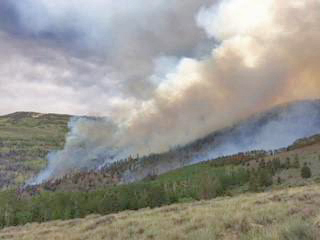
Trail Mountain Fire
Trail Mountain Fire, posted to InciWeb around June 8, 2018.

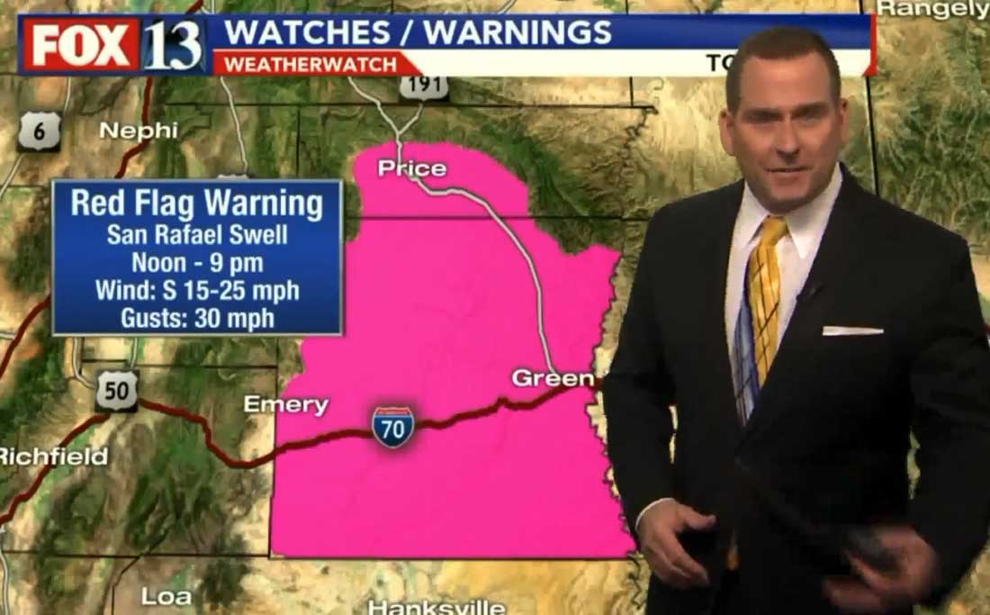
On Thursday a Red Flag Warning for strong wind was in effect and the fire continued to grow until it stopped temporarily at a high voltage power line. At that time a Fire Weather Watch predicted elevated fire danger on Saturday and Sunday, June 9-10.

red flag warning trail mountain escaped prescribed fire
Red Flag Warning in central Utah June 7, 2018. Screenshot from Salt Lake City Fox 13.

The fire was very active on Sunday, lofting burning embers that started spot fires a mile ahead. At least one cabin and some outbuildings have burned.

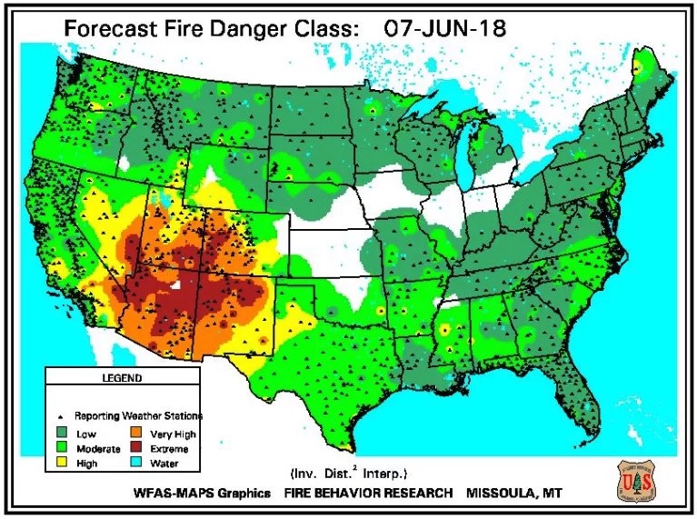
fire danger June 7, 2018

Below is information released by fire officials on Monday June 11:

The Trail Mountain Fire moved into Meetinghouse Canyon Sunday after it was hit with wind gusts of up to 55 miles per hour. Winds grounded all air support and caused the fire to run north and east. Currently at 2,637 acres, and 10% containment, the fire has created heavy smoke that has been visible from local communities in Emery, Carbon and Sanpete counties.
The fire is burning in mixed conifer, with large amounts of dead and down timber. It is spotting up to a mile, leaving islands of green aspen and sage untouched. A cabin was burned in the Whetstone Creek area and other outbuildings in that area are threatened. A high voltage line is in the path of the fire, but has not sustained significant damage. The powerline remains off.

There are 259 personnel assigned to the fire, five helicopters and 11 engines. There is Temporary Flight Restriction over the fire. No drones are allowed on the fire.

Tim Roide’s Type 2 Incident Management Team will be assuming command of the fire, taking over from a Type 3 Team.

The Emery County Progress has an excellent article about the fire written by Patsy Stoddard. It is one of the best I have seen about a wildfire — very thorough and detailed.

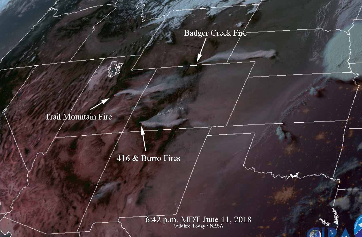
Smoke blowing into Colorado from the fire is visible from space.

trail mountain fire badger creek 416
Satellite photo at 6:42 p.m. MDT June 11, 2018, showing the Trail Mountain Fire, Badger Creek Fire, and the 416 Fire.

New film released — “Fire: In the Florida Scrub”

Above: Screenshot from the film.

In 2012 when I first heard of Jennifer Brown she was working in the Interpretation Division in Everglades National Park  and her term appointment was about to end. She had just produced for the National Park Service an excellent film about prescribed fire titled “River of Fire”. Now with many other videos about fire under her belt with her company Into Nature Films, she has produced another — “Fire: In the Florida Scrub”. As with some of her other projects, she partnered with the former Fire Management Officer at Everglades National Park, Rick Anderson.

Here is the official description of the film:

Fire is one of the earth’s dominant forces. ‘Surviving Fire: In the Florida Scrub’ features three decades of discovery by Dr. Eric Menges. After watching this powerful short film, you will never look at Florida plants the same away again. This film pays tribute to the special people who dedicate their lives to improving fire management. Join Eric Menges for a 16 minute exploration into the elegant and unexpected ways plants survive fire. Funded by the National Science Foundation (NSF) and produced by Into Nature Films in collaboration with Archbold Biological Station.

Like the other “Into Nature Films”, this one is beautifully photographed and very clearly tells the story. It’s impressive how they had video footage to illustrate almost every point brought up in the narration.

Ms. Brown’s other films can be seen at articles on Wildfire Today tagged “Jennifer Brown”.

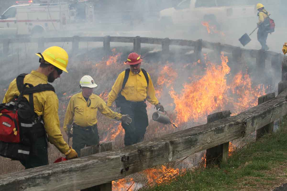
Prescribed fire near D.C.

Above: NPS photo by Nathan King

On April 6 firefighters conducted the first prescribed fire in Wolf Trap National Park for the Performing Arts west of the District of Columbia. According to the National Park Service it was also the first prescribed fire in Fairfax County, Virginia. (UPDATE April 11, 2018: Katie said in a comment that Fairfax County Park Authority has  been conducting prescribed burns in Fairfax County for many years.)

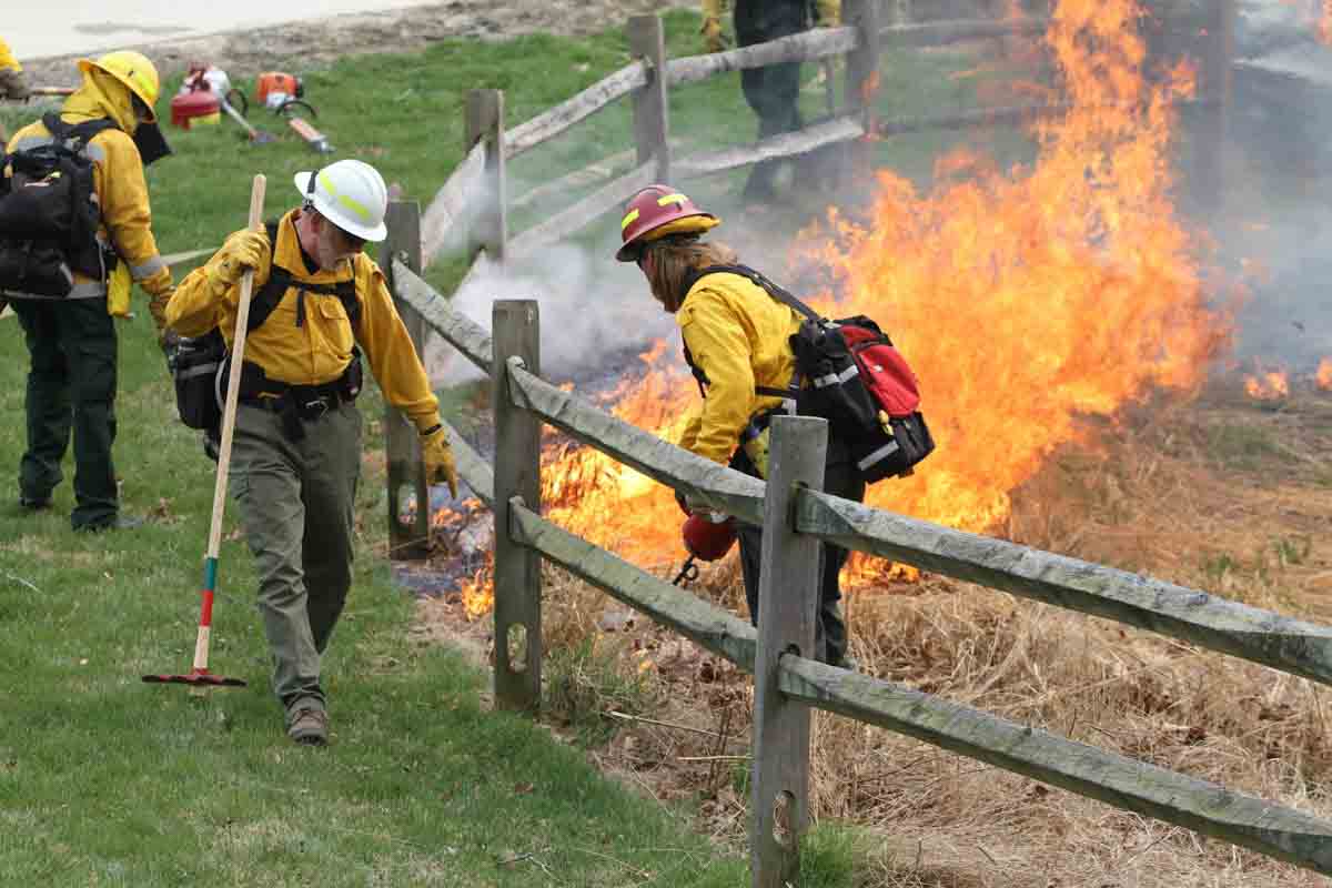
Fire was introduced to the native meadow in order to help the indigenous vegetation flourish while helping to control non-native plants.

Wolf Trap National prescribed fire
NPS photo by Nathan King

The agencies assisting included Prince William Forest Park, Fredericksburg and Spotsylvania County Battlefields National Military Park, and Fairfax County.

Wolf Trap National prescribed fire
NPS photo by Nathan King

The park is about 8 air miles west of the District of Columbia. It was created by legislation passed in 1966 “… for the performing arts and related educational programs, and for recreation use in connection therewith…”

Prescribed fire at Holiday Lake

One of the objectives of the project is to restore the habitat of the Tricolored Blackbird.

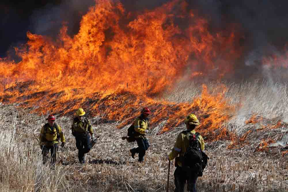
Above: Prescribed fire at Holiday Lake. Photo: Jeff Zimmerman

(Originally published at 7:39 p.m. MT March 1, 2018)

Jeff Zimmerman sent us these prescribed fire photos and the article below. Thanks Jeff.


By Jeff Zimmerman

The Los Angeles County Fire Department conducted a prescribed fire at Holiday Lake Thursday near Neenach in Southern California. The area is critical habitat for the endangered Tricolored Blackbirds that nest early in the spring at the lake. Since it last burned four years ago the bulrush and cattails have choked out the nesting areas for the birds.

Tricolored Blackbird
Tricolored Blackbird. Photo credit: California Department of Fish and Wildlife.

Thursday approximately 100 firefighters from the County Fire Department burned about 15 acres of land operated by the West Valley County Water District to restore the habitat.

I have been following the nesting habits of the birds with Don Groeschel of the Audubon Society. We have noticed a decline in the number of birds nesting in the area and asked for the area to be burned some time ago. Finally, taking advantage of the dry winter, the area was burned today under very controlled conditions.

The lake (map) is now dry and hopefully rain will finish putting out all hot spots overnight. Neenach has very strong winds so it is crucial to not allow the fire to escape control lines, while trying to generate enough heat to get rid of the dead fuel. With low winds and relative humidity at 30 percent this morning the lake was baptized with fire. New reeds will grow rapidly in the nitrogen rich soil now to make better habitat for the birds. Nesting season is quickly upon us so it is crucial to get this burn completed in a very narrow window of time.

Prescribed fire Holiday Lake
Prescribed fire at Holiday Lake. Photo: Jeff Zimmerman

The lake was dry during the migration period of Canada Geese this fall. Hopefully the water master will allow the lake to fill again to restore the habitat.

Of course this dry winter is very concerning, bringing the possibility of an early fire season.

Prescribed fire Holiday Lake
Prescribed fire at Holiday Lake. Photo: Jeff Zimmerman

Jeff Zimmerman photographs fires and writes about them, usually from Southern California.