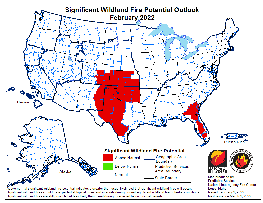
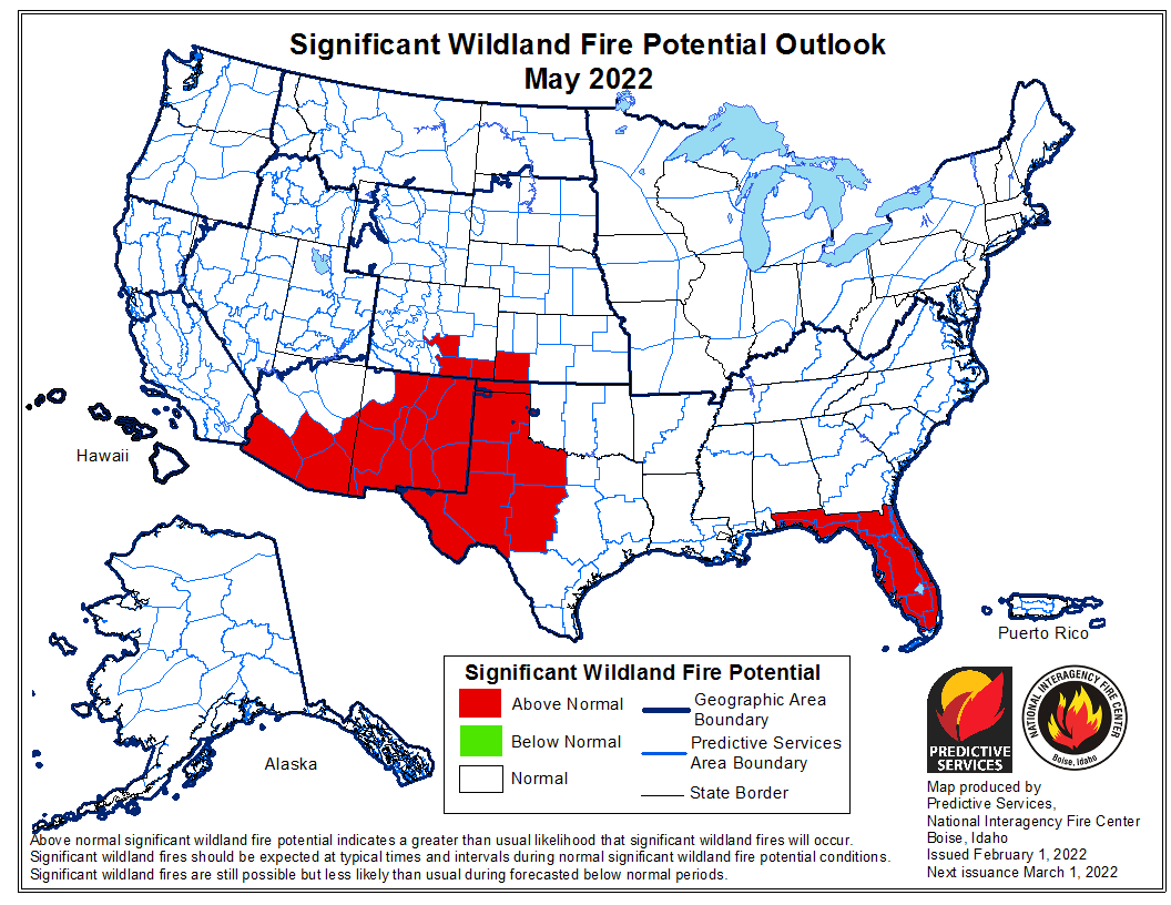
The forecast for wildland fire potential issued February 1 by the National Interagency Fire Center predicts that for the next four months the potential for wildfires will be higher than average at times in the Carolinas, Georgia, Florida, parts of New Mexico and Arizona, and the central and southern plains.
The data from NIFC shown here represents the cumulative forecasts of the ten Geographic Area Predictive Services Units and the National Predictive Services Unit.
Below:
- An excerpt from the NIFC narrative report for the next four months;
- Additional NIFC monthly graphical outlooks;
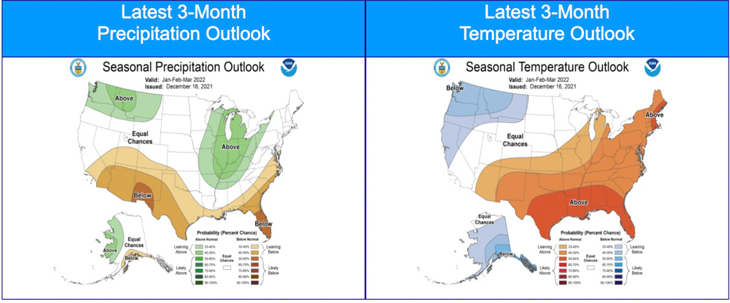
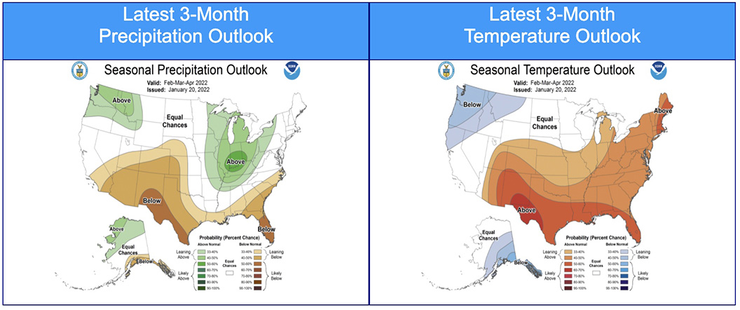
- NOAA’s three-month temperature and precipitation forecasts;
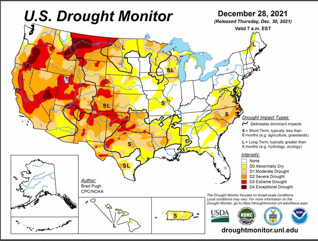
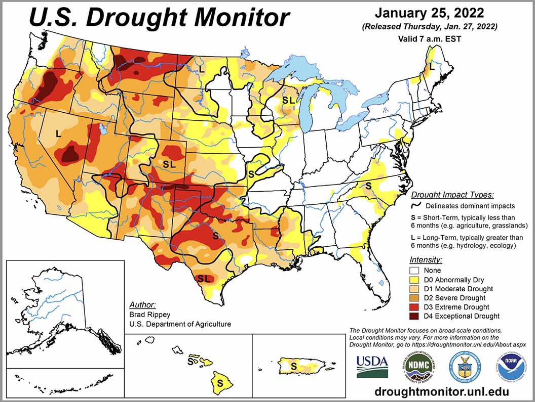
- Drought Monitor;
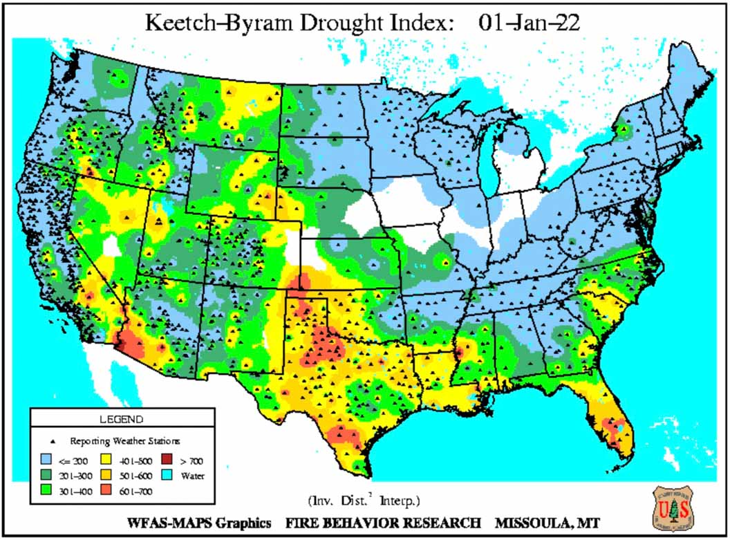
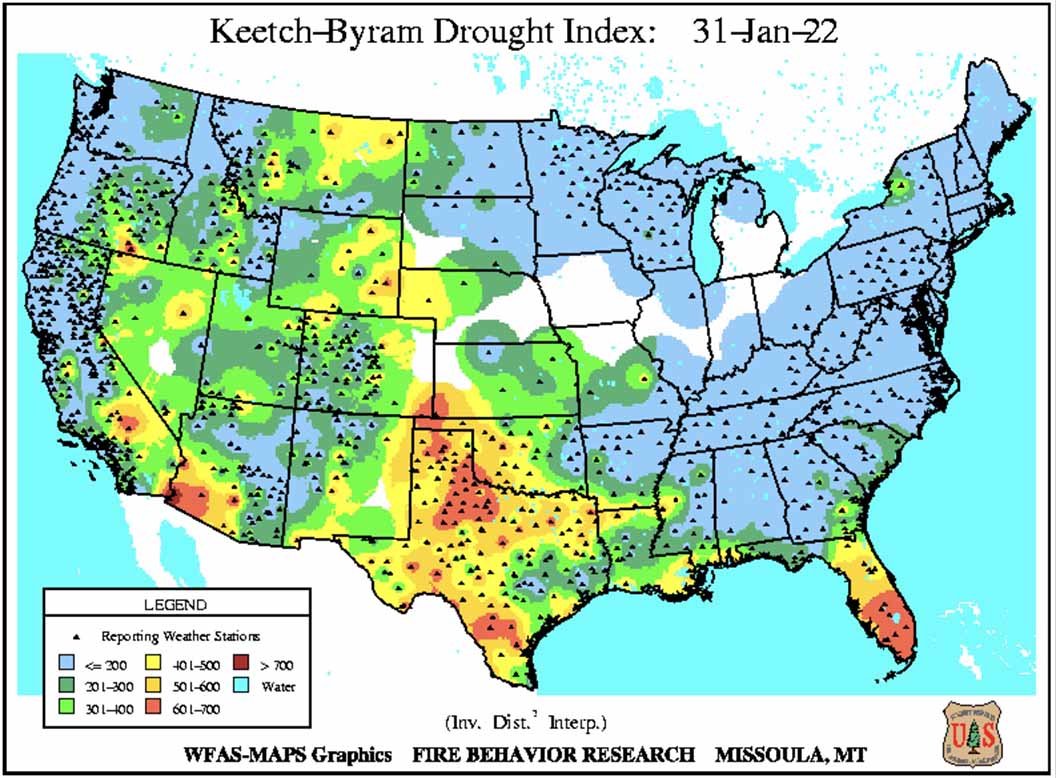
- Keetch-Byram Drought Index.
“Nearly 90% of the West remains in drought, with most of the Plains and Texas also in drought. Most of Texas and the Lower Mississippi Valley saw an expansion or exacerbation of drought as well. Much of the West had a dry January, but snowpack is mostly 75% to 125% of average. Above average precipitation across the Carolinas and Virginia reduced drought and fire potential concerns, while most of the Plains and Great Lakes observed below average precipitation.
“Climate outlooks through spring indicate near to below normal temperatures and near to above normal precipitation are likely across the northern half of the West into the western Great Lakes. Above normal precipitation is also likely across the Mid-Mississippi and Ohio Valleys and through much of the Great Lakes and Northeast into the Mid-Atlantic. However, drier than normal conditions are expected for the southern half of the West, southern and central Plains, and portions of the Southeast, with near to above normal temperatures likely as well across these areas. Guidance also indicates this could be a potentially busy severe weather season east of the Plains, which usually portends to periods of critical fire weather conditions on the Plains behind the severe weather.
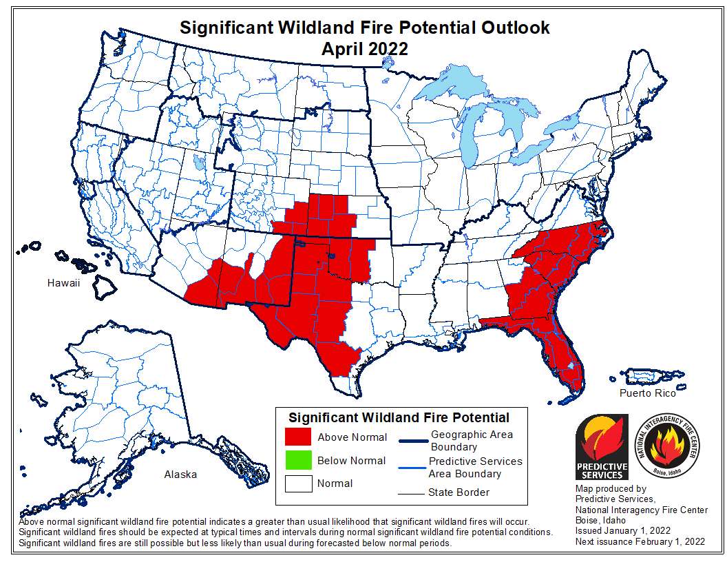
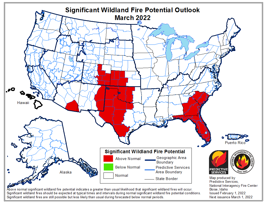
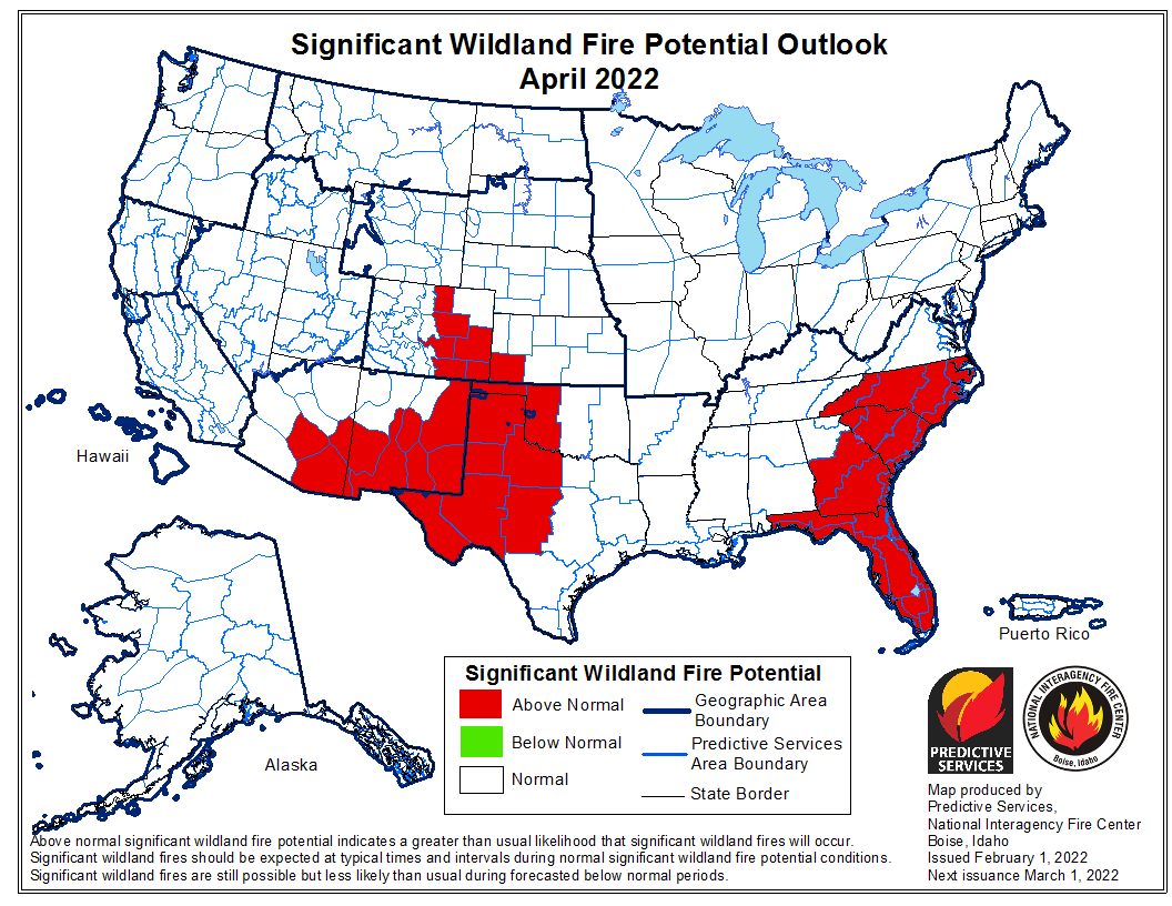
“Above normal significant fire potential is forecast for much of the central and southern Plains through March while persisting on the High Plains and eastern slopes of the Front Range through April into May. Above normal potential is forecast in portions of south Texas and the Hill Country during February then spreading across far southwest Texas, much of New Mexico, and southern Arizona by May. The westward retreat of above normal significant fire potential in Oklahoma, Kansas, and Texas is following the expected green-up procession.
“Due to the recent widespread and in places, heavy precipitation across the Carolinas and Virginia, forecast above normal significant fire potential was removed in February. However, above normal significant fire potential is forecast in portions of the Florida Peninsular into southeast Georgia in February and likely persisting through the spring. Additionally, above normal potential is likely to expand across Florida and into the Carolinas during March and April. Lingering above normal potential is forecast to remain across Florida in May. Areas of south and east Texas into the Lower Mississippi Valley will continue to be monitored for above normal potential.”

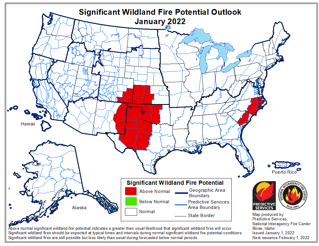
 The forecast for wildland fire potential issued January 1 by the National Interagency Fire Center predicts that for the next four months the potential for wildfires will be higher than average in the Carolinas, Georgia, Florida, and the central and southern plains.