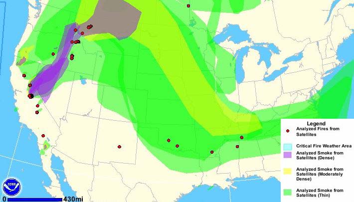
Wildfire briefing, October 29, 2013

Smoke creates health problems in Australia

Smoke from wildfires and prescribed fires is being blamed for increased visits to hospitals in New South Wales. On Monday when air quality was at its worst, the number of people treated for asthma in hospitals more than doubled. In recent weeks Sydney has been inundated with smoke from bushfires, but since the weather moderated a week or so ago smoke from prescribed fires, or “backburns”, has replaced it.

Landowners are motivated to use fire to reduce the hazards around their property by insurance companies that impose higher premiums if they don’t have a buffer around their improvements. Some of them are taking advantage of the favorable weather to conduct the backburns before the normal beginning of the bushfire season in December.

Australian government warns operators of UAVs who operate over fires

In what may be a reaction to a stunning video and others taken by unmanned aerial vehicles over bushfires, Australia’s Civil Aviation Safety Authority issued a warning to the operators of small UAVs, saying they are putting fire fighting operations at risk and should be aware of appropriate regulations.

Catastrophic wildfires in Colorado ignite new center for managing ‘WUI’ wildfire risk

Colorado State University’s Department of Forest and Rangeland Stewardship is launching a new center dedicated to creating and applying the next generation of wildfire management solutions. The Center for Managing Wildland Urban Interface (WUI) Wildfire Risk will provide science-based answers to critical questions raised by the most destructive wildfires in Colorado’s history. The Center for Managing WUI Wildfire Risk will provide science-based answers to critical questions raised by the most destructive wildfires in Colorado’s history.

Catching up with Fire Aviation

Recent articles at Fire Aviation:

  • Disney to release animated wildfire aviation movie
  • V-22 Tilt-Rotor Osprey as a firefighting aircraft
  • K-MAX helicopter converted to unmanned aircraft system
  • Slow-motion video of Lockheed Electra L-188 retardant drops
  • 10 Tanker Air Carrier moves to Albuquerque, begins converting a third DC-10
  • Two Aircraft crashes in Australia connected to bushfires
  • Stunning UAV video of bushfire
  • Airliner painted to honor FDNY firefighters
  • Airbus begins tests of C295 air tanker
  • 2013 Airtanker and Water Scooper Forum

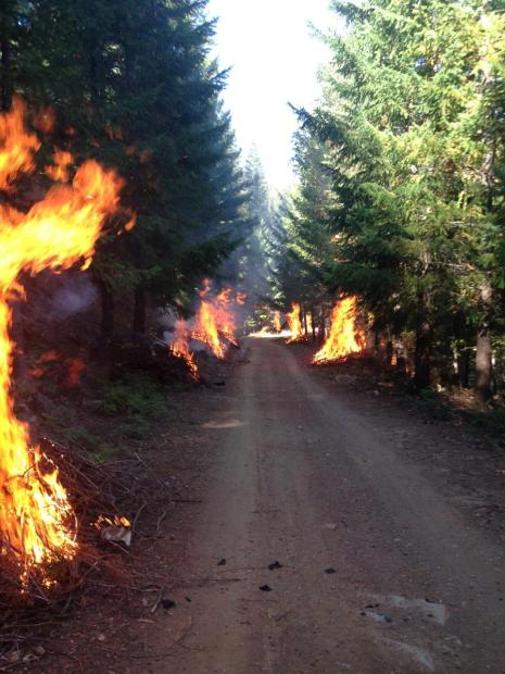
Prescribed fire projects underway
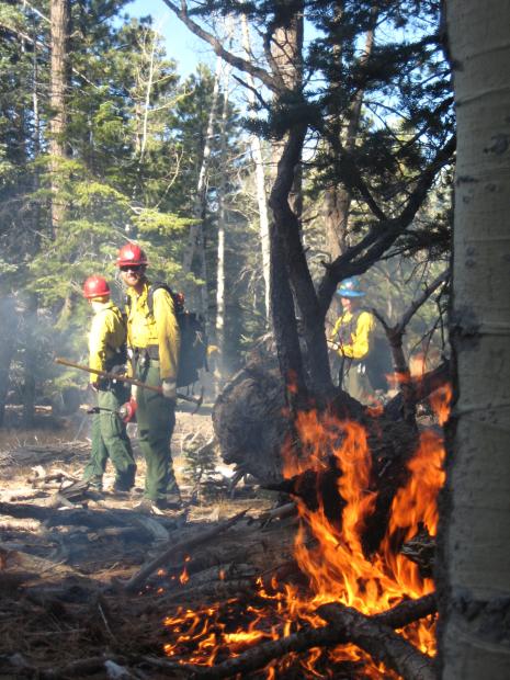
Pile burning, Grand Canyon
Pile burning on the Bright Angel project, North Rim of the Grand Canyon, October 24, 2013. NPS photo.
Prescribed fire Shasta-Trinity National Forest
Shasta-Trinity National Forest, October 21, 2013. USFS photo.
Prescribed fire on the Helena National Forest
Prescribed fire on the Helena National Forest, Helena Ranger District. USFS photo.

Cedar Fire, California’s largest

Above: map of Cedar and Laguna Fires. USFS map by Corey Ferguson.

We continue to find retrospective articles about the largest fire in the history of California, the Cedar Fire, that started 10 years ago this month, on October 25, 2003. One of the more interesting is an animation of the spread of the fire which was initially pushed by very strong Santa Ana winds blowing from the northeast and east.

The fire was started by a hunter that got lost and wanted to improve his chances of being found. The 273,246-acre fire accomplished that goal and then some.

Just yesterday a hiker from Redlands, California who had been missing for nearly a week was found stranded in Coldwater Canyon about five miles above Arrowhead Springs Resort after he started a fire to stay warm, but the fire grew out of control. He was rescued after firefighters responded to suppress the fire which had spread to an area about 20 by 30 feet.

The San Diego Union-Tribune has an article that examines how the vegetation is recovering from the 2003 Cedar Fire. Below is an excerpt:

…The Cedar Fire and subsequent burns in 2007 wiped out more than half of the mixed conifer in San Diego County, according to park documents. Cuyamaca [State Park] saw the worst of it. Before the fire, conifers covered about 40 percent of the park, in pine-oak woodlands and mixed conifer forest, [Mike Puzzo, an environmental scientist with the park] said. All but a few stands were incinerated.

A decade later, the alien terrain left after the blaze is recovering to varying degrees. In some spots, such as Fern Flat, charred stumps are surrounded by what Puzzo called a “monoculture” of ceanothus.

In nearby West Mesa, where the fire burned less intensely, signs are more encouraging. Scrub and saplings mingle with 15 to 20 foot oak trees which shot up since the fire. Several miles away, in a meadow near Los Vaqueros, some large pines survived, and new ones are cropping up.

“I think this place is recovering very nicely,” Puzzo said. “This right here is a good representation of what a fire should do. Some is dead, but a lot is still alive.”

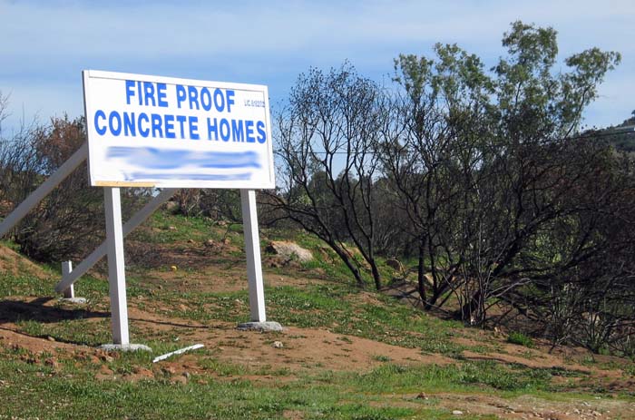
Sign in the Cedar Fire area
Sign within the Cedar Fire five months after the fire. Photo by Bill Gabbert.

The video below appears to have been shot by a homeowner in Poway as the Cedar fire burned near his home.

Historic late October California wildfires

Late October has historically seen many large destructive wildfires in California. In addition to the Esperanza fire that killed five U.S. Forest Service firefighters seven years ago today, October 20 through November 1 at times has been an extremely busy period of the year for firefighters.

  • October 20, 1991. The Tunnel Fire (or Oakland Hills or East Bay Hills Fire) killed 25 people (23 civilians, 1 police officer and 1 firefighter), injured 150, and destroyed 2,449 single-family dwellings and 437 apartment and condominium units in Oakland.
  • October 21, 2007. Witch, Harris, Poomacha, Horno/Ammo, Rice, Ranch, Buckweed, Santiago, and Slide fires in the Southern California counties of San Diego, Riverside, Los Angeles, Orange, San Bernardino and Ventura.
  • October 21 to 26, 2003 Piru, Grand Prix, Old, Paradise, Padua, Simi, Roblar 2, Verdale, Mountain, and Otay.
  • October 25, 2003. The Cedar Fire east of San Diego is still ranked as the largest fire in the recorded history of California. It started late in the afternoon and the first night killed 14 people living in Wildcat Canyon and Eucalyptus Hills who had little or no warning. Eight of those killed died while they were evacuating. The fire burned 273,246 acres, and destroyed 2,232 homes in San Diego, Alpine, Harbison Canyon, Crest, Cuyamaca, Julian, and Santa Ysabel. While trying to defend a house near Santa Ysabel, fire Captain Steven Rucker, 38, from the Novato Fire Department was overrun by the fire and killed on October 29.
  • November 1, 1966. On the Loop Fire, the El Cariso Hotshots were trapped by flames as they worked on a steep hillside in Pacoima Canyon on the Angeles National Forest. Ten members of the crew perished that day. Another two members succumbed from burn injuries in the following weeks. Most of the nineteen members who survived were critically burned and remained hospitalized for some time.

Esperanza engine crew, seven years ago today

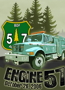
Engine 57It was seven years ago today that five U.S. Forest Service wildland firefighters died on the Esperanza fire near Cabazon, California on October 26, 2006. Killed were engine Capt. Mark Loutzenhiser, 44, of Idyllwild; engine operator Jess McLean, 27, of Beaumont; assistant engine operator Jason McKay, 27, of Phelan; and firefighter Daniel Hoover-Najera, 20, of San Jacinto. A fifth firefighter Pablo Cerda, 23, of Fountain Valley, who was injured along with the other four, passed away on October 31. The five firefighters comprised the crew of a wildland engine, Engine 57, from the San Bernardino National Forest.

They were assigned to a state managed fire approximately 60 miles east of Los Angeles and were entrapped while protecting a structure. The crew and their supervisors were not aware of the location of the fire relative to the location of the firefighters. The fire overran their position.

****

UPDATE November 12, 2013:

Esperanza Fire Factual Report, and the USDA Office of Inspector General’s Report on the fire.

Researchers design satellite to detect wildfires — a step toward the Holy Grail of Firefighter Safety?

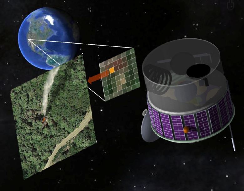
A concept for a satellite that would be dedicated to detecting new wildfires.

Researchers at Berkeley have designed a concept for a satellite that would be dedicated to detecting new wildfires. Decades ago we relied on a network of lookout towers staffed by employees and later volunteers who observed emerging fires and reported them by telephone or radio. Today most fires are turned in by residents or travelers with cell phones.

Dr. Gabbert’s prescription for keeping new fires from becoming megafires is:

Rapid initial attack with overwhelming force using both ground and air resources, arriving within the first 10 to 30 minutes when possible.

But if a fire is not detected and reported quickly, rapid initial attack is not possible.

This proposed satellite, called FUEGO – Fire Urgency Estimator in Geosynchronous Orbit, would survey the entire western United States every two minutes or less and could detect a fire that is about 10 feet in diameter. Assuming that the data from the satellite could be transmitted to the appropriate dispatch center within a minute or two, this could be a major step toward keeping fires small… IF the fire agencies have the appropriate initial attack policies in place and an adequate number of firefighting resources, both ground and air-based, to respond and arrive at the fire within the first 10 to 30 minutes.

FUEGO satellite
Artist’s concept for FUEGO on orbit (FUEGO Concept Art by R. E. Lafever, LBNL)

While the cost of the satellite could be several hundred million dollars, it could conceivably save money if it prevents a few megafires like the Rim Fire in Yosemite National Park last summer that to date has cost more than $127 million.

The real time detection of new fires is a very worthy goal, but added to this system should be the capability for real time monitoring and mapping of existing fires. The Holy Grail of Wildland Firefighter Safety is a system that could track firefighters on the ground AND the location of the fire, all displayed on one screen. This data should be available in real time to key supervisors and decision makers in the Operations and Planning Sections on fires. Knowing the positions of personnel relative to the fire would be a massive step in improved situational awareness and could reduce the number of firefighters killed on fires. This information could have saved 24 lives in recent years — 19 on the Yarnell Hill Fire and 5 on the Esperanza Fire. In both cases the firefighters and their supervisors did not know where the firefighters were relative to the location of the fire.

All of this technology exists. It would be expensive to implement, but it could save lives.

Report: in 2011 two-thirds of Americans lived in counties affected by wildfire smoke

Wildfire smoke,  August 24, 2013
Wildfire smoke, August 24, 2013 (click to enlarge)

Last summer large wildfires in Idaho, California, Oregon and many other states produced huge amounts of smoke that affected residents across much of the United States. The Natural Resources Defense Council has studied and quantified wildfire smoke that drifted across America the year before, in 2011. Below is an excerpt from their report:

****

New Report Shows Wildfire Smoke Poses Health Risk to Millions of Americans Many Miles from the Blazes

WASHINGTON (October 24, 2013) – Wildfires will get worse with climate change, not only endangering those near the blazes, but also threatening the health of millions of Americans from wildfire smoke that can drift hundreds of miles, according to a new report by the Natural Resources Defense Council.

As a result, communities must protect themselves from the health risks arising from exposure to wildfire smoke—including asthma attacks, pneumonia, and more serious chronic lung diseases. And the report, titled “Where There’s Fire, There’s Smoke,” suggests the country should take action to curb the threat of climate change.

“There’s trouble in the wind: What blazes in Texas rarely stays in Texas. Wildfire smoke can pose serious health risks to people hundreds of miles away from the sources of fires,” said Kim Knowlton, a senior scientist in NRDC’s Health and Environment Program, who directed the analysis. “Wildfire smoke already clouds the skies of millions of Americans and because climate change will fuel more wildfires, that danger will rise.

“Communities need safeguards against this peril, and our country needs standards to curb the unlimited carbon pollution from power plants that’s driving climate change.”

The study, based on smoke data from the 2011 wildfire season, one of the worst in recent decades, found that the area affected by smoke is 50 times greater than the area burned by fire. About two-thirds of Americans—nearly 212 million people—lived in counties affected by smoke conditions in 2011. Many states had large wildfires that year, but the study found that among the top 20 most affected states, six with no major fires nonetheless had to cope with more than a week of medium- to high-density smoke conditions during the year.

The states with the greatest numbers of residents affected by wildfire smoke conditions for a week or longer in 2011, according to the report, were: Texas, Illinois, Florida, Missouri, Georgia, Louisiana, Michigan, Alabama, Oklahoma and Iowa.

The report found that in 2011:

  • Texas ranked 1st nationally with more than 25 million people living in areas with wildfire smoke conditions for one week or more.
  • Illinois ranked 2nd with 11.9 million residents in affected areas.
  • Florida ranked 3rd with 11.2 million residents in affected areas.
  • Missouri ranked 4th with 5.9 million residents in affected areas.
  • Georgia ranked 5th, with 5.7 million residents in affected areas.
  • Louisiana ranked 6th, with 4.5 million residents in affected areas.
  • Michigan ranked 7th, with 3.93 million residents in affected areas.
  • Alabama ranked 8th, with 3.92 million residents in affected areas.
  • Oklahoma ranked 9th, with 3.7 million residents in affected areas.
  • Iowa ranked 10th, with 3 million residents in affected areas.

Other states where large numbers of people lived in areas with smoky conditions include, ranked in order, are Arkansas, Mississippi, Kansas, Tennessee, Colorado, New Mexico, Nebraska, Indiana, South Carolina and Minnesota. Altogether, more than one-third of the states experienced medium-to-high density smoke conditions for a week or longer, the report shows.

“The clear takeaway is that wildfires, smoke and the conditions that increase fire risk are national health concerns that spread well beyond the borders of local fire perimeters, conditions that are only projected to worsen with climate change,” the report says. NRDC used smoke data from federal weather satellites and also looked at the locations of Environmental Protection Agency ground-based air quality monitoring stations.

Climate change is fueling droughts that are projected to intensify in the future in across much of the United States as a result of less rainfall and more evaporation, turning wild-land vegetation tinder-dry. It also is projected to fuel more frequent, longer lasting extreme heat and lengthen warm-weather seasons, reducing moisture and setting the stage for fire risks, the report says.