Forest Service facing difficulties hiring firefighters

McBride Fire
McBride Fire in southern New Mexico. From Melissa Gibbs KRQE video April 12, 2022.

When the US Forest Service Deputy Chief of State and Private Forestry testified before members of Congress on April 5 that a firefighter hiring event “went very well”, the event had not started yet.

Jaelith Hall-Rivera, US Forest Service Deputy Chief of State and Private Forestry
Jaelith Hall-Rivera, US Forest Service Deputy Chief of State and Private Forestry, testified April 5 before a House Committee.

“We just completed an additional fire hire event in California at the end of March and those numbers are still coming in,” Ms. Jaelith Hall-Rivera said. “I do think we are on pace. By all accounts that hiring event went very well. Importantly what we are seeing is a very high acceptance rate in our permanent and seasonal permanent firefighting positions, which is what we want.”

In an article published today, Brianna Sacks of BuzzFeed News reported that the hiring event actually began April 11, six days after Ms. Hall-Rivera’s testimony, and is scheduled to go through April 29.

Ms. Hall-Rivera’s statement was in response to a series of questions from Rep. Katie Porter from California. You can watch this exchange in the video of the hearing we posted April 5 as part of a summary of the testimony before the House Subcommittee on National Parks, Forests, and Public Lands. Rep. Porter’s excellent questions begin at 138:35.

Below are excerpts from the BuzzFeed article:

A Forest Service spokesperson told BuzzFeed News that the deputy chief made an “error” because she “didn’t have all the information in front of her.”

“There are several hiring events throughout the year, and I think she was thinking of a different one in a different region,” the spokesperson said, but he did not provide specifics as to which one that might have been. The spokesperson also did not have hiring numbers that might back up Hall-Rivera’s assurances.

Interviews with firefighters in Colorado, New Mexico, Oregon, Washington, and California, as well as internal communications, hiring data, org charts, and surveys from the nonprofit Grassroots Wildland Firefighters, also tell a different story.

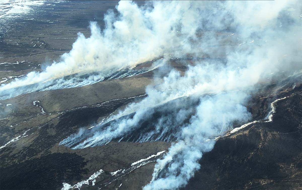
For example, in a Feb. 15 meeting hosted and attended by senior Washington officials, fire directors from across the US shared their issues with hiring, according to meeting notes obtained by BuzzFeed News. In New Mexico, where fires are currently raging, leaders said multiple hotshot crews would not be fully staffed. In the Pacific Northwest and Alaska, leaders said there is a “lack of candidates” and they are “unable to staff seven days in many places.” There is a “continued decline of folks to do the work.”

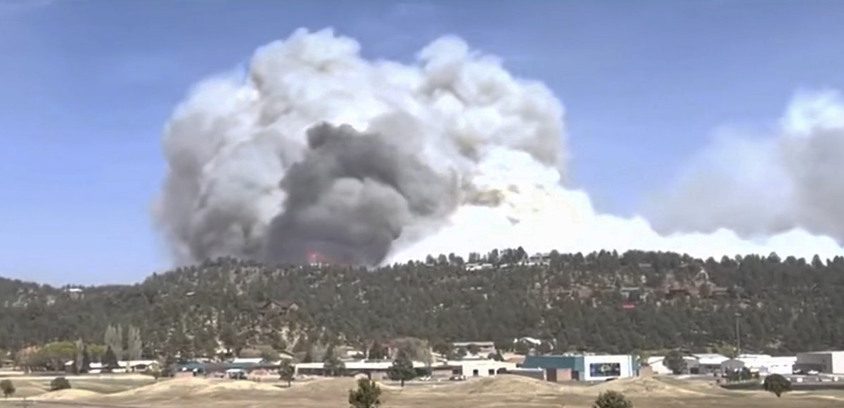
As California, Oregon, Utah, Washington, and Colorado gear up for fire season, interviews with three Forest Service employees familiar with hiring say the situation is grim. Without a serious staffing push, engines will sit idle, helicopters won’t be able to fly daily, crews won’t be able to start the season on time, and those who have worked multiple seasons in the field aren’t sure how much more they can stretch themselves without falling apart, they said. The Thomson Reuters Foundation, which also recently investigated systemic staffing issues, highlighted retention issues due to pay and housing.

In parts of Montana and Idaho, which had 700 seasonal workers last year, only 460 have returned for this fire season, a source familiar with the numbers said. And after last year’s Fire Hire, California had filled only 56 of 781 open positions, according to data obtained by BuzzFeed News. As of April 8, two days before this year’s hiring push, California had more than 1,560 vacancies, according to a review of the state’s openings.

More and more articles like this are being published documenting the hiring and retention difficulties that face the US Forest Service and Bureau of Land Management.

From Thomson Reuter Foundation News, April 25, 2022:

An engine captain involved in temporary hiring in northern California indicated that almost all Forest Service forests in the area expected to have less than 65% of full staffing for firefighters this year, some below 50%, according to a federal firefighting source who spoke on condition of anonymity.

“Fundamentally, people don’t want to take jobs because they can’t find a place to stay,” [Kelly] Martin [of the Grassroots Wildland Firefighters] said.

One female wildland firefighter – who lives out of her camper in California to save on rent – said proposals to increase base pay would not make up for the lack of an attractive career path for more experienced firefighters.

“Just raising the wages for those coming into fire is not going to be enough to keep people around,” she said, asking not to be named.

Wildfire in Southwest Alaska burns more than 10,000 acres

Less winter snow than usual, and dry, windy weather contributed to the growth

Kwethluk Fire, southwest Alaska, April 21, 2022
Kwethluk Fire, southwest Alaska, April 21, 2022. Alaska DNR DOF.

At Wildfire Today we don’t often write about fires in Alaska. In some years they have a great many fires but it varies enormously from year to year. Since 2010 the number of acres burned annually has ranged from a low of 181,169 in 2020 to a high of 5,111,404 in 2015. Many of the blazes are not suppressed and they don’t often affect a significant amount of private property or structures.

But it stirred my interest when I saw a headline about a current fire that is supposedly the largest April wildfire in Alaska in a quarter century. It is the 10,302-acre Kwethluk Fire in southwest Alaska 30 miles southeast of Bethel. An April 26 article in the Anchorage Daily News reported that climate scientist Rich Thoman said, “It’s not like dry Aprils are unusual; this is the dry season. But typically you would expect there would still be enough snow around that, even if a fire got going, that it would, within yards, run into snow.”

The area had less snow than usual this winter and it melted and exposed the tundra early. Wind, sun, and less precipitation than usual have dried out the fuel.

Map, Kwethluk Fire, southwest Alaska, April 24, 2022
Map, Kwethluk Fire, southwest Alaska, April 24, 2022.

The Alaska Division of Forestry reported April 26 that the spread of the Kwethluk Fire had stopped.

Below are excerpts from an April 26 update by the DOF about the fire:

“Burning in tundra, grasses and brush since Saturday April 16th, the wind driven wildfire has been finding sun dried fuels in the Yukon Delta National Wildlife Refuge.  DOF’s mapping specialist Matt Snyder flew a mapping and reconnaissance of the fire today noting in his field report this afternoon: “the fire is showing no smoke or activity. An infrared (IR) scan showed no heat. The fire will remain in monitor status so that further aerial observations can be made.”

“Originally scheduled for yesterday but delayed due to heavy cloud cover, today’s flight under clear sky shows the lack of smoke production from what was a 10% active perimeter when last observed on Friday’s flight. The natural barriers halting further spread include mountains, winter snowpack, icy creeks and rivers. Precipitation and increased humidities have also slowed fire spread. Persistently able to throw spotfires over frozen creeks and drainages for most of the last 10 days, the Kwethluk Fire remains two miles from the nearest native allotment.

Kwethluk Fire, southwest Alaska, April 26, 2022
Kwethluk Fire, southwest Alaska, April 26, 2022. Alaska DNR DOF.

“Values at risk include native allotments one mile to the northeast, 2.3 miles to the southeast, 3.3 miles to the west, and the Kwethluk Fish Weir approximately 5 miles to the west southwest. An additional surveillance flight will take place this week as needed and fire managers will continue to monitor both satellite heat sensors, FAA Weather Aviation cameras, and good Samaritan reports from Kwethluk, Bethel and Napakiak.

“It is common to have wildfires at this time of year in Alaska. As our daylight lengthens, the snowpack recedes and exposes the tundra grasses, mosses and shrubs to the drying effects of the wind and the sun. These conditions, coupled with sparse precipitation, work to dry out the tundra plants and make them available as fuel for combustion. Western Alaskan wildfires burning at this time of year tend to be wind driven and fast moving but also short-lived. These fires cannot burn deeply below the surface due to the shallow frost layer and tend to readily extinguish themselves as they encounter drainages and sloughs, differing vegetation, existing areas of snow, or changes in weather.”

Below is a flyover of the Kwethluk Fire narrated by DOF Specialist Matt Snyder recorded April 18, 2022. At the time it was 4,048 acres.

Thanks and a tip of the hat go out to Gerald.

More information about the fire from the Alaska Division of Forestry.

Forecast for wildfire smoke, April 24 & 25

In the crosshairs are portions of Arizona, New Mexico, Texas, Oklahoma, and Nebraska… for now

Forecast for vertically integrated wildfire smoke
Forecast for vertically integrated wildfire smoke at 5 p.m. MDT April 24, 2022. NOAA.

Above is the forecast from NOAA for the distribution of smoke from wildfires at 5 p.m. MDT April 24, 2022.

Below is the forecast for 3 a.m. MDT April 25, 2022.

Forecast for vertically integrated wildfire smoke
Forecast for vertically integrated wildfire smoke at 3 a.m. MDT April 25, 2022. NOAA.

Bookmark this page where the most recent articles about smoke on Wildfire Today can always be found:  https://wildfiretoday.com/tag/smoke/

Wildfire smoke, April 22, 2022

4:37 p.m. MDT April 22, 2022

Vertically integrated smoke, 4 p.m. MDT April 22, 2022

Wildfires in Arizona and New Mexico plus fires in the Southeast are putting a large amount of smoke in the air. Strong winds in New Mexico and Colorado are dispersing smoke from the two large fires in New Mexico, Calf Canyon and Cooks Peak, keeping the those near surface plumes more narrow than they would be with slower wind speeds.

map Near surface smoke, 4 p.m. MDT April 22, 2022
Near surface smoke, 4 p.m. MDT April 22, 2022
Forecast for vertically integrated smoke
Forecast for vertically integrated smoke at 1 p.m. MDT April 23, 2022.

Vertically integrated smoke can be at any altitude. In some cases it might be only at high altitudes and may not be very noticeable at ground level. Near surface smoke will hover within 8 meters (26 feet) of the ground—the kind responsible for burning eyes and aggravated asthma.

Click to see all articles on Wildfire Today, including the most recent, about the Calf Canyon, Hermits Peak, and Cooks Peak fires.

This is where much of that smoke is coming from…..

Cooks Peak Fire
Cooks Peak Fire in New Mexico by @little_emilee6 April 21, 2022.

Executive Order to inventory and protect old-growth forests

In a two year period 13 to 19 percent of all giant sequoias in their natural range over four feet in diameter were killed by fire

burned Sequoia grove in Sequoia and Kings Canyon NP
Sequoia grove in Sequoia and Kings Canyon National Park, November, 2021. NPS photo by Daniel Jeffcoach.

Today, on Earth Day, President Biden will sign an Executive Order to conduct the first-ever inventory of mature and old-growth forests on federal lands. This will be completed and made publicly available in a year with the objective of establishing consistent definitions and accounting for regional and ecological variation. The agencies will then analyze threats facing these forests, including from wildfires and other climate impacts.

After completing the inventory, the Departments of Interior and Agriculture will develop new policies, after public comment, to institutionalize climate-smart management and conservation strategies that address the threats facing mature and old-growth forests on federal lands.

We are losing thousands of giant sequoia trees that can live for 3,000 years

Nowhere is the need for protecting old growth forests more obvious than in the giant sequoia groves in California. In a two year period 13 to 19 percent of all giant sequoias in their natural range over four feet in diameter were killed by fire (and neglect) or will die in the next few years. In 2020, 10 to 14 percent of the entire Sierra Nevada population of giant sequoia trees over 4 feet in diameter were killed in the Castle Fire. Early estimates after two fires the following year, the KNP Complex and the Windy Fire, 2,261 to 3,637 sequoias over four feet in diameter were killed or will die within the next three to five years. These losses make up an estimated additional 3-5% of the entire Sierra Nevada sequoia population over four feet in diameter.

Three Fires, giant sequoia trees
Three fires in two years that killed giant sequoia trees. The darker green areas represent groves of giant sequoias.

Under normal conditions giant sequoia trees can live for more than 3,000 years, which is 38 times the life expectancy of a human in the United States. The multi-year drought and higher temperatures have led to extremely dry fuel moistures which is causing wildfires in California and other areas to burn with unusual intensity, making even some of the giant sequoias with bark up to a foot thick susceptible to wildfires burning under these conditions.

It is probably safe to assume that when large fires are burning most of the priorities of the Multi-Agency Coordinating Groups for allocating scarce resources are decided by individuals with a history of on the ground firefighting. They may have a bias toward allocating more fire personnel to protect buildings, rather than fires where 3,000-year old trees 300 feet tall and 20 feet in diameter are being destroyed.

Since only approximately 100,000 of these mammoth trees are left that are larger than four feet in diameter, government employees allocating firefighting resources need to strongly consider the value of these treasures to the nation and the world, and that some of them have been living for thousands of years. It is disheartening to see hundreds of them destroyed in a matter of hours, especially if due in part to sending resources, instead, to protect structures that have not been hardened to FireSafe standards or constructed under reasonable county and city building codes.

The giant sequoias have already been inventoried. We know where they are. What NEEDS to be done is to ramp up the management of the fuels beneath these big trees, and greatly increase the prescribed fire programs around them on lands managed by the National Park Service, Forest Service, and Bureau of Indian Affairs.

Firefighter on the Windy Fire burning giant sequoia tree
Firefighter on the Windy Fire applies water on a burning giant sequoia tree. Photo uploaded to InciWeb Oct. 11, 2021.

Extreme fire weather expected Friday in portions of New Mexico and Colorado

“Friday’s expected weather could rival the most powerful fire events of the past decade,” said a NWS meteorologist

Updated 7:22 a.m. MDT April 22, 2022

Extreme fire weather April 22, 2022
Critical and Extreme fire weather predicted by the Storm Prediction Center for 6 a.m. Friday to 6 a.m. Saturday, April 22 & 23, 2022.

The Storm Prediction Center has issued a Fire Weather Outlook for 6 a.m. MDT Friday April 22 until 6 a.m. MDT Saturday April 23 that uses language we rarely see in a fire weather forecast, including “extremely critical” and “dangerous”.

The forecast warns about extremely critical fire weather conditions in portions of central and eastern New Mexico and eastern Colorado, and critical fire weather for portions of the southern and central high plains.

Click to see all articles on Wildfire Today, including the most recent, about the Calf Canyon, Hermits Peak, and Cooks Peak fires.

Sustained winds out of the south-southwest at 30 to 40 mph with widespread gusts of 50-60 mph are expected with 5 to 15 percent relative humidity. The fuels are exceptionally dry and isolated thunderstorms with little or no rain are possible in some areas.

Three existing fires in northern New Mexico east and northeast of Santa Fe could be vulnerable to extreme conditions, the Cooks Peak Fire, Calf Canyon Fire, and the Hermits Peak Fire. Friday’s forecast for the Calf Canyon Fire, which was very active Thursday, calls for southwest winds of 46 mph gusting to 64 mph with relative humidity in the teens and 20s. It will also be very windy on Saturday.

In Northern New Mexico the wind speeds will increase through the morning, peaking in the afternoon.

Satellite photo smoke from fires New Mexico
Satellite photo showing smoke from the Cooks Peak and Hermits Peak Fires in northern New Mexico at 6:30 p.m. MDT April 21, 2022. NOAA.

CNN is taking this forecast seriously in an article written by four of their meteorologists. Here are some excerpts:

Friday’s expected weather could rival the most powerful fire events of the past decade, Zach Hiris, a meteorologist at the National Weather Service office in Boulder, Colorado, told CNN.

Compared to recent extremely critical, wind-driven fire dangers in rural areas, some major population centers are threatened in this event, including Albuquerque, New Mexico, and Colorado Springs and the Denver metro area in Colorado.

“There is high confidence that a widespread extreme and potentially catastrophic fire weather event will occur on Friday,” said the National Weather Service office in Albuquerque.

In addition to fueling the fires, widespread wind gusts of 60 to 70 mph — and even 80 mph in scattered areas — could knock down large tree limbs, utility poles and other structures while threatening to topple high-profile vehicles, the weather service said.

Here is the forecast produced by the NOAA Storm Prediction Center at 12:20 p.m. MDT Thursday April 21:


Day 1 Fire Weather Outlook
NWS Storm Prediction Center Norman OK
0202 AM CDT Fri Apr 22 2022

Valid 221200Z – 231200Z

…EXTREMELY CRITICAL FIRE WEATHER AREA FOR PORTIONS OF CENTRAL AND EASTERN NEW MEXICO INTO EASTERN COLORADO… …CRITICAL FIRE WEATHER AREA FOR PORTIONS OF THE SOUTHERN AND CENTRAL HIGH PLAINS…

…Synopsis… ***DANGEROUS FIRE-WEATHER CONDITIONS EXPECTED TODAY ACROSS PORTIONS OF EAST-CENTRAL NEW MEXICO INTO EASTERN COLORADO***

A highly amplified large-scale trough and accompanying intense deep-layer south-southwesterly flow will emerge over the southern Rockies and adjacent High Plains by peak heating. As a result, strong cyclogenesis will occur over far northeastern Colorado during the afternoon, with a sharpening dryline extending southward along the Kansas/Colorado border and the Texas/New Mexico border. The combination of a strong surface pressure gradient, hot/dry conditions behind the dryline, and strong south-southwesterly flow aloft will result in extremely critical fire-weather conditions from east-central New Mexico into eastern Colorado today.

…East-central New Mexico into eastern Colorado… As temperatures climb into the upper 70s to middle 80s behind the sharpening dryline, deep boundary-layer mixing into very dry air aloft will result in widespread 5-15 percent minimum RH. At the same time, 30-40 mph sustained south-southwesterly surface winds (with widespread gusts of 50-60 mph) will overspread critically dry fuels (ERCs above the 90th+ percentile). The volatile combination of very strong/gusty winds, anomalously warm/dry conditions, and near-record dry fuels will encourage extreme fire-weather conditions.

…Remainder of the central and southern High Plains… The eastern extent of critical fire-weather conditions will be demarcated by the placement of the dryline. Strong 30+ mph sustained southerly surface winds (with higher gusts) concurrent with afternoon RH values below 20% will extend into southern New Mexico, West Texas, the western Texas/Oklahoma Panhandles, western Kansas, and western Nebraska — where fuels remain critically dry.

…Dry Thunderstorm Potential… Another point of concern will be isolated dry thunderstorm development immediately along and ahead of the dryline this afternoon, which is expected to take place along the axis of the driest fuels. Any cloud-to-ground lightning flashes that can occur in proximity to the Colorado/Kansas and New Mexico/Texas border area will do so over very receptive fuels, and likely with little wetting rainfall at the early stages of thunderstorm evolution.

..Jirak.. 04/22/2022

(end of forecast)


Below is the forecast for the area near the Calf Canyon fire 23 miles east of Santa Fe.

Weather forecast Calf Fire
Weather forecast for the Calf Fire area, 7 a.m. MDT April 22, 2022.

Thanks and a tip of the hat go out to Rick.