Wyoming: Browning Fire causes evacuations

(UPDATED at 4:32 p.m. MDT July 7, 2016)

Map Browning Fire
Map showing the location of heat (the red dots) detected by a satellite over the Browning Fire at 1:58 p.m. MT July 7, 2016.  It is possible that portions of the fire burned areas of light fuel, such as grass, that cooled before the overpass by the heat sensing satellite; therefore, it could be larger than indicated here. Click to enlarge.

Crook County Fire & Emergency Management reported Thursday afternoon that the Browning Fire has been mapped at 875 acres.

Browning Fire
The Browning Fire at 2:14 p.m. MDT July 7, 2016. The photo was taken by a local resident 10 miles north of Upton looking west.

The photos below were supplied by Crook County Fire and Emergency Management.

Browning Fire Browning Fire Browning Fire

****

(UPDATED at 1:10 p.m. MDT July 7, 2016)

A local resident told us that smoke from the Browning Fire northwest of Upton, Wyoming can be seen from Spearfish, South Dakota and Newcastle, Wyoming.

The weather forecast for the fire area will not be helpful to firefighters on Thursday. It predicts northwest winds at 16 mph gusting at 23 mph, relative humidity in the low 20s, and temperature in the mid-70s. On Friday it should be warmer but less windy, with the RH dipping into the high teens.

****

(Originally published at 10:34 a.m. MDT July 7, 2016)

More lightning poured through northeastern Wyoming and the Black Hills Wednesday afternoon. After it passed the Browning Fire and another fire were discovered 7 miles west of Inya Kara and 9 miles northeast of Upton, Wyoming. The two fires merged.

Crook County Fire and Emergency Management reports it has burned 600 to 800 acres and has required evacuations, but no structures have been destroyed.

Map Browning Fire
Map showing the location of heat detected by a satellite over the Browning Fire at 11:03 p.m. MT July 6, 2016. Click to enlarge.

The fire is about 3 miles south of the Douglas Fire that burned about 1,700 acres a couple of weeks ago. Both the Douglas Fire and the 12,000-acre Kara Creek Fire that burned at about the same time are contained.

On Wednesday a helicopter assisted firefighters by dropping water and it will be available on Thursday as well.

Chimpanzees and elk featured in stories about wildfire in Washington

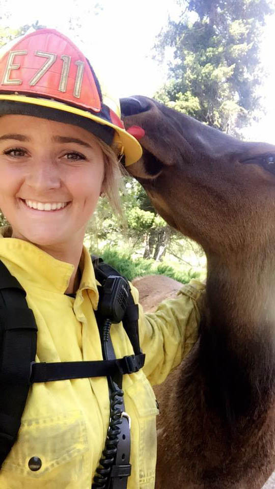
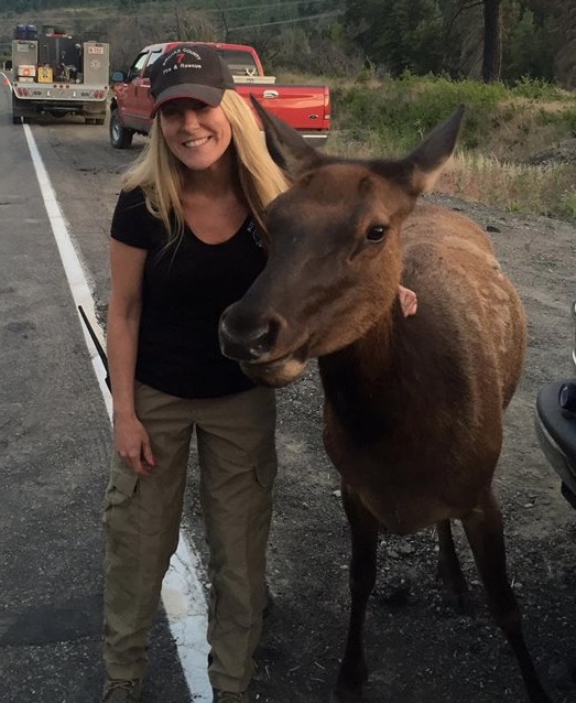
Elk and firefighterChimpanzees were one of the first to “report” the Highway 10/Hart Road fire near Cle Elum, Washington.

From the NWNewsNetwork:

…Jamie, a female chimp [at the Chimpanzee Sanctuary Northwest], let out a soft high-pitched call when she spotted a plume of smoke rising outside of the sanctuary center’s playroom. The other chimps turned their heads to look. Then, the human caretakers noticed and dialed 911. Staff scrambled, got all the chimps inside and safe, turned on emergency sprinklers and evacuated staff…

And now we hear that a cow elk has been visiting with firefighters, making her rounds “giving kisses to each firefighter and officer” at the Incident Command Post.

Her name is Button. She was orphaned and has taken up residence near the Chimp Sanctuary adopting some goats and horses as her family.

Elk at fire

Elk and firefighters

Photos of Buttons with the firefighters are by the Kittitas County Fire District #7. More are here.

Former dispatcher: the training and experience of fire managers no longer relevant

Teepee Springs Fire, 8-29-2015
Teepee Springs Fire, August 29, 2015, as seen from Island Bar in Idaho. InciWeb photo.

Allison Linville, a former aircraft dispatcher for the U.S. Forest Service, wrote an interesting article for High Country News, saying last year’s fires pushed wildland firefighters to the edge.

Below is an excerpt:

****

“…In Montana, fire managers were watching fire models and using their extensive training and experience to manage fires just as they always had, only to have people on the ground begging them to understand that they were seeing something totally different. “Their models weren’t showing what a beast it actually was,” said a firefighter on the Flathead National Forest. She was talking about a fire that she barely escaped before it blew up.

It occurred to me last August that wildfires have become qualitatively different. And it was a disturbing thought, the realization that no one had the ability to manage fire anymore. Fire managers can’t understand the fires we have today, because their training and experience are no longer relevant to modern-day fires.

Given the conditions now piling up — hot summers, long fire seasons, low snowpack, heavy fuel loading, an ignorant public, erratic storms — there is simply not enough education or experience available to help teach a fire manager what to do. It’s not the managers’ fault; it’s not any one person’s fault.”

Montana: Pole and Fine Fires

Pole Fire
Pole Fire – USFS photo

The Pole and Fine Fires are burning a mile apart in southwest Montana 18 miles southwest of Ennis and 47 miles northwest of West Yellowstone. The lightning-caused fires were discovered June 30 in stands of standing dead and down timber.

Firefighters are engaging the fires as they move out of the timber stands into meadows in order to minimize exposure to numerous snags. Actions to secure the whitebark pine stand adjacent to the Pole Fire continue. Structure and private property assessments are on-going on the Fine fire.

Pole and Fine Fires
Vicinity map for the Pole and Fine Fires. Click to enlarge.

The heat-sensing satellites, capable of detecting large concentrations of heat from vegetation fires, has not found any since July 1 at 4:30 a.m.

Map Pole-Fine Fire
They yellow icons represent heat detected by a satellite over the Pole and Fine Fires at 4:30 a.m. MDT July 1, 2016. Click to enlarge.

The spread of the Beaver Creek Fire in northern Colorado slows

Above: Varying burn intensities on the Beaver Creek Fire.

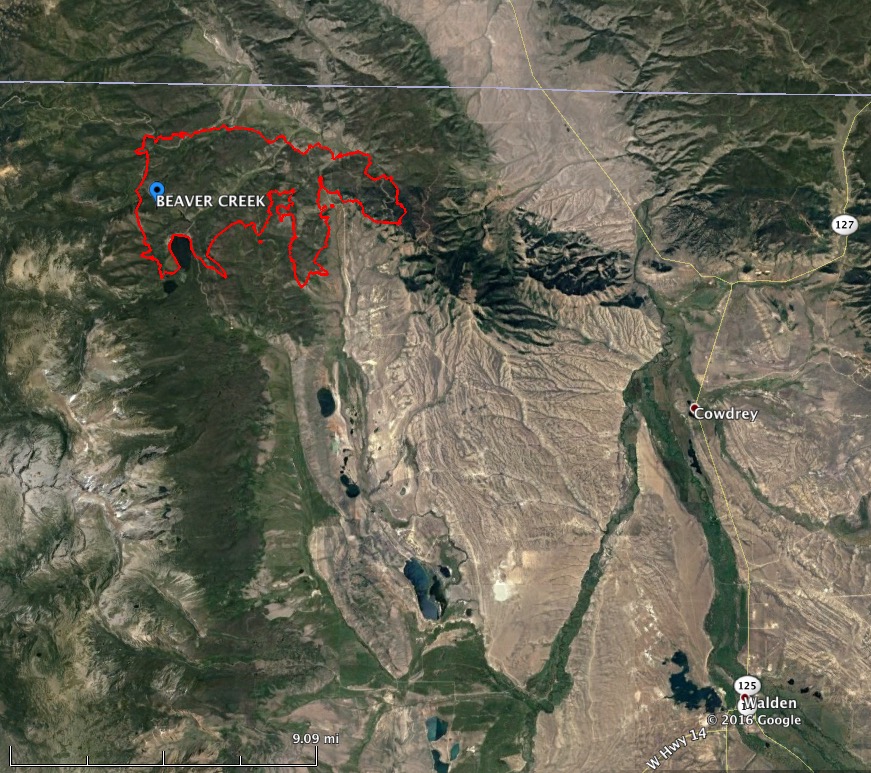
The spread of the Beaver Creek Fire in northern Colorado one mile south of the Wyoming border has slowed over the last week. It has been listed at 13,275 acres since June 30 and according to the incident commander is 5 percent conplete after burning for 18 days. The strategy is not to put it out, but to manage it for “multiple objectives”.

The fire is 17 miles northwest of Walden, Colorado and 52 miles southwest of Laramie, Wyoming.

Within the last 48 hours the fire received about 0.2 inches of rain but the fuels should dry out today, aided by a 9 mph southwest wind gusting up to 23 mph.

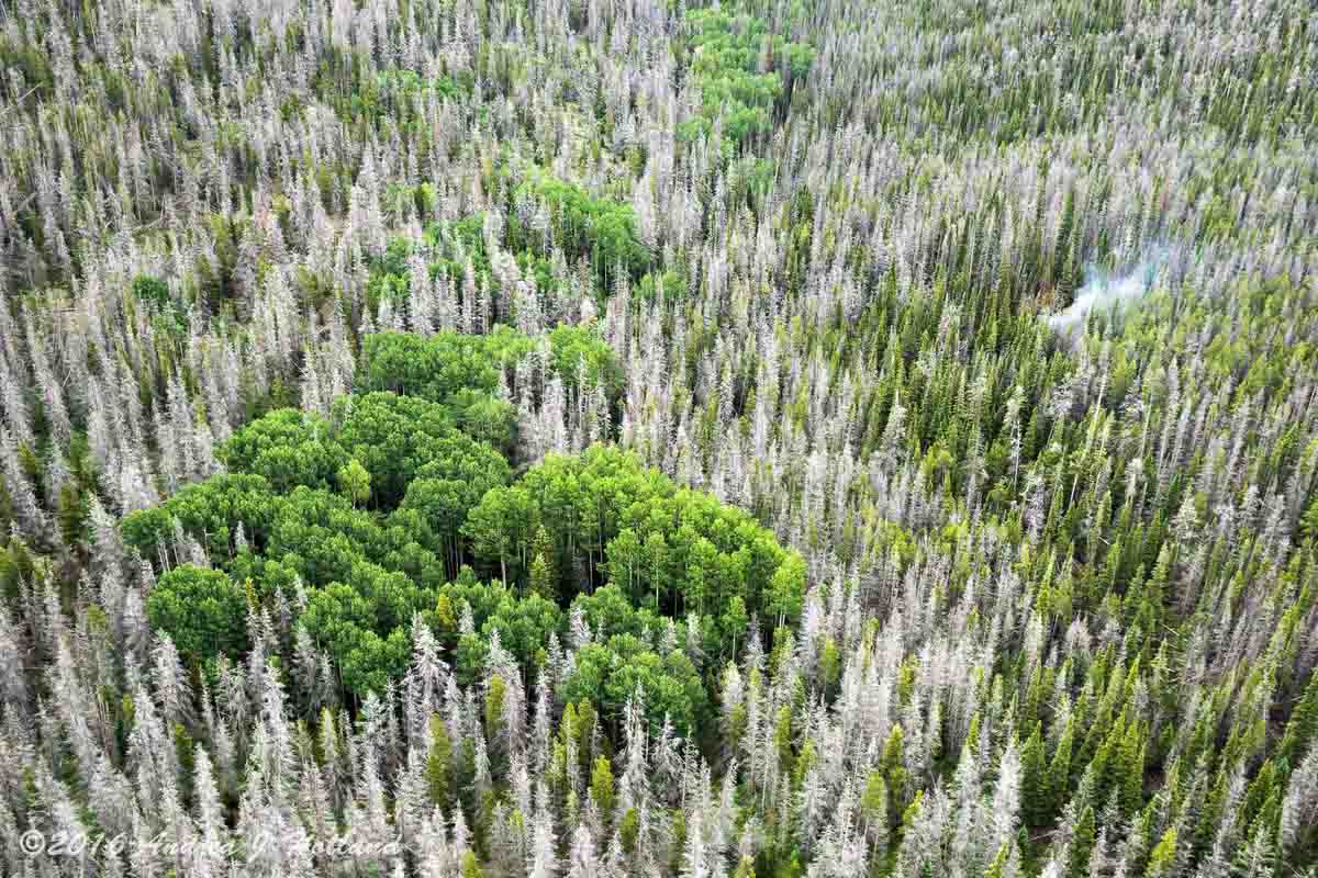
Beaver Creek Fire beetles intensity
Photo of a portion of the Beaver Creek Fire in an area with heavy beetle kill. One smoke is visible. USFS photo by Andrea Holland.

People who are extremely worried about forests attacked by beetles and assume fire intensity will be greatly enhanced in those areas, should examine the photo above that was taken within the fire area.

Jay Esperance’s Type 2 incident management team will transition to the West Slope Type 3 Team B on Thursday.

The photos were provided by the Medicine Bow-Routt National Forests and Thunder Basin National Grassland. Except as noted the photographer and dates taken were not given.

More information about the Beaver Creek Fire.

Beaver Creek Fire map
Map of the Beaver Creek Fire July 3, 2016. USFS.
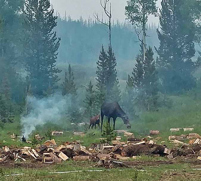
Beaver Creek Fire moose
A moose and her calf investigate evidence of firefighter activity on the Beaver Creek Fire.
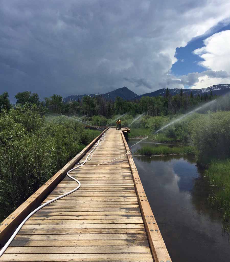
Beaver Creek Fire sprinklers
Sprinklers are set up on an ATV bridge near the Beaver Creek Fire.
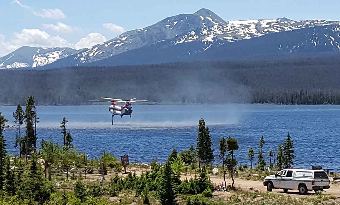
Beaver Creek Fire Chinook
A Chinook helicopter uses its snorkle to refill its internal water tank while working on the Beaver Creek Fire.
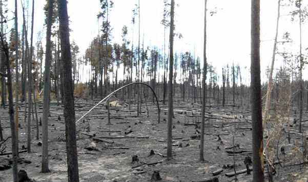
Beaver Creek Fire
AN area of high burn intensity on the Beaver Creek Fire.

A few more details released about fire shelter deployment on the Cedar Fire

On Sunday the Bureau of Indian Affairs released a “72-hour report” that contains a few more details about the entrapment of six firefighters and deployment of their fire shelters on the Cedar Fire south of Show Low, Arizona.

The new information includes mentions of a large fire whirl and three lookouts that were posted.

Below is the press release version of the 72-hour report. The formal memo-style document is HERE. They contain approximately the same information.

****

“On June 28, a large fire whirl formed near six members of the Navajo Interagency Hotshot Crew (IHC), entrapping them. In response to the intense heat, flying ash and woody debris, the firefighters deployed their fire shelters.

Throughout the 15 minute event, the crew maintained radio communication with each other and agency personnel. Aviation and safety resources were immediately dispatched to assist the crew.

After the fire whirl passed, the IHC walked out of the fire area and were transported to Summit Healthcare in Show Low, Arizona. Two firefighters were treated for smoke inhalation and all six firefighters were released from the hospital that evening. After the crew was released, a Critical Incident Stress Management Team was made available to the crew.

The Bureau of Indian Affairs initiated an Interageny Serious Accident Investigation (SAI) that evening. On June 30, the SAI Team members, led by Clark Richins, Team Leader, Bureau of Indian Affairs, reported to Western Region, Fort Apache Agency. Members of the SAI Team include: Chief Investigator, Safety Officer, Personal Protective Equipment Specialist, Long Term Fire Analyst, Hotshot Crew Representative, Public Information Officer, Writer/ Editor, and Regional and National Agency Liaisons.

The investigation will collect evidence, which includes conducting personnel interviews, inspecting equipment and analyzing photographs, weather and voice data. On June 30, the SAI Team completed their interviews of the IHC, which allowed the crew to return home.

According to the National Wildfire Coordinating Group Terminology Glossary, a fire whirl is a spinning vortex column of ascending hot air and gases rising from a fire and carrying aloft smoke, debris, and flame. Fire whirls may range in size from less than one foot to over 500 feet in diameter and have the intensity of a small tornado.

Prior to the event, the crew was working along the western flank of the uncontained fireline where they had previously been assigned for several days. At 12:00p.m three nearby lookouts observed low intensity surface fire, but by 2:00p.m., as the day got warmer, the fire behavior increased. These lookouts and an additional firefighter scouting the fireline witnessed the large fire whirl.

While managing wildland fires is inherently dangerous, all firefighters are trained to minimize the risk they take on every assignment. In the rare circumstance firefighters are faced with an impending entrapment, they are trained to consider all options to insure the safety of all crew members. This includes deploying fire shelters for protection from smoke, heat, and embers. The Navajo Interageny Hotshot Crew executed their training, which resulted in a successful outcome to a hazardous wildfire anomaly.

As a highly reliable organization, the wildland fire community strives to learn and transfer lessons learned on a continual basis. In the spirit of this culture, the BIA Western Region will provide the Factual Report to the Lessons Learned Center when the Report is finalized.”

****

Thanks and a tip of the hat goes out to Jonah.