The true cost of wildfire

It is more than simply dollars spent to knock down the flames

October 8, 2020   |   1:04 p.m. MDT

White Draw Fire, June 29, 2012. Photo by Bill Gabbert.
White Draw Fire near Edgemont, SD, June 29, 2012. Photo by Bill Gabbert.

An article at National Public Radio recommends what we should be focusing on when discussing the effects of wildfires instead of simply the number of acres burned.

That general topic can cover not only the dollars spent while knocking down the flames, but the actual cost of damage to infrastructure, community water sources, flooding, mud slides, health effects of smoke on populations, repairing the damage done in the burned areas, rebuilding structures, mental health of residents, and the economic effects of evacuations and reduced tourism.

Here is an excerpt from the NPR article:

Often, the human cost of wildfires has little to do with their size. California’s three most destructive wildfires aren’t among the state’s largest. The 1991 Tunnel fire in the Oakland hills was relatively tiny at 1,600 acres, but destroyed 2,900 structures and killed 25 people. Even the Camp Fire, which burned more than 18,000 structures in Paradise, California, isn’t even in the top 20, ranked by acreage.

“I think we should concentrate more on the human losses,” says Ernesto Alvarado, professor of wildland fire at the University of Washington. “Wildfires in populated areas, it doesn’t matter what size those are.”

Public authorities could also report on a broader human impact: the number of people experiencing harmful air due to smoke. While detailed maps are available with smoke concentrations, showing the air quality index, there are few measures of the scale of that public health impact. Poor air quality due to smoke is linked to a rise in emergency room visits due to asthma, stroke and heart attacks.

The article reminded us of one we published April 18, 2014, titled, “The true cost of wildfire.” For Throwback Thursday, here it is again:


A conference in Glenwood Springs, Colorado on Wednesday and Thursday of this week explored a topic that does not make the news very often. It was titled The True Cost of Wildfire.

Usually the costs we hear associated with wildfires are what firefighters run up during the suppression phase. The National Incident Management Situation Report provides those daily for most ongoing large fires.

But other costs may be many times that of just suppression, and can include structures burned, crops and pastures ruined, economic losses from decreased tourism, medical treatment for the effects of smoke, salaries of law enforcement and highway maintenance personnel, counseling for post-traumatic stress disorder, costs incurred by evacuees, infrastructure shutdowns, rehab of denuded slopes, flood and debris flow prevention, and repairing damage to reservoirs filled with silt.

And of course we can’t put a monetary value on the lives that are lost in wildfires. In Colorado alone, fires since 2000 have killed 8 residents and 12 firefighters.

The total cost of a wildfire can be mitigated by fire-adaptive communities, hazard fuel mitigation, fire prevention campaigns, and prompt and aggressive initial attack of new fires with overwhelming force by ground and air resources. Investments in these areas can save large sums of money. And, it can save lives, something we don’t hear about very often when it comes to wildfire prevention and mitigation; or spending money on adequate fire suppression resources.

Below are some excerpts from a report on the conference that appeared in the Grand Junction Sentinel:

[Fire ecologist Robert] Gray said the 2000 Cerro Grande Fire in New Mexico ended up having a total estimated cost of $906 million, of which suppression accounted for only 3 percent.

Creede Mayor Eric Grossman said the [West Fork Complex] in the vicinity of that town last summer didn’t damage one structure other than a pumphouse. But the damage to its tourism-based economy was immense.

“We’re a three-, four-month (seasonal tourism) economy and once that fire started everybody left, and rightfully so, but the problem was they didn’t come back,” he said.

A lot of the consequences can play out over years or even decades, Gray said.

He cited a damaging wildfire in Slave Lake, in Alberta, Canada, where post-traumatic stress disorder in children didn’t surface until a year afterward. Yet thanks to the damage to homes from the fire there were fewer medical professionals still available in the town to treat them.

“You’re dealing with a grieving process” in the case of landowners who have lost homes, said Carol Ekarius, who as executive director of the Coalition for the Upper South Platte has dealt with watershed and other issues in the wake of the 2002 Hayman Fire and other Front Range fires.

The Hayman Fire was well over 100,000 acres in size and Ekarius has estimated its total costs at more than $2,000 an acre. That’s partly due to denuded slopes that were vulnerable to flooding, led to silt getting in reservoirs and required rehabilitation work.

“With big fires always come big floods and big debris flows,” Ekarius said.

Gray said measures such as mitigating fire danger through more forest thinning can reduce the risks. The 2013 Rim Fire in California caused $1.8 billion in environmental and property damage, or $7,800 an acre, he said.

“We can do an awful lot of treatment at $7,800 an acre and actually save money,” he said.

Bill Hahnenberg, who has served as incident commander on several fires, said many destructive fires are human-caused because humans live in the wildland-urban interface.

“That’s why I think we should maybe pay more attention to fire prevention,” he said.

Just how large the potential consequences of fire can be was demonstrated in Glenwood Springs’ Coal Seam Fire. In that case the incident commander was close to evacuating the entire town, Hahnenberg said.

“How would that play (out)?” he said. “I’m not just picking on Glenwood, it’s a question for many communities. How would you do that?”

He suggested it’s a scenario communities would do well to prepare for in advance.

The chart below from EcoWest.org shows that federal spending per wildfire has exceeded $100,000 on an annual basis several times since 2002. Since 2008 the cost per acre has varied between $500 and $1,000. These numbers do not include most of the other associated costs we listed above. (click on the chart to see a larger version)

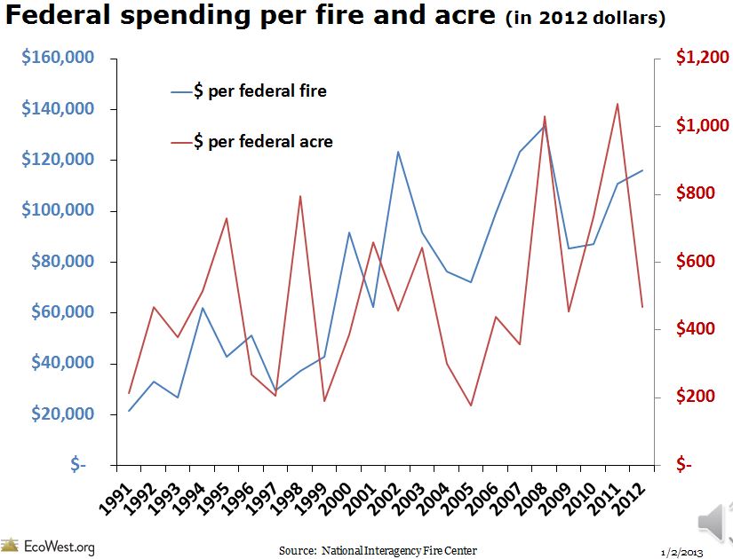
Cost per wildfire acre

Mullen Fire reaches Albany, Wyoming

Updates on the Middle Fork and Cameron Peak fires in Colorado

Updated October 8, 2020   |   7:53 a.m. MDT

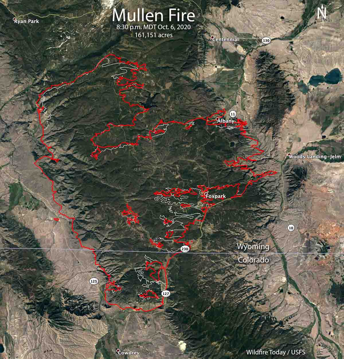
map of the Mullen Fire
The red line was the perimeter of the Mullen Fire at 8:30 p.m. MDT October 6, 2020. The white line was the perimeter two days before.

The Mullen Fire has been active on the east and northeast sides and reached the small community of Albany, Wyoming on Highway 11. The fire grew to the east and is now on both sides of the highway. Firefighters have been working to protect structures in Albany, the Wyoming Infrared Observatory, and the Rob Roy reservoir which is the main water source for the city of Cheyenne, WY.

The incident management team reported October 7 that 32 residences and 33 other structures have been destroyed.

Albany County crews established and strengthened indirect fire lines to slow the potential spread towards Centennial which is six miles north of the fire.

The Mullen Fire has burned 170,996 acres, according to the Incident Management Team Thursday morning. The weather forecast through Saturday could be troublesome for firefighters — breezy conditions and low relative humidity. The wind will be generally out of the west or southwest at 8 to 14 mph with the humidity in the teens. There is a slight chance of a small amount of rain Sunday but that will come with 20 mph winds gusting out of the west at 29 mph.

The resources assigned include 14 hand crews, 116 engines, and 16 helicopters, for a total of 1,079 personnel.

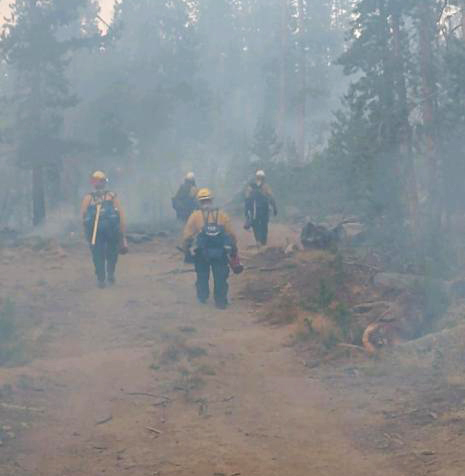
Firefighters on the Mullen Fire
Firefighters on the Mullen Fire hike to their assignment Oct. 5, 2020. Photo by Josh Shroyer.


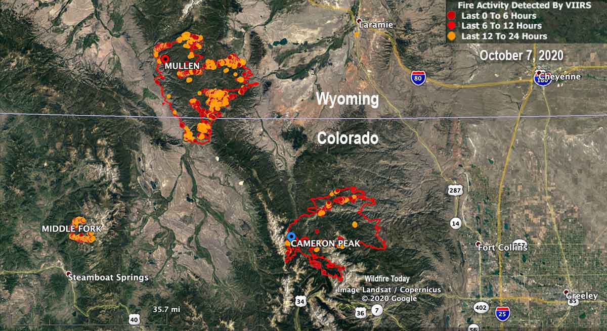
The Cameron Peak Fire has been much less active than the Mullen Fire, and has been mapped at 129,055 acres. The incident management team reported October 7 that 27 residences and 30 other structures have been destroyed.

The 11,005-acre Middle Fork Fire 7 miles north of Steamboat Springs, Colorado was very active Tuesday and Wednesday on the south, west, and north sides. As of Wednesday evening the resources assigned, according to the national situation report, included no hand crews or engines, and 4 helicopters, for a total of 70 personnel. Two structures are threatened.

Fires in Colorado & Wyoming Oct. 7, 2020.

Where did the term “gigafire” originate

After the August Complex fire grew beyond 1 million acres news articles around the world yesterday referred to it as a “gigafire”. For an article they were working on, Harmeet Kaur a reporter for CNN contacted us yesterday.

I’m interested in the origin of the term “gigafire” and how it compares to “megafire.” From what I’ve been reading on your website, it seems that you may have coined the terms. Could you confirm whether that is the case?

I told the reporter that as far as I know, a person working for the U. S. Forest Service was one of the first to use “megafire” to describe a fire that burns 100,000 acres. But to my knowledge the first use of “gigafire” for a 1 million-acre fire occurred on Wildfire Today in 2017.

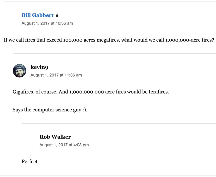
Below an article I wrote about the Elephant Hill Fire in British Columbia which at that time had burned 194,000 acres, I posted a comment asking our readers to suggest a term to describe 1,000,000-acre fires. “kevin9” wrote, “Gigafires, of course.” So he gets the credit for coining the term.

On July 10, 2018 we first used the word in an article on Wildfire Today when writing about the 425,000-acre Martin Fire in Northern Nevada.

When a wildfire reaches 100,000 acres we often refer to it as a “megafire”. But what name do we put on a fire when it is four times the megafire threshold? The incident management team on the Martin Fire in Northern Nevada estimates their fire has burned approximately 425,000 acres. (I think we should reserve “gigafire” for a 1 million-acre fire.)

The next time we used the word was October 26, 2018 in an article with the headline, Bushfire in Australia burns over 2 million acres, becoming a “gigafire”. Following that, it showed up in more articles — Chuckegg Creek Fire in Alberta, six bushfires in Australia that merged, and most recently, the August Complex fire in California.

We are aware of one gigafire that has occurred in the United States within the last few decades.

The fires in the greater Yellowstone area in 1988 burned a total of 1.6 million acres. The largest was the result of five fires burning together totaling 1,200,453 acres: North Fork, Clover Mist, Fan, Hellroaring, and Storm Creek.

The seven fires that comprised the Taylor Complex of fires in Alaska in 2004 totaled 1,303,358 acres, with the largest being the Billy Creek Fire at 463,994 acres.

Fire managers sometime arbitrarily draw a line on a map around multiple separate fires and call the group a “complex” in order to simplify the organization and paperwork, but they are still multiple fires. On a largest-fires list, complexes treated as one fire should not be welcome, but fires that burn together should be allowed.

Origin of the term "gigafire"
Origin of the term “gigafire”

Firefighters on Glass Fire evaluated for possible carbon monoxide exposure

October 6, 2020   |   2:31 p.m. PDT

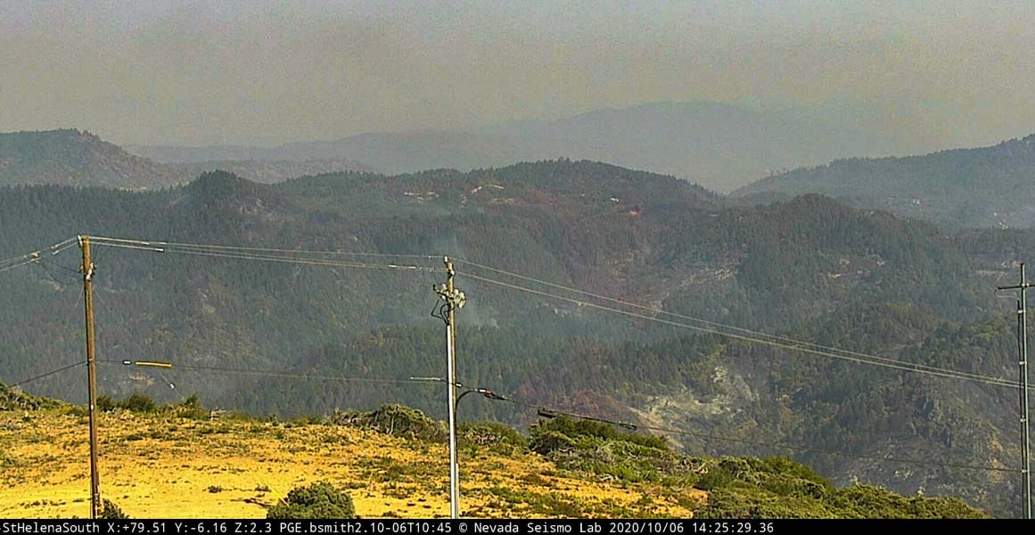
The north end of the Glass Fire
The north end of the Glass Fire, as seen from St Helena South camera at 225 p.m. PDT Oct. 6, 2020. Looking east. AlertWildfire.

Sixteen firefighters assigned to the Glass Fire near the Napa Valley in Northern California were evaluated for possible carbon monoxide exposure Tuesday morning October 6. One was transported to a hospital and the others were allowed to return to their duties.

CAL FIRE said the exposure occurred at a location off-site out of the fire area. The personnel were evaluated by members of the Santa Rosa Fire Department and medical personnel assigned to the incident.

CAL FIRE did not disclose where the firefighters were or what they were doing when the possible exposure occurred. Five ambulances were dispatched to the CAL FIRE incident command post at the Sonoma County Fairgrounds in Santa Rosa Tuesday morning.

The Glass Fire has burned 66,840 acres, 310 homes, and 12 commercial buildings.

UPDATE October 7, 2020   |   12:09 a.m. PDT:

Pat McLean, a spokesperson for CAL FIRE, said on October 7, “16 firefighters were evaluated yesterday. Fifteen were cleared to go right back to active duty yesterday and the 16th was evaluated at the hospital and has since been released back to full duty as well.”

When asked where the firefighters were when they were exposed to carbon monoxide, Mr. McLean said, “I don’t have that information. They were outside, they were not on the fire, nor were they at base camp.”

He said he did not have information about the source of the carbon monoxide. The incident is being investigated.

August Fire grows to over one million acres

Gigafire in Northern California

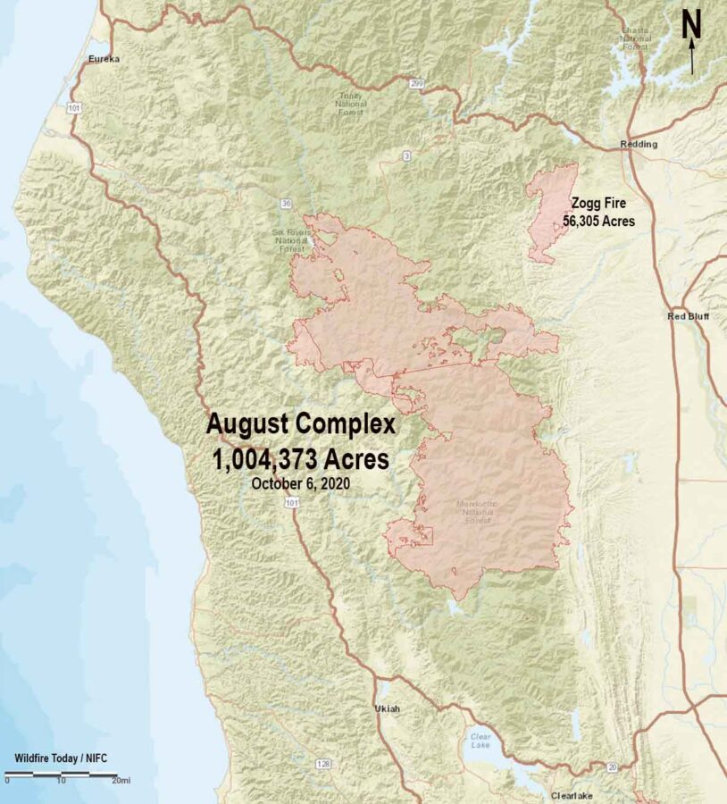
Map of the August Complex of fires
Map of the August Complex of fires in Northern California, October 6, 2020.

On August 16 a weather pattern that does not occur often began working its way slowly through northern California. During the next three days about 2,500 lightning strikes were recorded that started over 600 fires, creating what became the Siege of ’20. The lightning was a result of moist unstable air from Tropical Storm Fausto colliding with a high pressure ridge during a heat wave. Many of the thunderstorm cells produced little or no rain that reached the ground. The lightning ignited dry fuels causing fires that spread rapidly, quickly overwhelming the suppression capability of local, state, and federal fire organizations. Some fires were not staffed at all for days, and for weeks most incidents struggled, with fewer resources than they needed.

The August Complex of fires is the result of 37 blazes that started on August 17 and eventually burned together on the Mendocino National Forest. It has now blackened 1,004,373 acres becoming a gigafire, the largest fire in the recorded history of California, by far. The scope of the fire is almost difficult to comprehend — approximately 72 miles by 32 miles. It is larger than Rhode Island which is 988,832 acres.

Resources assigned include 65 hand crews, 353 fire engines, and 31 helicopters for a total of 4,075 personnel. About 100 residences and 104 other structures have been destroyed . The estimated costs to date are $166 million.

The fire is divided into two zones with individual areas managed by four Type 1 Incident Management Teams overseen by an Area Command Team.

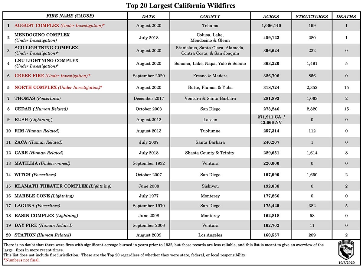
Largest fires, California, October 6, 2020
Largest fires in the recorded history of California as of October 6, 2020. The number of structures includes all types of structures, from small sheds to large commercial buildings.
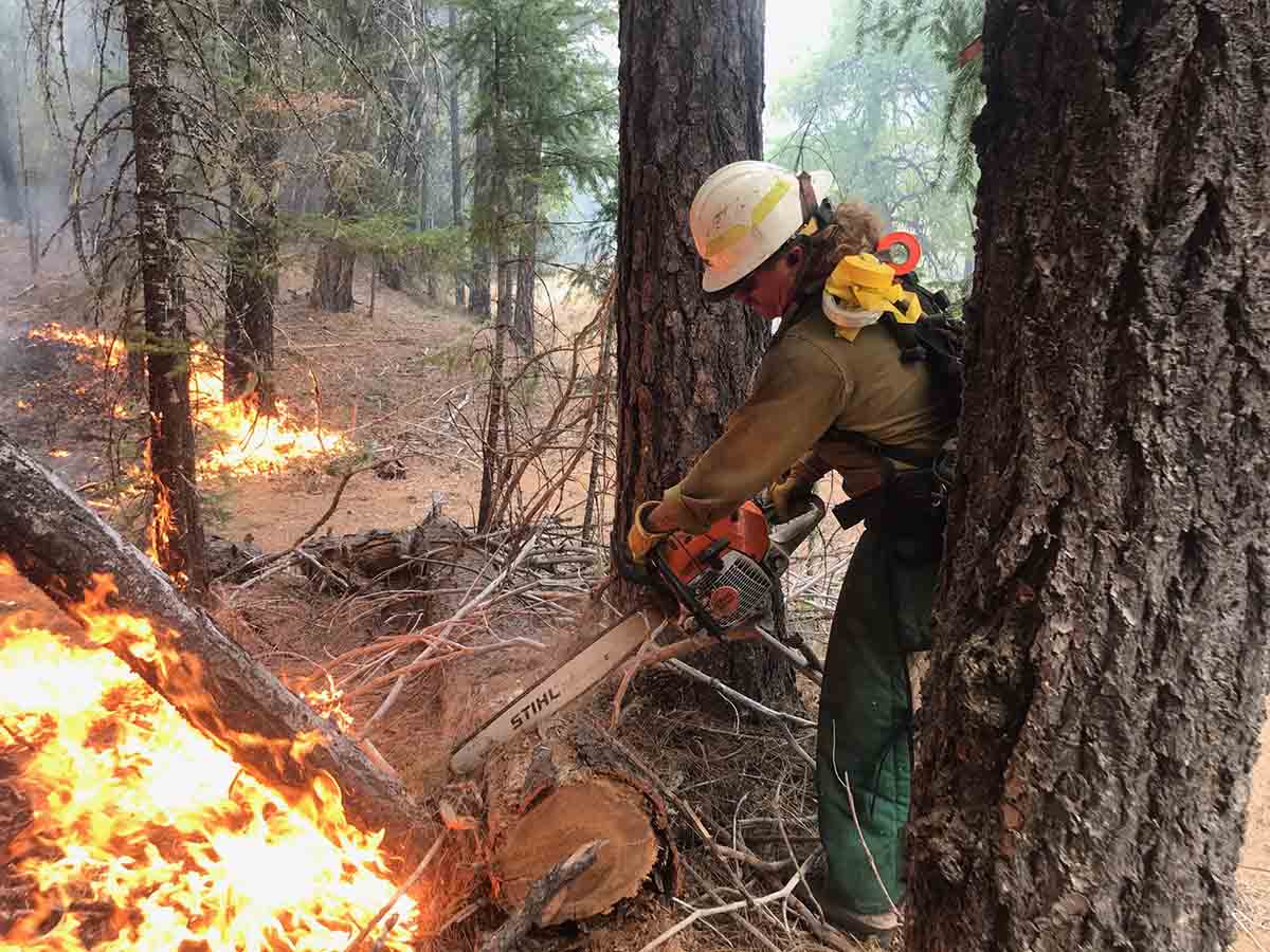
August Complex fire
A firefighter bucks a log near Van Duzen Road on the Northwest Zone of the August Complex. Credit: Jacob Welsh

Our take on the largest fires list

The next three fires on the “Top 20 Largest California Wildfires” are all complexes, comprised of multiple separate fires that were arbitrarily clumped together on paper and called a complex. If they are listed at all on a Top 20 list, they should at least have an asterisk indicating each complex is actually multiple fires. If they burn together they should be treated as one fire. Geographically separate fires should be listed independently.

Firefighters dealing with strong winds on the Mullen Fire

An interstate fire in Wyoming and Colorado, 25 air miles southwest of Laramie, WY

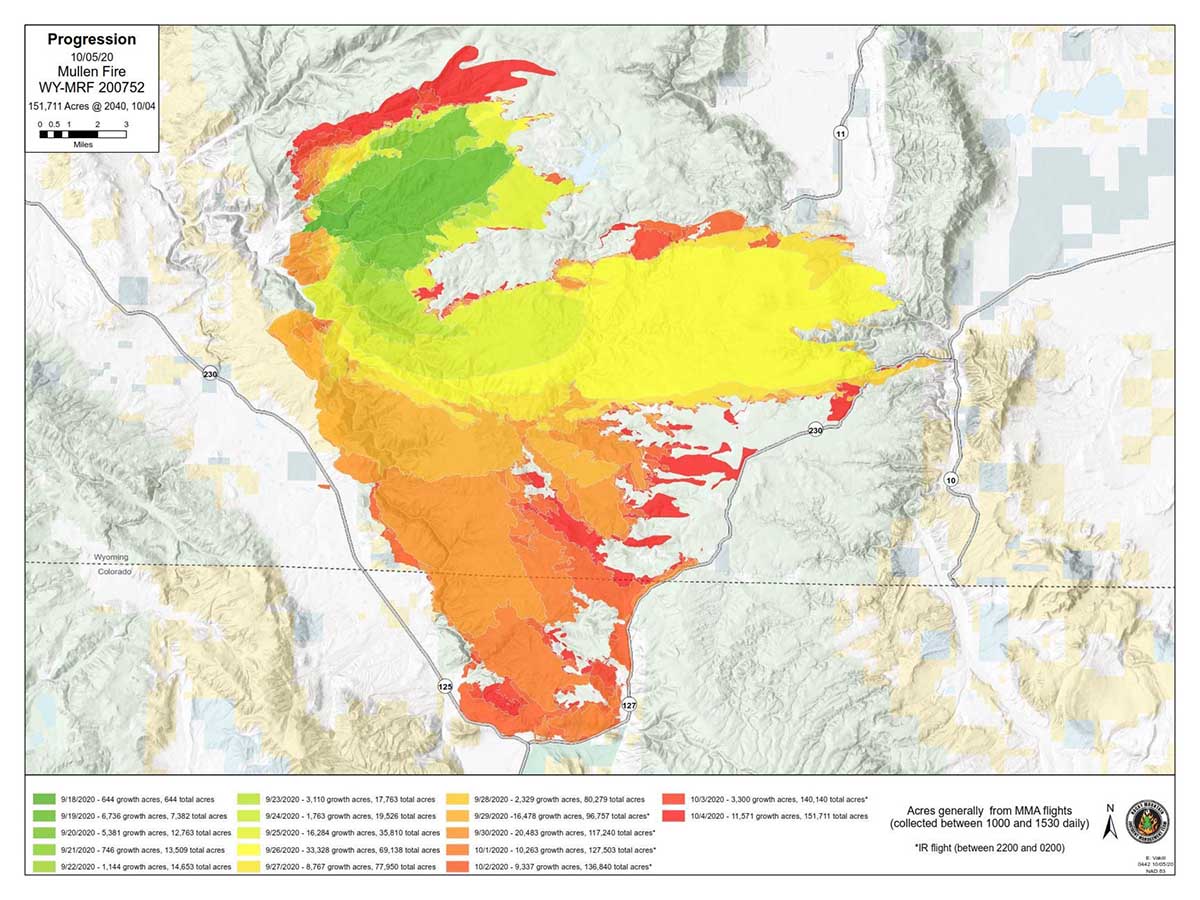
Progression of Mullen Fire, Oct. 5, 2020
Progression of Mullen Fire, Oct. 5, 2020. Situation Unit Leader, Sonya Feaster.

Monday afternoon update from the Incident Management Team for the 151,711-acre Mullen fire in Wyoming and Colorado, 25 air miles southwest of Laramie, WY:

“The fire is very active in the northern part south of Centennial between Albany and Keystone along the 542 road. Strong afternoon winds from the west are hampering firefighters efforts as they try to keep the fire south of the road. A predicted shift to bring winds more from the northwest could prove helpful in this effort.

“The fire will continue to produce smoke and possibly large visible smoke columns Monday afternoon.

“The Southern Area Type 1 Incident Management Team is shadowing the Rocky Mountain Blue Team this afternoon to ensure a smooth transition of leadership Tuesday morning at 6:00 a.m.”

Mullen Fire
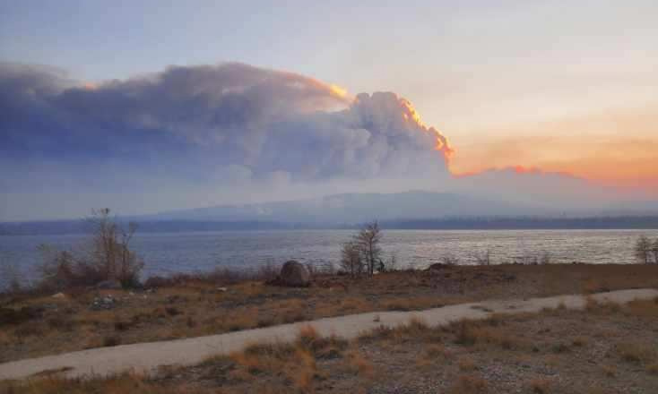
Mullen Fire. USFS photo.
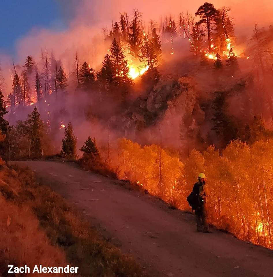
Mullen Fire, night firing
Mullen Fire, night firing, October 1, 2020, by Zach Alexander.

To see all articles on Wildfire Today about the Mullen Fire, including the most recent, click here.