Norbeck prescribed fire in the Black Hills

Norbeck prescribed fire
Briefing for the Norbeck Section 2 prescribed fire at 7 a.m., October 20, 2014. Photo by Bill Gabbert.

Monday morning we attended the 7 a.m. briefing for the Norbeck Section 2 prescribed fire in the Black Hills. It is a complex, Type 1, 1,938-acre project on State, Federal and private lands approximately 4 miles northeast of Pringle, South Dakota. The 120 personnel will be igniting vegetation in Wind Cave National Park, Custer State park, Black Hills National Forest, and private land. Some of the funding is provided by the Rocky Mountain Elk Foundation. To assist with ignition on the large project a Type 3 helicopter will be dropping plastic spheres that burst into flame about 30 seconds after they exit the dispenser on the helicopter.

When I looked at the large crowd assembled for the briefing and remarked to Todd Pechota, the Fire Management Officer for the Black Hills National Forest, that I didn’t expect to see so many people, he said, “We wanted to get this one right”.

Norbeck prescribed fire
Communications Unit Leader Bob Fischer briefs on radio usage for the Norbeck Section 2 prescribed fire. Photo by Bill Gabbert.

The four different land owners and the funding from a non-government organization are some of the reasons why planning for the project has been going on for at least five years. They brought in a Prescribed Fire Burn Boss, Ross Wilmore the Fire Management Officer on the White River National Forest in Colorado, to work with the trainee Burn Boss, Matt Spring.

And just to make things a little more complicated, the annual buffalo roundup in Wind Cave National Park is occurring now, with the animals being herded to corrals about a half mile east of the prescribed fire. Many people from the national park are tied up on that project.

The ignition of the burn is expected to take two days, Monday and Tuesday of this week. Dew and even frost in some areas may delay the start of the project Monday morning, but things should dry out by mid- to late morning.

Highway 87 through Custer State Park and Wind Cave National Park will be closed Monday through Wednesday. As the fire progresses through the ponderosa pine and grass meadows in the area, it will be putting up a large amount of smoke. The firefighters expect to work from north to south, primarily concentrating on the three northern-most units on Monday, and move to Unit 4 on the south end on Tuesday. (See the map below.)

We will return to the prescribed fire Monday afternoon to report on the progress and hopefully grab some more photos.

(UPDATE: photos taken as the project was underway are here.)

Norbeck prescribed fire
A heliwell and two dozers at the Norbeck Section 2 prescribed fire in the Black Hills of South Dakota. The heliwell is filled with water, so that a helicopter with a buck can dip out it. Photo by Bill Gabbert.
Map of the Norbeck prescribed fire
Map of the Norbeck Section 2 prescribed fire. I drew in NPS 5, the dirt road that intersects with Highway 87 at Drop Point 6. (click to enlarge)

The weather for the project looks pretty good. The spot weather forecast for Monday predicts southwest then south winds at 6 to 10 mph, 72 degrees, and relative humidity of 31 percent; Tuesday looks about the same. The smoke will be pushed toward the north and northeast.

Wildlife in the park at sunset

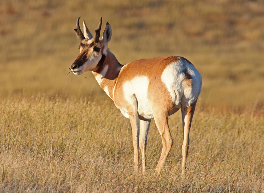
antelope in Wind Cave NP
A pronghorn antelope in Wind Cave NP just before sunset. Photo by Bill Gabbert.

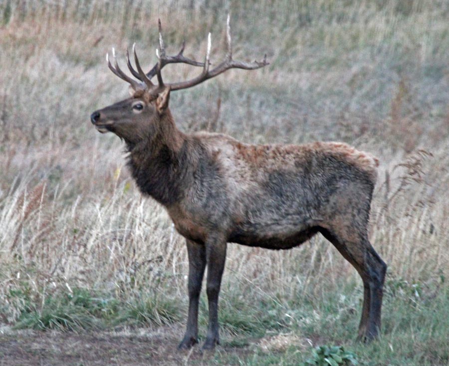
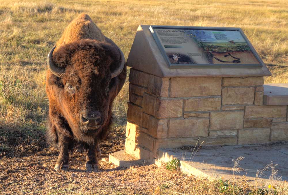
During a quick two-hour trip into Wind Cave National Park that started just before sunset yesterday I ran across these critters.

elk Custer State Park
This elk was seen after sunset just outside Wind Cave NP, in Custer State Park. Photo by Bill Gabbert
bison Wind Cave National Park
You can call me the Bison Whisperer for getting this bison to pose by an interpretive sign in Wind Cave NP. I would have preferred for him to pose next to the Welcome to Wind Cave NP sign, but I settled for the interpretive sign. Photo by Bill Gabbert.

Oregon: Founders Day Fire at Crater Lake National Park is not being suppressed

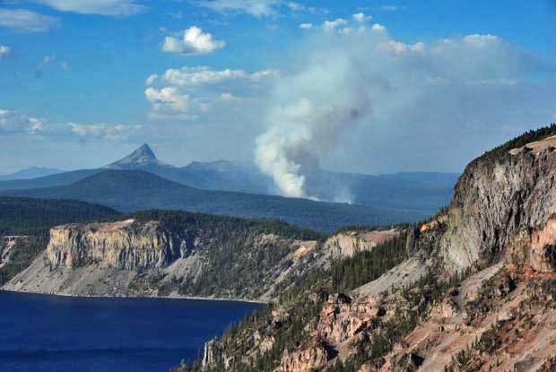
Founders Day Fire
Founders Day Fire at Crater Lake National Park. Crater Lake is in the foreground. Undated NPS photo by Greg Funderburk.

The National Park Service is not suppressing a 98-acre fire at Crater Lake National Park in Oregon. Instead, they are “managing it to achieve natural resource benefit objectives”. It is five miles north of the famous crater, a geologic feature formed by a volcano. The fire started August 25 and for a while it could not be detected by the MODIS satellite, but recently the activity has increased making possible the data in the image below. Today September 16, the fire is one mile outside of a Red Flag Warning area to the east.

3-D Map of the Founders Day Fire
3-D Map of the Founders Day Fire, looking south to Crater Lake. The dots represent heat detected by a satellite at 2:02 p.m. September 16, 2014. They are accurate to within a mile.

The lightning-caused fire was discovered on the 98th anniversary of the founding of the National Park Service. Hence, the name.

The Meadow Fire in Yosemite National Park was “managed” for several weeks, burning only 19 acres, until it took off. As of today it has spread to 4,772 acres and is being suppressed at a cost to date of $4.9 million. The incident management team is calling it 80 percent contained.

Crater Lake
Crater Lake, looking northeast on July 30, 2014. Photo by Bill Gabbert.

Recruiting volunteer firefighters — in Colorado and Australia

A fire near Craig, Colorado
A fire near Craig, Colorado in 2000. Photo by Bill Gabbert.

Relying on unpaid volunteers to fight wildfires and structure fires is the only feasible way to provide fire protection services in some rural areas. Many of these departments are finding that as residents, especially the younger generation, move into cities, the departments are faced with declining numbers of firefighters.

Below are excerpts from two articles on the issue, from Colorado and South Australia.

From KUNC, Community Radio for Colorado:

Volunteer firefighters protect about half of Colorado’s residents, with solely volunteer departments being responsible for about 70 percent of the state’s land surface.
And they are significantly understaffed.

The Colorado State Fire Chiefs Association estimates that Colorado is short 3,500 volunteers in meeting National Fire Protection Agency standards. That would require an increase of more than 40 percent to the present force.

“Generally, all fire departments that have volunteers need more volunteers,” said Garry Briese, executive director of the fire chiefs association.

“It’s a struggle at times and you just do the best you can do, the best for the community.”

There are 198 all-volunteer departments in Colorado serving more than 450,000 residents, and an additional 137 agencies that are a combination of career and volunteer firefighters. These “hybrid” stations serve 2.2 million residents, and 33 of them have only one or two paid firefighters…

From South Australia’s Messenger:

The Country Fire Service is recording an increase in volunteers for the first time in years on the back of last year’s horror fire season.

Total CFS volunteer numbers have increased from 13,325 to 13,737 over the past six months. The 3 per cent increase bucks a steady downward trend in numbers from the 15,590 volunteers there were in 2004/05. Damaging fires in January and February this year at Eden Valley in the northern Mount Lofty Ranges and at Bangor in the Southern Flinders Ranges appear to have sparked people into action.

Volunteer numbers in CFS Region 4, where the Bangor fire was, are up 6.5 per cent from 1776 to 1891. Similarly, numbers in CFS Region 2, where the Eden Valley fire was, are up 5.8 per cent from 2630 to 2784.

South Australian Fire and Emergency Services Commission Volunteer Services Branch manager Toni Richardson said it was a great sign. “It’s the first time we can actually remember it increasing over an extended period, which is really good,” she said…