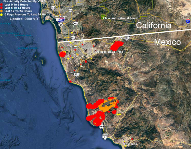
One of the fires is west of Tijuana, another is northwest of Ensenada, and the third is south of Tecate.
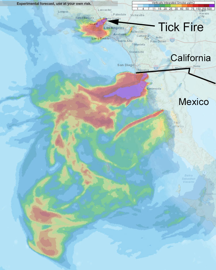
Smoke from the Tick Fire at Santa Clarita is expected to affect Oxnard and western Los Angeles.
News and opinion about wildland fire
The fires are south and southeast of San Diego, California

One of the fires is west of Tijuana, another is northwest of Ensenada, and the third is south of Tecate.
Smoke from the Tick Fire at Santa Clarita is expected to affect Oxnard and western Los Angeles.

Possibly the strongest wind event of the fall season will occur in northern California Saturday morning into Monday

UPDATED at 6:09 p.m. PDT October 25, 2019
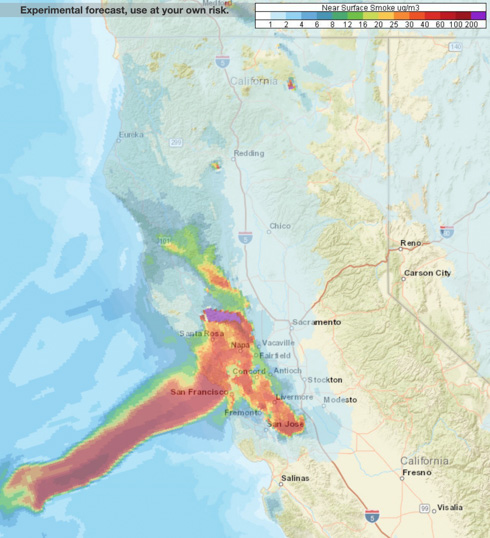
The map above is the forecast for the distribution of near surface smoke at 4 a.m. PDT October 26, in the San Francisco area and south as far as Santa Barbara.
7:56 a.m. PDT October 25, 2019
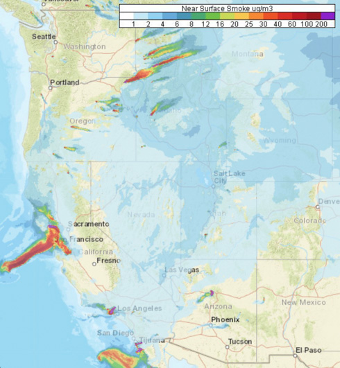
Forecasters predict that smoke from the Kincade and Tick Fires will heavily affect some locations in northern and southern California Friday. Especially affected will be the San Francisco Bay Area, from San Jose north to Santa Rosa, including the city of San Francisco.
Smoke from prescribed burning will be noticed by residents in Oregon, Idaho, and Montana.
Red Flag Warnings will continue in Southern California until Friday night.
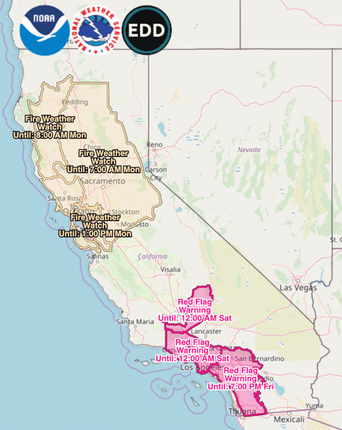
Very strong, dry winds are in the forecast for northern California beginning Saturday morning. This wind event which will continue into Monday is being described as “likely the strongest wind storm of the fall season” with northeast to east winds of 30 to 40 mph gusting at 45 to 70. The Watch areas in the map above will probably be upgraded to Red Flag Warnings by late Friday or Saturday morning.
(Red Flag Warnings can be modified throughout the day as NWS offices around the country update and revise their weather forecasts.)
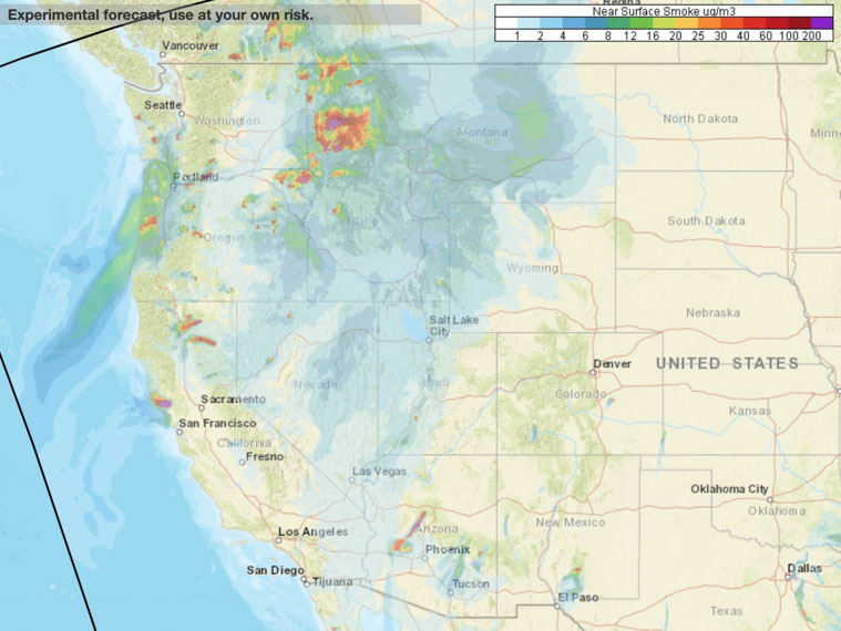
Thursday morning there were very few wildfires producing large quantities of smoke, however the Kincade Fire 63 miles north of San Francisco has the potential to become an air quality problem for residents in northern California especially on Friday.
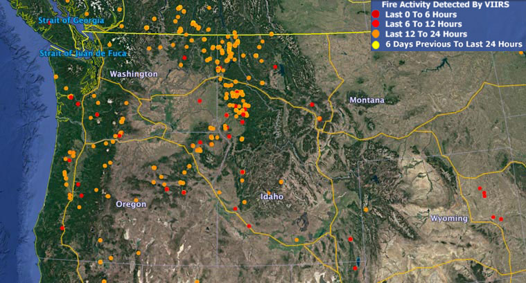
There is a surprising amount of smoke in the Northwest, especially in Idaho, Oregon, and western Montana presumably created by extensive prescribed burning.
Heads Up, Bay Area! Although the #KincadeFire isn’t causing smoke issues over the Bay Area today, shifting winds tomorrow will likely cause the smoke to be directly over much of the region. Impacts to SFO may begin as early as 11am Friday. pic.twitter.com/3tlCIXIC5r
— NWS CWSU Oakland (@NWSCWSUZOA) October 24, 2019
Smoke from the Decker Fire west of Colorado Springs will affect areas southwest of Denver
Above: Smoke forecast for 8 p.m MDT October 3, 2019, near surface and vertically integrated.
These maps were generated by NOAA at 6 a.m. MDT October 3, predicting the distribution of smoke. The forecast below indicates that near surface smoke from the Decker Fire south of Salida will be affecting the Denver area as well as locations southwest and north of Denver on Thursday.

Red Flag Warnings for areas in California, Nevada, Oregon, and Wyoming
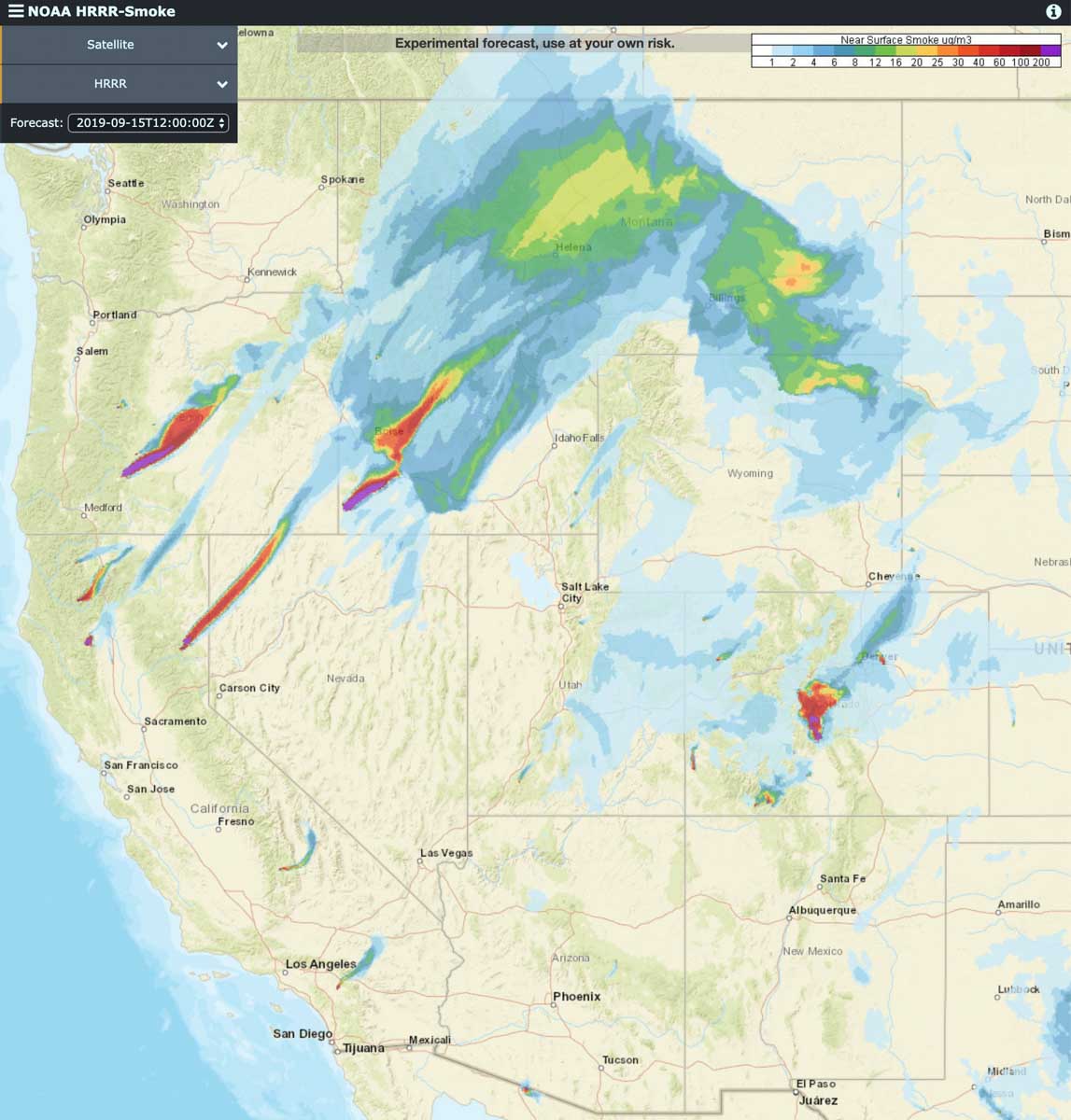
Smoke from wildfires are producing smoke that forecasters expect to affect large portions of Idaho, Montana, and Colorado on Sunday. The map above is the forecast for 6 p.m. MDT.
The largest producers of smoke today are:
Red Flag Warnings are in effect Sunday for areas of California, Nevada, Oregon, and Wyoming.
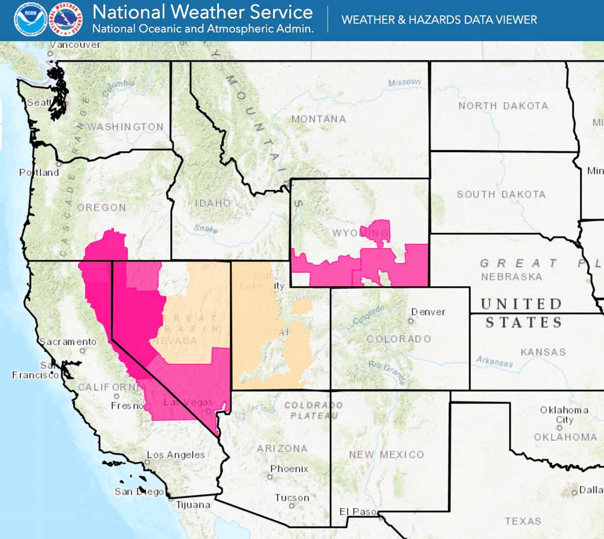
(Red Flag Warnings can be modified throughout the day as NWS offices around the country update and revise their weather forecasts.)
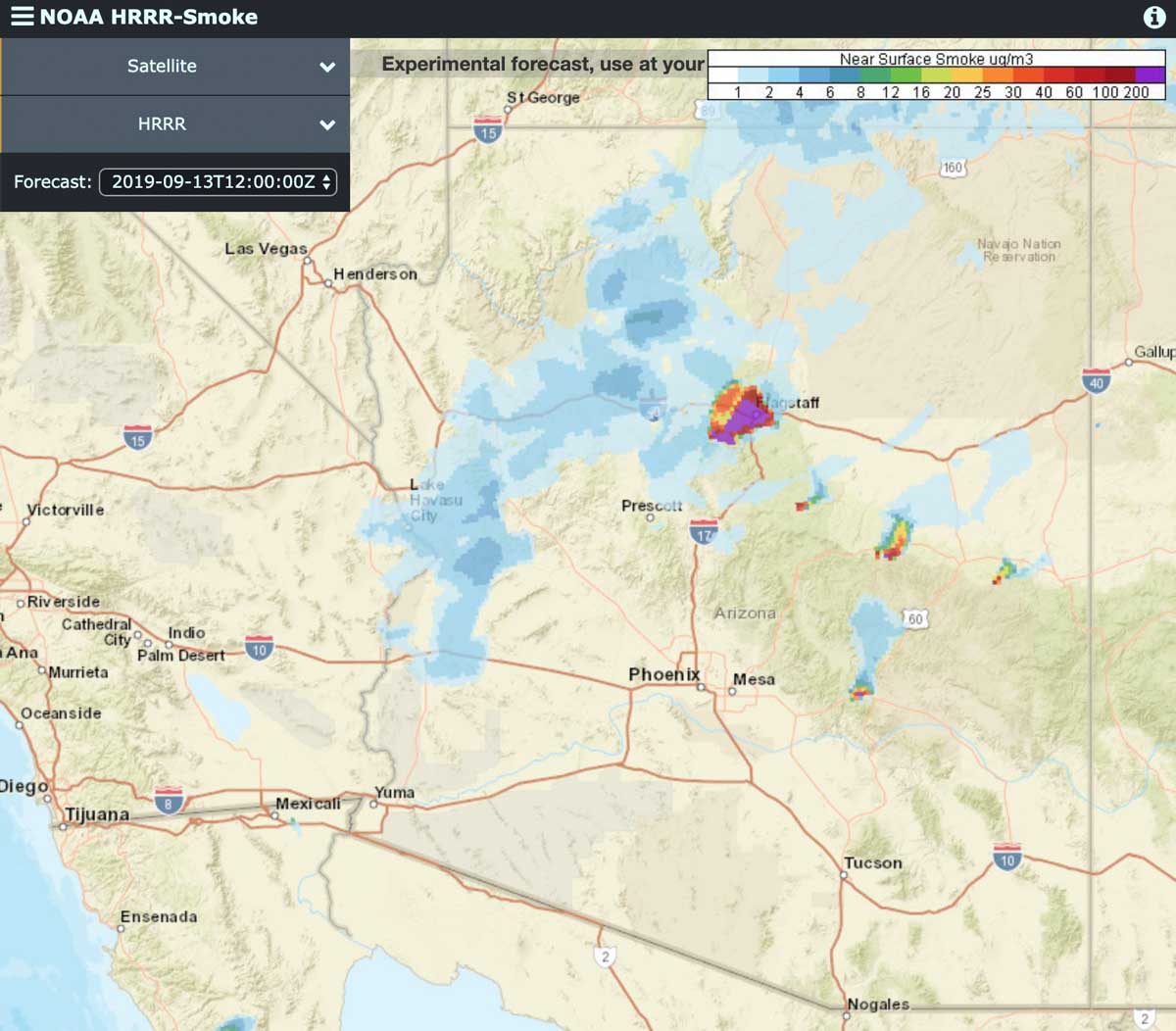
(9:52 a.m. MDT September 13, 2019)
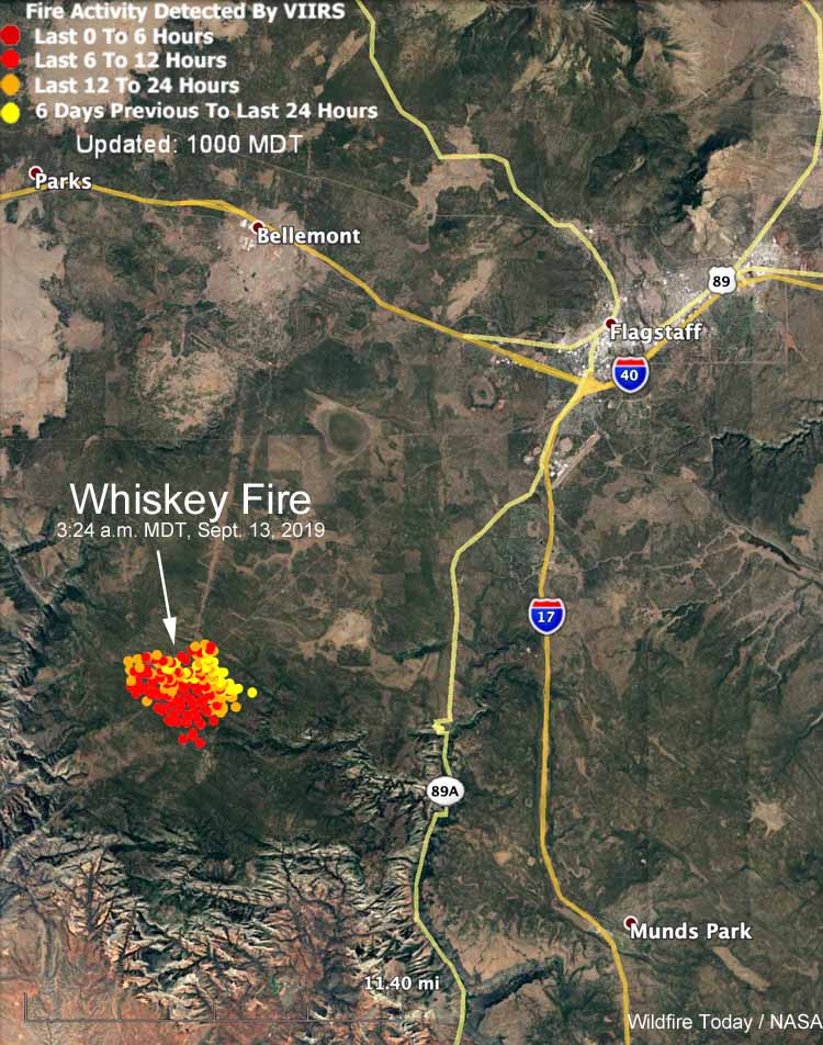
Forecasts predict that smoke from the Whiskey Fire 10 miles southwest of the Flagstaff Airport will move into the city Friday afternoon. (see maps)
Thursday and Thursday night the wind from the east and northeast moved smoke from the fire off to the southwest but that direction is predicted to change shortly after noon Friday to come from the south and southwest, pushing the smoke into the Flagstaff area. If the fire activity continues on Saturday the smoke is expected to continue to impact the city.
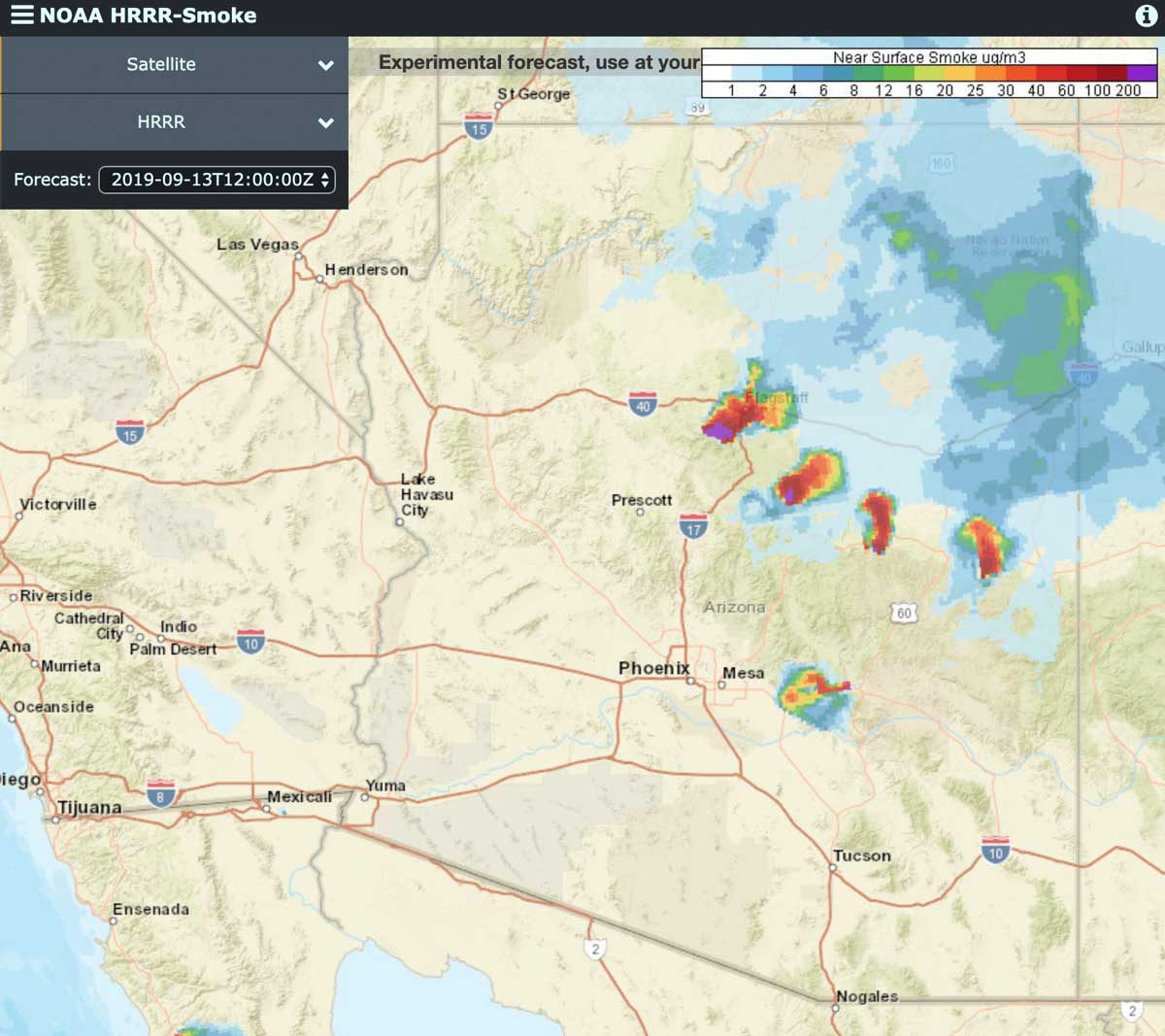
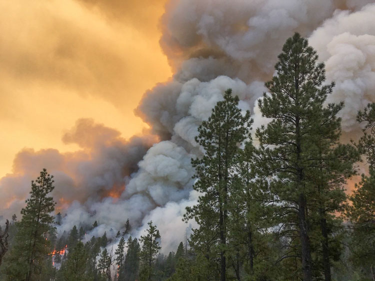
The Whiskey Fire started September 2 on the Coconino National Forest and is being managed rather than completely suppressed. Thursday firefighters began conducting firing operations along Forest Road 231 to ensure the wildfire stays in its containment area. Today, Friday, the plan is to moderate but continue the firing operations through the weekend, according to information released by the Forest Service.
The agency said smoke may affect Flagstaff, Munds Park, Mountainaire, Kachina Village, Forest Highlands, Doney Park, Mormon Lake Village, Highway 89A Corridor, Sedona, Village of Oak Creek, and portions of Interstate 40.
The fire has burned 3,500 acres.
