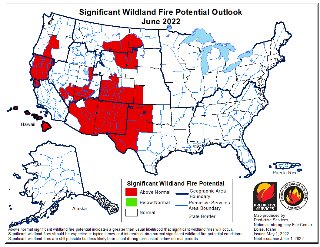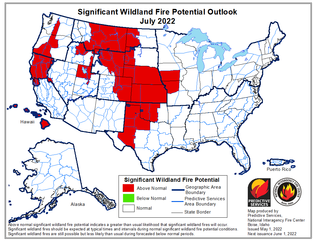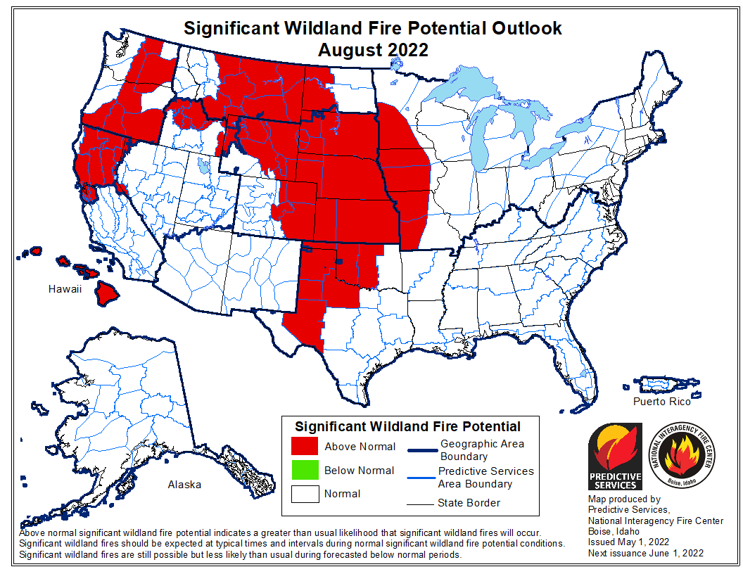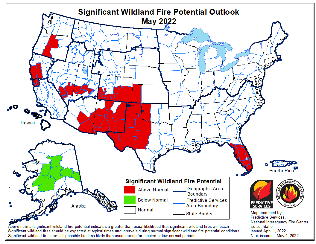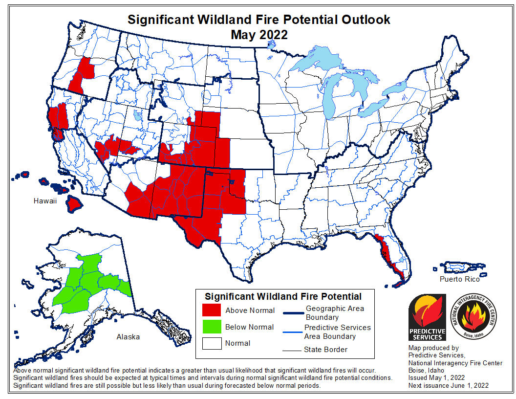
The forecast for wildland fire potential issued May 1 by the National Interagency Fire Center predicts that in July and August the wildland fire potential will be above normal in the Great Plains, Rocky Mountains, and the Northwest. Until then, in May and June it will be above average in the Southwest, Northern California, Central Oregon, and the Central and Southern Plains. Hawaii will be above normal for the entire May through August period, and Alaska will be in the normal range except in May when the central part of the state will be below normal. Most of the eastern half of the country is expected to be in the normal range through August.
The fire potential text and maps from NIFC shown here represents the cumulative forecasts of the ten Geographic Area Predictive Services Units and the National Predictive Services Unit. Additional graphics are included from other sources.
Below:
- Excerpts from the NIFC narrative report for the next four months;
- Additional NIFC monthly graphical outlooks;
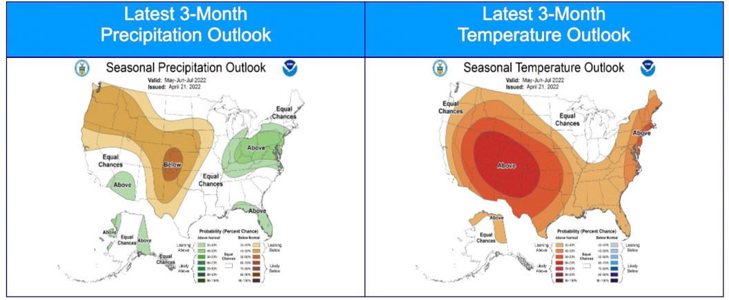
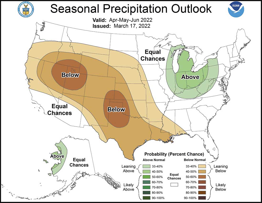
- NOAA’s three-month temperature and precipitation forecasts;
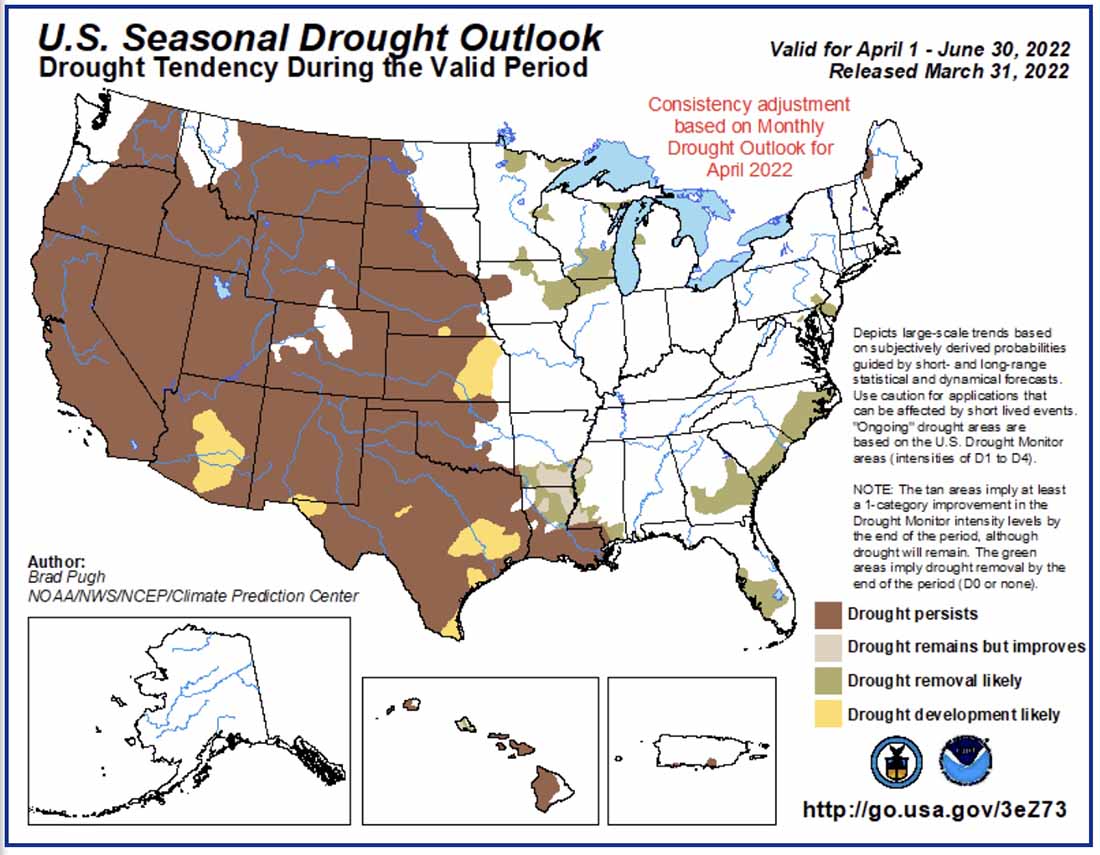
- Drought Monitor;
- Keetch-Byram Drought Index;
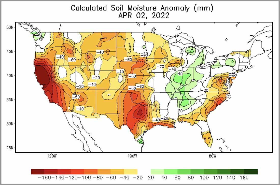
- Soil moisture.
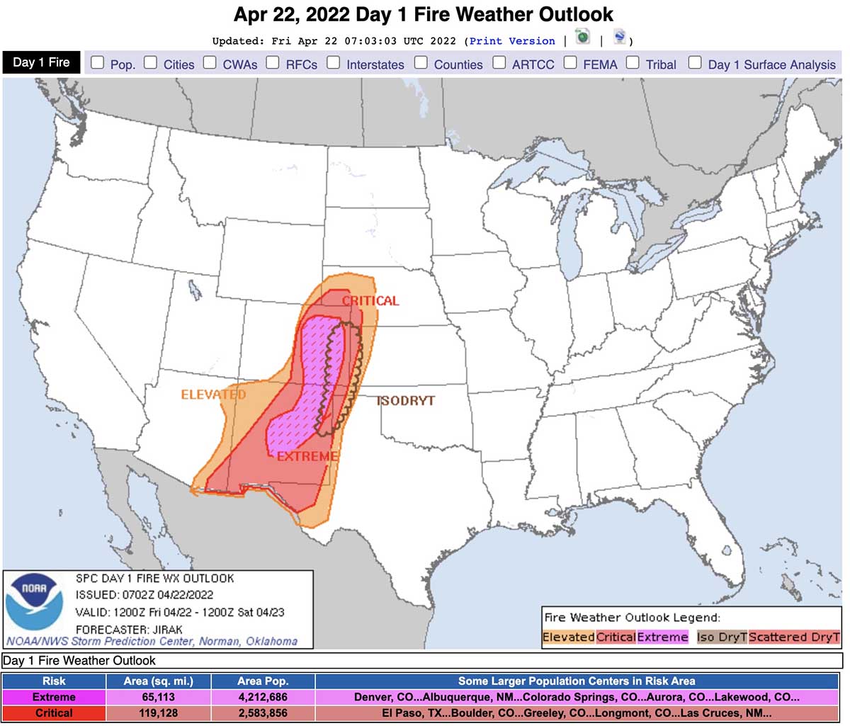
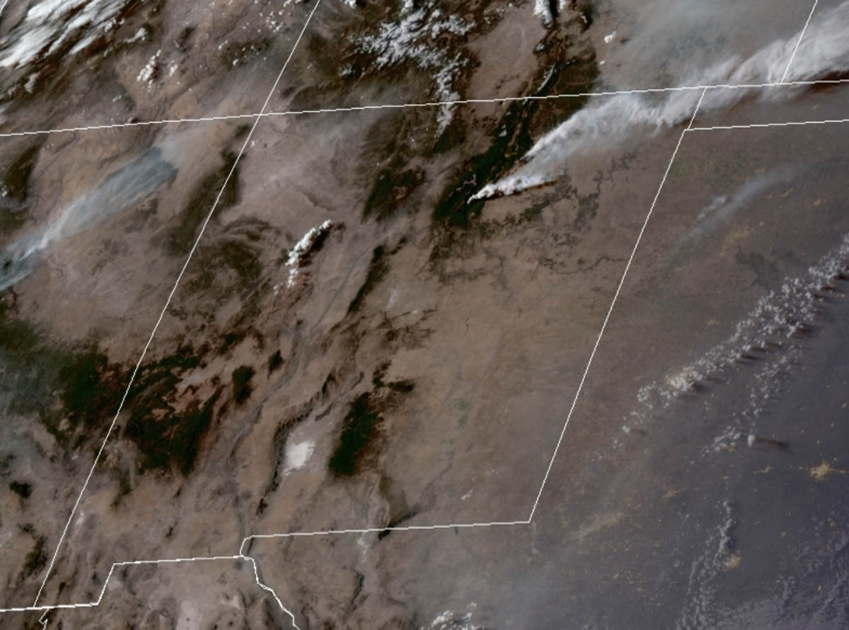
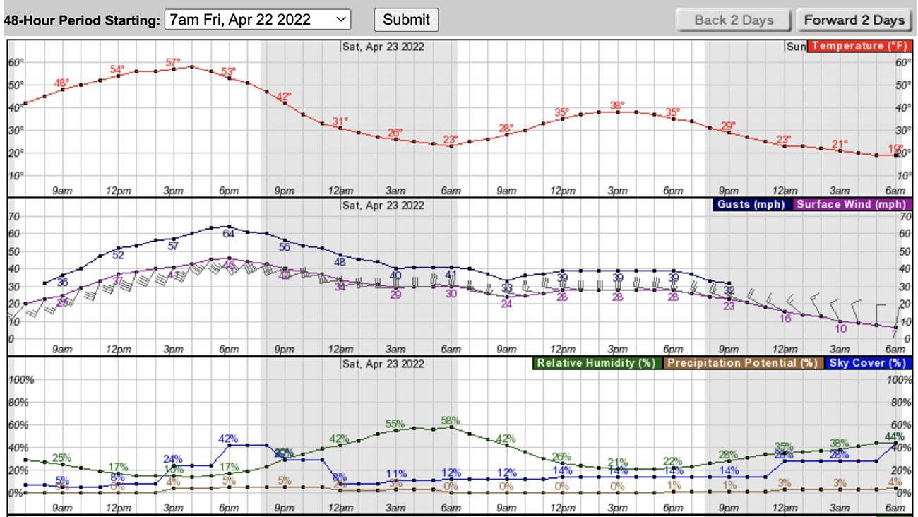
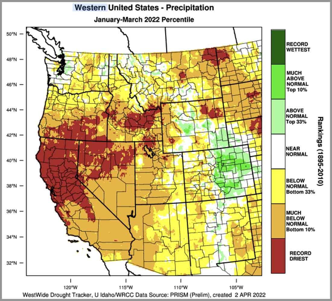
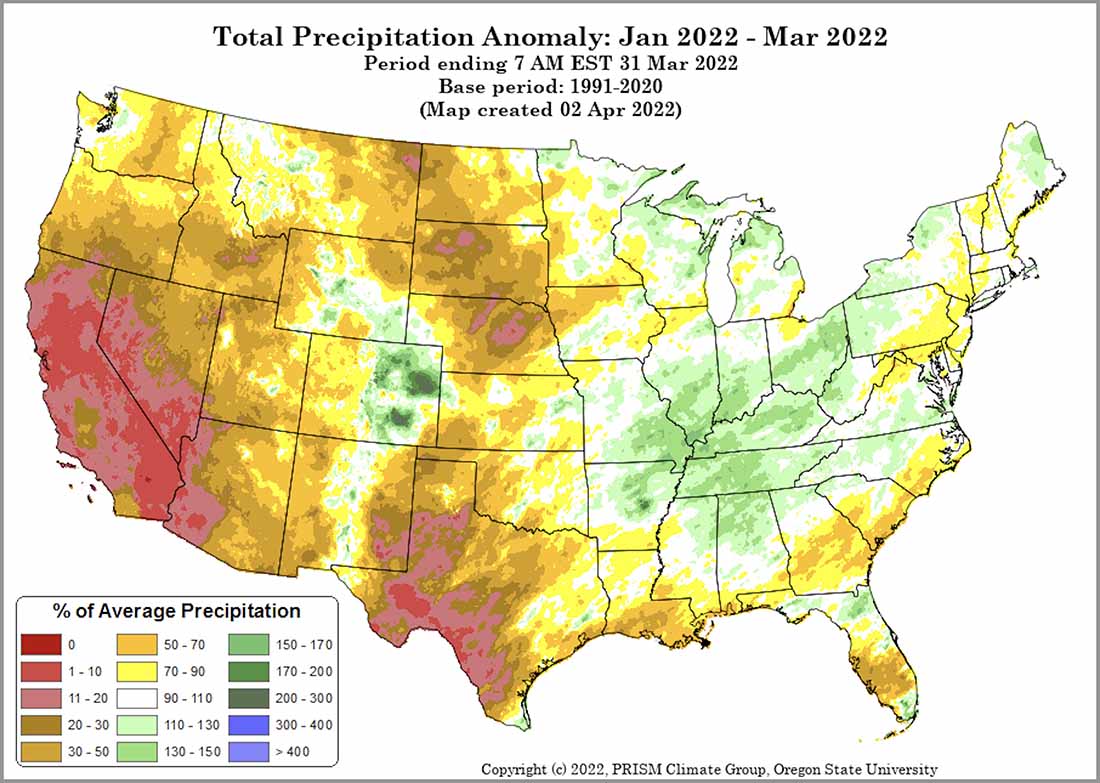
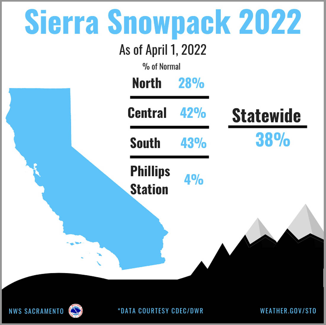
“Most of the West, Plains, and Texas remain in drought, with areas of drought also along the Gulf Coast and South Florida. Temperatures were above normal across the Southwest into Texas with below normal temperatures across much of the northern US. Below normal precipitation continued in the Southwest into the central and southern Plains. Snowpack continued to rapidly melt in the Southwest, with the below normal snowpack in the Northwest and Rockies melting off at a slow rate.
“Climate outlooks indicate below normal precipitation is likely across much of the Plains west through the central Rockies to the Northwest, with above normal temperatures likely across much of the contiguous US (CONUS) through spring into summer. Critically windy and dry periods are likely to continue through June for the Southwest and central and southern High Plains with an active severe weather pattern to the east over the eastern Plains and Ohio Valley. The North American Monsoon is likely to arrive on time and be robust this summer, but potential early moisture surges during June could result in periods of lightning across the Southwest, Colorado, and the southern Great Basin.
“Above normal significant fire potential is forecast across the western Florida peninsula in May. The southern High Plains will retain above normal significant fire potential through August, with much of the Plains forecast to have above normal potential by July and spread into the western Mid-Mississippi Valley in August after green-up and subsequent curing occurs due to anticipated warmer and drier than normal conditions.
“Most of the Southwest is forecast to have above normal significant fire potential in May and June, with potential increasing across southern and western Colorado and southern portions of the Great Basin before returning to normal in July. Above normal potential will likely expand from central Oregon to southwest Oregon and central Washington by July and much of the Northwest in August. Above normal significant fire potential is also forecast to increase across northern California from May into July, with rising potential likely along portions of the Sierra Front. Alaska is forecast to have below normal potential across the Interior in May, returning to normal in June. Leeward locations of Hawaii are forecast to have above normal potential during June and July.”