Suspected arsonist captured and tied to tree by locals

Updated at 12:06 p.m. PDT July 27, 2022

mapJ uly 25 arson fires in Southwest Oregon
General area of the July 25 arson fires in Southwest Oregon.

On Monday a Bureau of Land Management employee reported that a man was walking down a road igniting vegetation fires in a remote area about 25 miles northwest of Grants Pass, Oregon.

From the AP:

Ground crews, assisted by local residents, and three helicopters quickly got the two fires under control, Curry County Sheriff John Ward said.

Meanwhile, three local residents located the suspect walking on the road near the fires and detained him.

“It was reported that the suspect became very combative with the three residents and had to be tied to a tree to subdue him.,” Ward said in a statement. “An ambulance crew was asked to respond due to some injuries that the suspect apparently received from falling down.”

Smith was transported to Three Rivers Hospital in Grants Pass and once he was medically cleared, transported by US Forest Service law enforcement to the Curry County Jail and held on Reckless Burning and two counts of First-Degree Arson. There was also a Detention Warrant in effect out of Lane County for probation violation.
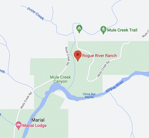
Trennon Ray Smith mug shot
Trennon Ray Smith. Lane County Sheriff’s Office.

Forest Service withdraws decision about 50,566-acre fuel treatment project in New Mexico

Planned on the Santa Fe National Forest

The U.S. Forest Service announced Tuesday that they are withdrawing the draft Decision Notice and Finding of No Significant Impact issued in March for the 50,566-acre Santa Fe Mountains Landscape Resiliency Project. It would involve prescribed fire and vegetation thinning treatments on 36,680 acres east of Santa Fe, New Mexico on a landscape scale. Each year at least 750 acres would have been thinned and up to 4,000 acres would have been treated with prescribed fire during a 15- to 20-year time frame.

Map Santa Fe Mountains Landscape Resiliency Project
Map of the Santa Fe Mountains Landscape Resiliency Project.

On July 12 the Board of County Commissioners of Santa Fe County passed a resolution urging the FS to conduct a full Environmental Impact Statement (EIS) for a planned very large fuel management project. The FS went through the much less complicated Environmental Assessment (EA) process, which included the draft EA, public outreach, and accepting comments, then issued a Finding of No Significant Impact (FONSI) which they felt enabled the implementation of the project.

The statement issued by the Santa Fe National Forest dated July 26, 2022 said, “The SFNF is taking this step to reengage with our partners and community on this very important project to improve forest health in and around Santa Fe…Our intent is to reinitiate the decision and NEPA process for this project after the Chiefs 90-day pause with the publication of a legal notice in the Albuquerque Journal, the newspaper of record. If you previously submitted an objection to the final environmental assessment and draft notice of decision, you will need to resubmit your objection at that time.”

After three prescribed burning projects on the Santa Fe National Forest got out of control since 2018 and had to be converted to wildfires, some of the locals are worried about future projects on the forest.

The current 341,735-acre Calf Canyon / Hermits Peak Fire is the result of two prescribed fires that escaped control earlier this year on the Santa Fe National Forest. One was a broadcast burn that crossed control lines during strong winds. The other originated from slash piles that were ignited in late January that continued burning for months. In mid-April one or more of those piles became very active during strong winds and merged with the other escaped fire on April 22. The fire has destroyed at least 400 homes, forced up to 18,000 people to evacuate their properties, resulted in flooding, and cost more than $248 million in firefighting expenses.

In 2018 another pile burning project on the Santa Fe escaped months after it was ignited and had to be converted to a wildfire. A Facilitated Learning Analysis found that “communication” and “prescribed fire preparation and risk” were common themes.

The notice from the FS is below.

[pdf-embedder url=”https://wildfiretoday.com/wp-content/uploads/2022/07/USFS_withdraws_Decision_Notice.pdf” title=”USFS withdraws Decision Notice Santa Fe National Forest”]


The USFS documents regarding the project can be found here.

Moose Fire grows to 37,264 acres

Northwest of Salmon, Idaho

Moose Fire map 10:18 p.m. MDT July 25, 2022
Moose Fire map. The red line was the perimeter at 10:18 p.m. MDT July 25, 2022. The white line was the perimeter about 48 hours before. The brown areas had extreme heat when the fire was mapped.

Most of the growth on the Salmon Fire 10 miles northwest of Salmon, Idaho has been south of the Salmon River in recent days. It was mapped Monday night at 37,264 acres, a 24-hour growth of more than 1,500 acres.

On the east side, fire activity was high in Bobcat Gulch and the Napoleon Hill area in the late afternoon Monday and through the night. Spot fires occurred one mile south of Napoleon Hill as the fire was pushed by winds out of the north. The south side of the fire generally is holding in place with no new growth in the Moose Creek area. The fire is still spreading on the west side south of the river.

On the south side where the strategy is to “confine”, not “contain”, heavy equipment task forces are constructing and reinforcing indirect fire line six to nine miles south of the fire from Morning Glory west to Leesburg, and further west into Panther Creek, then to the Salmon River.

One of these indirect firelines being constructed is five miles south of the southeast corner of the fire, south of Moose Creek Road.

The photos below were taken July 23 by Mike McMillan for the US Forest Service.

Moose Fire Salmon Idaho
Firefighters on the Moose Fire prepare to defend structures along Hwy 93 corridor, July 23, 2022. Photo by Mike McMillan-USFS
Moose Fire Salmon Idaho
Firefighters on the Moose Fire, July 23, 2022. Photo by Mike McMillan-USFS
Moose Fire Salmon Idaho
Moose Fire backs down a slope, July 23, 2022. Photo by Mike McMillan-USFS


Oak Fire slows, but still spreads into footprint of 2018 Ferguson Fire

CAL FIRE is using one of their new Firehawk helicopters to drop water at night

 7:05 a.m. PDT July 26, 2022

Oak Fire map 7:27 p.m. July 25, 2022
Oak Fire map. The red line was the perimeter at 7:27 p.m. July 25, 2022. The white line was the perimeter about 23 hours before.

Fire officials called Monday a successful day on the Oak Fire northwest of Mariposa, California, saying there was minimal growth. The 1,200 acres added paled in comparison to the rapid spread seen on Friday and Saturday. It was mapped Monday night at 18,017 acres, with most of the increase being on the east side where it is chewing through the four-year old vegetation in the footprint of the 2018 Ferguson Fire. East of Jerseydale it has advanced nearly two miles into the fire scar.

To see all articles on Wildfire Today about the Oak Fire, including the most recent, click HERE.

Helicopters dropped 300,000 gallons of water Monday, including thousands of gallons dropped by one of CAL FIRE’s new night-flying helicopters, H-903, normally based at McClellan near Sacramento. According to tracking data recorded by FlightAware it conducted what appeared to be two fuel cycles working out of the Columbia airport 42 miles northwest of the Oak Fire. Until CAL FIRE recently purchased their 12 new Sikorsky S-70i Firehawk helicopters they were not in the night-flying business. This was one of the first fires CAL FIRE has flown at night.

CAL FIRE H-903, Sikorsky S-70i FireHawk
CAL FIRE H-903, Sikorsky S-70i FireHawk, N483DF, Photo by Dylan Phelps, Sept. 2020.

The damage assessment team has been working for the last two days to identify structures affected by the fire. Monday afternoon their findings to date were released — 21 residences and 34 outbuildings have been destroyed.

Resources on the incident Monday night included 24 helicopters, 302 fire engines, 82 dozers, 68 water tenders, and 61 hand crews for a total of 2,991 personnel.

Grass fire burns into Dallas suburb, destroys 9 homes

Another 17 were damaged

11:53 p.m. CDT July 25, 2022

Balch Springs Fire
Grass fire spreads into neighborhood in Balch Springs, Texas, July 25, 2022. Image from video by FOX 4 Dallas-Fort Worth.

A grass fire burned into a suburb of Dallas, Texas Monday afternoon destroying 9 homes and damaging another 17, according to city officials. It occurred in Balch Springs when a mower struck an object in a field, creating a spark which ignited dry grass near Interstate 20 and South Beltline Road.

A steady breeze pushed the fire into a row of houses adjacent to the field. One by one the fire ignited house after house, aided by a fence that ran behind and between all of the homes which contributed to the fuel load and the continuous spread.

Balch Springs Fire
Grass fire spreads into neighborhood in Balch Springs, Texas, July 25, 2022. Image from video by FOX 4 Dallas-Fort Worth.

In the 30-minute video below very few firefighters are seen for the first 20 minutes. Balch Springs, with an estimated population of about 25,000 in 2019 has about eight firefighters working on any given day, Fox 4 news reported. The fire was well established when the video began, with at least one home already burning.

Looking at the video from a firefighter’s perspective, it is interesting to see how the fire progresses as the fence and outbuildings burn intensely, structures ignite, police gather in the street, a dog in a backyard looks worried (at 17:48), and little is seen in the video to initially stop the spread through the field or the neighborhood. However we don’t see the street side of the homes except at the very beginning; there may have been more firefighter activity on that side. There was a tower/ladder truck in the street that looked like it kept about four houses from being destroyed.

Our hearts go out to the residents who lost their homes.

Interim report released about helicopter crash at Idaho’s Moose Fire

N388RZ Boeing CH-47D at Penticton Airport
N388RA Boeing CH-47D preparing to take off at Penticton Airport in British Columbia July 16, 2022. Image from VMC Aviation Videos.

The US Forest Service has released a brief initial report about the July 21 crash of the Boeing CH-47D helicopter in the Salmon River while working on the Moose Fire 20 air miles northwest of Salmon, Idaho. The two pilots were killed.

Below is the complete text of the narrative section of the document which was dated July 22, 2022, but was not posted on the Wildland Fire Lessons Learned site until today around noon.

On Thursday, July 20, a call when needed CH-47D Series Chinook Helicopter crashed into the Salmon River, adjacent to the Indianola Work Center approximately 11 miles west of North Fork, Idaho on the Moose Fire. The aircraft sustained severe damage, the pilots were extracted and transported to hospitals but both sustained fatal injuries. The NTSB has been notified and will be conducting an accident investigation. The USDA Forest Service has assigned a learning review team.

The pilots, the only personnel on board, were Thomas Hayes, 41, of Post Falls, Idaho, and Jared Bird, 36, of Anchorage, Alaska.

The helicopter was operated by Anchorage-based ROTAK Helicopter Services.

The FAA confirms that the registration number of the helicopter is N388RA, which is one of two CH-47D ships ROTAK recently purchased from Columbia Helicopters.

area where the CH-47D crashed July 21, 2022
The general area where the CH-47D crashed July 21, 2022. Google Earth. The red shading represents an area burned in the Moose Fire.

There are unconfirmed reports that a hotshot crew was nearby when it crashed and they went into the Salmon River and extricated the pilots in an attempt to save them.

The last time Flight Aware tracked N388FA was at 3:02 p.m. MDT July 21. Because of the rugged terrain, it first showed it north of the Salmon Airport. Then it went northwest generally toward the Moose Fire and lost tracking at 3:12 p.m., minutes before it reached the river.

As an example of the terrain here is a photo of the Comet Fire I took a few years ago from Highway 93 just east of the current Moose Fire, 13 air miles north of Salmon, ID. The Salmon River is in the foreground.

Comet Fire, July 28, 2016
Comet Fire, July 28, 2016. Photo by Bill Gabbert.

The video below was shot at Penticton Airport in British Columbia July 16, 2022 when it stopped for fuel en route from Alaska to Idaho.

The GoFundMe fundraisers for the two pilots can be found through the following links:
https://www.gofundme.com/f/support-jared-birds-family-moose-fire-crash

https://www.gofundme.com/f/thomas-tommy-hayes-moose-fire-crash