Senator wants to require more steps before beginning a prescribed fire

Senator John Thune has been critical of federal firefighters previously.

A U.S. Senator has proposed an amendment to introduced legislation that would require additional procedures before federal agencies could conduct a prescribed fire. Senator John Thune from South Dakota wants to require consultation with local and state fire officials before the project begins. One of his reasons is that he contends local and state officials know more than the federal professional prescribed fire managers.

“Local officials are going to know a little bit more about what the conditions are in the area”, Senator Thune said in a newsletter distributed by his office on September 15.

This requirement has been offered as an amendment to a Republican backed bill introduced by Senator Pat Roberts of Kansas June 22, 2016, titled S.3085 – Emergency Wildfire and Forest Management Act of 2016. Senator Thune contends that the amendment was adopted by unanimous consent during a Senate Agriculture Committee markup, but no official action after the introduction is showing up at bill-tracking websites. After three months the bill has no cosponsors, and GovTrack.us predicts a 2 percent chance of it being enacted.

The primary purpose of the bill is to eliminate some environment restrictions for planned “forest management activities”. The list of these activities is long and vague enough to cover a very wide range of land treatments, including timber harvesting.

Senator Thune advocated his consultation procedure before when he introduced a stand-alone bill in 2015. It had one cosponsor and never advanced beyond being introduced. Apparently the powerful Senator did not work hard to promote his idea, or perhaps he only wanted some publicity. 

Senator Thune has generated publicity before in matters regarding prescribed fire. In 2015 he distributed to the media a strongly-worded very critical letter he sent to the Secretary of the Interior after the Cold Brook prescribed fire in Wind Cave National Park in South Dakota escaped, burning an additional 5,420 acres of prairie. It never spread beyond the park boundaries.

Four days after the escape and months before the official report came out, the Senator was apparently very satisfied that he knew exactly the cause, writing to the Secretary, “The Cold Brook Fire could easily have been prevented”, and “the intense smoke will likely damage the lungs of young calves in the vicinity resulting in high risk of pneumonia and death loss.”

Ready. Fire. Aim.
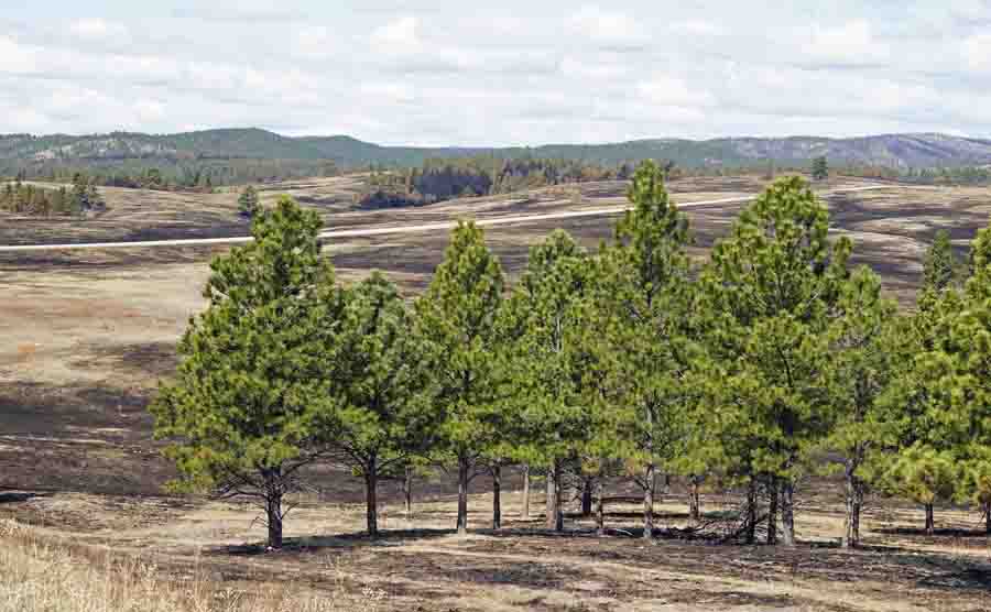
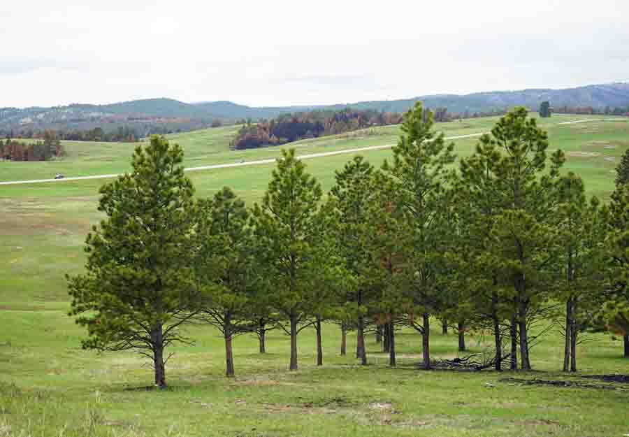
Cold Brook Fire
Highway 385, which can be seen in the distance, was supposed to be the boundary of the Cold Brook prescribed fire. Only the land on the far side of the highway was intended to burn. Photo taken a few days after the fire by Bill Gabbert.
Wind Cave prescribed fire
Photo taken of the area where the Cold Brook prescribed fire crossed US Highway 385, taken 39 days after the fire. Photo by Bill Gabbert.

The escaped fire was in grass and ground fuels beneath scattered trees that had been treated with prescribed fire before, and there was no significant crowning. It was basically over after one afternoon, but that didn’t stop Senator Thune from prognosticating about the lung condition of calves outside the park.

Revisions to the National Fire Danger Rating System

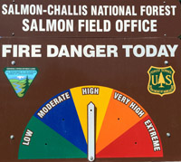
fire dangerThe National Fire Danger Rating System tracks weather events through their effects on live and dead fuels and adjusts them accordingly based on forecasted weather. The most visible product of the system, which is used by most large land management agencies in the United States, is the predicted fire danger, often expressed as adjectives ranging from Low to Extreme.

The NFDRS was first released for general use in 1972 and was subsequently revised in 1978 and 1988. Work on another revision began in 2000 and is nearing completion. Reportedly this next version is much simpler and more automated than its predecessors and it represents a vast improvement in fire potential assessment capabilities.

Three major changes will be:

  • The Fosberg Dead Fuel Moisture Model will be replaced with the Nelson Dead Fuel Moisture Model.
  • The Burgan Live Fuel Moisture Model will be replaced with the Growing Season Index-based live fuel moistures.
  • The number of fuel models in the NFDRS will be reduced from 40 to 5.

Jon Wallace, a member of the team rolling out and implementing the new system described the transition in an email today:

“The system is expected to be back from contracting and thus complete on November 1st of 2016. After the first of the year we’re going to begin training of Subject Matter Expert groups located within each geographic area, and when that training is complete we will open the system up for all users.  We had to wait to conduct this training until the system was fully functional.

“As you can imagine, there is going to be a learning curve for the user community and these Subject Matter Expert groups are going to help us get through that curve within their respective geographic area.

“All members of the user community will be able to see the new NFDRS2016, as well as the 1978 and 1988 NFDRS models during the spring of 2017.  This will allow them to work with the subject matter expert groups to set up NFDRS parameters prior to the Summer of 2017 fire season.  They will then be able to compare the outputs of the new system to what they are used to seeing in the older versions of NFDRS.

“This side by side comparison will be available to users through the 2018 fire season, at which time we will re-evaluate the need to continue support of the old systems.”

Researchers study how the Fort McMurray fire ignited homes

screen-shot-2016-09-14-at-5-00-06-pmA preliminary report report released by the Institute for Catastrophic Loss Reduction looked at how the 1,500,000-acre Fort McMurray Fire ignited some of the 2,400 structures in the Alberta city in May of this year.

Below are excerpts from the document.

****

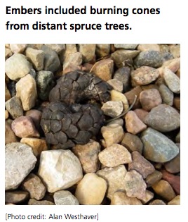
After evaluating the fire environment and clearances between homes and the forest edge, the investigator discounted direct contact from flames or radiant heat of the forest fire as being significant sources of home ignition at Fort McMurray. Instead, it was concluded that wind-driven embers were the most probable cause for the majority of early home ignitions in the zone where the fire made its transition from forest into urban neighbourhoods. Once established, the fire would have spread from structure to structure as an urban conflagration, accounting for the majority of home losses.

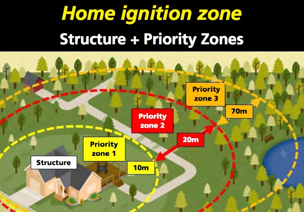
home ignition zone
NFPA

In all neighbourhoods studied, homes whose owners had adopted FireSmart guidelines survived much more frequently than homes where they had not, despite the extraordinarily harsh conditions.

Recommended FireSmart guidelines work. They are effective in reducing the probability of home ignition and wildfire losses. Home survival does not appear to be random or a matter of luck.

Home survival depends on conditions in the home ignition zone, for which owners are responsible.

While low total hazard rating is important, a single critical weakness can lead to home loss.

****

Articles on Wildfire Today tagged “Fort McMurrary Fire”.

Wildfire news, September 14, 2016

Highlights of recent news about wildland fire.

California has fewer inmates available for fighting wildfires

With fewer inmates available for fighting fires, the state of California is turning to civilian crews within their Conservation Corps.

From KCRA:

…But the number of available inmates is declining because counties now oversee most lower-level felons under a law aimed at easing prison overcrowding. In addition, there are fewer incentives for inmates to risk their lives since a federal court broadened an early release program for firefighters to include other inmates.

The state is about 600 inmates short of the 4,300 prisoners who could be available for fire lines. So this year, the California Conservation Corps reopened a camp to train three crews of young civilians to do the same backbreaking work as the inmates. Corps Director Bruce Saito expects to create at least four more fire crews with roughly 15 members each by next summer and a half-dozen new crews during each of the next two years.

The corps has more than 1,400 members, but fewer than 200 currently work alongside local, state and federal firefighters battling blazes in rural areas.

The members include both men and women and range in age from 18 to 25. They enlist for one year and earn the state’s minimum wage of $10 an hour. Military veterans can enroll until they turn 30…

Oregon sues 3 people responsible for starting the Ferguson Fire

Oregon hopes to recover $892,082 from three individuals who they say are responsible for starting the Ferguson Fire that burned 200 acres and destroyed two structures in Klamath County in July 2014.

The suit alleges that Joe Askins started a campfire, then took a nap. When he awoke, the campfire had escaped. Askins also said “I’ll take all the blame for the fire,” according to the lawsuit.

More evidence that beetle-killed forests do not increase the risk of catastrophic wildfires.

An article at News Deeply summarizes several research studies which mostly concluded that beetle-killed forests do not burn more severely than forests that have not been attacked by the insects. This is in spite of statements to the contrary by the Secretary of Agriculture, a spokesperson for CAL FIRE, and media stories about trees that are now part of a “tinder box”.

Air tanker 132 starts contract in Australia

air tanker 132 australia
Air Tanker 132 is reintroduced to the media in New South Wales, Australia. Photo by Sgt. Brett Sherriff, Royal Australian Air Force.

Fire Aviation reports that Coulson’s Air Tanker 132 started its contract with New South Wales on September 6, helping to provide air support for wildland firefighters in Australia. This is the second year in a row that the L-382G, a variant of the C-130 platform, has worked down under during their summer bushfire season.

Cheyenne is concerned about the effects of the Snake Fire on their water system

“The location of the fire is close proximity to our major watershed collection area for the Hog Park Reservoir” said Dena Egenhoff, the Board of Public Utilities’ (BOPU) Water Conservation Manager. “We are unable to know the impact of the Snake Fire at this time, but the location suggests there may be some adverse impacts to the City of Cheyenne’s water collection system.” As of September 11, 2016, the Hog Park Reservoir is 91.8% full

For Cheyenne, BOPU collects water in the Little Snake River drainage from snow melt and streams and transports it under a mountain by a tunnel to the eastside of the Continental Divide. That water is then stored in Hog Park Reservoir. From there, the collected water from Hog Park Reservoir is traded for water in Rob Roy Reservoir which can more easily be transported without pumping to Cheyenne. “In this way, the amount of water can be exchanged between the two different Mountain Ranges with all water rights being satisfied,” said Dena Egenhoff.

The Snake fire is in south-central Wyoming just north of the Colorado border. It is 115 air miles miles west of Cheyenne, and 20 miles west of the 38,000-acre Beaver Creek Fire that has been burning in Colorado and Wyoming since July 19, 2016.

Precipitation on Berry Fire allows reopening of south entrance to Yellowstone

The highway reopened September 13 after being closed since September 11.

Originally published at 1:39 p.m. MDT September 14, 2016.

Precipitation, which included snow in the higher elevations, put a damper on the Berry Fire and allowed officials to reopen the south entrance into Yellowstone National Park and Highway 89 on September 13. The highway had been closed since September 11 when the fire ran to the northeast for six miles in northwest Wyoming. The blaze ran for about six miles from Grand Teton National Park toward the northeast, burning another 6,000 acres, and forced evacuations at the Flagg Ranch, the north entrance station into Grand Teton National Park, and Sheffield Campground on the Bridger-Teton National Forest.

On Wednesday crews will continue to secure the Flagg Ranch area, which is still closed, and improve safety along the Grassy Lake Road corridor.

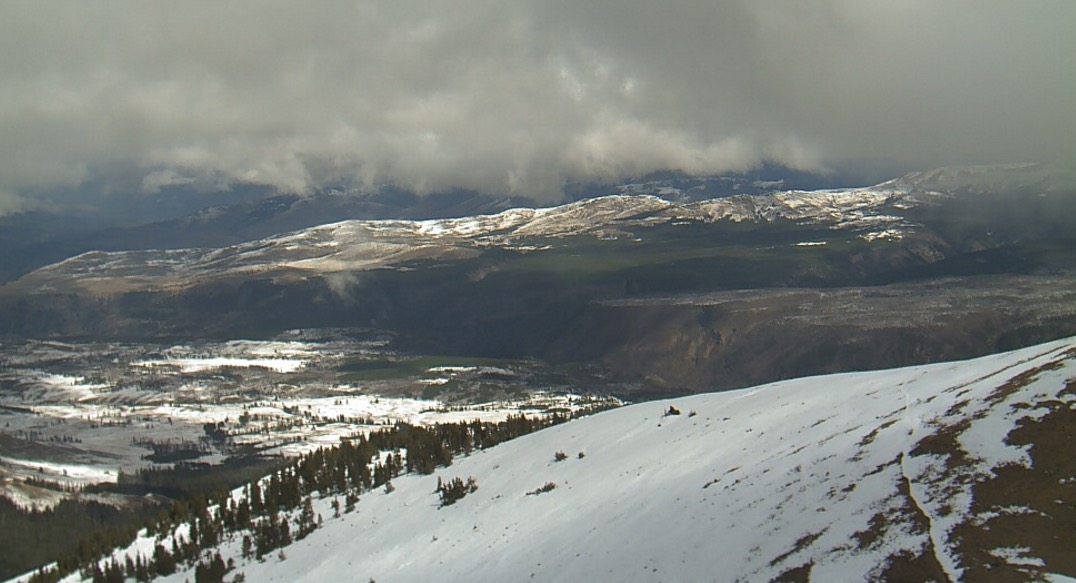
Mt. Washburn Yellowstone
This was the view from Mt. Washburn in Yellowstone National Park looking northeast at 1:44 p.m. MDT, September 14, 2016. NPS photo.

Time-lapse video of Alcorn Fire in Utah

Bill Blevins shot this fascinating time lapse of the Alcorn Fire on September 11, 2016 from a point 3 miles southwest of the fire. He said it was captured at one frame every three seconds.

The fire burned 730 acres 25 miles southwest of Provo, Utah. Firefighters expect full containment today, September 13.
Thanks and a tip of the hat go out to Jim.