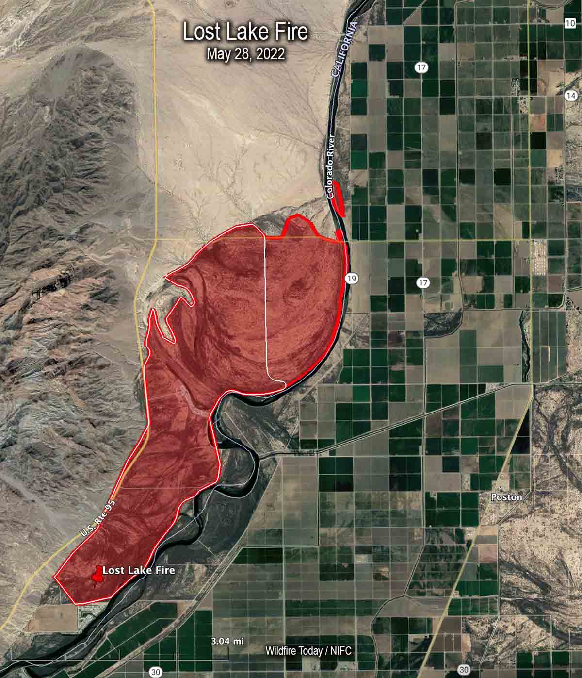
Map of the Lost Lake Fire. The red line was the perimeter late in the afternoon of May 28, 2022. The white line was the perimeter earlier in the day.
The Lost Lake Fire along the Colorado River on the California/Arizona border was mapped late in the afternoon on Saturday May 28 at about 5,300 acres. At that time about 30 acres had burned on the Arizona side, north of Agnes Wilson Road and west of 19.
Saturday evening resources assigned to the fire included two hand crews, eight fire engines, and one helicopter for a total of 150 personnel.
3:44 p.m. PDT May 28, 2022
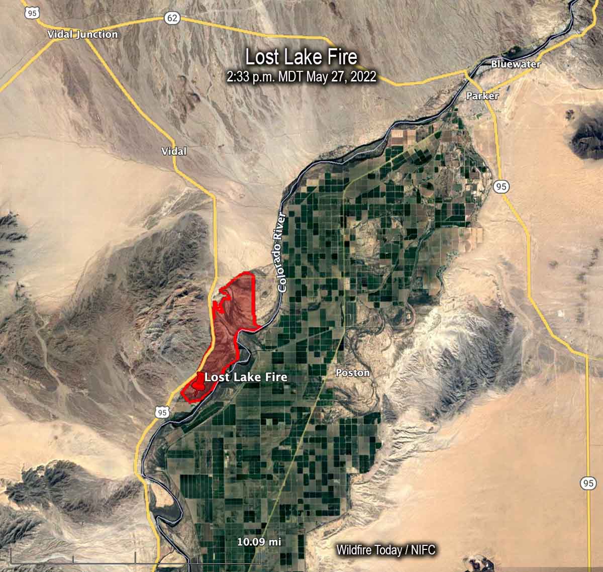
Map of the Lost Lake Fire at 2:33 p.m. PDT May 27, 2022.
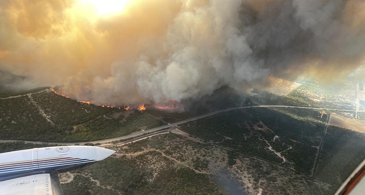
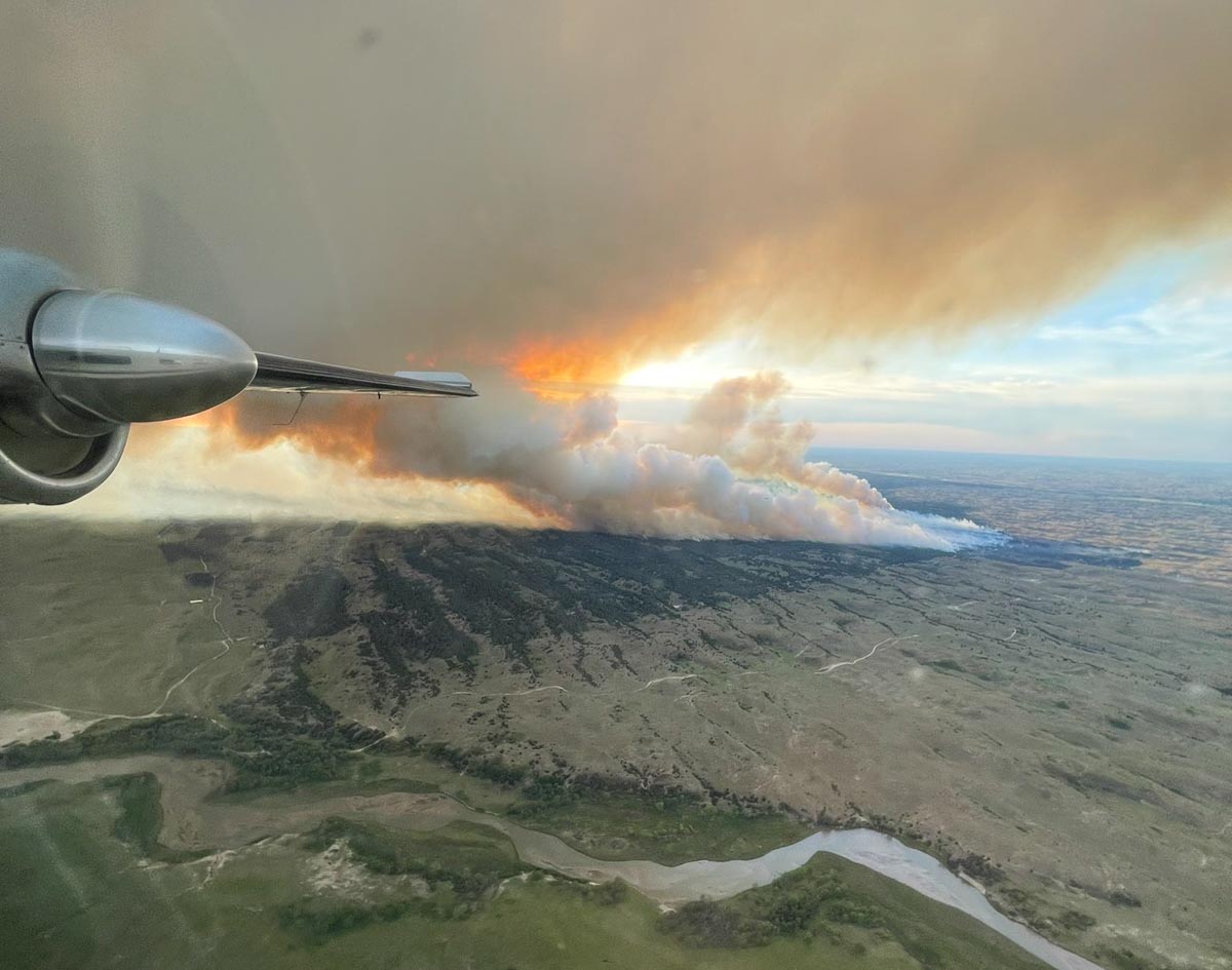
The Lost Lake Fire which had been burning in California on the west side of the Colorado River, crossed the river Saturday prompting evacuations of about a dozen homes of the Colorado River Indian Tribes near Poston, Arizona.
It started Thursday morning but strong winds Saturday afternoon caused spot fires on the Arizona side of the river, which is the boundary between the two states.
The blaze is 11 air miles southwest of Parker, AZ and until it crossed the river it was 3 miles west of Poston. Saturday morning it had burned 5,900 acres but the afternoon growth is adding to that total.
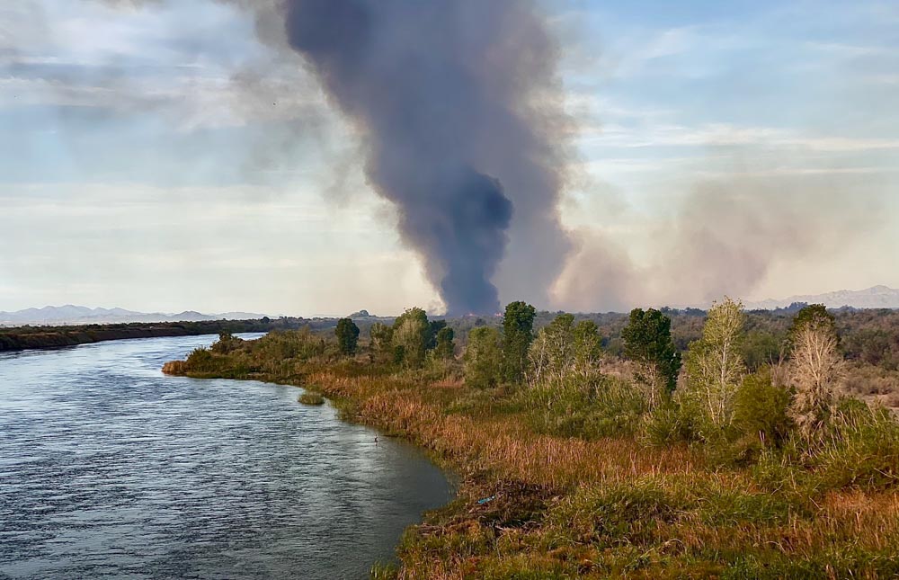
Lost Lake Fire. Photo by Incident Management Team.Lost Lake Fire. Photo by Incident Management Team.This appears to be a briefing at the beginning of a shift on the Lost Lake Fire. In case any of the firefighters forget the name of the fire, they have a handy reference.
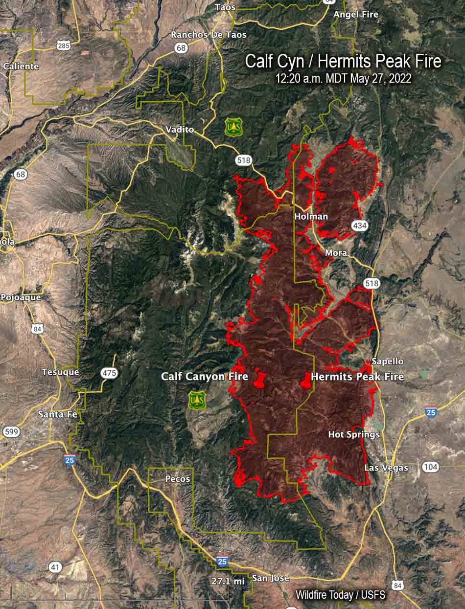
It later merged with the Hermits Peak Fire northwest of Las Vegas, New Mexico
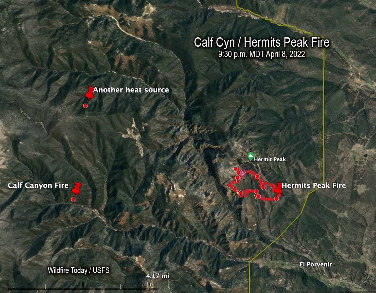
An April 8, 2022 map showing the Calf Canyon Fire before it grew large, another heat source nearby, and the Hermits Peak Fire.
The US Forest Service announced today that the Calf Canyon Fire northwest of Las Vegas, New Mexico was caused by piles that were still burning more than two months after they were ignited near the end of January, 2022. The heat remained after having been at times under snow when it was detected on April 9. The piles were comprised of vegetation and debris remaining after a fuel treatment project.
A statement released by the Santa Fe National Forest indicated that crews constructed a fireline around the 1.5-acre blaze on April 9 and “…continued to monitor the fire over the next couple of days to ensure there were no signs of heat or flames near the edge. Ten days later,” the statement continued, “on April 19 the Calf Canyon Fire reignited and escaped containment lines. A wind event on April 22 caused significant fire spread, and the Calf Canyon Fire merged with the Hermits Peak Fire, which was caused by an escaped prescribed burn.”
The term “reignited” is misleading. The burning piles were never completely put out. Wildfire Today found records showing that on April 8 fixed wing aircraft with thermal heat sensors began mapping the Hermits Peak Fire nearly every night the rest of the month. From imagery on April 8 at 9:30 p.m. MDT the Infrared Analyst noted two small heat sources both about 4 miles from the fire, one to the northwest and another almost due west which later became the Calf Canyon Fire. The heat to the northwest, 2.7 miles north of the Calf Canyon Fire, was not detected in subsequent mapping flights, indicating that it went out on its own or was successfully suppressed by firefighters.
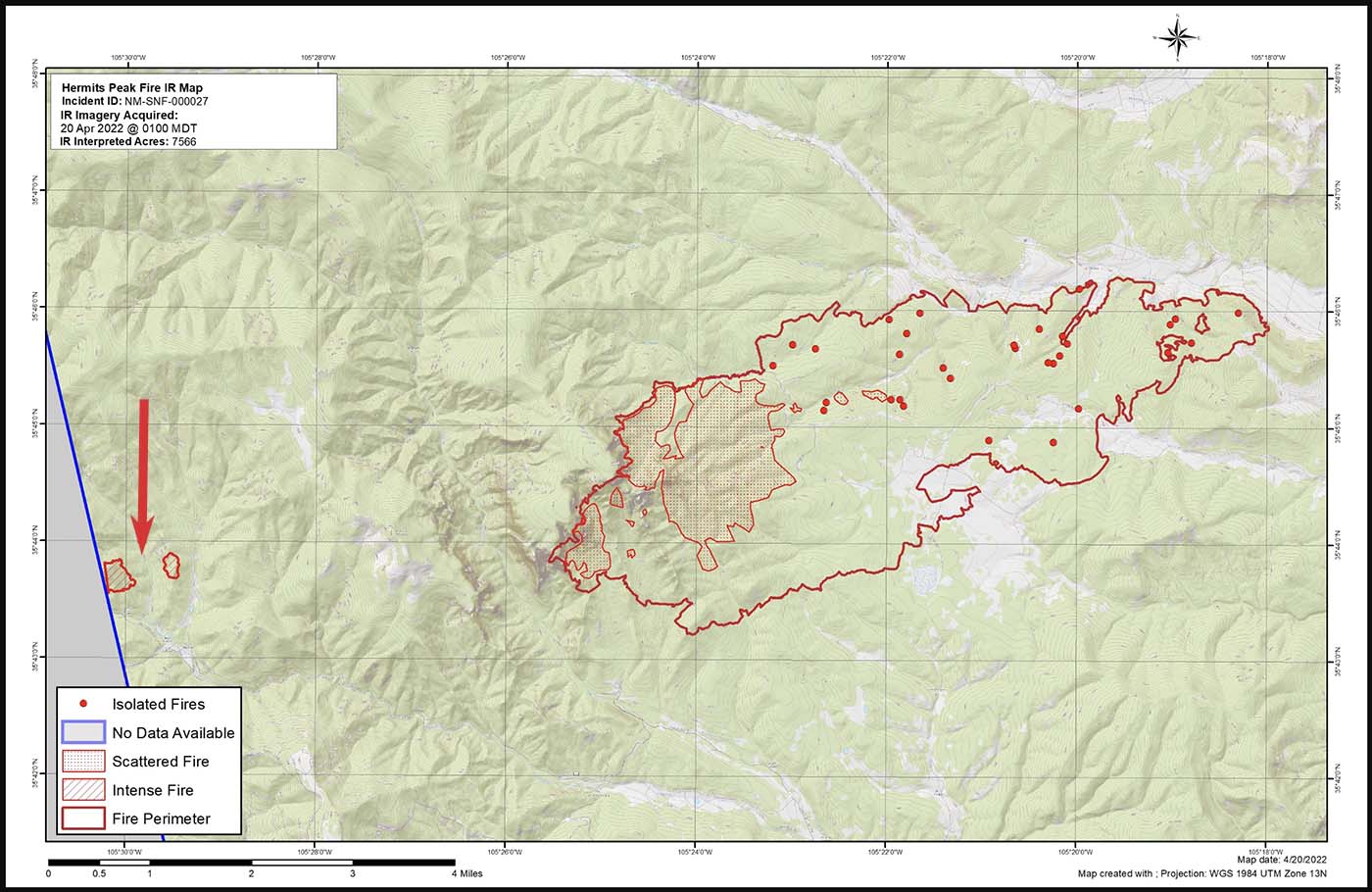
Map of the Calf Canyon and Hermits Peak Fires at 1 a.m. April 20, 2022 by the Incident Management Team. The red arrow, added by Wildfire Today, points to the Calf Canyon Fire which may have spotted, or there was an additional burn pile that spread.
Here are the results, related to what became the Calf Canyon Fire, of the Hermits Peak Fire aerial fire mapping from April 8 through April 21, 2022 (times are CDT):
8 @ 9:30 p.m.: heat noted at the pile burning site
9: (firefighters constructed line around a 1.5-acre fire spreading at the pile burning site)
10 @ 3 a.m.: heat noted
10 @ 10 p.m.: mapping mission unable to be filled (UTF)
11 @ 8:45: heat noted
13 @ 2 a.m.: not noted
13 @ 7:30 p.m.: not noted
14 @ 8:15 p.m.: not noted
15 @ 7:30 p.m.: not noted
16 @ 10 p.m.: UTF
18 @ 1:45 a.m.: not noted
18 @ 10 p.m.: UTF
20 @ 1 a.m.: intense heat noted at two locations at the pile burning site which were separately mapped by the Infrared Analyst. (See the map above. Either the fire spotted about 0.4 miles out ahead, or a second area in the pile burning project began spreading)
21 @ 1:30 a.m.: had grown to about 220 acres; was approximately half a mile wide and one mile long)
It is unknown if the mapping mission each night included the pile burning site four miles west of the Hermits Peak Fire, or if the Infrared Analyst was careful to examine the imagery for small detections of heat at the pile burning site.
After April 20 the Calf Canyon Fire was large and merged with the Hermits Peak Fire on the 22ndwhen both fires blew up. At that time the Hermits Peak fire was nearly contained and had been relatively quiet for several days, but pushed by very strong winds both fires ran 11 miles to the northwest in narrow parallel footprints until the wind speed decreased, allowing the flanks of both fires to spread laterally until they merged. The winds monitored at a weather station that day near Las Vegas, NM recorded sustained speeds of 40 to 50 mph with gusts up to 67 while the relative humidity dropped as low as 6 percent.
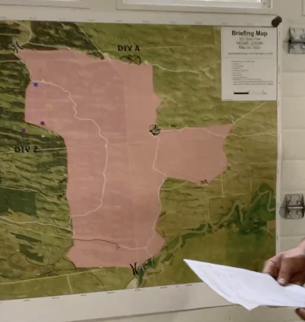
“We don’t have enough resources to do everything we want to do at one time so we have to prioritize the resources we have at the right location,” said Incident Commander Carl Schwope in a briefing on April 23.
The two merged fires, both the result of escaped prescribed fires and now called Calf Canyon / Hermits Peak Fire, are now 17 miles wide, 45 miles long, and have burned more than 312,000 acres, about 1/3 the size of Rhode Island. If you were driving from the south end of the fire at Las Vegas, NM on Highway 518 going north, it would take about an hour to reach the north edge of the fire near Angostura.
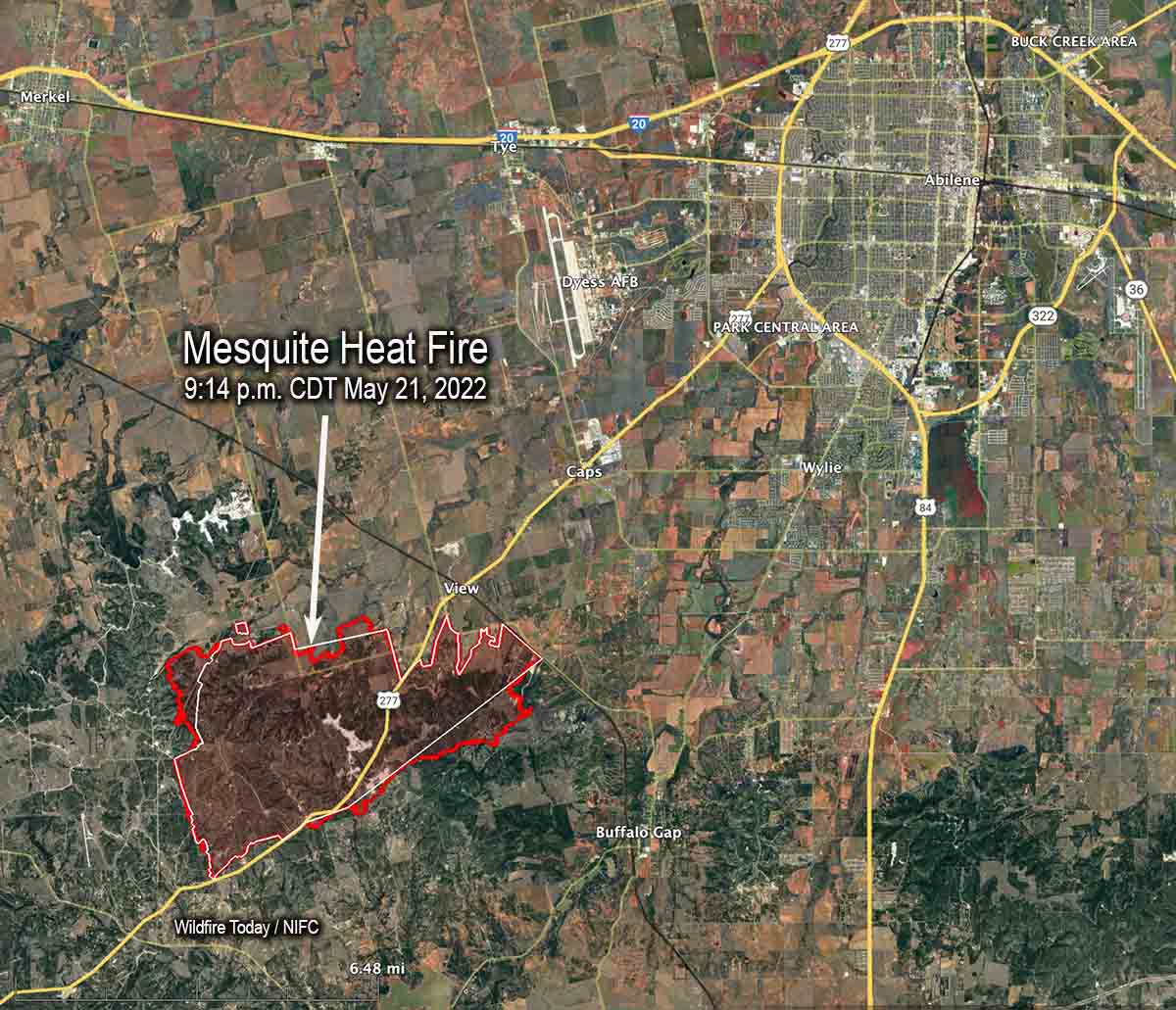
Map of the Mesquite Heat Fire in Texas. The red line was the perimeter at 9:14 p.m. May 21, 2022. The white line was the perimeter about 24 hours before.
The Incident Management Team on the Mesquite Heat Fire 7 miles southwest of Abilene, Texas reports that it has burned 11,256 acres. The increase is due to more accurate mapping.
Active, open flame was reported Saturday morning on the eastern side of the fire although fire intensity was low. Minimal fire behavior is expected Sunday. However, fuels remain extremely dry and could support some moderate, low intensity growth.
Fire authorities have revised the number of homes destroyed from 27 to 20, with another 7 outbuildings destroyed.
Firefighters are focusing on the uncontained firelines along the north, west, and southern edges of the fire, assisted by heavy equipment.
Saturday at 8 a.m. the Southern Area Incident Management Gold Team assumed command led by Incident Commander Dave Martin and in unified command with the Taylor County Sheriff’s Office.
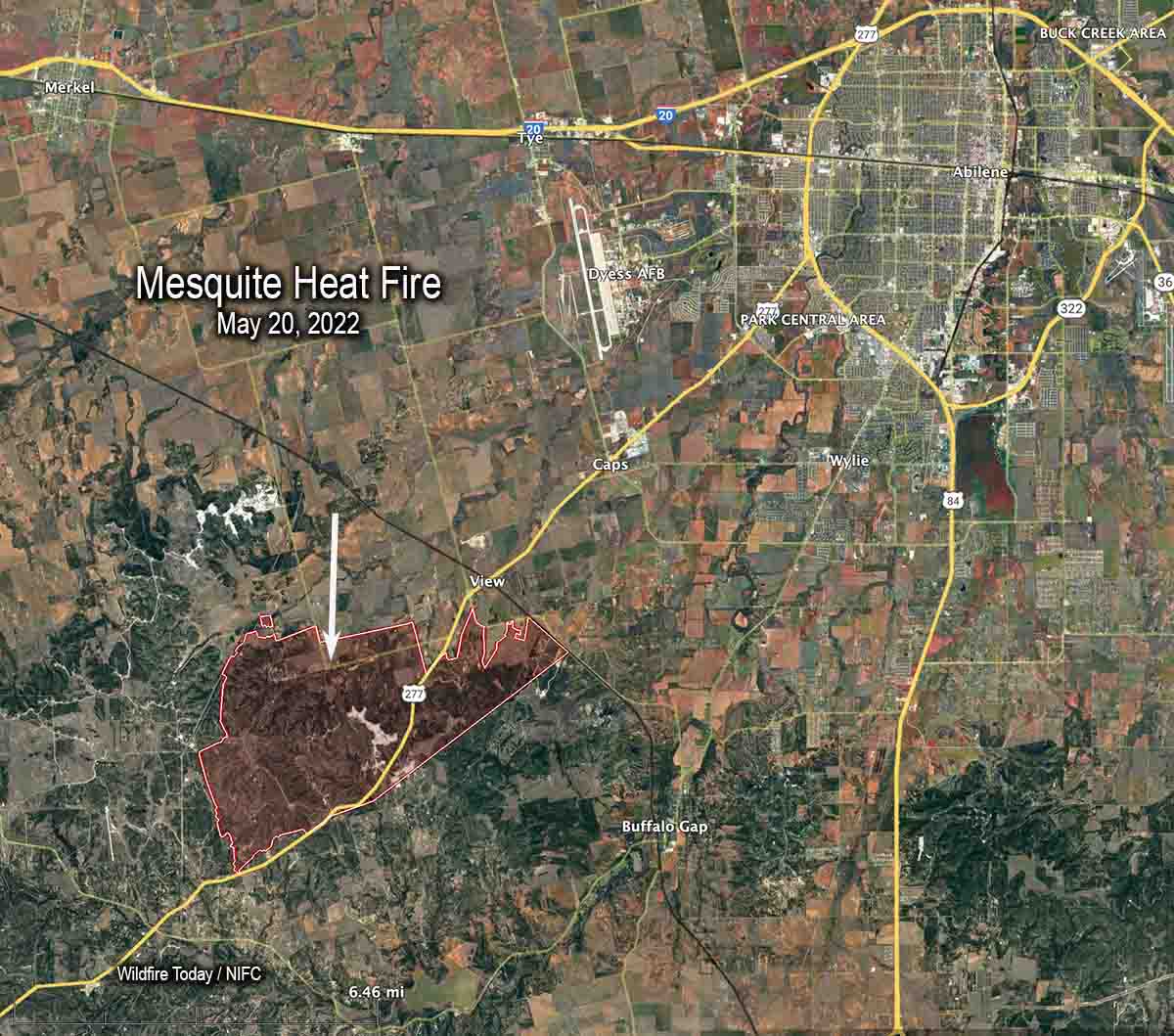
The Mesquite Heat Fire has destroyed approximately 27 homes 7 miles southwest of Abilene, Texas. Since it started May 17 alongside Highway 277 it has burned 7 miles to the northeast, consuming 9,613 acres during extreme weather conditions — temperature of 107 degrees, 10 percent relative humidity, and winds gusting to 30 mph.
Firefighters aided by aircraft kept it from spreading significantly Friday as unburned pockets of fuel flared up in the interior. Crews continued to construct containment line along the perimeter of the fire with a heavy focus on the southern flank in preparation for the predicted winds out of the north Saturday morning.
The Southern Geographic Area Incident Management Team #2 (Gold Team) is assigned. Resources on the fire Friday evening included 15 fire engines and 1 helicopter for a total of 59 personnel.
Friday evening evacuations were still in place with limited access for Country Place South to FM 89, South of FM 1235, Hillside Rd, Denton Valley Rd, Braune Rd and CR 297.
US Highway 277 reopened Friday night. The Taylor County Sheriff’s Office wrote on Facebook, “Several guardrails are only laying on the ground and reflective striping may not be visible or still present due to fire damage.”
Mesquite Heat Fire southwest of Abilene, TX, posted May 18, 2022 by Texas Forest Service.
Map of the Calf Canyon / Hermits Peak Fire. The bright red dots represent heat detected by a satellite at 3:49 a.m. MDT May 20, 2022.
The four largest active wildfires in New Mexico all continued to grow Thursday and have burned a total of more than 476,000 acres. Red Flag Warnings are in effect Friday for winds gusting from 30 to 40 mph with single digit humidity.
The 303,701-acre Calf Canyon / Hermits Peak Fire northwest of Las Vegas was subject to single digit humidity and strong winds Thursday afternoon, 10 to 20 mph with 30 to 40 mph gusts out of the west. Since the east side is somewhat secure most of the additional spread was limited to the west side, which experienced in some areas fire behavior described as “extreme, crowning, group torching, and spotting.”
Smoke over the Calf Canyon – Hermits Peak Fire May 18, 2022 by pilot Travis Graham.
The Black Fire 28 miles west-northwest of Truth or Consequences consumed more vegetation on the northwest, northeast, east, and southeast sides. Fire officials said in some places it spread for three miles, growing on the southeast side to within one or two miles of Hermosa. It has burned 104,969 acres.
Map of the Black Fire. The bright red dots represent heat detected by a satellite at 3:49 a.m. MDT May 20, 2022.
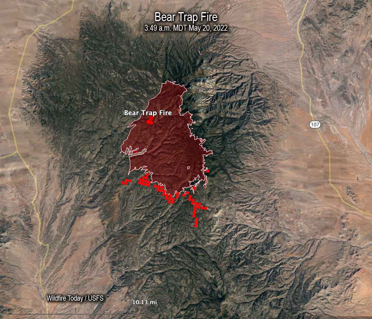
Most of the spread of the 21,687-acre Bear Trap Fire 34 miles southwest of Socorro was on the south side Thursday. Hand crews are prepping and conducting tactical burning operations, some of which may be conducted by aerial ignition. Limited movement to the east off the San Mateo crest is expected due to non-continuous fuels in several recent fire scars.
Map of the Bear Trap Fire. The bright red dots represent heat detected by a satellite at 3:49 a.m. MDT May 20, 2022.
The 45,605-acre Cerro Pelado Fire six miles southwest of Los Alamos has been relatively quiet for several days.
Map of the 201 East Fire, Friday morning, May 20, 2022.
In a Friday morning briefing Caleb, Operations Section Chief, said the 201 East Fire in Central Nebraska is still 4,100 acres and is not expected to grow larger.
Updated 9:09 p.m. MDT May 19, 2022
201 East Fire in central Nebraska, May 19, 2022. By@littleemilee6.
The 201 East Fire in Central Nebraska was very active again Thursday afternoon, as the convection column topped out with a hint of pyrocumulus. Thursday evening fire officials estimated it had grown to 4,100 acres, an increase of about 2,600 acres since Wednesday evening. Much of the growth was on the east side where it ran for about two miles, but when the wind shifted from coming from the west and then north gusting to 30 to 35 mph, it spread to the south where it merged with the Whitetail Fire, which also started from Tuesday’s lightning; it had been stopped at 8 acres, but flared up again Thursday. As of Thursday evening, the additional southward spread had not crossed the Dismal River.
Firefighters were battling 90 degree temperatures and strong, shifting winds.
Additional firefighting resources are arriving, including hand crews, helicopters, and engines. They hoping to directly suppress the flanks as it moves into the grass to the east.
The forecast for Friday is cooler temperatures, 55 degrees, 40 percent relative humidity, and 18 mph winds gusting out of the northwest at 28 mph, but there is a 26 percent chance of rain Friday night.
201 East Fire in central Nebraska, May 19, 2022. By@littleemilee6.
9:48 a.m. MDT May 19, 2022
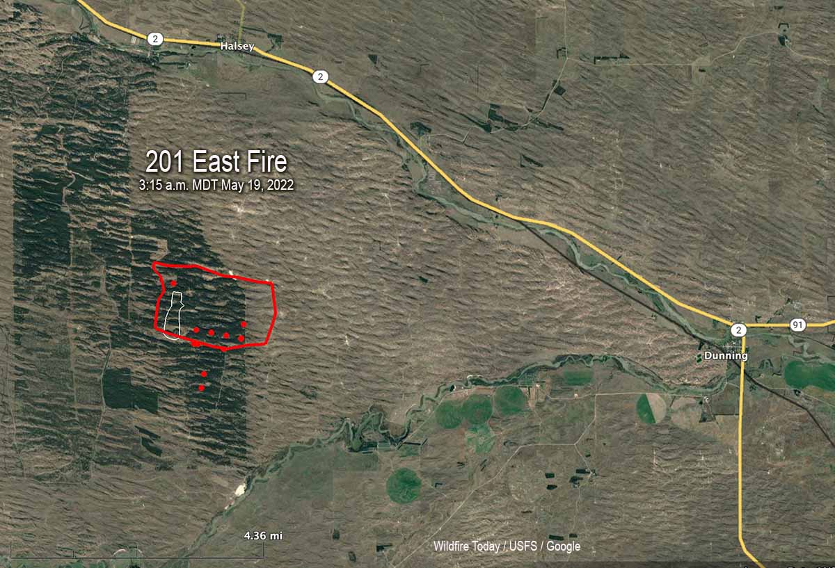
Map of the 201 East Fire in Nebraska. The red line was the approximate perimeter early in the morning May 19, 2022. The white line was the perimeter about 24 hours before. The red dots represent heat detected by a satellite at 3:15 a.m. MDT May 19, 2022.
A fire in central Nebraska has burned about 1,500 acres of timber in the Nebraska National Forest. The 201 East Fire is one of six in the area ignited by lightning on Tuesday May 17. Firefighters were able to stop the spread of the others at less than 9 acres.
It started in a 21,000-acre patch of timber three miles south of Halsey. By Wednesday morning a dozer line had it mostly encircled, but in the afternoon the fire crossed the line on the east side and ran for about 1.5 miles, leaving the timber and getting into grass. District Ranger Julie Bain said greenup has started but there is enough dead grass mixed with this year’s growth to still carry a fire, but they feel they can more easily stop it in the grass.
201 East Fire in Nebraska, May 18, 2022. Photo by Air Attack pilot @littleemilee6.
Aircraft used on the fire Wednesday included two single engine air tankers, two large air tankers, and an air attack ship. A Type 3 incident management team has been assigned.
The weather recorded at Thedford Wednesday afternoon as the fire made the run to the east was 6 to 13 mph winds occasionally gusting to 17 mph, 84 degrees, and 26 percent relative humidity.
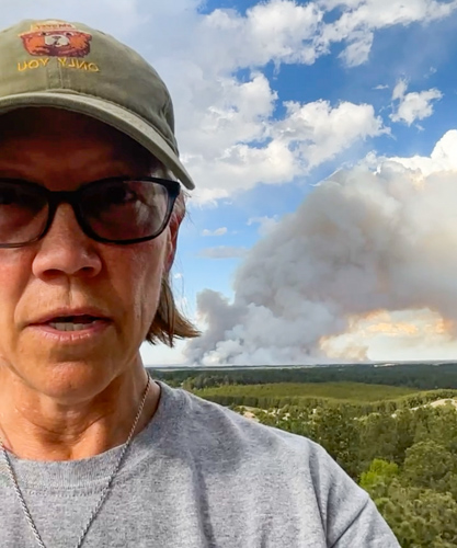
USFS District Ranger Julie Bain at a lookout tower during a briefing about the 201 East Fire, Wednesday afternoon May 18, 2022.
Red Flag Warning for the Calf Canyon / Hermits Peak Fire, May 19-20, 2022. NWS.
The National Weather Service has taken the unusual step of issuing a Red Flag Warning one and two days in advance for the Calf Canyon / Hermits Peak Fire 21 miles east of Santa Fe, New Mexico. The prediction is for winds gusting from the west and southwest at more than 30 mph with single digit relative humidity. Similar conditions will exist at least on Thursday for the area of the Black and Bear Trap Fires in southwest New Mexico.
Updated 12:10 p.m. MDT May 18, 2022
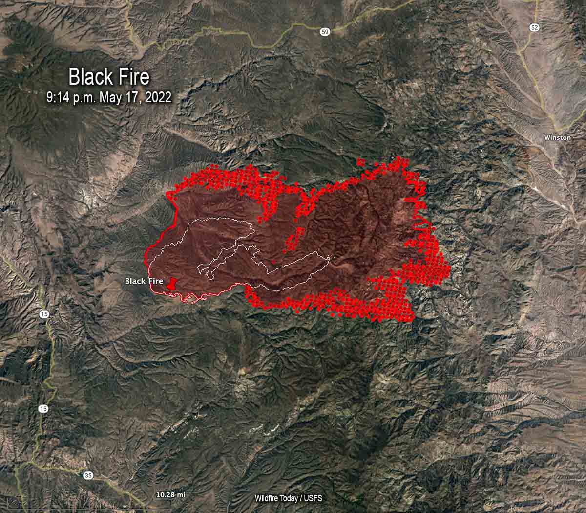
Map of the Black Fire. The bright red dots represent heat detected by a satellite at 2:48 a.m. May 18. The red line is the perimeter at 9:14 p.m. May 17. The white line is the perimeter about 48 hours before.
On Wednesday the northern half of New Mexico is under a Red Flag Warning. Isolated dry thunderstorms are predicted for portions of New Mexico, Texas, and Colorado.
Red Flag Warnings Wednesday.
Chance for isolated dry thunderstorms in portions of NM, CO, & TX.
From the NWS:
“Thunderstorms are expected across portions of the central Rockies this afternoon. Storms should be dry with the potential for new lightning induced fire starts.” pic.twitter.com/kT4KwlJC27
The Calf Canyon – Hermits Peak Fire 21 miles east of Santa Fe, NM was active on the west side Tuesday, but there was very little significant activity on the east side between Mora and Las Vegas.
The Cerro Pelado Fire 25 miles west of Santa Fe was relatively quiet Tuesday. There has been no major spread for several days and a satellite was only able to detect one large heat source early Wednesday morning.
Black Fire, May 16, 2022. IMT photo.
The Black Fire (see map above) 28 miles west-northwest of Truth or Consequences made another large run to the east Tuesday adding another 21,000 acres to bring the total up to 77,360. Fuel treatments and wildfires that have occurred over the last 20 years may slow any major spread to the north, west, and south, but the NIFC database shows no significant history of fire east of the incident.
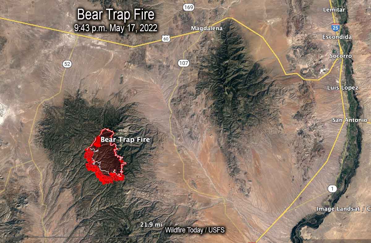
Map of the Bear Trap Fire. The bright red dots represent heat detected by a satellite at 2:48 a.m. May 18. The red line is the perimeter at 9:43 p.m. May 17. The white line is the perimeter about 24 hours before.
Another fire in southwest New Mexico, the Bear Trap Fire, is 34 miles southwest of Socorro. It spread southwest on Tuesday and was mapped Tuesday night at 15,215 acres. The fire is surrounded by fuel treatments and prescribed natural fires on all sides except for the southwest — which is where the most of the spread has occurred during the last couple of days.
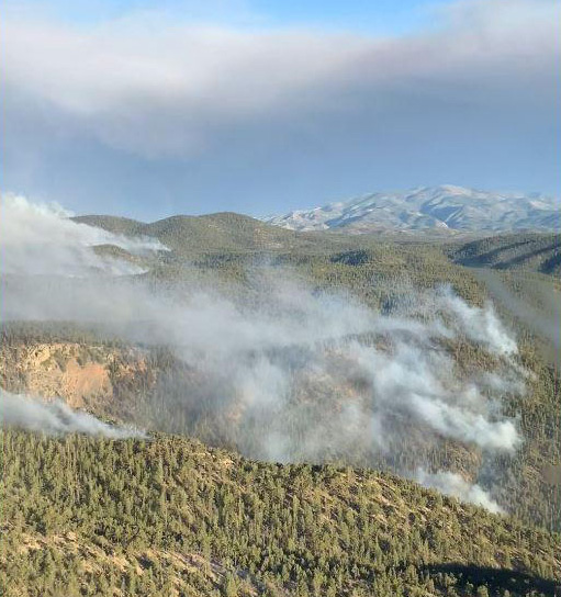
South side of the Bear Trap Fire, May 16. IMT photo.
5:10 p.m. MDT May 17, 2022
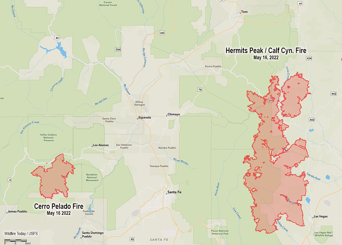
Map showing the location of the Cerro Pelado and Calf Canyon – Hermits Peak Fires, the evening of May 16, 2022.
High temperatures and very low humidity on Tuesday kept most of the large wildfires in New Mexico very active.
Calf Canyon – Hermits Peak Fire
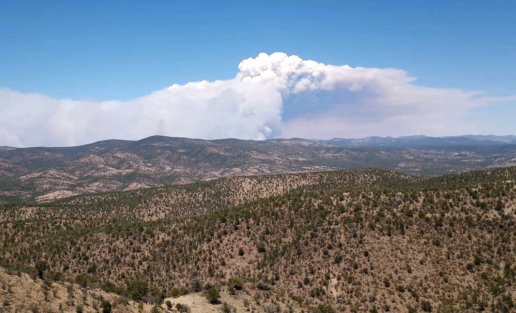
The Calf Canyon – Hermits Peak Fire 21 miles east of Santa Fe has become the largest fire in the recorded history of New Mexico. At 299,565 acres it has eclipsed the previous record set by the 297,845-acre Whitewater and Baldy Fires when they burned together in May of 2012 in Southwest New Mexico. On Tuesday it was again putting up a large smoke column while a 5 to 20 mph wind gusted out of of the northwest, west, and southwest at 25 mph. The humidity dropped to 10 percent in the afternoon.
Cerro Pelado Fire
On Monday most of the fire activity on the 45,605-acre Cerro Pelado Fire was on the northwest and southeast sides. On Tuesday the fire 25 miles west of Santa Fe was putting up much less smoke than the Calf Canyon – Hermits Peak Fire, judging from the Satellite photo below taken at 3:56 p.m.