The South Dakota Division of Wildland Fire supplied these photos today of piles being burned by their hand crews near Hermosa and Rockerville in the Black Hills.
News and opinion about wildland fire
The 16″ x 20″ prints of Tanker 07 dropping on the Red Canyon Fire are sold out, but stepping up to take its place is another unusually low price on a print.
Still looking for that special gift? How about a 20″ x 16″ stretched canvas print of Tanker 161, an RJ-85, dropping on the Crow Peak Fire June 27 near Spearfish, SD.
This special lower than usual price of $64 expires at the end of the day on Friday December 23. And only 10 are available at this price.
The image will be printed on a premium glossy canvas and then stretched on a wooden frame of 1.5″ x 1.5″ stretcher bars. All stretched canvases ship within one business day and arrive “ready to hang” with pre-attached hanging wire, mounting hooks, and nails.
Here is the description of the video:
The Bear Mountain and Black Hat Handcrews are considered Type 2 Initial Attack handcrews and are comprised of 22 firefighters each. The primary function of the crews is hazardous fuels reduction on state and private lands within the Black Hills of South Dakota. The crews are available for in and out-of-state dispatch assignments, and have responded to various all risk incidents throughout the United States since their inception.
Last month we posted end of the season videos created by five crews. Check them out and vote for the one you like the best.
Above: Snow cover in the United States, November 18, 2016. The Weather Channel.
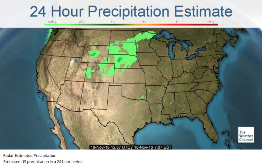
Precipitation in the northwest quarter of the United States this week has put even more of a damper on the occurrence of wildfires, the execution of prescribed fires, and agricultural burning.
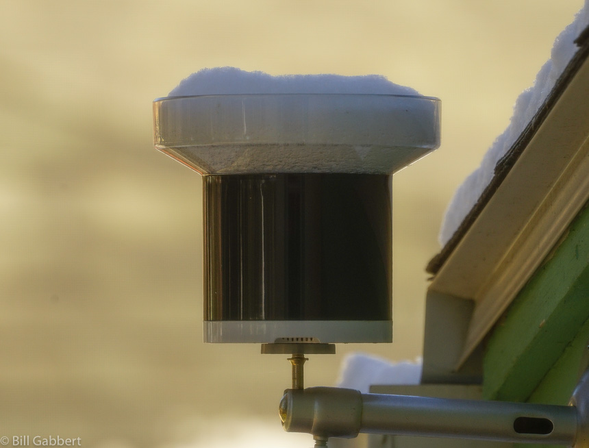
After weeks of warm, dry weather the Black Hills finally received a little precipitation over the last 24 hours. I won’t know the exact amount at my house until the snow in the rain gauge melts, but there was an inch or two of the white stuff on the ground. Today is sunny with a high of 32 predicted, so maybe it will trickle through the tipping bucket this afternoon.
Small amounts of precipitation in southern Saskatchewan may be the reason smoke from that area is no longer immigrating into the United States, as you can see in the two maps below. The first one was the smoke forecast for November 15 and the one after that is for today, November 18.
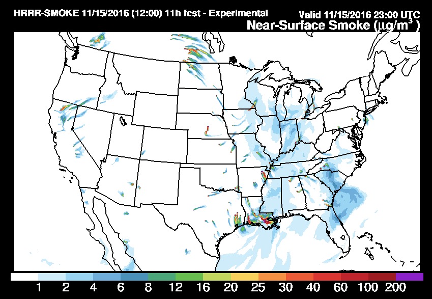
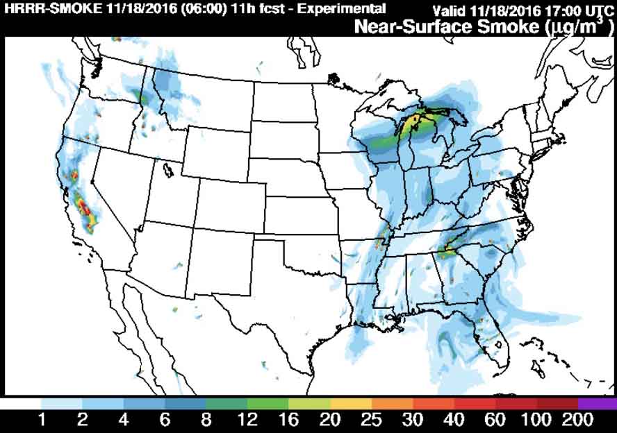
However, prescribed fires, wildfires, or agricultural burning in Louisiana, Arkansas, and eastern Texas are still producing large quantities of smoke that at times moves north into the midwest.
No rain is predicted until the middle of next week for the areas where wildfires are smoking out the residents in some areas of Tennessee, North Carolina, Georgia, and South Carolina.
Another documented case of Animal Arson:
E 3-1 and E-1 knocked down a small grass fire at Willsie and North St. Fire is out. Caused by a squirrel in the power line. pic.twitter.com/CB0yhyupR0
— Rapid City Fire Dept (@RapidCityFire) October 31, 2016
Thanks and a tip of the hat go out to Darren.
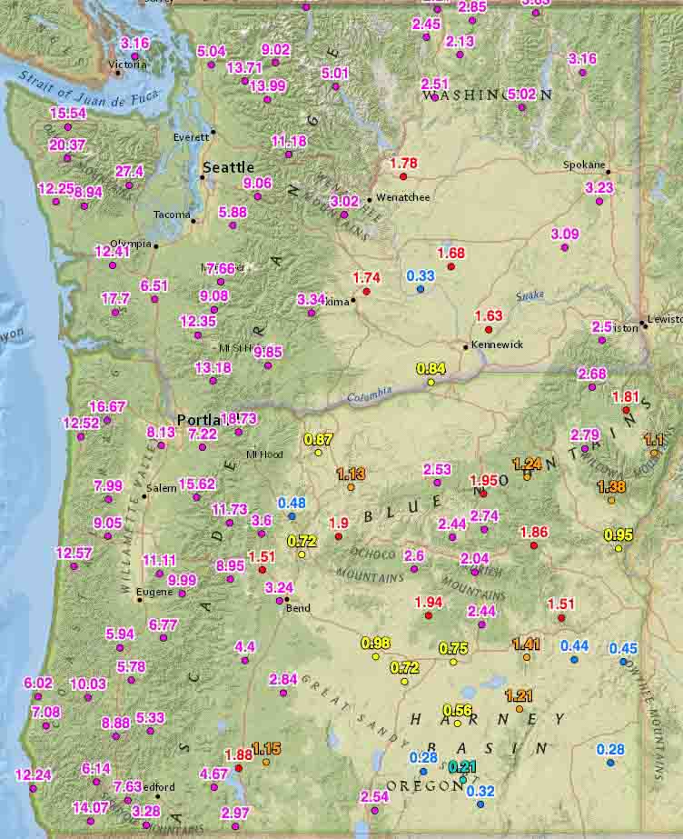
Rainfall over the last two weeks has slowed or in some cases, ended the wildfire season in some areas.
On October 19 we ran the numbers for the accumulated precipitation for the last 14 days in the western states. These maps show amounts that exceeded 0.05 inches at some of the Interagency Remote Automatic Weather Stations (RAWS).
Washington, Oregon, and northern California have received a good soaking and I would imagine that local fire officials may be declaring an end to the fire season. Of course this is not unusual for these areas this time of the year, and some locations had already seen their season end. But what IS unusual, is the high amount of moisture that occurred in just two weeks.
You can click on the images to see larger versions.

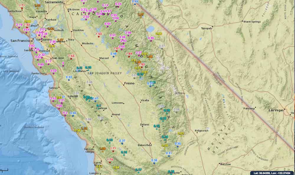
Continue to see maps for the other western states.
Continue reading “Rainfall in western states slows wildfire season in many areas”