Executive Order to inventory and protect old-growth forests

In a two year period 13 to 19 percent of all giant sequoias in their natural range over four feet in diameter were killed by fire

burned Sequoia grove in Sequoia and Kings Canyon NP
Sequoia grove in Sequoia and Kings Canyon National Park, November, 2021. NPS photo by Daniel Jeffcoach.

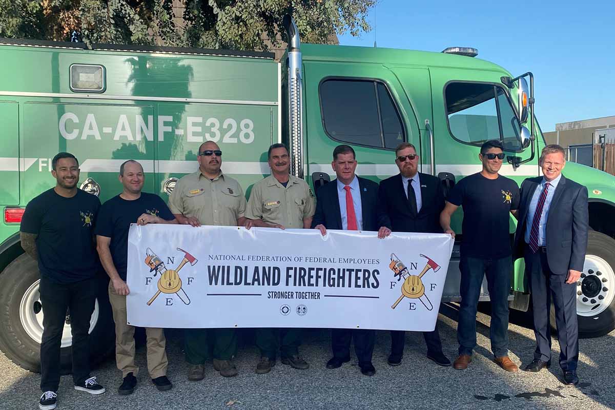
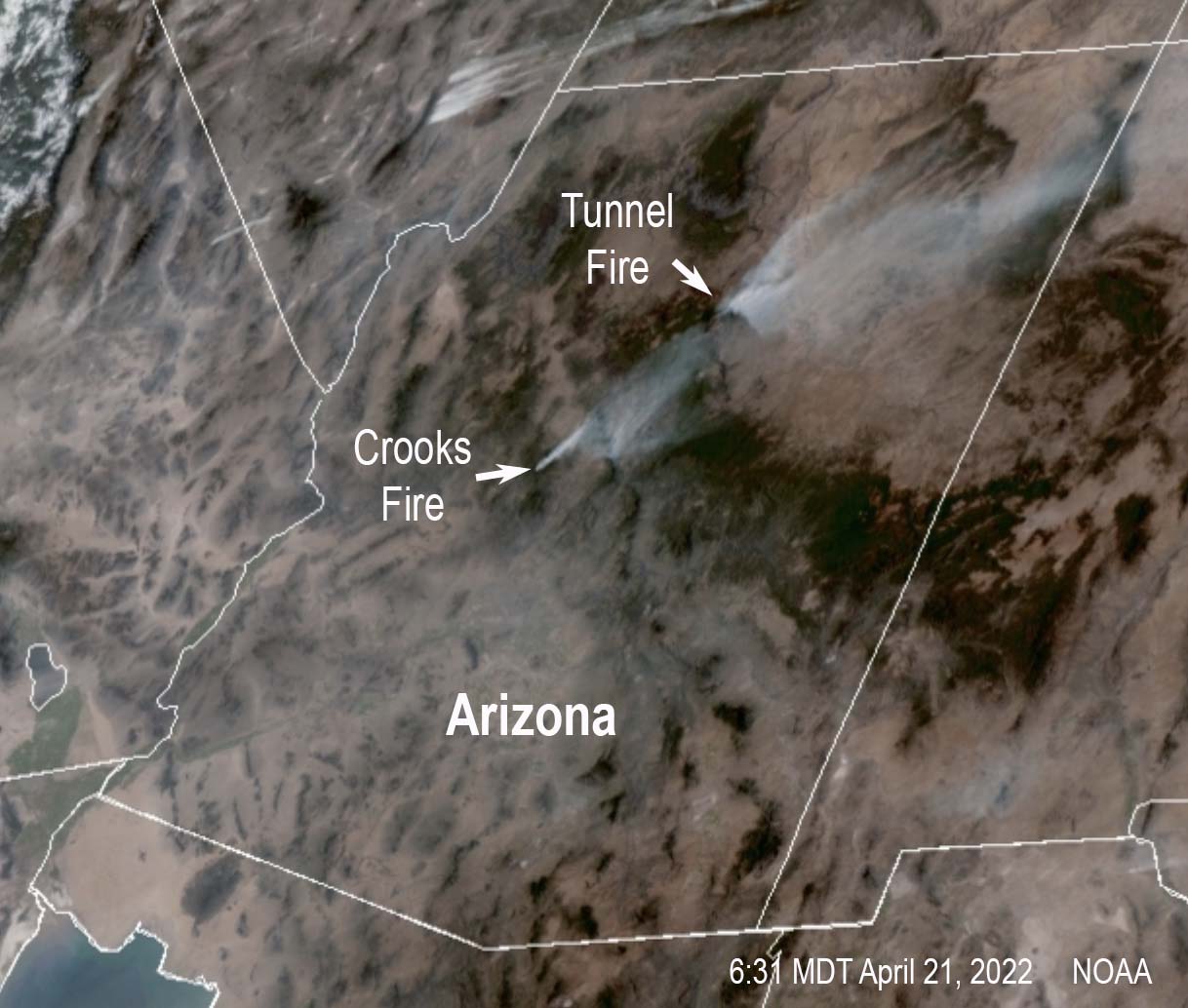
Today, on Earth Day, President Biden will sign an Executive Order to conduct the first-ever inventory of mature and old-growth forests on federal lands. This will be completed and made publicly available in a year with the objective of establishing consistent definitions and accounting for regional and ecological variation. The agencies will then analyze threats facing these forests, including from wildfires and other climate impacts.

After completing the inventory, the Departments of Interior and Agriculture will develop new policies, after public comment, to institutionalize climate-smart management and conservation strategies that address the threats facing mature and old-growth forests on federal lands.

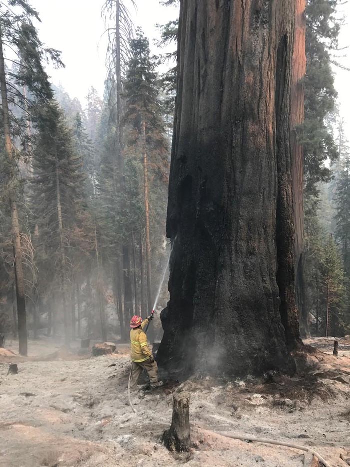
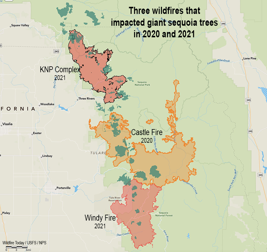
We are losing thousands of giant sequoia trees that can live for 3,000 years

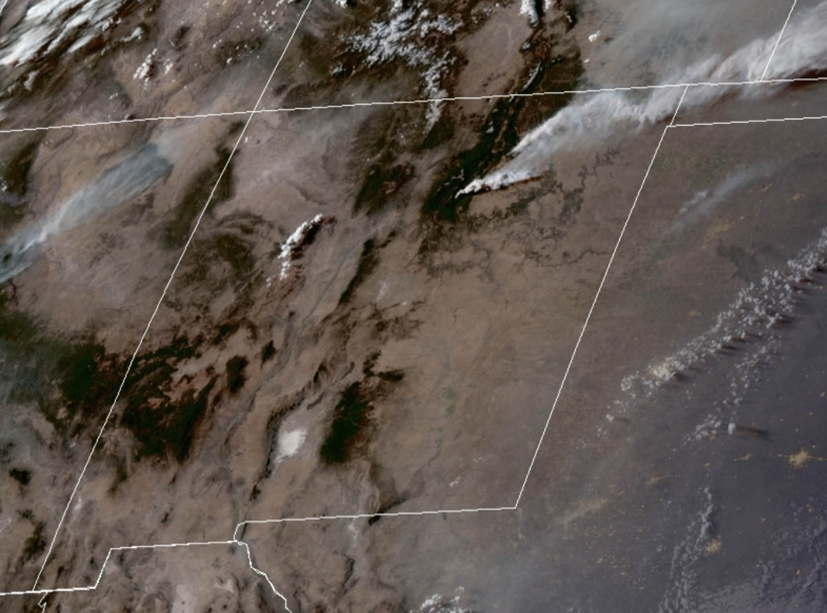
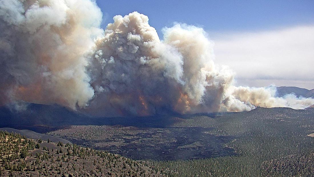
Nowhere is the need for protecting old growth forests more obvious than in the giant sequoia groves in California. In a two year period 13 to 19 percent of all giant sequoias in their natural range over four feet in diameter were killed by fire (and neglect) or will die in the next few years. In 2020, 10 to 14 percent of the entire Sierra Nevada population of giant sequoia trees over 4 feet in diameter were killed in the Castle Fire. Early estimates after two fires the following year, the KNP Complex and the Windy Fire, 2,261 to 3,637 sequoias over four feet in diameter were killed or will die within the next three to five years. These losses make up an estimated additional 3-5% of the entire Sierra Nevada sequoia population over four feet in diameter.

Three Fires, giant sequoia trees
Three fires in two years that killed giant sequoia trees. The darker green areas represent groves of giant sequoias.

Under normal conditions giant sequoia trees can live for more than 3,000 years, which is 38 times the life expectancy of a human in the United States. The multi-year drought and higher temperatures have led to extremely dry fuel moistures which is causing wildfires in California and other areas to burn with unusual intensity, making even some of the giant sequoias with bark up to a foot thick susceptible to wildfires burning under these conditions.

It is probably safe to assume that when large fires are burning most of the priorities of the Multi-Agency Coordinating Groups for allocating scarce resources are decided by individuals with a history of on the ground firefighting. They may have a bias toward allocating more fire personnel to protect buildings, rather than fires where 3,000-year old trees 300 feet tall and 20 feet in diameter are being destroyed.

Since only approximately 100,000 of these mammoth trees are left that are larger than four feet in diameter, government employees allocating firefighting resources need to strongly consider the value of these treasures to the nation and the world, and that some of them have been living for thousands of years. It is disheartening to see hundreds of them destroyed in a matter of hours, especially if due in part to sending resources, instead, to protect structures that have not been hardened to FireSafe standards or constructed under reasonable county and city building codes.

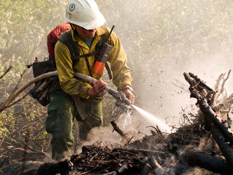
The giant sequoias have already been inventoried. We know where they are. What NEEDS to be done is to ramp up the management of the fuels beneath these big trees, and greatly increase the prescribed fire programs around them on lands managed by the National Park Service, Forest Service, and Bureau of Indian Affairs.

Firefighter on the Windy Fire burning giant sequoia tree
Firefighter on the Windy Fire applies water on a burning giant sequoia tree. Photo uploaded to InciWeb Oct. 11, 2021.

Wildfires in New Mexico have potential to spread significantly Friday during wind event

Extreme fire weather predicted with wind gusts more than 50 mph

Updated 4:14 p.m. MDT April 22, 2022

Satellite photo, New Mexico Fires 336 p.m. MDT April 22, 2022
Satellite photo, showing smoke from the Cooks Peak and Calf Canyon Fires in New Mexico at 3:36 p.m. MDT April 22, 2022. NOAA.

Additional evacuations have been ordered for the Calf Canyon and the nearby Hermits Peak Fires in Northern New Mexico. They were posted at 1 p.m. April 22 by San Miguel and mora Counties in New Mexico. A map is available on Facebook but it is almost undecipherable. Below is a list of the areas affected.

Calf fire evacuations, 1 p.m. MDT April 22, 2022

The satellite photo above shows a large plume of smoke from the Calf Canyon Fire which was blowing northeast over the Cooks Fire when the photo was taken at 3:36 p.m. MDT Friday. It appears that pyrocumulus was forming over the Cooks Peak Fire, indicating extreme fire behavior.

Click to see all articles on Wildfire Today, including the most recent, about the Calf Canyon, Hermits Peak, and Cooks Peak fires.

At 3:04 p.m. MT Friday the Bartley weather station north of the Calf Fire recorded 17 mph winds gusting from the south at 35 mph. The relative humidity was 11 percent.

Smoke maps are posted in another article on Wildfire Today.


9 a.m. MDT April 22, 2022

Map of fires in Northern New Mexico April 22, 2022
Map of fires in Northern New Mexico, 3:24 a.m. MDT April 22, 2022.

The critical and extreme fire weather predicted for areas in New Mexico and Colorado on Friday will affect the three existing wildfires in Northern New Mexico on Friday and Saturday.

The Calf Canyon and Hermits Peak Fires are 24 and 27 miles, respectively, east of Santa Fe, and are northwest of Las Vegas, NM.

The Calf Canyon Fire was very active Thursday, creating a large smoke plume as it spread primarily north and northeast. It was listed at 2,877 acres Thursday night.

The Hermits Peak Fire has been fairly quiet in recent days and is nearing containment. The strong winds will test the fire lines on the 7,573-acre blaze.

The 21,000-acre Cooks Peak Fire 13 miles south of Cimarron was also very active Thursday as it grew to the north and northeast.

The Storm Prediction Center’s forecast for Northeast New Mexico and Eastern Colorado on Friday is for “5-15 percent minimum RH. At the same time, 30-40 mph sustained south-southwesterly surface winds (with widespread gusts of 50-60 mph) will overspread critically dry fuels.” There is a chance for scattered thunderstorms with lightning and little or no rain.

The specific forecast for the Calf Canyon Fire calls for southwest winds of 46 mph gusting up to 64 mph with relative humidity in the teens and 20s. It will also be very windy on Saturday. Conditions on the Cooks Peak Fire will be similar, but with the humidity dropping into the single digits.

The southwest winds on Friday will shift to come out of the west-southwest Friday night, then from the west on Saturday. The speeds will decrease Friday night and Saturday, but will still be sustained in the mid-20s with gusts in the 30s.

These dangerous conditions will be conducive to significant spreading of the Cooks Peak and Calf Canyon Fires to the northeast and east.

Forecast weather Cooks Peak Fire
Forecast for the area near the Cooks Peak Fire. NWS.

Extreme fire weather expected Friday in portions of New Mexico and Colorado

“Friday’s expected weather could rival the most powerful fire events of the past decade,” said a NWS meteorologist

Updated 7:22 a.m. MDT April 22, 2022

Extreme fire weather April 22, 2022
Critical and Extreme fire weather predicted by the Storm Prediction Center for 6 a.m. Friday to 6 a.m. Saturday, April 22 & 23, 2022.

The Storm Prediction Center has issued a Fire Weather Outlook for 6 a.m. MDT Friday April 22 until 6 a.m. MDT Saturday April 23 that uses language we rarely see in a fire weather forecast, including “extremely critical” and “dangerous”.

The forecast warns about extremely critical fire weather conditions in portions of central and eastern New Mexico and eastern Colorado, and critical fire weather for portions of the southern and central high plains.

Click to see all articles on Wildfire Today, including the most recent, about the Calf Canyon, Hermits Peak, and Cooks Peak fires.

Sustained winds out of the south-southwest at 30 to 40 mph with widespread gusts of 50-60 mph are expected with 5 to 15 percent relative humidity. The fuels are exceptionally dry and isolated thunderstorms with little or no rain are possible in some areas.

Three existing fires in northern New Mexico east and northeast of Santa Fe could be vulnerable to extreme conditions, the Cooks Peak Fire, Calf Canyon Fire, and the Hermits Peak Fire. Friday’s forecast for the Calf Canyon Fire, which was very active Thursday, calls for southwest winds of 46 mph gusting to 64 mph with relative humidity in the teens and 20s. It will also be very windy on Saturday.

In Northern New Mexico the wind speeds will increase through the morning, peaking in the afternoon.

Satellite photo smoke from fires New Mexico
Satellite photo showing smoke from the Cooks Peak and Hermits Peak Fires in northern New Mexico at 6:30 p.m. MDT April 21, 2022. NOAA.

CNN is taking this forecast seriously in an article written by four of their meteorologists. Here are some excerpts:

Friday’s expected weather could rival the most powerful fire events of the past decade, Zach Hiris, a meteorologist at the National Weather Service office in Boulder, Colorado, told CNN.

Compared to recent extremely critical, wind-driven fire dangers in rural areas, some major population centers are threatened in this event, including Albuquerque, New Mexico, and Colorado Springs and the Denver metro area in Colorado.

“There is high confidence that a widespread extreme and potentially catastrophic fire weather event will occur on Friday,” said the National Weather Service office in Albuquerque.

In addition to fueling the fires, widespread wind gusts of 60 to 70 mph — and even 80 mph in scattered areas — could knock down large tree limbs, utility poles and other structures while threatening to topple high-profile vehicles, the weather service said.

Here is the forecast produced by the NOAA Storm Prediction Center at 12:20 p.m. MDT Thursday April 21:


Day 1 Fire Weather Outlook
NWS Storm Prediction Center Norman OK
0202 AM CDT Fri Apr 22 2022

Valid 221200Z – 231200Z

…EXTREMELY CRITICAL FIRE WEATHER AREA FOR PORTIONS OF CENTRAL AND EASTERN NEW MEXICO INTO EASTERN COLORADO… …CRITICAL FIRE WEATHER AREA FOR PORTIONS OF THE SOUTHERN AND CENTRAL HIGH PLAINS…

…Synopsis… ***DANGEROUS FIRE-WEATHER CONDITIONS EXPECTED TODAY ACROSS PORTIONS OF EAST-CENTRAL NEW MEXICO INTO EASTERN COLORADO***

A highly amplified large-scale trough and accompanying intense deep-layer south-southwesterly flow will emerge over the southern Rockies and adjacent High Plains by peak heating. As a result, strong cyclogenesis will occur over far northeastern Colorado during the afternoon, with a sharpening dryline extending southward along the Kansas/Colorado border and the Texas/New Mexico border. The combination of a strong surface pressure gradient, hot/dry conditions behind the dryline, and strong south-southwesterly flow aloft will result in extremely critical fire-weather conditions from east-central New Mexico into eastern Colorado today.

…East-central New Mexico into eastern Colorado… As temperatures climb into the upper 70s to middle 80s behind the sharpening dryline, deep boundary-layer mixing into very dry air aloft will result in widespread 5-15 percent minimum RH. At the same time, 30-40 mph sustained south-southwesterly surface winds (with widespread gusts of 50-60 mph) will overspread critically dry fuels (ERCs above the 90th+ percentile). The volatile combination of very strong/gusty winds, anomalously warm/dry conditions, and near-record dry fuels will encourage extreme fire-weather conditions.

…Remainder of the central and southern High Plains… The eastern extent of critical fire-weather conditions will be demarcated by the placement of the dryline. Strong 30+ mph sustained southerly surface winds (with higher gusts) concurrent with afternoon RH values below 20% will extend into southern New Mexico, West Texas, the western Texas/Oklahoma Panhandles, western Kansas, and western Nebraska — where fuels remain critically dry.

…Dry Thunderstorm Potential… Another point of concern will be isolated dry thunderstorm development immediately along and ahead of the dryline this afternoon, which is expected to take place along the axis of the driest fuels. Any cloud-to-ground lightning flashes that can occur in proximity to the Colorado/Kansas and New Mexico/Texas border area will do so over very receptive fuels, and likely with little wetting rainfall at the early stages of thunderstorm evolution.

..Jirak.. 04/22/2022

(end of forecast)


Below is the forecast for the area near the Calf Canyon fire 23 miles east of Santa Fe.

Weather forecast Calf Fire
Weather forecast for the Calf Fire area, 7 a.m. MDT April 22, 2022.

Thanks and a tip of the hat go out to Rick.

Cooks Peak Fire grows to 21,000 acres

16 miles south of Cimarron, New Mexico

3-D Map of the Cooks Peak Fire, 8 p.m. MDT April 20, 2022
3-D Map of the Cooks Peak Fire, 8 p.m. MDT April 20, 2022.

The Cooks Peak Fire in Northeast New Mexico 16 miles south of Cimarron has been very active Thursday afternoon, with reports of pyrocumulus clouds topping the large smoke plume blowing off to the east-northeast.

Click to see all articles on Wildfire Today, including the most recent, about the Calf Canyon, Hermits Peak, and Cooks Peak fires.

The blaze was reported at 4:15 p.m on April 17, 2022. Several ranches are under evacuation orders. The Type 3 Incident Management Team said on Thursday that the fire has burned 21,200 acres.

Cooks Peak Fire. Satellite photo at 3:46 p.m. MDT April 21, 2022.

Resources assigned include 6 hand crews, 11 fire engines, and no helicopters for a total of 198 personnel.

There are no reports of structures burning.

Based on reports of the fire activity on Thursday and the satellite photo of the large smoke plume, the perimeter is most likely significantly different from the one below, mapped Wednesday evening. It likely spread further to the east-northeast.

Map of the Cooks Peak Fire, 8 p.m. MDT April 20, 2022
Map of the Cooks Peak Fire, 8 p.m. MDT April 20, 2022.

Almost all of New Mexico is under a Red Flag Warning Thursday, with a prediction for 20 to 25 mph winds gusting out of the southwest to 60 mph, with 5 to 10 percent relative humidity. The forecast for Friday calls for stronger winds, from the southwest at 40 mph gusting to 57 mph. It will also be very windy on Saturday.

OWCP moves toward recognizing presumptive diseases for wildland firefighters

wildland firefighter with hose
NWCG photo.

Yesterday the Department of Labor announced that they have implemented important changes for processing Federal Employees’ Compensation Act (FECA) claims submitted by firefighters. FICA can pay medical expenses and compensation benefits to injured workers and survivors, and helps injured employees return to work when they are medically able to do so. The new policy eases the evidentiary requirements needed to support claims filed by federal employees engaged in fire protection and suppression activities for certain cancers, heart conditions and lung conditions. In essence, to an untrained observer, the new program looks similar to the presumptive disease policy employed by many fire departments and governments.

The new Office of Workers’ Compensation Programs FECA Bulletin, No. 22-07 “Special Case Handling in Certain Firefighter FECA Claims Processing and Adjudication” issued April 19, 2022, establishes a list of cancers and medical conditions for which the firefighter does not have to submit proof that their disease was caused by an on the job injury. The requirements to qualify for this new policy are that the condition must be diagnosed by a doctor, the person was engaged in fire protection activities for at least 5 years, and the diagnosis must have occurred no more than 10 years after employment.

If these requirements are met, the employee’s claim would be deemed “high-risk” and qualify for expedited processing.

The medical conditions covered are:

  • Cancers: esophageal, colorectal, prostate, testicular, kidney, bladder, brain, lung, buccal cavity/pharynx, larynx, thyroid, multiple myeloma, nonHodgkin’s lymphoma, leukemia, mesothelioma, or melanoma; or
  • Hypertension, coronary artery disease, chronic obstructive pulmonary disease, pulmonary fibrosis, asthma, or a sudden cardiac event or stroke.

To implement the policy changes, OWCP has created a special claims unit to process federal firefighters’ claims. The unit consists of existing staff specifically trained to handle these issues. The agency is also providing comprehensive training to the unit’s examiners on the impacts of the policy changes, and working with federal agencies including the departments of Agriculture, Defense, Homeland Security and Interior to explain the changes in policy and procedures.

These two major changes in how the OWCP handles illness and injury claims from firefighters appear to be monumental improvements if they pan out as advertised. In recent years the reputation and services provided by the agency for injured or sick firefighters, or the surviving spouses and family members of those killed on the job, has been abysmal. Too often they have been driven to beg for money at GoFundMe just to pay medical bills after being hounded by bill collectors when the federal government did not fulfill their legal obligations.

NFFE and IAFF met with Labor Secretary Marty Walsh
NFFE and IAFF met with Labor Secretary Marty Walsh (wearing the red tie) and Department of Labor officials in Los Angeles, April 20, 2022 to discuss processing of firefighters’ injury claims. NFFE photo.

Some of these changes and improvements are due in part to efforts that have been going on behind the scenes by members of the Grassroots Wildland Firefighters, International Association of Fire Fighters, and the National Federation of Federal Employees. In the last month they have traveled to Washington DC and Los Angeles (at least) to meet with federal officials who can make things happen. For example they have met with Marty Walsh, the Secretary of Labor, twice. These folks deserve your thanks.

One of the causes of the slow response to firefighters’ injury and death claims has been a reduction in the number of OWCP claims examiners due to declining budgets over the last few years. It is critical that the President and both houses of Congress follow up and ensure that the agency is appropriately funded so that they can perform their required duties, assisting employees injured or sickened on the job.

More information from the Department of Labor:

How to file a workers’ compensation claim (From the OWCP):

To file a workers’ compensation claim, you must first register for an Employees’ Compensation Operations and Management Portal (ECOMP) account at www.ecomp.dol.gov. ECOMP is a free web-based application. You do not need approval from your supervisor or anyone else at your agency to initiate your FECA workers’ compensation claim. Once you register for an ECOMP account, you will be able to file either Form CA-1 ‘Notice of Traumatic Injury’ (single event trauma) or Form CA-2 ‘Notice of Occupational Disease’ (repeated exposure).

Thanks and a tip of the hat go out to Ben.

Tunnel Fire in Northern Arizona grows to 20,000+ acres

Strong winds have spread the fire for 12 miles to the northeast

Updated 10:46 a.m. MDT April 21, 2022

From the staff at Sunset Crater Volcano National Monument, which was overrun by the Tunnel Fire.

“April 20

“All Sunset Crater Volcano and Wupatki staff are accounted for and safe. We were also able to successfully evacuate all culturally important items from the visitor center. For those who worried, the Kabotie painting, corn rock, Qa’na Katsina doll, and other items are safe.

“As of 4:45 this morning, the visitor center remains unharmed, as well. However, active fires continue to burn nearby. Sadly, Sunset Crater Volcano National Monument has burned in its entirety. The park is closed, and we do not have any estimated timeline for reopening.”

Sunset Crater Volcano National Monument
File photo of Sunset Crater Volcano National Monument, May 20, 2017.

In the map below, the Monument is inside the yellow border.


7:57 a.m. MDT April 21, 2022

3-D Map Tunnel Fire at 12:30 a.m. MDT April 21, 2022
Map of the Tunnel Fire. Looking southwest at 12:30 a.m. MDT April 21, 2022.

The Tunnel Fire five miles north of the Flagstaff suburbs grew by about 3,000 acres Wednesday to bring the size up to more than 20,500 acres.

To see all articles on Wildfire Today about the Tunnel Fire, including the most recent, click here.

The fire started during the afternoon of April 17 west of Highway 89. Pushed by strong winds it spread rapidly to the northeast, crossed the highway, burned through Sunset Crater Volcano National Monument, crossed major electrical transmission lines, and early Thursday morning was about 10 miles east of Highway 89 approximately two miles from burning out of the Coconino National Forest.

Map Tunnel Fire 12:30 a.m. MDT April 21, 2022
Map of the Tunnel Fire at 12:30 a.m. MDT April 21, 2022. The brown shaded areas represent intense heat at the time the fire was mapped.

On Wednesday crews worked to keep the fire out of the Timberline Estates and Wupatki Trail subdivisions. They encountered natural gas leaking from foundations of burned structures, which slowed suppression activities. On Tuesday fire officials said 24 structures had burned. The number was not broken down by residences or outbuildings.

Strong winds on Wednesday again limited the ability of aircraft to safely and effectively support firefighters on the ground. Conditions are expected to become windier Thursday and Friday. A Red Flag Warning is in effect Thursday until 8 p.m. MST due to predicted gusts of 40 to 50 mph and 10 to 15 percent relative humidity.

Tunnel Fire, April 19, 2022
Tunnel Fire, April 19, 2022, as seen from O’Leary Lookout in Northern Arizona. USFS photo.

A National Type 1 Incident Management Team was ordered Tuesday. The 76 personnel with the team will begin arriving Thursday, with plans to assume command from the Type 3 IMT Friday morning.

Firefighting resources on scene include three dozers, 24 fire engines, and one Type 3 helicopter, for a total of 260 personnel.

U.S. Highway 89 is still closed from milepost 425 (Campbell Road) to milepost 445 and will likely remain closed for the next several days due to firefighting operations.

Information about evacuations, structures that have burned, and when people might be able to return is handled by Coconino County, which is posting updates online.

Satellite photo fires in Arizona, 6:31 p.m. MDT April 20, 2022
Satellite photo showing smoke from fires in Arizona, 6:31 p.m. MDT April 20, 2022.