The map above is a forecast for the distribution of smoke from wildfires currently burning in the Southwest United States for 5 p.m. MDT June 16, 2017.
Tag: New Mexico
Cajete Fire west of Los Alamos causes evacuations
The Bonita Fire continues to burn in the Carson National Forest.
Above: Map showing the location of the Cajete Fire in northern New Mexico at 2:04 a.m. MDT June 16, 2017.
The Cajete Fire in northern New Mexico grew quickly after it was reported on Thursday, burning about 660 acres in the first burning period along the southern boundary of the Valles Caldera National Preserve. The fire has burned on both sides of Highway 4 in the Santa Fe National Forest 7 miles northeast of Jemez Springs and 12 miles west of Los Alamos.
It burned intensely Thursday to the east creating spot fires more than 600 feet ahead of the main fire.
On Thursday approximately 200 people were evacuated from the communities of Los Griegos, Sierra de los Pinos, and the Ruby Holt Plat.
California’s Interagency Incident Management Team #3, a Type 1 team led by Mark von Tillow, was dispatched to the fire Thursday after being staged in Mesa, Arizona. The strategy on the fire is full suppression.

Steve Bassett constructed the map below showing that the Cajeta Fire is partially hemmed in by several large fires that occurred between 2005 and 2016 — the Thompson Ridge, Valle, Big Hat, and Las Conchas Fires. It is possible that if it burns into those fire scars the rate of spread will decrease.
#CajeteFire up to 600 acres (https://t.co/dodQ7HBDE9). This is what 600 acres looks like as a circle centered on the initial point. #nmfire pic.twitter.com/f6YcUpm0vJ
— Steve Bassett (@CartoBassett) June 16, 2017
The Bonita Fire farther to the north in the Carson National Forest has been burning since June 3 and has been very active today and yesterday, spreading across 4,170 acres. It is being managed in both full suppression and confine strategies, depending on the location. It is 4 miles south of highway 64, 9 miles west of Highway 285, and 9 miles southwest of Tres Piedras.
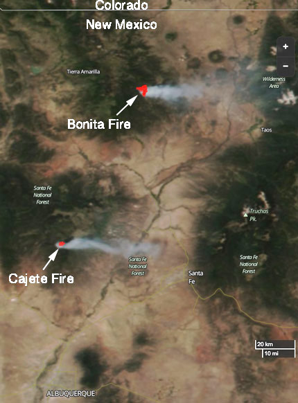
The smoke plume from both the Bonita and Cajeta Fires can be clearly seen in the satellite image above.

Five fires are burning in the Gila National Forest
Above: A satellite detected smoke from 5 fires in the Gila National Forest in New Mexico on June 14, 2017. The red dots on the map represent heat. The acreages shown were reported within the last 48 hours.
Five wildfires burning in the Gila National Forest in southwest New Mexico are all being managed using a strategy of less than full suppression.
For example, the Round Fire is listed like this:
- Confine (25%)
- Full Suppression (25%)
- Monitor (25%)
- Point Zone Protection (25%)
There are a total of eight large wildfires in New Mexico that are uncontained and are being managed with a less than full suppression strategy. Arizona has 12 large uncontained fires, and 6 are being fully suppressed.
The Southwest Geographic area is in Preparedness Level 4 (5 is the highest possible). The National PL is 2.

Rainfall in western states slows wildfire season in many areas

Rainfall over the last two weeks has slowed or in some cases, ended the wildfire season in some areas.
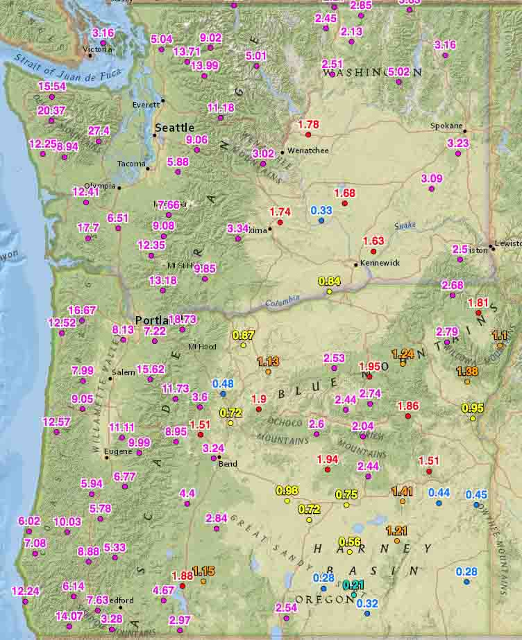
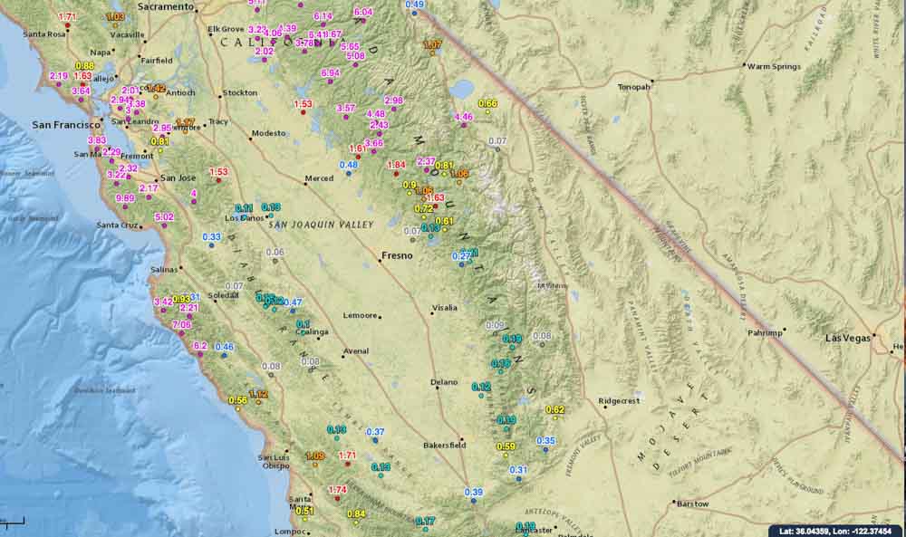
On October 19 we ran the numbers for the accumulated precipitation for the last 14 days in the western states. These maps show amounts that exceeded 0.05 inches at some of the Interagency Remote Automatic Weather Stations (RAWS).
Washington, Oregon, and northern California have received a good soaking and I would imagine that local fire officials may be declaring an end to the fire season. Of course this is not unusual for these areas this time of the year, and some locations had already seen their season end. But what IS unusual, is the high amount of moisture that occurred in just two weeks.
You can click on the images to see larger versions.


Continue to see maps for the other western states.
Continue reading “Rainfall in western states slows wildfire season in many areas”
Wildfire burns approximately 30 homes in Timberon, New Mexico
About 67 structures have burned, including about 30 homes and numerous vehicles.
Above: The yellow dots represent heat detected by a satellite over the Timberon Fire at 2:10 a.m. MDT July 14, 2016. Click to enlarge.
A wildfire has burned through a portion of the town of Timberon in south-central New Mexico destroying approximately 30 homes 22 air miles southeast of Alamogordo. The fire started July 13 and burned 290 acres before firefighters completed a fireline around the perimeter.
One engine from the Timberon Volunteer Fire Department burned after a mechanical failure. An update provided Friday by incident management team said approximately 30 vehicles were destroyed or damaged, including 14 recreational vehicles.
The Type 4 incident management team headed by Caleb Finch transitioned to the Type 3 Pecos team led by Tom Barta Friday morning.
Thanks and a tip of the hat go out to Allen.
Small fire camp burned over in New Mexico
 Three firefighters rode horses into a wilderness area in the Gila National Forest to assess the Turkey Fire in early June. As they were setting up fire camp the least experienced of the three began to construct a fire line around the location, but the Incident Commander, who spent 17 years on a local hotshot crew, told him not to bother, explaining that nearby meadows would keep the fire from spreading toward their camp. After dropping off their equipment, they left to develop a plan to protect a cabin.
Upon returning they discovered that the fire had burned through the site, destroying all of their supplies and equipment.
You can read the entire report at the Lessons Learned website, which is the source of these photos.


